

August 2014 - Showers/Storms Possible To End The Month
-
South_Texas_Storms
- Pro Met

- Posts: 55
- Joined: Fri Sep 02, 2011 1:23 pm
- Location: Houston, TX
- Contact:
12z CMC run has it making landfall near the Florida Keys in 8 days.
-
Andrew
- Site Admin

- Posts: 3440
- Joined: Wed Feb 03, 2010 9:46 pm
- Location: North-West Houston
- Contact:
Getting some good rain and thunder up here in NW Houston just inside the loop. Slow moving storms once again. As srain mentioned models are doing a poor job initializing storms of this nature. The scale is really hard for most global models to really grasp.
For Your Infinite Source For All Things Weather Visit Our Facebook
-
Portastorm

- Posts: 800
- Joined: Wed Feb 03, 2010 3:04 pm
- Location: Southwest Austin/Oak Hill, TX
- Contact:
Based on various model guidance alone, there's probably going to be *some* kind of disturbance in the Gulf next week. Beyond that ... all is speculation. We should be keeping our eyes open anyhow this time of year.
Any rain-making tropical system (sans destructive winds) would be welcome in south central Texas.
Any rain-making tropical system (sans destructive winds) would be welcome in south central Texas.
-
srainhoutx

- Site Admin
- Posts: 19615
- Joined: Tue Feb 02, 2010 2:32 pm
- Location: Maggie Valley, NC
- Contact:
BULLETIN - IMMEDIATE BROADCAST REQUESTED
SEVERE THUNDERSTORM WARNING
NATIONAL WEATHER SERVICE HOUSTON/GALVESTON TX
140 PM CDT TUE AUG 19 2014
THE NATIONAL WEATHER SERVICE IN LEAGUE CITY HAS ISSUED A
* SEVERE THUNDERSTORM WARNING FOR...
EAST CENTRAL HARRIS COUNTY IN SOUTHEAST TEXAS...
SOUTH CENTRAL LIBERTY COUNTY IN SOUTHEAST TEXAS...
NORTHWESTERN CHAMBERS COUNTY IN SOUTHEAST TEXAS...
* UNTIL 230 PM CDT
* AT 139 PM CDT...DOPPLER RADAR INDICATED A SEVERE THUNDERSTORM
CAPABLE OF PRODUCING DAMAGING WINDS IN EXCESS OF 60 MPH. THIS
STORM WAS LOCATED NEAR BAYTOWN...AND MOVING NORTHEAST AT 30 MPH.
PENNY SIZE HAIL MAY ALSO ACCOMPANY THE DAMAGING WINDS.
* LOCATIONS IMPACTED INCLUDE...
BAYTOWN...LA PORTE...SOUTHWESTERN LIBERTY...DAYTON...HIGHLANDS...
BARRETT...MONT BELVIEU...OLD RIVER-WINFREE...COVE...MORGAN`S POINT
AND SAN JACINTO STATE PARK.
Carla/Alicia/Jerry(In The Eye)/Michelle/Charley/Ivan/Dennis/Katrina/Rita/Wilma/Humberto/Ike/Harvey
Member: National Weather Association
Facebook.com/Weather Infinity
Twitter @WeatherInfinity
Member: National Weather Association
Facebook.com/Weather Infinity
Twitter @WeatherInfinity
-
Texaspirate11

- Posts: 1278
- Joined: Tue Dec 31, 2013 12:24 am
- Contact:
Had a power outage by the bay today with that storm that blew thru.
Keeping an eye on that 96L.
Keeping an eye on that 96L.
Just because you're disabled, you don't have to be a victim
Be Weather Aware & Prepared!
Barbara Jordan Winner in Media
Disability Integration Consultant
Be Weather Aware & Prepared!
Barbara Jordan Winner in Media
Disability Integration Consultant

Flood Advisory for the Beaumont area...
FLOOD ADVISORY
NATIONAL WEATHER SERVICE LAKE CHARLES LA
301 PM CDT TUE AUG 19 2014
TXC245-361-192200-
/O.NEW.KLCH.FA.Y.0033.140819T2001Z-140819T2200Z/
/00000.N.ER.000000T0000Z.000000T0000Z.000000T0000Z.OO/
JEFFERSON TX-ORANGE TX-
301 PM CDT TUE AUG 19 2014
THE NATIONAL WEATHER SERVICE IN LAKE CHARLES HAS ISSUED AN
* URBAN AND SMALL STREAM FLOOD ADVISORY FOR...
NORTH CENTRAL JEFFERSON COUNTY IN SOUTHEAST TEXAS...
THIS INCLUDES THE CITY OF BEAUMONT...
NORTHWESTERN ORANGE COUNTY IN SOUTHEAST TEXAS...
THIS INCLUDES THE CITY OF VIDOR...
* UNTIL 500 PM CDT
* AT 258 PM CDT...NATIONAL WEATHER SERVICE RADAR INDICATED 2 TO 4
INCHES OF RAIN HAD FALLEN OVER PORTIONS OF THE WARNED AREA FROM SLOW
MOVING THUNDERSTORMS ADVANCING NORTHEAST. THIS ACTIVITY IS EXPECTED
TO CONTINUE WITH AN ADDITIONAL 1 TO 2 INCHES POSSIBLE.
PRECAUTIONARY/PREPAREDNESS ACTIONS...
EXCESSIVE RUNOFF FROM HEAVY RAINFALL MAY CAUSE FLOODING OF LAND
ADJACENT TO SMALL CREEKS AND BAYOUS. ADDITIONALLY...FRONTAGE ROADS...
HIGHWAY UNDERPASSES...FARM-TO-MARKET AND OTHER SECONDARY ROADS MAY
FLOOD.
TURN AROUND...DON`T DROWN... MOST FLOOD DEATHS OCCUR IN AUTOMOBILES.
NEVER DRIVE YOUR VEHICLE INTO AREAS WHERE THE WATER COVERS THE
ROADWAY. FLOOD WATERS ARE USUALLY DEEPER THAN THEY APPEAR. JUST ONE
FOOT OF FLOWING WATER IS POWERFUL ENOUGH TO SWEEP VEHICLES OFF THE
ROAD. WHEN ENCOUNTERING FLOODED ROADS MAKE THE SMART CHOICE...TURN
AROUND...DONT DROWN.
Mike
Beaumont, TX
(IH-10 & College Street)
Beaumont, TX
(IH-10 & College Street)
Man, we are getting hammered here in Beaumont. Nice!!
Mike
Beaumont, TX
(IH-10 & College Street)
Beaumont, TX
(IH-10 & College Street)


The Northwest Caribbean is very warm with warm waters that go down deep.
-
srainhoutx
- Site Admin
- Posts: 19615
- Joined: Tue Feb 02, 2010 2:32 pm
- Location: Maggie Valley, NC
- Contact:
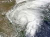
Isolated to scattered showers/storms appear likely today with PW's near 2 inches from increased moisture from the Gulf. The shear axis that brought rain to Central Texas yesterday morning is shearing out near Dallas and today will likely bring and end to the daily sea/bay breeze storms as the Upper Ridge across Florida builds W and dries our Region out into the weekend. We are covering the tropical disturbance E of the Lesser Antilles in our Hurricane Central area of the Forum.
Carla/Alicia/Jerry(In The Eye)/Michelle/Charley/Ivan/Dennis/Katrina/Rita/Wilma/Humberto/Ike/Harvey
Member: National Weather Association
Facebook.com/Weather Infinity
Twitter @WeatherInfinity
Member: National Weather Association
Facebook.com/Weather Infinity
Twitter @WeatherInfinity
-
Electric Lizard
- Posts: 53
- Joined: Sat May 24, 2014 7:37 am
- Contact:
Wise thoughts from NOAA:
Now that we have entered the heart of the hurricane season, there is an increase in the Internet hype around disturbances that NHC is monitoring. Given the long lead times involved, the wide range of possible outcomes, and the historically poor and erratic performance of guidance models with weak disturbances, there is no reliable science to forecast potential impacts to specific locations that would be more than a week away.
Nearly every disturbance poses some potential to become a dangerous hurricane. Folks in hurricane-prone areas should always be keeping an eye on the tropics and be prepared to respond when a true threat develops, but also remember the limitations in the science. NHC’s forecasts of tropical cyclone formation and track extend out only to 5 days - because the science hasn’t advanced enough to reliably forecast beyond that time frame. (We’re working on internal forecasts out to 7 days, but we’re a ways away from feeling comfortable making them public because the errors can be quite large.)
The bottom line really is: be alert, be prepared, but also be wary of long-range projections that go beyond what the science can offer. And make the NOAA National Hurricane Center www.hurricanes.gov your calm, clear, and trusted source for official forecast and warning information on tropical cyclones.

I'm sorry this is off-topic. But Where's Ron Trevino? Haven't seen him for several mornings now. Did I miss something?
-
Texaspirate11
- Posts: 1278
- Joined: Tue Dec 31, 2013 12:24 am
- Contact:
kayci wrote:I'm sorry this is off-topic. But Where's Ron Trevino? Haven't seen him for several mornings now. Did I miss something?
Wasn't he busted for DUI? Not sure, don't want to start rumors.
Maybe he's on vacation??????????
Just because you're disabled, you don't have to be a victim
Be Weather Aware & Prepared!
Barbara Jordan Winner in Media
Disability Integration Consultant
Be Weather Aware & Prepared!
Barbara Jordan Winner in Media
Disability Integration Consultant
-
srainhoutx
- Site Admin
- Posts: 19615
- Joined: Tue Feb 02, 2010 2:32 pm
- Location: Maggie Valley, NC
- Contact:
It is vacation time at KHOU so I would read anymore into this.kayci wrote:I'm sorry this is off-topic. But Where's Ron Trevino? Haven't seen him for several mornings now. Did I miss something?
Carla/Alicia/Jerry(In The Eye)/Michelle/Charley/Ivan/Dennis/Katrina/Rita/Wilma/Humberto/Ike/Harvey
Member: National Weather Association
Facebook.com/Weather Infinity
Twitter @WeatherInfinity
Member: National Weather Association
Facebook.com/Weather Infinity
Twitter @WeatherInfinity
Thanx Srain... He's my favorite morning show personality, missing him.
i hope you summer lover's turn you a/c's off and siaking up all the gosh awful heat!!!! come on autumn!!!! dangbit is hot outside!!!!


-
srainhoutx
- Site Admin
- Posts: 19615
- Joined: Tue Feb 02, 2010 2:32 pm
- Location: Maggie Valley, NC
- Contact:
One more hot day ahead where we may finally reach that 100F mark and then changes are lurking. Increasing moisture is spreading W across the Eastern Gulf and heading towards Louisiana and Texas. To the NW, a deep Western trough will slowly advance E across the Plains and a cold front will begin to sag S across Oklahoma into Texas. PW's rise to the 2+ range with convective temperatures near 90F and capping decreases. There are indications that a more typical sea/bay breeze showers/storms regime that we have seen most of the summer returns for most of the upcoming work week. The fly in the ointment is where that sagging frontal boundary stalls. The GFS is the most aggressive with bring the front near the I-10 Corridor later this week. The Euro is somewhat drier, but does indicate the frontal boundary will near the Central/SE Texas area by Friday. The good news is we have likely endured the hottest weather we will see for the summer once we get beyond today. Showers and storms should increase and cloud cover will likely finally give us a break from our short lived summer heat wave as we transition into September.
- Attachments
-
Carla/Alicia/Jerry(In The Eye)/Michelle/Charley/Ivan/Dennis/Katrina/Rita/Wilma/Humberto/Ike/Harvey
Member: National Weather Association
Facebook.com/Weather Infinity
Twitter @WeatherInfinity
Member: National Weather Association
Facebook.com/Weather Infinity
Twitter @WeatherInfinity