
May 2021:

I wish it was 50 here in SETX!
Mike
Beaumont, TX
(IH-10 & College Street)
Beaumont, TX
(IH-10 & College Street)
https://www.spc.noaa.gov/products/outlo ... _1630.html
Day 1 Convective Outlook
NWS Storm Prediction Center Norman OK
1129 AM CDT Mon May 10 2021
Valid 101630Z - 111200Z
...THERE IS AN ENHANCED RISK OF SEVERE THUNDERSTORMS THIS
AFTERNOON/EVENING FOR PARTS OF THE EDWARDS PLATEAU AND SOUTH CENTRAL
TX...
...THERE IS A SLIGHT RISK OF SEVERE THUNDERSTORMS THIS AFTERNOON
ACROSS NORTHEAST TX...AND THIS AFTERNOON/EVENING ACROSS CENTRAL AND
EASTERN NC...
...SUMMARY...
Severe thunderstorms with very large to giant hail and damaging
winds are expected across parts of southern Texas this afternoon
into tonight. Severe storms with occasional large hail will be
possible this afternoon across northeast Texas and northwest
Louisiana, and a few damaging gusts will also be possible this
afternoon/evening across central and eastern North Carolina.
...Rio Grande Valley/south central TX this afternoon/evening...
Boundary-layer dewpoints in the low 70s have spread westward across
south central TX to the Rio Grande, beneath very steep midlevel
lapse rates near 9 C/km. The combination of surface heating in
cloud breaks by afternoon, low-level ascent along a stalled front
across the Edwards Plateau, and upslope flow into the Serranias Del
Burro (west of DRT), will support at least widely-scattered
thunderstorm development by mid afternoon. The initial storms
should be discrete, with some clustering possible later this evening
as a result of cell mergers/interactions of right- and left-moving
supercells. MLCAPE near 4000 J/kg and effective bulk shear of 40-50
kt with long hodographs will favor supercells capable of producing
isolated very large to giant hail (3-4" diameter) and damaging
gusts. Additionally, low-level hodograph curvature/shear may remain
sufficient for an isolated tornado late this afternoon/evening.
...Central/eastern NC this afternoon/evening...
A subtle midlevel trough will move over NC this afternoon, as a
surface cold front moves southward from VA into NC. Surface heating
in cloud breaks will boost afternoon temperatures to near 80 F with
boundary-layer dewpoints in the low-mid 60s along and south of the
front, resulting in MLCAPE of 500-1000 J/kg this afternoon across
NC. Scattered thunderstorm development is expected along and a
little south of the front as buoyancy is maximized and convective
inhibition is removed by mid afternoon, and storms will subsequently
spread east-southeastward across NC through this evening. Though
midlevel lapse rates will not be steep, deep-layer vertical shear
will be sufficient for a few organized clusters/supercells capable
of producing damaging outflow gusts and marginally severe hail.
...Northeast TX to northwest LA through mid afternoon...
Elevated storms formed this morning over the Red River Valley in
association with warm advection and a subtle midlevel speed max
moving eastward. The storms may persist for a few more hours while
moving along the northeast edge of the buoyancy gradient (MUCAPE of
1000-2000 J/kg), given the potential to maintain some organized
structures with effective bulk shear near 50 kt for the elevated
parcels. Occasional large hail will be the main threat.
...Southern LA this afternoon...
A cluster of storms with occasional bow and embedded supercell
structures is now moving across the New Orleans area. The
near-storm environment is somewhat favorable for organized storm
structures along the residual outflow boundary from overnight
convection. However, the storms appear to have peaked in intensity
earlier this morning, and the potential for any substantial uptick
this afternoon appears too uncertain to warrant any change to the
Marginal risk assessment.
..Thompson/Moore.. 05/10/2021
CLICK TO GET WUUS01 PTSDY1 PRODUCT
NOTE: THE NEXT DAY 1 OUTLOOK IS SCHEDULED BY 2000Z
reminded me of one of my fav xkcd https://xkcd.com/831/djmike wrote: ↑Mon May 10, 2021 7:39 am Grrr. Why is everything staying north? This is so frustrating. Have not seen a drop so far for May in Beaumont so far. Seems like Beaumont southward just doesn’t get storms anymore this time of year, like our highway of storms we always got 5-10 years ago has shifted northward. Always forecasting 60-90% for us then when the system enters our area, poof.
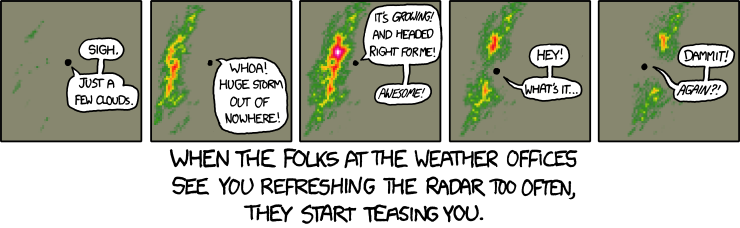
Hahaha thats it EXACTLY! Too funny.unome wrote: ↑Mon May 10, 2021 12:32 pmreminded me of one of my fav xkcd https://xkcd.com/831/djmike wrote: ↑Mon May 10, 2021 7:39 am Grrr. Why is everything staying north? This is so frustrating. Have not seen a drop so far for May in Beaumont so far. Seems like Beaumont southward just doesn’t get storms anymore this time of year, like our highway of storms we always got 5-10 years ago has shifted northward. Always forecasting 60-90% for us then when the system enters our area, poof.
Mike
Beaumont, TX
(IH-10 & College Street)
Beaumont, TX
(IH-10 & College Street)
The HRRR looks interesting Wednesday. Not much at all for tomorrow. Medium to long range has a lot of different storm systems moving into the southern plains but none of them really seem to push into southeast TX very much. We’ll see.

The story of my life in College Station from May - August.djmike wrote: ↑Mon May 10, 2021 12:48 pmHahaha thats it EXACTLY! Too funny.unome wrote: ↑Mon May 10, 2021 12:32 pmreminded me of one of my fav xkcd https://xkcd.com/831/djmike wrote: ↑Mon May 10, 2021 7:39 am Grrr. Why is everything staying north? This is so frustrating. Have not seen a drop so far for May in Beaumont so far. Seems like Beaumont southward just doesn’t get storms anymore this time of year, like our highway of storms we always got 5-10 years ago has shifted northward. Always forecasting 60-90% for us then when the system enters our area, poof.
Dan Satterfield used that xkcd in one of his blog posts, it explains why sometimes it looks like the rain disappears or splits near you, depending on where local radars are in relation to your location. And anyone who is a fan of xkcd deserves a follow, imo 
https://blogs.agu.org/wildwildscience/2 ... all-lines/
https://blogs.agu.org/wildwildscience/2 ... all-lines/

Yeah the HRRR shows training along the stalled frontal boundary Wednesday morning with some locations getting 6+ inches of rain.Something to watch for sure if the trend continues.

That comic says it all - haha!
94f here with a dew point of 80. Summer-like.
94f here with a dew point of 80. Summer-like.
Its pretty dang hot out. 91 here in Katy at my work with a feels like of 98*
-
Iceresistance
- Posts: 577
- Joined: Fri Apr 30, 2021 11:48 pm
- Location: Tecumseh, OK
- Contact:
A very mean line of storms has blown up & is impacting DFW . . .
-
Iceresistance
- Posts: 577
- Joined: Fri Apr 30, 2021 11:48 pm
- Location: Tecumseh, OK
- Contact:
Well, that's not the case for me 80% of the time!unome wrote: ↑Mon May 10, 2021 12:32 pmreminded me of one of my fav xkcd https://xkcd.com/831/djmike wrote: ↑Mon May 10, 2021 7:39 am Grrr. Why is everything staying north? This is so frustrating. Have not seen a drop so far for May in Beaumont so far. Seems like Beaumont southward just doesn’t get storms anymore this time of year, like our highway of storms we always got 5-10 years ago has shifted northward. Always forecasting 60-90% for us then when the system enters our area, poof.
And btw, is there a comic on when the storms/snow rates EXPLODE over you?
This is a very wet signal for an ensemble:

The EURO looks very wet starting this weekend and through next week, we'll see.
- Attachments
-
In other news this morning, brief, very small tornado touchdown up in Huntsville yesterday. I wasn't even aware that the far north of the area was getting rain yesterday amidst the stifling humidity.
https://www.khou.com/article/weather/to ... 9c31f12a1a
https://www.khou.com/article/weather/to ... 9c31f12a1a
-
Iceresistance
- Posts: 577
- Joined: Fri Apr 30, 2021 11:48 pm
- Location: Tecumseh, OK
- Contact:
4 Inch hail has been reported in Ponder, TX Last Night . . .
Lots of action close to home.
Anyone else notice all the convection moving into the Bay of Campeche?
Anyone else notice all the convection moving into the Bay of Campeche?
-
Iceresistance
- Posts: 577
- Joined: Fri Apr 30, 2021 11:48 pm
- Location: Tecumseh, OK
- Contact: