June 2022

General Weather Discussions and Analysis
Stormlover2020
Posts: 457
Joined: Mon Jun 01, 2020 6:04 pm
Contact:

I bet we have tropical storm/depression this week
User avatar
don
Posts: 2611
Joined: Wed Feb 03, 2010 3:33 pm
Location: Heights
Contact:

Expect chances of development to go up today... The conservative EURO finally shows shows TC genesis in its 6Z run this morning.It has a Tropical Storm making landfall near Matagorda.
Attachments
Screenshot 2022-06-27 at 07-55-38 Models ECMWF Hi-Res — Pivotal Weather.png
Screenshot 2022-06-27 at 07-55-52 Models ECMWF Hi-Res — Pivotal Weather.png
Screenshot 2022-06-27 at 08-07-00 Models ECMWF Hi-Res — Pivotal Weather.png
Last edited by don on Mon Jun 27, 2022 8:30 am, edited 1 time in total.
User avatar
djmike
Posts: 1703
Joined: Fri Jan 07, 2011 12:19 pm
Location: BEAUMONT, TX
Contact:

Well again it’s looking more and more like bulk of the showers stay off shore till at least Thursday. Rain chances lowered here in Beaumont till Thursday. Hopefully this changes but Im not holding my breath. My Opinion Only.
Mike
Beaumont, TX
(IH-10 & College Street)
User avatar
djmike
Posts: 1703
Joined: Fri Jan 07, 2011 12:19 pm
Location: BEAUMONT, TX
Contact:

Where does the low trek after Matagorda? If it treks close enough and we remain on the right side, we may get enough rain but again, anyones guess…
Mike
Beaumont, TX
(IH-10 & College Street)
User avatar
don
Posts: 2611
Joined: Wed Feb 03, 2010 3:33 pm
Location: Heights
Contact:

Nearly all models have the "dirty side" and area of most precip over SE Texas.
Kingwood32
Posts: 31
Joined: Sun Sep 28, 2014 2:58 pm
Contact:

Chances weren't raised still 10% and 20%
Stormlover2020
Posts: 457
Joined: Mon Jun 01, 2020 6:04 pm
Contact:

I say it will go up to 30 percent later than 50 by wed morning
User avatar
don
Posts: 2611
Joined: Wed Feb 03, 2010 3:33 pm
Location: Heights
Contact:

Kingwood32 wrote: Mon Jun 27, 2022 8:50 am Chances weren't raised still 10% and 20%
Yeah i wasn't expecting them to raise it this morning.They still want to see 12Z model runs im sure before raising it probably this afternoon or evening.Hopefully we get an invest today also.
Cromagnum
Posts: 2616
Joined: Thu Feb 03, 2011 10:42 pm
Contact:

Rain chances down to 30% and not until late this afternoon. Based on the large plume of moisture digging southwest offshore, I'm betting we see nothing until Wednesday or Thursday.

Image
Last edited by Cromagnum on Mon Jun 27, 2022 9:07 am, edited 1 time in total.
Cpv17
Posts: 5285
Joined: Fri Aug 31, 2018 1:58 pm
Location: El Campo/Wharton
Contact:

Cromagnum wrote: Mon Jun 27, 2022 9:04 am Rain chances down to 30% and not until late this afternoon. Based on the large plume of moisture digging southwest offshore, I'm betting we see nothing until Wednesday or Thursday.
HRRR has a nice scattering of showers south of 10 for later this afternoon.
User avatar
djmike
Posts: 1703
Joined: Fri Jan 07, 2011 12:19 pm
Location: BEAUMONT, TX
Contact:

Cpv17 wrote: Mon Jun 27, 2022 9:06 am
Cromagnum wrote: Mon Jun 27, 2022 9:04 am Rain chances down to 30% and not until late this afternoon. Based on the large plume of moisture digging southwest offshore, I'm betting we see nothing until Wednesday or Thursday.
HRRR has a nice scattering of showers south of 10 for later this afternoon.
Can you post the HRRR for this afternoon/evening?
Mike
Beaumont, TX
(IH-10 & College Street)
Cpv17
Posts: 5285
Joined: Fri Aug 31, 2018 1:58 pm
Location: El Campo/Wharton
Contact:

djmike wrote: Mon Jun 27, 2022 9:53 am
Cpv17 wrote: Mon Jun 27, 2022 9:06 am
Cromagnum wrote: Mon Jun 27, 2022 9:04 am Rain chances down to 30% and not until late this afternoon. Based on the large plume of moisture digging southwest offshore, I'm betting we see nothing until Wednesday or Thursday.
HRRR has a nice scattering of showers south of 10 for later this afternoon.
Can you post the HRRR for this afternoon/evening?
Image
redneckweather
Posts: 1022
Joined: Mon Feb 08, 2010 7:29 pm
Location: Montgomery, Texas
Contact:

So much for a wet week....isolated to scattered type showers with a few rumbles of thunder. Consider yourself lucky if you have one sit on top of you. At least the temps will be down a little.
User avatar
don
Posts: 2611
Joined: Wed Feb 03, 2010 3:33 pm
Location: Heights
Contact:

redneckweather wrote: Mon Jun 27, 2022 10:02 am So much for a wet week....isolated to scattered type showers with a few rumbles of thunder. Consider yourself lucky if you have one sit on top of you. At least the temps will be down a little.
It was always suppose to be scattered storms.If you want widespread rain you'll have to wait to see how the tropical feature evolves later this week...
User avatar
don
Posts: 2611
Joined: Wed Feb 03, 2010 3:33 pm
Location: Heights
Contact:

12Z NAM with a Tropical Storm making landfall in Matagorda very similar to the 6Z EURO.Most of the mesoscale models I've seen so far this morning are coming in more aggressive with the storm.
Attachments
Screenshot 2022-06-27 at 09-44-52 Models NAM — Pivotal Weather.png
Screenshot 2022-06-27 at 09-45-00 Models NAM — Pivotal Weather.png
User avatar
don
Posts: 2611
Joined: Wed Feb 03, 2010 3:33 pm
Location: Heights
Contact:

The 12Z WRF models also came in more aggressive both show a moderate Tropical Storm now.
Attachments
Screenshot 2022-06-27 at 10-10-59 Models HRW WRF-NSSL — Pivotal Weather.png
Screenshot 2022-06-27 at 10-07-37 Models HRW WRF-ARW — Pivotal Weather(1).png
User avatar
DoctorMu
Posts: 5669
Joined: Sun Jun 28, 2015 11:58 am
Location: College Station
Contact:

jasons2k wrote: Mon Jun 27, 2022 6:34 am So for days and days and days Monday (today) was supposed to be a big rain day. And now the latest forecast only has 30%??
That’s just not right. Lucy Lucy waves hello.
Total bust IMBY last night. The cells circumvented us.
User avatar
DoctorMu
Posts: 5669
Joined: Sun Jun 28, 2015 11:58 am
Location: College Station
Contact:

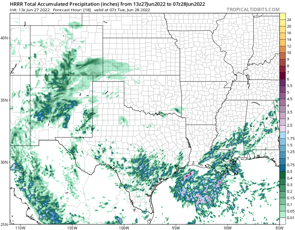
Most of the mesos have sparse rain over the next few days. This is about the most optimistic.

Image
User avatar
don
Posts: 2611
Joined: Wed Feb 03, 2010 3:33 pm
Location: Heights
Contact:

Makes since as the TC is absorbing all the moisture away.BTW there is a rapid increase in convection south of Louisiana this morning with a broad circulation forming.
Dls2010r
Posts: 160
Joined: Sat Dec 01, 2018 6:21 am
Contact:

I’m in Santa Fe. The cloud cover is amazing.🙂
Post Reply
  • Information
  • Who is online

    Users browsing this forum: Semrush [Bot] and 11 guests