
September 2023
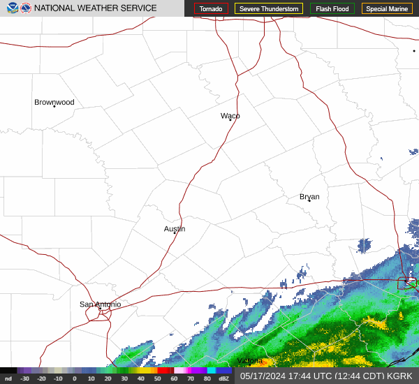
Severe thunderstorm in the Magnolia Gardens area by the San Jacinto River. Strong winds, torrential rain, numerous lighting strikes, hail.
-
tireman4

- Global Moderator

- Posts: 4488
- Joined: Wed Feb 03, 2010 9:24 pm
- Location: Humble, Texas
- Contact:
00
FXUS64 KHGX 142027
AFDHGX
Area Forecast Discussion
National Weather Service Houston/Galveston TX
Issued by National Weather Service Lake Charles LA
327 PM CDT Thu Sep 14 2023
...New SHORT TERM, LONG TERM, MARINE...
.SHORT TERM...
(This evening through Friday Night)
Issued at 325 PM CDT Thu Sep 14 2023
A very moist air mass is in place over the forecast area this
afternoon with an eastward moving upper level disturbance moving
overhead. This has allowed for scattered showers and thunderstorms
to develop across the forecast area. A quasi-stationary frontal
boundary is bisecting the forecast area in half this afternoon and
areas south of the frontal boundary are seeing enough instability
to get some strong to severe storms going.
The upper level disturbance will move off to the east this
evening, and combined with a loss of daytime heating, shower
activity is expected to diminish. May see some patchy fog over
mainly rural areas during the overnight period at locations that
show decent rainfall.
On Friday, the surface boundary may make a little progress to the
southwest, but overall will still be hanging around the forecast
area along with a moist air mass, that scattered showers and
thunderstorms will again occur with daytime heating. Of some
concern is another upper level disturbance that will be heading
this way during the afternoon, as some CAMs have activity
organizing into a thunderstorm complex as it moves through. Again,
any shower activity should gradually come to an end during the
evening hours.
Rua/WFOLCH
&&
.LONG TERM...
(Saturday through next Wednesday)
Issued at 325 PM CDT Thu Sep 14 2023
Still looking at decent rain chances on Saturday as a moist air
mass sticks around and a series of upper level disturbances move
overhead in the zonal flow.
On Sunday, a northern stream short wave will move across the
region and bring a surface front out into the coastal waters.
Showers and thunderstorm chances will occur out ahead of this
system, however drier and more stable air looks to move in behind
it by late Sunday into early next week to reduce rain chances.
A more progressive upper level pattern seems to be developing that
will bring another short wave across in the mid week period to
bring another decent chance of showers and thunderstorms.
Rua/WFOLCH
&&
.AVIATION...
(18Z TAF Issuance)
Issued at 1224 PM CDT Thu Sep 14 2023
An upper level disturbance and moist air mass will work together
the bring about scattered showers and thunderstorms this afternoon
affecting the terminals. Went with tempo groups for all terminals
during mainly the 14/18z-22z time period. Gusty winds along with
visibility restrictions and ceilings lowering to the MVFR/IFR
levels.
Activity is expected to end by sunset as the upper level
disturbance moves off to the east and daytime heating ends.
During the night should be mainly quiet with the exception of
spots dealing with low clouds and patchy fog late tonight into
early Friday morning.
Rua/WFOLCH
&&
.MARINE...
Issued at 325 PM CDT Thu Sep 14 2023
A quasi-stationary frontal boundary will hang around the coastal
waters into the weekend and this will provide a period of mainly
light and variable winds along with low seas.
A series of upper level disturbances will keep a chance for
showers and thunderstorms in the forecast into the weekend. Winds
and seas will be higher in and near the thunderstorms.
Rua/WFOLCH
&&
.PRELIMINARY POINT TEMPS/POPS...
College Station (CLL) 73 88 72 88 / 50 60 50 60
Houston (IAH) 75 92 74 91 / 40 60 40 60
Galveston (GLS) 78 89 78 89 / 60 60 70 70
&&
.HGX WATCHES/WARNINGS/ADVISORIES...
TX...None.
GM...None.
&&
$$
SHORT TERM...WFO LCH
LONG TERM....WFO LCH
AVIATION...WFO LCH
MARINE...WFO LCH

Yall are getting more than me. Yesterday and today so far Im totaling 0.65”. Hopefully soon I can get a deluge in the next day or so. All of us!
Mike
Beaumont, TX
(IH-10 & College Street)
Beaumont, TX
(IH-10 & College Street)

1.74” I feel very lucky.

Only 0.2 inch here, but better than nothing. Enjoying the cloud cover and cooer temps.
Looks like 0.00" here. There was a mist earlier, but entire driveway didn't even get wet. Completely dry when I just checked.
In Las Vegas and it absolutely poured earlier. Meanwhile, home is 20 miles from the gulf and cant get more than a half inch total over 3 months. What a joke.
In Las Vegas and it absolutely poured earlier. Meanwhile, home is 20 miles from the gulf and cant get more than a half inch total over 3 months. What a joke.

.25” today. Not much of anything but better than nothing. The clouds help a lot. Some nasty storms to the west along the boundary. Hopefully more to come tomorrow and Saturday
Overall, HOU and east received more rain that expected. Northern counties north of Hwy 1*5, not so much.
Still, temps are close to 25°F lower than a week ago with could cover - we'll take what we can get.
Still, temps are close to 25°F lower than a week ago with could cover - we'll take what we can get.
From a friend who just washed both cars…
- Attachments
-
- IMG_5696.jpeg (72.73 KiB) Viewed 427 times
Beaucoup rain south of Hwy 1*5.
Mother nature flipped the rain local forecast real time.
Mother nature flipped the rain local forecast real time.
Hoping our friend Cpv17 gets something from this.
-
MontgomeryCoWx

- Posts: 2356
- Joined: Wed Dec 14, 2011 4:31 pm
- Location: Weimar, TX
- Contact:
Just landed in ATX from KC and I was greeted by RAINNNNN
Team #NeverSummer
1-2 inches of rain my ***. What a busted forecast.
I know the feeling, but in fairness, nobody called for a 100% chance of rain. And the most of the models I saw showing that much were mostly north of I-10, and that was still going out forward a few more days from now.
We have another disturbance coming across overnight and then a recharge with another disturbance tomorrow. There may be also a decent shot on Saturday depending on how things play out. This event isn't over yet and already a lot of of folks have seen more rain in the last couple of days than they have seen all summer.
I know it's frustrating so far - I have been there so many times - but eventually you will see rain again and some day soon with El Nino here - you'll even be telling us about all the swampy muck and mosquitos
-
- Information
-
Who is online
Users browsing this forum: Ahrefs [Bot], Bing [Bot], TexasBreeze and 65 guests