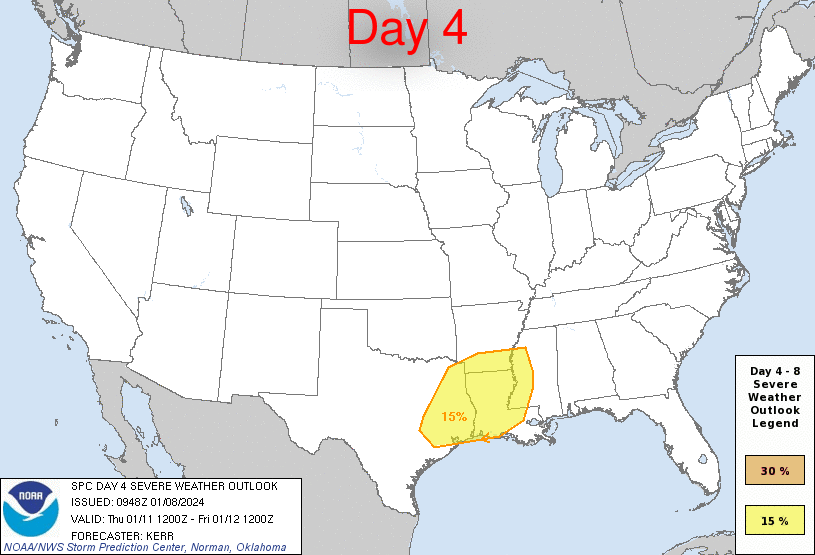
By the way, SPC has also included the HOU metro area (along with SETX/E TX/Most of Louisiana) in the "slight" risk for severe weather again on Friday.....

Of course, I use https://imgbb.com to upload the pic. Then copy the image URL address, then click the insert image button when making a post, and paste the image URL in between the "[img]".


Thank you so much.don wrote: ↑Mon Jan 08, 2024 11:18 amOf course, I use https://imgbb.com to upload the pic. Then copy the image URL address, then click the insert image button when making a post, and paste the image URL in between the "[img]".
tireman4 wrote: ↑Mon Jan 08, 2024 11:41 am ERCOT is closely monitoring the weather conditions moving across Texas this week. Grid conditions are expected to be normal, and ERCOT expects to have sufficient supply to meet demand. Any outages are local in nature. Please contact your local electric provider for information if you are experiencing an outage: http://bit.ly/3TQXHSA. You can monitor grid conditions on http://ercot.com and the app.
@PUCTX
@TDEM
This is why I never really worry about severe thunderstorms where I live. It’s almost always north of me, especially NE of me.

Pas_Bon wrote: ↑Mon Jan 08, 2024 12:40 pmtireman4 wrote: ↑Mon Jan 08, 2024 11:41 am ERCOT is closely monitoring the weather conditions moving across Texas this week. Grid conditions are expected to be normal, and ERCOT expects to have sufficient supply to meet demand. Any outages are local in nature. Please contact your local electric provider for information if you are experiencing an outage: http://bit.ly/3TQXHSA. You can monitor grid conditions on http://ercot.com and the app.
@PUCTX
@TDEM
I’ll believe it when I see it.
This is what happens when your abysmal handling of the icemageddon 3yrs ago remains front and center
Post it. On my phone right now trying to winterize our AWG and cattle troughs.Stratton20 wrote: ↑Mon Jan 08, 2024 1:05 pm Big winter storm on the Euro, bringing snow/ ice down into the houston metro
Thanks for the update. Watching all of this over here in Louisiana. What Houston gets, many times we get the next day.Stratton20 wrote: ↑Mon Jan 08, 2024 1:05 pm Big winter storm on the Euro, bringing snow/ ice down into the houston metro


