
May 2024
-
Stratton20
- Posts: 4300
- Joined: Tue Feb 09, 2021 11:35 pm
- Location: College Station, Texas
- Contact:
I personally think most of the rain will focused in north and eastern texas, still think we see maybe some activity though, i do agree with the WPC outlook, but personally central and western texas need the rain way more than we do, lets send it that way lol
Watch me get another quarter or half inch again lolStratton20 wrote: ↑Thu May 09, 2024 3:50 pm I personally think most of the rain will focused in north and eastern texas, still think we see maybe some activity though, i do agree with the WPC outlook, but personally central and western texas need the rain way more than we do, lets send it that way lol
-
Stratton20
- Posts: 4300
- Joined: Tue Feb 09, 2021 11:35 pm
- Location: College Station, Texas
- Contact:
Cpv17 yeah you have been unlucky recently, but you'll get some more, and even though models currently focus most of the rain North and East of se texas, still is plenty of time for that to change

Technically models show the corridor of disturbances further south than they did last time.For example the Euro has disturbances originating further south in South central Texas before moving east along the I-10 corridor.(FWIW) It's important to not get hung up on QPF amounts and locations in this range. Just like last week we'll have to watch mesoscale models daily to get an idea on rainfall amounts and severe weather areas of interest.And also like last week some areas may get triple the amounts or more than what the models are showing now.
18Z GFS (notice the corridor of higher QPF along I-10 and to the coast of Louisiana).
18Z GFS (notice the corridor of higher QPF along I-10 and to the coast of Louisiana).
- Screenshot 2024-05-09 at 17-20-34 Models GFS - Pivotal Weather.png (1020.44 KiB) Viewed 589 times

18Z GFS
- Screenshot 2024-05-09 at 18-27-42 Models GFS - Pivotal Weather.png (1.01 MiB) Viewed 566 times
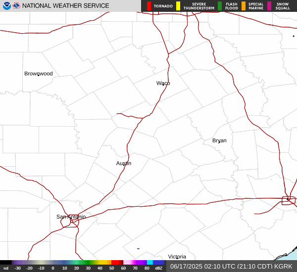
Those hail-filled supercells approaching I-35 are rippin' it!! A Tornado watch is in effect immediately north of us and a severe T-storm watch in CLL.
https://www.star.nesdis.noaa.gov/GOES/s ... &length=24
https://www.star.nesdis.noaa.gov/GOES/s ... &length=24
There is some backbuilding streamer showers forming east of CLL and supercells bearing down Hwy 6 that don't want to take prisoners.
Largely a bust here, but an impressive outflow boundary as intense cells collapsed. A DP of 67°F with the breeze never felt so refreshing. 
The rivers are flooded enough, so losing out on rain is no biggie.
The line may reform as the showers head towards Houston.
The rivers are flooded enough, so losing out on rain is no biggie.
The line may reform as the showers head towards Houston.


A lot of uncertainty. There were thunderstorms earlier today.
-
MontgomeryCoWx

- Posts: 2357
- Joined: Wed Dec 14, 2011 4:31 pm
- Location: Weimar, TX
- Contact:
6 solar storms headed our way. First time in 2.5 decades.
Sun is very angry right now. 12% chance of global EMP.
Sun is very angry right now. 12% chance of global EMP.
Team #NeverSummer
-
christinac2016

- Posts: 116
- Joined: Thu Dec 01, 2016 3:18 pm
- Location: The Woodlands
- Contact:
Is Sunday still looking wet? There’s a tri (now a duathon) at Alexander duessen park.
Yes. They should’ve moved it to Saturday.christinac2016 wrote: ↑Fri May 10, 2024 11:24 am Is Sunday still looking wet? There’s a tri (now a duathon) at Alexander duessen park.
The WPC has increased totals throughout the area. Interesting though that Channel 13 had an 80% chance yesterday for Sunday and now decreased it to 70%. Seems odd to me.

Is this, this evening or tomorrow?MontgomeryCoWx wrote: ↑Fri May 10, 2024 8:44 am 6 solar storms headed our way. First time in 2.5 decades.
Sun is very angry right now. 12% chance of global EMP.
Today's 12Z Global Models
- Screenshot 2024-05-10 at 17-08-12 Models GFS - Pivotal Weather.png (1.09 MiB) Viewed 197 times
- Screenshot 2024-05-10 at 17-08-04 Models GDPS - Pivotal Weather.png (1.03 MiB) Viewed 197 times
- Screenshot 2024-05-10 at 17-08-27 Models ECMWF - Pivotal Weather.png (1.13 MiB) Viewed 197 times
-
Stratton20
- Posts: 4300
- Joined: Tue Feb 09, 2021 11:35 pm
- Location: College Station, Texas
- Contact:
Mesocale models so far are rather unimpressed with much rain down here on mothers day, HRRR, WRF and NAM models keep most of the rain on sunday to our north and east, not a lot of action across se texas
Edit: Mesocales stop at sunday night after 48 hours, will see in another day what they show monday
Edit: Mesocales stop at sunday night after 48 hours, will see in another day what they show monday
Stratton20 wrote: ↑ Mesocale models so far are rather unimpressed with much rain down here on mothers day, HRRR, WRF and NAM models keep most of the rain on sunday to our north and east, not a lot of action across se texas
Edit: Mesocales stop at sunday night after 48 hours, will see in another day what they show monday
- Screenshot 2024-05-10 at 17-23-20 Models HRRR - Pivotal Weather.png (496.94 KiB) Viewed 187 times
- Screenshot 2024-05-10 at 17-23-29 Models HRRR - Pivotal Weather.png (517.75 KiB) Viewed 187 times
I really don’t care two cents what the NAM says. The only time I use that model is during the winter for temperatures. It does somewhat decent for that. Other than that it’s a pile of garbage.