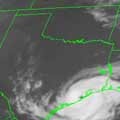
desiredwxgd wrote:95L showing up on the 5-Day. We wait with anticipation.
Perhaps this belongs in the 95L thread?
LOL It doesn't bother me either way Steve. I figured as it was the 5-Day forecast I would palce it here. But I would be happy to place it in the 95 thread as well.
desiredwxgd wrote:95L showing up on the 5-Day. We wait with anticipation.
Perhaps this belongs in the 95L thread?
LOL It doesn't bother me either way Steve. I figured as it was the 5-Day forecast I would palce it here. But I would be happy to place it in the 95 thread as well.
Cool! (thinking cool front... ) Goodnight folks. Have fun and I suspect the 'night crew' will be active in the days ahead.
Carla/Alicia/Jerry(In The Eye)/Michelle/Charley/Ivan/Dennis/Katrina/Rita/Wilma/Humberto/Ike/Harvey
Member: National Weather Association
Facebook.com/Weather Infinity
Twitter @WeatherInfinity
I find these maps disturbing and concerning. There's a broad swath of untapped ocean heat sweeping through the Caribbean leading up to the Texas coast. Hopefully, we can make it through this season without any storms taking this track.
Here is the PREDICT Team Synopsis of what they think will evolve over Central America...
1. GFS & ECMWF continue to show development of a large
circulation to the east of Matthew around day 4. Yesterday, it
looked like it would come out of a east-west oriented vorticity
strip associated with a line of convection emanating out of the
northeast sector of Matthew itself. As of yesteday's 12Z run,
the story has changed. Now it seems that the models are locking
onto a monsoonal-type of development in which high OW values are
pulled eastward by the flow on the south side of Matthew from
the Eastpac into the Caribbean, which then develop. UKMET and
NOGAPS also show this OW max, but they haven't depicted a
circulation or pouch at the day 4-5 period yet. (See the fields
for Matthew to see this potential system.)
T.S. MATTHEW EXPECTED TO MOVE IN THE YUCATAN PENINSULA AND LINGER
INTO WEDNESDAY. SEE NHC ADVISORIES AND DISCUSSIONS. GLOBAL MODELS
HAVE BEEN INSISTENT BUT SOMEWHAT ERRATIC ON ANOTHER AREA OF
CYCLOGENSIS IN THE WESTERN CARIBBEAN AND CONTINUE TO DO SO WITH
MUCH BETTER AGREEMENT. A CONTINUED WESTERLY PHASE MJO IS CURRENTLY
AND FORECAST TO KEEP UP ANOMALOUSLY WESTERLY H850 MB WINDS OVER
THE TROPICAL EPAC AND INTO THE CARIBBEAN. THIS CREATES FAVORABLE
BROAD SCALE CYCLONIC FLOW AND ALONG WITH FAVORABLE CHI VERTICAL
VELOCITY ANOMALIES SETS THE STAGE FOR SOME FORM OF CYCLOGENSIS IN
THIS REGION. ALL GLOBAL MODELS GFS/ECMWF/NGPS/CMC/UKMET AND THEIR
ENSEMBLE MEANS INDICATE A LARGE AREA OF LOW PRESSURE WITH A CENTER
ROUGHLY NEAR WRN CUBA BY DAY 7 FRI. SEE FUTURE NHC/TPC
DISCUSSIONS. HPC PREFERENCE AT THIS TIME IS AGAIN THE DEPICTION BY
ECMWF ENS MEAN.
Carla/Alicia/Jerry(In The Eye)/Michelle/Charley/Ivan/Dennis/Katrina/Rita/Wilma/Humberto/Ike/Harvey
Member: National Weather Association
Facebook.com/Weather Infinity
Twitter @WeatherInfinity
The GFS is ceratinly providing a lot of entertaining solutions lately. Today we have a cyclone hitting the W Coast of FL to only be driven S back to the Western Caribbean.
Carla/Alicia/Jerry(In The Eye)/Michelle/Charley/Ivan/Dennis/Katrina/Rita/Wilma/Humberto/Ike/Harvey
Member: National Weather Association
Facebook.com/Weather Infinity
Twitter @WeatherInfinity
FOR THE PAST FEW DAYS GLOBAL MODELS HAVE BEEN CONSISTENTLY DEPICTING
A TROPICAL CYCLONE IN THE NORTHWESTERN CARIBBEAN SEA TOWARD THE
MIDDLE OF NEXT WEEK. THE MOST RECENT RUNS INDICATE THAT ANY
DEVELOPMENT THERE WOULD LIKELY NOT HAVE CONTINUITY WITH MATTHEW...
BUT RATHER REPRESENT THE FORMATION A NEW TROPICAL CYCLONE.
Carla/Alicia/Jerry(In The Eye)/Michelle/Charley/Ivan/Dennis/Katrina/Rita/Wilma/Humberto/Ike/Harvey
Member: National Weather Association
Facebook.com/Weather Infinity
Twitter @WeatherInfinity
Gosh! I just looked at that too. Is that the remains of Matt? Ironic. That is the area of landfall I had suggested for Matt a few days ago. It was a guess based potential pattern changes. Wow! That would be too bad.


