
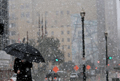
February 1-5, 2011 Arctic Blast/Winter Storm Discussion
-
biggerbyte
- Posts: 1142
- Joined: Thu Feb 04, 2010 12:15 am
- Location: Porter, Texas. (Montgomery County)
- Contact:
Srain, that statement is for south Texas. Once again, they mention bigger chances for winter precip. down there.
Last edited by biggerbyte on Wed Feb 02, 2011 7:36 am, edited 1 time in total.
-
TexasMetBlake
- Pro Met

- Posts: 839
- Joined: Wed Feb 03, 2010 7:03 pm
- Location: Spring/Woodlands
- Contact:

I like the way that looksCandy Cane wrote:img
Last edited by helloitsb on Wed Feb 02, 2011 7:39 am, edited 1 time in total.
-
srainhoutx

- Site Admin

- Posts: 19616
- Joined: Tue Feb 02, 2010 2:32 pm
- Location: Maggie Valley, NC
- Contact:
lol, I'm aware of that BB. As you see, the ramp up is beginning in the chatter from NWS offices along the TX Coastal regions. I strongly suspect we'll see Watches issued from S TX to the Upper TX Coast before the afternoon is out.
Carla/Alicia/Jerry(In The Eye)/Michelle/Charley/Ivan/Dennis/Katrina/Rita/Wilma/Humberto/Ike/Harvey
Member: National Weather Association
Facebook.com/Weather Infinity
Twitter @WeatherInfinity
Member: National Weather Association
Facebook.com/Weather Infinity
Twitter @WeatherInfinity
CC, can you do one like that for Lake Charles?
-
wxman57

- Global Moderator

- Posts: 2621
- Joined: Thu Feb 04, 2010 5:34 am
- Location: Southwest Houston (Westbury)
- Contact:
Hmm, I have no problem turning away or going to bed early, as I did last night at 8:30. It's just a little cold and snow. My main thoughts are that I need to stop at Wal-Mart and get an electric throw to keep me warm on the couch for the next week.
Called Comcast about the internet outage at home. They sent a refresh signal and I can now see that my home PCs are online (LogMeIn Free is great!).
Called Comcast about the internet outage at home. They sent a refresh signal and I can now see that my home PCs are online (LogMeIn Free is great!).
-
TexasMetBlake
- Pro Met
- Posts: 839
- Joined: Wed Feb 03, 2010 7:03 pm
- Location: Spring/Woodlands
- Contact:
It is a product put out by HGX. I did not create it. I looked at the LCH office and they do not have one. Sorry.snowman65 wrote:CC, can you do one like that for Lake Charles?
New Orleans NWS has this one: http://www.srh.noaa.gov/lix/Candy Cane wrote:It is a product put out by HGX. I did not create it. I looked at the LCH office and they do not have one. Sorry.snowman65 wrote:CC, can you do one like that for Lake Charles?

Shreveport has this: http://www.srh.noaa.gov/shv/

Last edited by unome on Wed Feb 02, 2011 7:55 am, edited 1 time in total.
I work in the energy industry here in Houston (at one of the local power plants generating electricity) and there are currently some issues with the entire system. Centerpoint is having some transmission issues which are affecting some of the local substations at the power generating plants in the area. There have been numerous units that have "tripped" and gone offline (basically stopped producing power and not transmitting power out into the lines) and we lost another unit about 20 minutes ago. I can honestly say I haven't seen this much action from the cold affecting the power system since '89 (when I saw first hand what single digit temps can do to cripple a power plant).srainhoutx wrote:Seeing reports of no power in the West U area this morning. Hopefully someone can confirm that.
I've also heard (but have not confirmed) our area is performing rolling blackouts to prevent further damage to system integrity - this may be why certain, larger-block areas are without power and this will continue sporadically. I don't want to sound like chicken little, but I do want to caution folks that things could get worse before they get better - especially with the frozen precipitation we're expecting tomorrow.
I'll try to post more if/when I get any info.
"Weather forecast for tonight: dark. Continued dark overnight, with widely scattered light by morning." - The late/great George Carlin
-
srainhoutx
- Site Admin
- Posts: 19616
- Joined: Tue Feb 02, 2010 2:32 pm
- Location: Maggie Valley, NC
- Contact:
wxman57 wrote: My main thoughts are that I need to stop at Wal-Mart and get an electric throw to keep me warm on the couch for the next week.
Carla/Alicia/Jerry(In The Eye)/Michelle/Charley/Ivan/Dennis/Katrina/Rita/Wilma/Humberto/Ike/Harvey
Member: National Weather Association
Facebook.com/Weather Infinity
Twitter @WeatherInfinity
Member: National Weather Association
Facebook.com/Weather Infinity
Twitter @WeatherInfinity
-
biggerbyte
- Posts: 1142
- Joined: Thu Feb 04, 2010 12:15 am
- Location: Porter, Texas. (Montgomery County)
- Contact:
wxman57 wrote:Hmm, I have no problem turning away or going to bed early, as I did last night at 8:30. It's just a little cold and snow. My main thoughts are that I need to stop at Wal-Mart and get an electric throw to keep me warm on the couch for the next week.
Called Comcast about the internet outage at home. They sent a refresh signal and I can now see that my home PCs are online (LogMeIn Free is great!).
Yes, we realize you are less than thrilled, wxman.
Try and stay warm.
-
srainhoutx
- Site Admin
- Posts: 19616
- Joined: Tue Feb 02, 2010 2:32 pm
- Location: Maggie Valley, NC
- Contact:
Thanks for that very important information, updraft. Please let us know regarding any updates.updraft wrote:I work in the energy industry here in Houston (at one of the local power plants generating electricity) and there are currently some issues with the entire system. Centerpoint is having some transmission issues which are affecting some of the local substations at the power generating plants in the area. There have been numerous units that have "tripped" and gone offline (basically stopped producing power and not transmitting power out into the lines) and we lost another unit about 20 minutes ago. I can honestly say I haven't seen this much action from the cold affecting the power system since '89 (when I saw first hand what single digit temps can do to cripple a power plant).srainhoutx wrote:Seeing reports of no power in the West U area this morning. Hopefully someone can confirm that.
I've also heard (but have not confirmed) our area is performing rolling blackouts to prevent further damage to system integrity - this may be why certain, larger-block areas are without power and this will continue sporadically. I don't want to sound like chicken little, but I do want to caution folks that things could get worse before they get better - especially with the frozen precipitation we're expecting tomorrow.
I'll try to post more if/when I get any info.
Carla/Alicia/Jerry(In The Eye)/Michelle/Charley/Ivan/Dennis/Katrina/Rita/Wilma/Humberto/Ike/Harvey
Member: National Weather Association
Facebook.com/Weather Infinity
Twitter @WeatherInfinity
Member: National Weather Association
Facebook.com/Weather Infinity
Twitter @WeatherInfinity
-
TexasMetBlake
- Pro Met
- Posts: 839
- Joined: Wed Feb 03, 2010 7:03 pm
- Location: Spring/Woodlands
- Contact:
In other news....
I AM LOVING THIS WEATHER!
I AM LOVING THIS WEATHER!
-
biggerbyte
- Posts: 1142
- Joined: Thu Feb 04, 2010 12:15 am
- Location: Porter, Texas. (Montgomery County)
- Contact:
Ah ha... You must have slept.
-
TexasMetBlake
- Pro Met
- Posts: 839
- Joined: Wed Feb 03, 2010 7:03 pm
- Location: Spring/Woodlands
- Contact:
Well the fall in temps has halted.
IAH: 22 (up 1 degree)
CXO: 19 (last four hours)
Hooks: 20 (up 1 degree)
CLL: 19 (last four hours)
UTS: 18 (up 1 degree)
DFW: 13 (down 1 degree)
ACT: 17
Amarillo: -4 (up 1 degree)
IAH: 22 (up 1 degree)
CXO: 19 (last four hours)
Hooks: 20 (up 1 degree)
CLL: 19 (last four hours)
UTS: 18 (up 1 degree)
DFW: 13 (down 1 degree)
ACT: 17
Amarillo: -4 (up 1 degree)
Last edited by TexasMetBlake on Wed Feb 02, 2011 8:04 am, edited 1 time in total.
-
wxman57
- Global Moderator
- Posts: 2621
- Joined: Thu Feb 04, 2010 5:34 am
- Location: Southwest Houston (Westbury)
- Contact:
It's not a Saffir-Simpson Cat 5. Aussies use a different scale, though it is a Cat 4 (125 kts). Don't have any clients in Cairns - they're drilling off NW Australia. I can sleep quite well when there's a hurricane in eastern Australia.Ed Mahmoud wrote: Wow.
A Cat 5 threatening Cairns, QLD doesn't get you checking the MTSAT imagery and BOM warnings, I take it. Going to probably miss Cairns with the eyewall, good for them.
6Z model runs indicate from 0.13" (GFS) to 0.25" (NAM) to near 1/2" (Canadian) precip tomorrow night/Friday here. Predicting snow accumulations isn't much more than a guess. Small bands can set up and produce significantly heavier amounts over small areas. In general, I'm expecting from 1/2" to 3" across the area. And it's possible some areas could see more than 3". Can't tell who'll be hit most yet.
Here's a 6Z GFS 2m temp forecast. Note the second Arctic front NEXT Tuesday. It's a stronger front than yesterday's. No post-frontal precip indicated, though.

-
TexasMetBlake
- Pro Met
- Posts: 839
- Joined: Wed Feb 03, 2010 7:03 pm
- Location: Spring/Woodlands
- Contact:
Hey wxman, I think you'd agree that there's no way we're getting to 38 today. We may not even hit freezing at IAH. Tomorrow either for that matter.


Is it looking more like this event may start out as Freezing rain or sleet and then transitioning to snow? Or is it looking like more of a snow event? Thanks!
-
TexasMetBlake
- Pro Met
- Posts: 839
- Joined: Wed Feb 03, 2010 7:03 pm
- Location: Spring/Woodlands
- Contact:
Morning Humor: (Fox News)
