
Extratropical Depression Lee: Inland N Gulf States
-
srainhoutx

- Site Admin

- Posts: 19616
- Joined: Tue Feb 02, 2010 2:32 pm
- Location: Maggie Valley, NC
- Contact:
The 12Z GFS suggests a stalled system for 42 hour before slowly moving the 850mb vort NE.
Carla/Alicia/Jerry(In The Eye)/Michelle/Charley/Ivan/Dennis/Katrina/Rita/Wilma/Humberto/Ike/Harvey
Member: National Weather Association
Facebook.com/Weather Infinity
Twitter @WeatherInfinity
Member: National Weather Association
Facebook.com/Weather Infinity
Twitter @WeatherInfinity

These models have been too slow so far with the system...it was not even going to make landfall until late Sunday or Monday yesterday morning and now it is nearly on the coast. Could still slow and stall some...but it will likely be over land.srainhoutx wrote:The 12Z GFS suggests a stalled system for 42 hour before slowly moving the 850mb vort NE.
biggerbyte wrote:Radar depicts a different story. And if this rain stops just shy of Montgomery and Harris Counties, I will personally drive over and slap somebody named Lee.
Gusty winds in Stafford, some clouds. No sign of any rain drops. 
biggerbyte wrote:Radar depicts a different story. And if this rain stops just shy of Montgomery and Harris Counties, I will personally drive over and slap somebody named Lee.
biggerbyte as bummed out as i am about Lee i can always use a good laugh. thanks.
-
srainhoutx
- Site Admin
- Posts: 19616
- Joined: Tue Feb 02, 2010 2:32 pm
- Location: Maggie Valley, NC
- Contact:
BULLETIN
TROPICAL STORM LEE INTERMEDIATE ADVISORY NUMBER 8A
NWS NATIONAL HURRICANE CENTER MIAMI FL AL132011
100 PM CDT SAT SEP 03 2011
...LEE STALLS JUST SOUTH OF LOUISIANA...HEAVY RAINS CONTINUE OVER
SOUTHERN PORTIONS OF LOUISIANA...MISSISSIPPI...AND ALABAMA...
SUMMARY OF 100 PM CDT...1800 UTC...INFORMATION
----------------------------------------------
LOCATION...29.3N 91.8W
ABOUT 45 MI...75 KM SW OF MORGAN CITY LOUISIANA
ABOUT 65 MI...100 KM S OF LAFAYETTE LOUISIANA
MAXIMUM SUSTAINED WINDS...60 MPH...95 KM/H
PRESENT MOVEMENT...STATIONARY
MINIMUM CENTRAL PRESSURE...991 MB...29.26 INCHES
WATCHES AND WARNINGS
--------------------
CHANGES WITH THIS ADVISORY...
NONE.
SUMMARY OF WATCHES AND WARNINGS IN EFFECT...
A TROPICAL STORM WARNING IS IN EFFECT FOR...
* ALABAMA/FLORIDA BORDER WESTWARD TO SABINE PASS TEXAS...INCLUDING
THE CITY OF NEW ORLEANS...LAKE PONTCHARTRAIN...AND LAKE MAUREPAS
A TROPICAL STORM WATCH IS IN EFFECT FOR...
* ALABAMA/FLORIDA BORDER EASTWARD TO DESTIN FLORIDA
A TROPICAL STORM WATCH MEANS THAT TROPICAL STORM CONDITIONS ARE
POSSIBLE WITHIN THE WATCH AREA...GENERALLY WITHIN 48 HOURS.
FOR STORM INFORMATION SPECIFIC TO YOUR AREA...INCLUDING POSSIBLE
INLAND WATCHES AND WARNINGS...PLEASE MONITOR PRODUCTS ISSUED BY
YOUR LOCAL NATIONAL WEATHER SERVICE FORECAST OFFICE.
DISCUSSION AND 48-HOUR OUTLOOK
------------------------------
AT 100 PM CDT...1800 UTC...THE CENTER OF TROPICAL STORM LEE WAS
LOCATED BY SATELLITE AND RECONNAISSANCE AIRCRAFT NEAR LATITUDE
29.3 NORTH...LONGITUDE 91.8 WEST. LEE HAS BEEN STATIONARY THE PAST
FEW HOURS. A SLOW AND POSSIBLY ERRATIC MOTION TOWARD THE NORTH OR
NORTH-NORTHWEST IS EXPECTED DURING THE NEXT 24 HOURS...FOLLOWED BY
A GRADUAL TURN TOWARD THE NORTHEAST. ON THE FORECAST TRACK...THE
CENTER OF LEE IS EXPECTED TO CROSS THE LOUISIANA COAST LATER THIS
AFTERNOON OR EVENING...THEN MOVE SLOWLY ACROSS SOUTHERN LOUISIANA
ON SUNDAY.
MAXIMUM SUSTAINED WINDS ARE NEAR 60 MPH...95 KM/H...WITH HIGHER
GUSTS. SOME FLUCTUATIONS IN STRENGTH ARE POSSIBLE THIS AFTERNOON
AND EVENING...WITH GRADUAL WEAKENING FORECAST TO OCCUR ON SUNDAY.
TROPICAL-STORM-FORCE WINDS EXTEND OUTWARD UP TO 230 MILES...370 KM
FROM THE CENTER. A SUSTAINED WIND OF 47 MPH...76 KM/H WAS RECENTLY
REPORTED BY A NOAA BUOY LOCATED ABOUT 50 MILES EAST OF THE MOUTH OF
THE MISSISSIPPI RIVER. A C-MAN STATION AT SOUTHWEST PASS LOUISIANA
RECENTLY MEASURED A SUSTAINED WIND OF 46 MPH...75 KM/H AT AN
ELEVATION OF 100 FEET ABOVE THE SURFACE.
A STORM SURGE OF 4 FEET HAS BEEN REPORTED AT SHELL BEACH LOUISIANA
AND ALSO AT NEW CANAL STATION IN LAKE PONTCHARTRAIN. A SURGE HEIGHT
OF 2 FEET HAS BEEN REPORTED AS FAR EAST AS PASCAGOULA MISSISSIPPI.
RAINFALL AMOUNTS UP TO 7 INCHES HAVE OCCURRED THUS FAR ACROSS
PORTIONS OF SOUTHEASTERN LOUISIANA.
REPORTS FROM AN AIR FORCE RESERVE RECONNAISSANCE AIRCRAFT AND
OFFSHORE OIL RIGS INDICATE THE MINIMUM CENTRAL PRESSURE IS
991 MB...29.26 INCHES.
HAZARDS AFFECTING LAND
----------------------
RAINFALL...TROPICAL STORM LEE IS EXPECTED TO PRODUCE TOTAL RAIN
ACCUMULATIONS OF 10 TO 15 INCHES OVER SOUTHERN LOUISIANA...SOUTHERN
MISSISSIPPI...AND SOUTHERN ALABAMA THROUGH SUNDAY NIGHT...WITH
POSSIBLE ISOLATED MAXIMUM AMOUNTS OF 20 INCHES. THESE RAINS ARE
EXPECTED TO CAUSE EXTENSIVE FLOODING. RAINFALL AMOUNTS OF 4 TO 8
INCHES WILL BE POSSIBLE OVER THE FLORIDA PANHANDLE THROUGH SUNDAY
NIGHT.
STORM SURGE...A STORM SURGE WILL RAISE WATER LEVELS BY AS MUCH AS
3 TO 5 FEET ABOVE GROUND LEVEL ALONG THE LOUISIANA COAST...AND BY AS
MUCH AS 2 TO 4 FEET ABOVE GROUND LEVEL ALONG THE MISSISSIPPI AND
ALABAMA COASTS INCLUDING MOBILE BAY. SEE PRODUCTS ISSUED BY LOCAL
NATIONAL WEATHER SERVICE FORECAST OFFICES FOR MORE DETAILS.
WIND...TROPICAL STORM CONDITIONS ARE EXPECTED TO CONTINUE OVER
PORTIONS OF THE WARNING AREA TODAY.
TORNADOES...A FEW TORNADOES WILL BE POSSIBLE THROUGH TONIGHT OVER
PORTIONS OF SOUTHERN LOUISIANA...SOUTHERN MISSISSIPPI...SOUTHERN
ALABAMA...AND THE FAR WESTERN FLORIDA PANHANDLE.
NEXT ADVISORY
-------------
NEXT COMPLETE ADVISORY...400 PM CDT.
$$
FORECASTER STEWART
Carla/Alicia/Jerry(In The Eye)/Michelle/Charley/Ivan/Dennis/Katrina/Rita/Wilma/Humberto/Ike/Harvey
Member: National Weather Association
Facebook.com/Weather Infinity
Twitter @WeatherInfinity
Member: National Weather Association
Facebook.com/Weather Infinity
Twitter @WeatherInfinity
mckinne63 wrote:Gusty winds in Stafford, some clouds. No sign of any rain drops.
Nothing here in Richmond either.
-
srainhoutx
- Site Admin
- Posts: 19616
- Joined: Tue Feb 02, 2010 2:32 pm
- Location: Maggie Valley, NC
- Contact:
For what it's worth, RECON data suggests a slow WNW motion over the past couple of hours along Coastal SW Vermillion/SE Cameron Counties just offshore.
Product: Air Force Vortex Message (URNT12 KNHC)
Transmitted: 3rd day of the month at 17:56Z
Aircraft: Air Force Aircraft (Last 3 digits of the tail number are 307)
Storm Number & Year: 13L in 2011
Storm Name: Lee (flight in the North Atlantic basin)
Mission Number: 5
Observation Number: 15
A. Time of Center Fix: 3rd day of the month at 17:40:30Z
B. Center Fix Coordinates: 29°15'N 92°29'W (29.25N 92.4833W)
B. Center Fix Location: 72 miles (116 km) to the SSW (202°) from Lafayette, LA, USA.
C. Minimum Height at Standard Level: 1,343m (4,406ft) at 850mb
D. Estimated (by SFMR or visually) Maximum Surface Wind: 42kts (~ 48.3mph)
E. Location of the Estimated Maximum Surface Wind: 44 nautical miles (51 statute miles) to the ESE (115°) of center fix
F. Maximum Flight Level Wind Inbound: From 205° at 41kts (From the SSW at ~ 47.2mph)
G. Location of Maximum Flight Level Wind Inbound: 57 nautical miles (66 statute miles) to the ESE (113°) of center fix
H. Minimum Sea Level Pressure: 990mb (29.23 inHg)
I. Maximum Flight Level Temp & Pressure Altitude Outside Eye: 18°C (64°F) at a pressure alt. of 1,523m (4,997ft)
J. Maximum Flight Level Temp & Pressure Altitude Inside Eye: 23°C (73°F) at a pressure alt. of 1,527m (5,010ft)
K. Dewpoint Temp & Sea Surface Temp (collected at same location as temp inside eye): Not Available
L. Eye Character: Not Available
M. Eye Shape: Not Available
N. Fix Determined By: Penetration, Wind, Pressure and Temperature
N. Fix Level: 850mb
O. Navigation Fix Accuracy: 0.02 nautical miles
O. Meteorological Accuracy: 2 nautical miles
Remarks Section:
Maximum Flight Level Wind: 41kts (~ 47.2mph) in the southeast quadrant at 17:07:50Z
Carla/Alicia/Jerry(In The Eye)/Michelle/Charley/Ivan/Dennis/Katrina/Rita/Wilma/Humberto/Ike/Harvey
Member: National Weather Association
Facebook.com/Weather Infinity
Twitter @WeatherInfinity
Member: National Weather Association
Facebook.com/Weather Infinity
Twitter @WeatherInfinity

Lee is such a big tease ..... c'mon nudge just a bit further NW please
~~~When Thunder Roars Go Indoors~~~
~~~Turn Around Don't Drown~~~
~~~Run From The Water, Hide From The Wind~~~
~~~Turn Around Don't Drown~~~
~~~Run From The Water, Hide From The Wind~~~

Continuous light/moderate rain here in Beaumont with breezy conditions! Several gusts of 30 here also! Nice! I'll take it! Houston, hopefully it comes your way! It does seem to be expanding west! Hopefully it makes it!
Mike
Beaumont, TX
(IH-10 & College Street)
Beaumont, TX
(IH-10 & College Street)
I took a look at the NAM this morning did anyone else look at what it does to Lee???
Edit to add I know the NAM isn't very reliable but the scenario it painted was interesting to say the least.
http://mag.ncep.noaa.gov/NCOMAGWEB/appc ... mageSize=M
Edit to add I know the NAM isn't very reliable but the scenario it painted was interesting to say the least.
http://mag.ncep.noaa.gov/NCOMAGWEB/appc ... mageSize=M
Last edited by djjordan on Sat Sep 03, 2011 1:49 pm, edited 1 time in total.
~~~When Thunder Roars Go Indoors~~~
~~~Turn Around Don't Drown~~~
~~~Run From The Water, Hide From The Wind~~~
~~~Turn Around Don't Drown~~~
~~~Run From The Water, Hide From The Wind~~~
-
biggerbyte
- Posts: 1142
- Joined: Thu Feb 04, 2010 12:15 am
- Location: Porter, Texas. (Montgomery County)
- Contact:
It is coming, folks. Entering Liberty County now.
LOL .... Closest I'll get to Lee is tonight when I'm over in Clear Lake
~~~When Thunder Roars Go Indoors~~~
~~~Turn Around Don't Drown~~~
~~~Run From The Water, Hide From The Wind~~~
~~~Turn Around Don't Drown~~~
~~~Run From The Water, Hide From The Wind~~~
Extreme outer bands JUST at the Harris county line...I think Houston will get some later today! 
Mike
Beaumont, TX
(IH-10 & College Street)
Beaumont, TX
(IH-10 & College Street)


-
txsnowmaker
- Posts: 632
- Joined: Wed Feb 03, 2010 4:07 pm
- Location: SW Houston (Galleria area)
- Contact:
It would be nice. I just can't help looking at the radar and seeing those small slivers of the outer rain bands disappear as they graze Harris County's eastern boundary. Hoping for the best but continuing to assume the worst.biggerbyte wrote:It is coming, folks. Entering Liberty County now.
By the way, I will be none too upset if we don't hear back from our friend in Monterrey about prospects for a La Nina return.
-
srainhoutx
- Site Admin
- Posts: 19616
- Joined: Tue Feb 02, 2010 2:32 pm
- Location: Maggie Valley, NC
- Contact:
Lake Charles radar suggests the board center is making some progress WNW skirting slowly along Coastal Vermillion/Cameron Parishes...

Carla/Alicia/Jerry(In The Eye)/Michelle/Charley/Ivan/Dennis/Katrina/Rita/Wilma/Humberto/Ike/Harvey
Member: National Weather Association
Facebook.com/Weather Infinity
Twitter @WeatherInfinity
Member: National Weather Association
Facebook.com/Weather Infinity
Twitter @WeatherInfinity
-
desiredwxgd
- Posts: 125
- Joined: Wed Feb 03, 2010 6:30 pm
- Location: TX/LA/Southern New England
- Contact:
I can only hope that you folks in Houston get in on some of this rain. Here in the Golden Triangle it has been nice with rain today, windy, and temps in the low 70's. Fingers and prayers for you folks west!!!
JMS
SR. ENSC.
SR. ENSC.
-
desiredwxgd
- Posts: 125
- Joined: Wed Feb 03, 2010 6:30 pm
- Location: TX/LA/Southern New England
- Contact:
[quote="djjordan"]I took a look at the NAM this morning did anyone else look at what it does to Lee???
Edit to add I know the NAM isn't very reliable but the scenario it painted was interesting to say the least.
Now that would be some set-up......
Edit to add I know the NAM isn't very reliable but the scenario it painted was interesting to say the least.
Now that would be some set-up......
JMS
SR. ENSC.
SR. ENSC.
-
desiredwxgd
- Posts: 125
- Joined: Wed Feb 03, 2010 6:30 pm
- Location: TX/LA/Southern New England
- Contact:
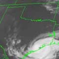
Not too bad looking.....
Edit to add-- perfect "comma"...
Edit to add-- perfect "comma"...
- Attachments
-
- avn-l.jpg (32 KiB) Viewed 5746 times
JMS
SR. ENSC.
SR. ENSC.