N. Atl Hurricane Season 2014 Discussions
Hey Wx and Srain....*please* pardon the question (which I'm sure is the bane of all weather forecasters) but....my family has been saving for two years for our trip to Disney and we're to arrive on June 12th. I would sincerely appreciate any information on this system trekking East towards Florida.....
- srainhoutx
- Site Admin

- Posts: 19616
- Joined: Tue Feb 02, 2010 2:32 pm
- Location: Maggie Valley, NC
- Contact:
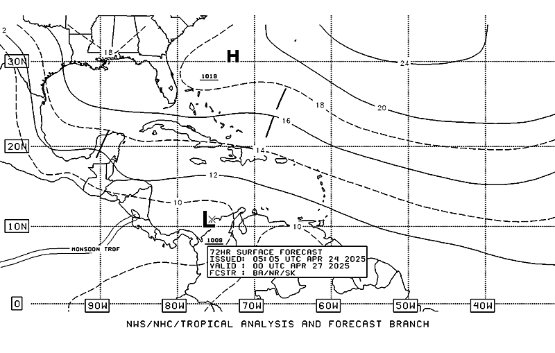
Over the weekend the GFS as well as the ensembles have suggested that an area of disturbed weather may develop near the Gulf of Belize. the NW Caribbean Sea as well as the Bay of Campeche into the Gulf of Tehuantepec appear to be the favored areas of any tropical development as the monsoon trough lingers and festers with a broad area of lower pressure across those areas of the Tropical Eastern Pacific and Western Atlantic Basin.
Carla/Alicia/Jerry(In The Eye)/Michelle/Charley/Ivan/Dennis/Katrina/Rita/Wilma/Humberto/Ike/Harvey
Member: National Weather Association
Facebook.com/Weather Infinity
Twitter @WeatherInfinity
Member: National Weather Association
Facebook.com/Weather Infinity
Twitter @WeatherInfinity
- Katdaddy
- Global Moderator

- Posts: 2502
- Joined: Thu Feb 04, 2010 8:18 am
- Location: League City, Tx
- Contact:
The tropics are being discussed briefly in this afternoon's Houston-Galveston AFD:
THE 12Z MODELS FROM YESTERDAY AND AGAIN TODAY POINTING TO A POTENT TROPICAL WAVE MOVING FROM THE CENTRAL CARIBBEAN ON SUNDAY TO THE YUCATAN ON TUESDAY AND (THEN MODELS DIVERGE) EITHER STALLING PER GFS IN THE CENTRAL GULF GETTING STRETCHED OUT INTO NRN FL TO BAY OF CAMPECHE OR PUSHING WEST AND INTO TX ON WEDNESDAY. IF THIS COMES TO PASS THAT IT REACHES SETX THEN RAIN CHANCES SHOULD INCREASE DRAMATICALLY.
Perhaps some additional well needed rainfall along the coastal areas should this tropical wave move toward the TX Coast next week.
a bit of a mention in the 2am TWO, but nothing on the graphical TWO as of yet
http://www.nhc.noaa.gov/text/refresh/MI ... WOAT.shtml
000
ABNT20 KNHC 270500
TWOAT
TROPICAL WEATHER OUTLOOK
NWS NATIONAL HURRICANE CENTER MIAMI FL
200 AM EDT FRI JUN 27 2014
For the North Atlantic...Caribbean Sea and the Gulf of Mexico:
An area of low pressure could form off the southeastern coast of
the United States this weekend and linger into early next week.
Some development of this system is possible if it remains over
water.
* Formation chance through 48 hours...low...near 0 percent.
* Formation chance through 5 days...low...20 percent.
$$
Forecaster Berg
the 24-thru 72-hr surface forecasts show the low dropping out of S Carolina
http://www.nhc.noaa.gov/marine/

-
Paul Robison
unome wrote:a bit of a mention in the 2am TWO, but nothing on the graphical TWO as of yet
http://www.nhc.noaa.gov/text/refresh/MI ... WOAT.shtml
000
ABNT20 KNHC 270500
TWOAT
TROPICAL WEATHER OUTLOOK
NWS NATIONAL HURRICANE CENTER MIAMI FL
200 AM EDT FRI JUN 27 2014
For the North Atlantic...Caribbean Sea and the Gulf of Mexico:
An area of low pressure could form off the southeastern coast of
the United States this weekend and linger into early next week.
Some development of this system is possible if it remains over
water.
* Formation chance through 48 hours...low...near 0 percent.
* Formation chance through 5 days...low...20 percent.
$$
Forecaster Berg
the 24-thru 72-hr surface forecasts show the low dropping out of S Carolina
http://www.nhc.noaa.gov/marine/
Dear Unome:
Could this low end up being a Gulf storm and a threat to SE TX. if it goes into florida per GFS?
- srainhoutx
- Site Admin

- Posts: 19616
- Joined: Tue Feb 02, 2010 2:32 pm
- Location: Maggie Valley, NC
- Contact:
TROPICAL WEATHER OUTLOOK
NWS NATIONAL HURRICANE CENTER MIAMI FL
200 PM EDT SUN JUL 20 2014
For the North Atlantic...Caribbean Sea and the Gulf of Mexico:
1. A broad area of low pressure, associated with a tropical wave, is
located over the eastern Atlantic Ocean about midway between the
west coast of Africa and the Leeward Islands. Showers and
thunderstorms are currently disorganized, and any development during
the next day or two should be slow to occur. Beyond a couple of
days, environmental conditions are expected to become unfavorable
for development while the system moves westward at 15 to 20 mph.
* Formation chance through 48 hours...low...10 percent.
* Formation chance through 5 days...low...10 percent.
Forecaster Cangialosi/Brennan

Carla/Alicia/Jerry(In The Eye)/Michelle/Charley/Ivan/Dennis/Katrina/Rita/Wilma/Humberto/Ike/Harvey
Member: National Weather Association
Facebook.com/Weather Infinity
Twitter @WeatherInfinity
Member: National Weather Association
Facebook.com/Weather Infinity
Twitter @WeatherInfinity
Tropical Weather Outlook Text
TROPICAL WEATHER OUTLOOK
NWS NATIONAL HURRICANE CENTER MIAMI FL
800 PM EDT SUN JUL 27 2014
For the North Atlantic...Caribbean Sea and the Gulf of Mexico:
1. A tropical wave is producing disorganized shower activity several
hundred miles west-southwest of the Cape Verde Islands.
Environmental conditions appear conducive for some gradual
development, especially by the middle of the week, while the system
moves westward to west-northwestward at 10 to 15 mph.
* Formation chance through 48 hours...low...10 percent.
* Formation chance through 5 days...medium...40 percent.
Forecaster Berg

It is the tropical wave to the far left.
TROPICAL WEATHER OUTLOOK
NWS NATIONAL HURRICANE CENTER MIAMI FL
800 PM EDT SUN JUL 27 2014
For the North Atlantic...Caribbean Sea and the Gulf of Mexico:
1. A tropical wave is producing disorganized shower activity several
hundred miles west-southwest of the Cape Verde Islands.
Environmental conditions appear conducive for some gradual
development, especially by the middle of the week, while the system
moves westward to west-northwestward at 10 to 15 mph.
* Formation chance through 48 hours...low...10 percent.
* Formation chance through 5 days...medium...40 percent.
Forecaster Berg

It is the tropical wave to the far left.
- srainhoutx
- Site Admin

- Posts: 19616
- Joined: Tue Feb 02, 2010 2:32 pm
- Location: Maggie Valley, NC
- Contact:
For those that follow twitter, I have been informed that a local forecasting company (ImpactWeather) is rather active via that social media venue...@TropicsWatch
Carla/Alicia/Jerry(In The Eye)/Michelle/Charley/Ivan/Dennis/Katrina/Rita/Wilma/Humberto/Ike/Harvey
Member: National Weather Association
Facebook.com/Weather Infinity
Twitter @WeatherInfinity
Member: National Weather Association
Facebook.com/Weather Infinity
Twitter @WeatherInfinity
- srainhoutx
- Site Admin

- Posts: 19616
- Joined: Tue Feb 02, 2010 2:32 pm
- Location: Maggie Valley, NC
- Contact:
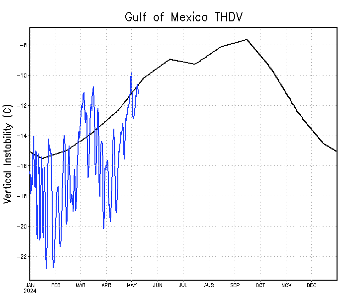
As mentioned in the Main Weather forum August Discussion threat, it appears the Tropical Atlantic particularly the Caribbean Sea and the Gulf of Mexico may become conducive for tropical development. Easterly waves have been rolling off the African Coast and heading W over the past week. The dust that has plagued the Main Development Region continues to abate and instability is increasing across the Caribbean and the Gulf. A couple of the waves cross the Atlantic have maintained their spin and showers/storms continue to fire along the monsoonal trough located around 10N. RECON has been tasked to investigate an area of disturbed weather late on Thursday if need be. If the are is designated and INVEST, we will start a Topic for that and follow the progress as the days move forward.
http://www.ssd.noaa.gov/goes/east/tatl/avn-animated.gif


WEATHER RECONNAISSANCE FLIGHTS
CARCAH, NATIONAL HURRICANE CENTER, MIAMI, FL.
1000 AM EDT TUE 19 AUGUST 2014
SUBJECT: TROPICAL CYCLONE PLAN OF THE DAY (TCPOD)
VALID 20/1100Z TO 21/1100Z AUGUST 2014
TCPOD NUMBER.....14-080
I. ATLANTIC REQUIREMENTS
1. NEGATIVE RECONNAISSANCE REQUIREMENTS.
2. OUTLOOK FOR SUCCEEDING DAY.....POSSIBLE LOW LEVEL INVEST
NEAR 15.0N 55.0W AT 21/1730Z.
http://www.ssd.noaa.gov/goes/east/tatl/avn-animated.gif


WEATHER RECONNAISSANCE FLIGHTS
CARCAH, NATIONAL HURRICANE CENTER, MIAMI, FL.
1000 AM EDT TUE 19 AUGUST 2014
SUBJECT: TROPICAL CYCLONE PLAN OF THE DAY (TCPOD)
VALID 20/1100Z TO 21/1100Z AUGUST 2014
TCPOD NUMBER.....14-080
I. ATLANTIC REQUIREMENTS
1. NEGATIVE RECONNAISSANCE REQUIREMENTS.
2. OUTLOOK FOR SUCCEEDING DAY.....POSSIBLE LOW LEVEL INVEST
NEAR 15.0N 55.0W AT 21/1730Z.
Carla/Alicia/Jerry(In The Eye)/Michelle/Charley/Ivan/Dennis/Katrina/Rita/Wilma/Humberto/Ike/Harvey
Member: National Weather Association
Facebook.com/Weather Infinity
Twitter @WeatherInfinity
Member: National Weather Association
Facebook.com/Weather Infinity
Twitter @WeatherInfinity
- srainhoutx
- Site Admin

- Posts: 19616
- Joined: Tue Feb 02, 2010 2:32 pm
- Location: Maggie Valley, NC
- Contact:
A couple of things to watch as we enter September. A robust Kelvin wave is moving E across the Central/Eastern Pacific and the medium to longer range reliable European and GFS are suggesting a tropical disturbance developing in the SW Caribbean Sea and heading NW across the Yucatan potentially ending up in the Western Gulf. While it is too soon to know with any certainty exactly if we see development, the Global models are suggesting a chance for increased tropical activity in early September in our part of the Atlantic Basin.
Carla/Alicia/Jerry(In The Eye)/Michelle/Charley/Ivan/Dennis/Katrina/Rita/Wilma/Humberto/Ike/Harvey
Member: National Weather Association
Facebook.com/Weather Infinity
Twitter @WeatherInfinity
Member: National Weather Association
Facebook.com/Weather Infinity
Twitter @WeatherInfinity
- Katdaddy
- Global Moderator

- Posts: 2502
- Joined: Thu Feb 04, 2010 8:18 am
- Location: League City, Tx
- Contact:
A weak tropical upper tropospheric trough (TUTT) low is along the Upper TX Coast and at the surface a trough of low pressure off the Upper TX Coast. This area remains disorganized however a burst of convection has developed overnight offshore of the TX and LA coast. The NHC continues to give this area a 10% chance of tropical development over the next 5 day however conditions are not that favorable. The current ongoing trend of convection could be a sign of a little more organization and will be watched.
it up to 20% at 8am
http://www.nhc.noaa.gov/gtwo.php?basin=atlc&fdays=5
TROPICAL WEATHER OUTLOOK
NWS NATIONAL HURRICANE CENTER MIAMI FL
800 AM EDT WED AUG 27 2014
For the North Atlantic...Caribbean Sea and the Gulf of Mexico:
The National Hurricane Center is issuing advisories on Hurricane Cristobal, located several hundred miles west of Bermuda.
1. Shower and thunderstorm activity associated with a weak low pressure area located over the northwestern Gulf of Mexico has increased during the past few hours. Some additional development is possible before the system moves inland over southern Texas and northern Mexico on Thursday.
* Formation chance through 48 hours...low...20 percent.
* Formation chance through 5 days...low...20 percent.
2. A tropical wave located about 600 miles east of the Lesser Antilles continues to produce disorganized cloudiness and showers. This system is now expected to move generally westward across the Caribbean Sea with little development during the next few days. However, environmental conditions could become favorable for some
development by early next week in the western Caribbean Sea or southern Gulf of Mexico.
* Formation chance through 48 hours...low...near 0 percent.
* Formation chance through 5 days...low...10 percent.
3. A tropical wave is forecast to move off the west coast of Africa on Friday. Conditions appear to be favorable for some development thereafter while the system moves westward at 10 to 15 mph across the eastern Atlantic.
* Formation chance through 48 hours...low...near 0 percent.
* Formation chance through 5 days...medium...40 percent.
Forecaster Brown/Brennan
August 28 two week forecast from August 28 thru September 10
http://tropical.atmos.colostate.edu/Inc ... 8_2014.pdf
CSU us forecasting below average. Despite MJO in Phase 2, which is most favorable, other factors are involved
http://tropical.atmos.colostate.edu/Inc ... 8_2014.pdf
CSU us forecasting below average. Despite MJO in Phase 2, which is most favorable, other factors are involved
-
Paul Robison

Would someone please identify the location on this euro 12z chart. Is it SE Texas? I can't tell at this scale.

Strange how the GFS shows nothing.
One final item: Does the Euro veto all other models when it comes to tropical weather forecasting?
http://www.noaanews.noaa.gov/stories201 ... _2014.html
"The Atlantic hurricane season will officially end November 30, and will be remembered as a relatively quiet season as was predicted. Still, the season afforded NOAA scientists with opportunities to produce new forecast products, showcase successful modeling advancements, and conduct research to benefit future forecasts. "
...

