
October 2015 - Severe Storms/Moderate Risk Excessive Rainfal
Says are definitely getting darker and the rain is picking up in Sugar Land
HGX update http://forecast.weather.gov/product.php ... glossary=0
area forecast discussion...corrected
national weather service houston/galveston tx
344 pm cdt sat oct 24 2015
.dangerous major storm event to affect parts of southeast texas with the greatest threat tonight through sunday morning...
.discussion...
expect surface low pressure to continue to organize along the south texas coast and head up to the north and northeast into our county warning area`s coastal waters tonight through sunday morning. increasingly diffluent flow aloft in combination with record breaking moisture levels will bring increasing shower and thunderstorm coverage to parts of our area as the evening and night progresses. the amount of rain we receive is going to depend on the position of the low as it moves up the coast... and some models are beginning to hint that there is a chance that the greatest rainfall totals might end up near the coast (coastal counties) and across the gulf waters. the potential remains for rainfall totals for this entire event (including the last 24 to 36 hours) of 4 to 6 inches north of a line from columbus to cleveland and 6 to 12 inches south of that line. higher amounts are possible. if the rainfall numbers end up this high... flash flooding will occur. besides the heavy rain threat... counties generally along and south of the highway 59 corridor are under a tornado watch until 10 pm for the potential of additional waterspout/tornado development. onshore winds ahead of this storm system and offshore winds behind this storm system have the potential to be strong... so a wind advisory will be in effect from 1 am sunday to 7 am monday for all coastal counties. we might need to add harris county to this advisory later. lowering rain chances can be expected from west to east on sunday as the storm system moves away from our area. 42
&&
.marine...
the overall philosophy hasn`t changed much over the past 8 hours or so... that of a developing low in the vicinity of south texas and passing offshore near parallel to our coastline through monday. since the low/trough is forming this afternoon it will be difficult to determine its eventual track... and ultimately... its coastal and maritime impacts. this forecast takes this low/trough close enough to the upper texas coastline to induce strong all local water overnight southeasterlies that will back to strong offshore by late sunday into early monday as the low exits into louisiana through the day monday. of course... water run-up will cause coastal flooding issues over the low-lying areas of the bolivar and inundate beaches and beach roadways down the coast... from galveston island to matagorda county. the forecast highest water levels (above mllw) during high tide times will range between 4 and 5 feet... or around 2 to 2.5 feet above normal tides.
beginning tonight into early sunday morning and persisting into late sunday evening/overnight monday morning... there will be a plethora of advisories and warnings in effect. please refer to our home page and the marine section to gather the details of the when and where of all hazards... from dangerous rip currents along the coast to the onset and duration of double digit sea heights over the far offshore waters. be safe out there! 31


MESOSCALE PRECIPITATION DISCUSSION 0609
NWS WEATHER PREDICTION CENTER COLLEGE PARK MD
512 PM EDT SAT OCT 24 2015
AREAS AFFECTED...SOUTHEAST TX
CONCERNING...HEAVY RAINFALL...FLASH FLOODING LIKELY
VALID 242115Z - 250130Z
SUMMARY...EFFICIENT WARM PROCESS HEAVY RAINFALL THREAT CONTINUES
INTO THE EVENING HOURS...RESULTING IN ADDITIONAL FLASH FLOODING.
DISCUSSION...A DEEP MOIST FLOW CONTINUES AHEAD OF A COLD FRONT
CROSSING CENTRAL INTO SOUTH TX. IN ADVANCE OF THE FRONT...A 20 TO
30 KNOT LOW LEVEL SOUTHERLY INFLOW PUMPS 2.25 TO 2.50 INCH
PRECIPITABLE
WATER AIR (WHICH IS ABOUT THREE STANDARD DEVIATIONS ABOVE THE
MEAN) INTO SOUTHEAST TX. DEEPER INSTABILITY IS IN THE PROCESS OF
BEING PUSHED TO THE SOUTHEAST TX COAST BY THE COLD
FRONT...LIMITING THE DEEP...WARM RAIN PROCESS DOMINATED CONVECTION
TO SOUTHEAST TX.
HOURLY RAINFALL RATES (PER THE KBRO RADAR AND THE MRMS RAINFALL
RATE PRODUCT) BETWEEN 2.00 AND 2.50 INCHES WILL RESULT IN
ADDITIONAL FLASH FLOODING AHEAD OF THE FRONT FROM KBRO TO KVCT
THROUGH ABOUT 25/00Z. AFTER THAT TIME...THE DEEPEST MOISTURE
SHOULD BE PUSHED JUST OFF THE FAR SOUTH TX COAST.
SURFACE LOW PRESSURE FORMING ON THE FRONT OFF THE FAR SOUTH TX
COAST SHOULD BEGIN TO FOCUS THE 25 TO 35 KNOT LOW LEVEL INFLOW
FURTHER NORTH (BETWEEN KVCT AND KIAH) BEFORE 25/01Z. INSTABILITY
OVER LAND IN THESE AREAS WILL BE FAIRLY MEAGER...BUT THE LOW LEVEL
INFLOW SHOULD TRANSPORT ENOUGH MUCAPE BASED INSTABILITY TO THE
COAST TO SUSTAINED LOW TOPPED WARM PROCESS CONVECTION INTO THE
EARLY EVENING.
THERE IS A FAIRLY STRONG HIGH RESOLUTION GUIDANCE SIGNATURE
(INCLUDING THE LATEST HRRR/RAP/12Z WRF-ARW/NMMB/12Z REGIONAL GEM)
FOR HEAVY RAINFALL OVER THE MID TX COAST...WITH LOCAL 3-5 INCH
AMOUNTS POSSIBLE. WHILE THREE HOUR FLASH FLOOD GUIDANCE VALUES ARE
RELATIVELY HIGH HERE...HIGH RAINFALL RATES IN THE HIGH MOISTURE
CONTENT AIRMASS SHOULD PRODUCE FLASH FLOODING.
~~~When Thunder Roars Go Indoors~~~
~~~Turn Around Don't Drown~~~
~~~Run From The Water, Hide From The Wind~~~
~~~Turn Around Don't Drown~~~
~~~Run From The Water, Hide From The Wind~~~
SPECIAL WEATHER STATEMENT
NATIONAL WEATHER SERVICE HOUSTON/GALVESTON TX
431 PM CDT SAT OCT 24 2015
TXZ227-237-242215-
BRAZORIA TX-FORT BEND TX-
431 PM CDT SAT OCT 24 2015
...SIGNIFICANT WEATHER ADVISORY FOR CENTRAL BRAZORIA AND SOUTHEASTERN
FORT BEND COUNTIES UNTIL 515 PM CDT...
AT 429 PM CDT...DOPPLER RADAR WAS TRACKING WEAK ROTATION IN STORMS
NEAR BAILEY`S PRAIRIE...AND HOLIDAY LAKES...MOVING NORTH AT 20 MPH.
FUNNEL CLOUDS AND WINDS IN EXCESS OF 40 MPH WILL BE POSSIBLE WITH
THESE STORMS.
LOCATIONS IMPACTED INCLUDE...
NORTHERN LAKE JACKSON...NORTHWESTERN ANGLETON...WEST COLUMBIA...IOWA
COLONY...HOLIDAY LAKES...BAILEY`S PRAIRIE...BONNEY...BRAZOS BEND
STATE PARK...WILD PEACH VILLAGE AND ROSHARON.
PRECAUTIONARY/PREPAREDNESS ACTIONS...
THIS STORM MAY INTENSIFY...SO BE CERTAIN TO MONITOR LOCAL RADIO AND
TV STATIONS...AS WELL AS LOCAL CABLE TV OUTLETS...FOR ADDITIONAL
INFORMATION AND POSSIBLE WARNINGS FROM THE NATIONAL WEATHER SERVICE.
TO REPORT SEVERE WEATHER...CONTACT YOUR NEAREST LAW ENFORCEMENT
AGENCY. THEY WILL RELAY YOUR REPORT TO THE NATIONAL WEATHER SERVICE
OFFICE IN LEAGUE CITY .
~~~When Thunder Roars Go Indoors~~~
~~~Turn Around Don't Drown~~~
~~~Run From The Water, Hide From The Wind~~~
~~~Turn Around Don't Drown~~~
~~~Run From The Water, Hide From The Wind~~~

I have about 1.25" in my rain gauge in the Pearland area.
If it keep raining at this rate (moderate/slow), we may be alright.
If it keep raining at this rate (moderate/slow), we may be alright.
5:88pm....
.18" of rain...wind east @ 16mph
.18" of rain...wind east @ 16mph

BULLETIN - EAS ACTIVATION REQUESTED
FLASH FLOOD WARNING
NATIONAL WEATHER SERVICE HOUSTON/GALVESTON TX
514 PM CDT SAT OCT 24 2015
THE NATIONAL WEATHER SERVICE IN LEAGUE CITY HAS ISSUED A
* FLASH FLOOD WARNING FOR...
MATAGORDA COUNTY IN SOUTHEASTERN TEXAS...
SOUTHWESTERN BRAZORIA COUNTY IN SOUTHEASTERN TEXAS...
SOUTHWESTERN FORT BEND COUNTY IN SOUTHEASTERN TEXAS...
EAST CENTRAL WHARTON COUNTY IN SOUTHEASTERN TEXAS...
EASTERN JACKSON COUNTY IN SOUTH CENTRAL TEXAS...
* UNTIL 815 PM CDT
* AT 512 PM CDT...DOPPLER RADAR INDICATED HEAVY RAIN ACROSS THE
WARNED AREA. BETWEEN 3 AND 5 INCHES OF RAIN HAVE FALLEN SINCE 11
AM CDT. FLASH FLOODING IS EXPECTED TO BEGIN SHORTLY.
* SOME LOCATIONS THAT WILL EXPERIENCE FLOODING INCLUDE...
MATAGORDA...BAY CITY...PALACIOS...WEST COLUMBIA...SWEENY...SOUTH
TEXAS NUCLEAR PLANT...BRAZORIA...NEEDVILLE...MARKHAM...
BOLING-IAGO...SARGENT...WILD PEACH VILLAGE...VAN VLECK...
BLESSING...WADSWORTH...DAMON AND MIDFIELD.
HEAVY SHOWERS WITH RAINFALL RATES OF UP TO 3 INCHES PER HOUR WILL
MOVE ACROSS THE AREA THROUGH 7 PM CDT.
PRECAUTIONARY/PREPAREDNESS ACTIONS...
MOVE TO HIGHER GROUND NOW. ACT QUICKLY TO PROTECT YOUR LIFE.
TURN AROUND...DONT DROWN WHEN ENCOUNTERING FLOODED ROADS. MOST FLOOD
DEATHS OCCUR IN VEHICLES.
PLEASE REPORT FLOODING TO YOUR LOCAL LAW ENFORCEMENT AGENCY WHEN YOU
CAN DO SO SAFELY.
~~~When Thunder Roars Go Indoors~~~
~~~Turn Around Don't Drown~~~
~~~Run From The Water, Hide From The Wind~~~
~~~Turn Around Don't Drown~~~
~~~Run From The Water, Hide From The Wind~~~

Alvin getting slammed right now, high winds and heavy rainfall... gonna enjoy my big pot of chili and watch this forum till I can't keep my eyes open anymore tonight... generator is at bay if needed. High and dry so far...
]
]
-
srainhoutx

- Site Admin

- Posts: 19616
- Joined: Tue Feb 02, 2010 2:32 pm
- Location: Maggie Valley, NC
- Contact:
Looks like the Coastal Low is organizing near Brownsville. Surface observations suggest W winds now in NE Mexico with SE and NE winds across the Coastal tier of Counties. Stay safe gang and keep everyone updated if/when things develop... 

- Attachments
-
-
Carla/Alicia/Jerry(In The Eye)/Michelle/Charley/Ivan/Dennis/Katrina/Rita/Wilma/Humberto/Ike/Harvey
Member: National Weather Association
Facebook.com/Weather Infinity
Twitter @WeatherInfinity
Member: National Weather Association
Facebook.com/Weather Infinity
Twitter @WeatherInfinity
-
Katdaddy

- Global Moderator

- Posts: 2502
- Joined: Thu Feb 04, 2010 8:18 am
- Location: League City, Tx
- Contact:
BULLETIN - EAS ACTIVATION REQUESTED
FLASH FLOOD WARNING
NATIONAL WEATHER SERVICE HOUSTON/GALVESTON TX
514 PM CDT SAT OCT 24 2015
THE NATIONAL WEATHER SERVICE IN LEAGUE CITY HAS ISSUED A
* FLASH FLOOD WARNING FOR...
MATAGORDA COUNTY IN SOUTHEASTERN TEXAS...
SOUTHWESTERN BRAZORIA COUNTY IN SOUTHEASTERN TEXAS...
SOUTHWESTERN FORT BEND COUNTY IN SOUTHEASTERN TEXAS...
EAST CENTRAL WHARTON COUNTY IN SOUTHEASTERN TEXAS...
EASTERN JACKSON COUNTY IN SOUTH CENTRAL TEXAS...
* UNTIL 815 PM CDT
* AT 512 PM CDT...DOPPLER RADAR INDICATED HEAVY RAIN ACROSS THE
WARNED AREA. BETWEEN 3 AND 5 INCHES OF RAIN HAVE FALLEN SINCE 11
AM CDT. FLASH FLOODING IS EXPECTED TO BEGIN SHORTLY.
* SOME LOCATIONS THAT WILL EXPERIENCE FLOODING INCLUDE...
MATAGORDA...BAY CITY...PALACIOS...WEST COLUMBIA...SWEENY...SOUTH
TEXAS NUCLEAR PLANT...BRAZORIA...NEEDVILLE...MARKHAM...
BOLING-IAGO...SARGENT...WILD PEACH VILLAGE...VAN VLECK...
BLESSING...WADSWORTH...DAMON AND MIDFIELD.
HEAVY SHOWERS WITH RAINFALL RATES OF UP TO 3 INCHES PER HOUR WILL
MOVE ACROSS THE AREA THROUGH 7 PM CDT.
PRECAUTIONARY/PREPAREDNESS ACTIONS...
MOVE TO HIGHER GROUND NOW. ACT QUICKLY TO PROTECT YOUR LIFE.
TURN AROUND...DONT DROWN WHEN ENCOUNTERING FLOODED ROADS. MOST FLOOD
DEATHS OCCUR IN VEHICLES.
PLEASE REPORT FLOODING TO YOUR LOCAL LAW ENFORCEMENT AGENCY WHEN YOU
CAN DO SO SAFELY.
FLASH FLOOD WARNING
NATIONAL WEATHER SERVICE HOUSTON/GALVESTON TX
514 PM CDT SAT OCT 24 2015
THE NATIONAL WEATHER SERVICE IN LEAGUE CITY HAS ISSUED A
* FLASH FLOOD WARNING FOR...
MATAGORDA COUNTY IN SOUTHEASTERN TEXAS...
SOUTHWESTERN BRAZORIA COUNTY IN SOUTHEASTERN TEXAS...
SOUTHWESTERN FORT BEND COUNTY IN SOUTHEASTERN TEXAS...
EAST CENTRAL WHARTON COUNTY IN SOUTHEASTERN TEXAS...
EASTERN JACKSON COUNTY IN SOUTH CENTRAL TEXAS...
* UNTIL 815 PM CDT
* AT 512 PM CDT...DOPPLER RADAR INDICATED HEAVY RAIN ACROSS THE
WARNED AREA. BETWEEN 3 AND 5 INCHES OF RAIN HAVE FALLEN SINCE 11
AM CDT. FLASH FLOODING IS EXPECTED TO BEGIN SHORTLY.
* SOME LOCATIONS THAT WILL EXPERIENCE FLOODING INCLUDE...
MATAGORDA...BAY CITY...PALACIOS...WEST COLUMBIA...SWEENY...SOUTH
TEXAS NUCLEAR PLANT...BRAZORIA...NEEDVILLE...MARKHAM...
BOLING-IAGO...SARGENT...WILD PEACH VILLAGE...VAN VLECK...
BLESSING...WADSWORTH...DAMON AND MIDFIELD.
HEAVY SHOWERS WITH RAINFALL RATES OF UP TO 3 INCHES PER HOUR WILL
MOVE ACROSS THE AREA THROUGH 7 PM CDT.
PRECAUTIONARY/PREPAREDNESS ACTIONS...
MOVE TO HIGHER GROUND NOW. ACT QUICKLY TO PROTECT YOUR LIFE.
TURN AROUND...DONT DROWN WHEN ENCOUNTERING FLOODED ROADS. MOST FLOOD
DEATHS OCCUR IN VEHICLES.
PLEASE REPORT FLOODING TO YOUR LOCAL LAW ENFORCEMENT AGENCY WHEN YOU
CAN DO SO SAFELY.
total precipitable water http://earth.nullschool.net/#current/wi ... 26.34,1235
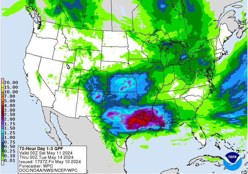
still a good feed from the gulf, & this forecast for days 1-3 http://www.wpc.ncep.noaa.gov/qpf/d13_fi ... 5725735818
still a good feed from the gulf, & this forecast for days 1-3 http://www.wpc.ncep.noaa.gov/qpf/d13_fi ... 5725735818
Looks like the center of the Low is in the Gulf, east of Las Malvinas.srainhoutx wrote:Looks like the Coastal Low is organizing near Brownsville. Surface observations suggest W winds now in NE Mexico with SE and NE winds across the Coastal tier of Counties. Stay safe gang and keep everyone updated if/when things develop...
-
srainhoutx
- Site Admin
- Posts: 19616
- Joined: Tue Feb 02, 2010 2:32 pm
- Location: Maggie Valley, NC
- Contact:
Corpus had a late AFD, but it is clear the Coastal Low is developing across that area up to Port Lavaca.Ounce wrote:Looks like the center of the Low is in the Gulf, east of Las Malvinas.srainhoutx wrote:Looks like the Coastal Low is organizing near Brownsville. Surface observations suggest W winds now in NE Mexico with SE and NE winds across the Coastal tier of Counties. Stay safe gang and keep everyone updated if/when things develop...
AREA FORECAST DISCUSSION
NATIONAL WEATHER SERVICE CORPUS CHRISTI TX
533 PM CDT SAT OCT 24 2015
.SHORT TERM (TONIGHT THROUGH SUNDAY)...A 1005 MB SFC LOW
SOUTHWEST OF PORT LAVACA AND A 1004 MB SFC LOW IN THE LAGUNA MADRE
(WHAT IS LEFT OF HURRICANE PATRICIA) WILL EVENTUALLY MERGE TONIGHT
AND SUNDAY ACROSS THE NORTHWEST GULF. THE RESULTING CYCLOGENESIS
INTO AT LEAST A 1001-1003 MB SFC LOW WILL INTENSIFY THE NORTHWEST
WINDS ACROSS THE ENTIRE CWA TNT AND SUNDAY.
Carla/Alicia/Jerry(In The Eye)/Michelle/Charley/Ivan/Dennis/Katrina/Rita/Wilma/Humberto/Ike/Harvey
Member: National Weather Association
Facebook.com/Weather Infinity
Twitter @WeatherInfinity
Member: National Weather Association
Facebook.com/Weather Infinity
Twitter @WeatherInfinity
-
Andrew
- Site Admin
- Posts: 3440
- Joined: Wed Feb 03, 2010 9:46 pm
- Location: North-West Houston
- Contact:
Beginning to get concerned about the increasing LLJ over the region. Setting up a little farther west than anticipated. GFS is really bullish on a good 10-15 inches just west of Galveston.
For Your Infinite Source For All Things Weather Visit Our Facebook
Yikes Andrew.
-
srainhoutx
- Site Admin
- Posts: 19616
- Joined: Tue Feb 02, 2010 2:32 pm
- Location: Maggie Valley, NC
- Contact:
NWS STORM PREDICTION CENTER NORMAN OK
0614 PM CDT SAT OCT 24 2015
AREAS AFFECTED...TX COASTAL WATERS AND INLAND ACROSS THE TX COAST.
CONCERNING...TORNADO WATCH 520...
VALID 242314Z - 250045Z
THE SEVERE WEATHER THREAT FOR TORNADO WATCH 520 CONTINUES.
SUMMARY...RISK FOR A FEW WATERSPOUTS/TORNADOES CONTINUES FROM THE
COASTAL WATERS ALONG MAINLY THE MIDDLE AND UPPER TX COASTS...AND
INLAND ACROSS 1-2 TIERS OF COUNTIES IN THIS COASTAL REGION OF THE
NORTHWEST GULF OF MEXICO.
DISCUSSION...LATE AFTERNOON/EARLY EVENING SURFACE ANALYSES CONTINUED
TO SHOW CYCLOGENESIS JUST EAST OF THE SOUTH TX COAST...AS THE
MIDLEVEL REMNANT CIRCULATION OF PATRICIA HAS MOVED TO THE NORTHEAST
OVER OR JUST EAST OF DEEP SOUTH TX AT 2230Z. A BAROCLINIC ZONE
EXTENDED POLEWARD FROM THE LOW TO NEAR RKP...AND THEN NORTHEAST TO A
LOW NEAR HOU WHERE THERE IS A PERSISTENT AREA OF PRESSURE FALLS WITH
THE INTERSECTION OF AN INVERTED TROUGH EXTENDING NORTHEAST THROUGH
EAST TX. NEAR AND SOUTH OF THE PRIMARY SURFACE LOW...RADAR IMAGERY
INDICATED A WELL-DEFINED OUTFLOW BOUNDARY CONTINUING TO SHIFT
EASTWARD OFFSHORE OF THE TX COAST FROM THE LATITUDES OF CRP TO BRO.
FURTHER DEEPENING OF THE PRIMARY SURFACE LOW IS EXPECTED THIS
EVENING AS IT TRACKS TO THE NORTHEAST ACROSS THE WARM NORTHWEST GULF
WATERS...WITH STRENGTHENING LOWER-TROPOSPHERIC WINDS AS THE MIDLEVEL
REMNANT OF PATRICIA MOVES TO THE NORTHEAST.
RADAR IMAGERY FROM THE TX COAST WSR-88DS SHOWED NUMEROUS SMALL
SUPERCELLS OVER THE GULF...EACH HAVING TRANSIENT LOW-LEVEL
ROTATIONAL COUPLETS POTENTIALLY PRODUCING WATERSPOUTS. CURRENTLY...
THE GREATEST TORNADO THREAT IS WITH STORMS TRACKING TO THE NORTHWEST
WITHIN THE NORTHEAST PERIPHERY OF THE SURFACE LOW/REMNANTS OF
PATRICIA INTO THE COASTAL AND INLAND COUNTIES FROM MATAGORDA/WHARTON
TO EITHER SIDE OF THE HOUSTON METRO AREA WITHIN WW 520. THE HGX VAD
INDICATED THE WIND PROFILE REMAINS VERTICALLY VEERED WITH SUFFICIENT
LOW-LEVEL SHEAR FOR SUSTAINED LOW-LEVEL ROTATION /0-3-KM SRH AROUND
250 M2 PER S2/. THE WATERSPOUT/TORNADO THREAT WILL SHIFT TO THE
NORTHEAST ALONG THE TX COAST...POTENTIALLY REACHING FAR SOUTHWEST LA
LATER THIS EVENING...POSSIBLY RESULTING IN A NEW TORNADO WATCH TO
THE NORTHEAST OF WW 520.
..PETERS.. 10/24/2015
ATTN...WFO...LCH...HGX...CRP...
Carla/Alicia/Jerry(In The Eye)/Michelle/Charley/Ivan/Dennis/Katrina/Rita/Wilma/Humberto/Ike/Harvey
Member: National Weather Association
Facebook.com/Weather Infinity
Twitter @WeatherInfinity
Member: National Weather Association
Facebook.com/Weather Infinity
Twitter @WeatherInfinity
Looking at the radar trends, it seems like the rain may be done for me after this last band moves through in the next hour or so.. Seems the edge of the rain is already moving in from the West. Is more supposed to build back towards the West? It looks to me this may be more of a problem for the folks in East Houston and Eastward. Any thoughts?