
I hope everyone remains safe this Thanksgiving holiday
Thank you for this wonderful forum, I am so grateful for this place.
Be blessed and safe everyone.
November 2015: Ending Cold & Rainy
-
Texaspirate11

- Posts: 1278
- Joined: Tue Dec 31, 2013 12:24 am
- Contact:
Just because you're disabled, you don't have to be a victim
Be Weather Aware & Prepared!
Barbara Jordan Winner in Media
Disability Integration Consultant
Be Weather Aware & Prepared!
Barbara Jordan Winner in Media
Disability Integration Consultant
http://www.wunderground.com/blog/JeffMa ... ench-texas
Late-Season Tropical Storm Sandra Could Strike Mexico and Drench Texas
By: Jeff Masters and Bob Henson , 4:05 PM GMT on November 24, 2015
part of it:
Sandra may complicate heavy rain threat over Southern Plains
The biggest impacts from Sandra may occur from Texas to Arkansas, where a prolonged heavy rain episode late this week seems likely to be enhanced by Sandra’s remnants. A strong upper-level low settling over the U.S. Southwest will help pull Sandra northeastward, and the storm’s moisture will flow atop a very shallow cold air mass that will spill across the Southern Plains later this week. Such setups involving Eastern Pacific hurricanes are notorious for giving the region some of its heaviest rains on record, but they are far more typical of September or October than late November. Localized flooding may become a major travel headache, as rainfall totals of 3-8” are expected from Thursday through Sunday over central and north Texas, southeast Oklahoma, southern Missouri, and northwest Arkansas (see Figure 2 below). These rains will fall over areas that have been doused repeatedly over the last few months. With 50.75” of rain for the year through Tuesday morning, Dallas-Fort Worth area may well break its all-time annual precipitation record of 53.54” (set in 1991) before November is done.
On the northwest edge of the heavy rain swath, there should be a parallel strip with low-level temperatures cold enough for mostly light but widespread freezing rain, sleet, and/or snow, with an initial round from Thanksgiving Day into Friday and perhaps a second batch over the weekend as another lobe rotates around the sprawling upper-level low. Frozen precipitation is most likely from the Texas Panhandle and northwest Oklahoma across much of Kansas to eastern Nebraska.
and, from
http://www.wunderground.com/blog/SteveG ... trynum=407
Stormy Thanksgiving / Potential Flash Flooding and Blizzard Conditions for Texas / W
By: Steve Gregory , 10:39 PM GMT on November 23, 2015
a bit of it:
While forecasts so far in advance have limited skill, it now appears that by the time most of the storm ends late Sunday – rainfall totals of 1” to 2” are possible over eastern New Mexico, with 4 to 6” possible in portions of Texas and Oklahoma - with isolated, T-Storm related totals up to 8”. In addition, 1 to 2 feet of snow is POSSIBLE in the TX/OK Panhandle. Stay Tuned…
-
srainhoutx

- Site Admin

- Posts: 19619
- Joined: Tue Feb 02, 2010 2:32 pm
- Location: Maggie Valley, NC
- Contact:
EXTENDED FORECAST DISCUSSION
NWS WEATHER PREDICTION CENTER COLLEGE PARK MD
1100 AM EST TUE NOV 24 2015
VALID 12Z FRI NOV 27 2015 - 12Z TUE DEC 01 2015
...OVERVIEW...
THE UPPER PATTERN CONCLUDING THE END OF NOVEMBER AND ENTERING
METEOROLOGICAL WINTER WILL BE QUITE AMPLIFIED FEATURING A CLOSED
LOW OVER THE CENTRAL GREAT BASIN ON FRIDAY MORNING. THE 00Z GFS
500-MB ANOMALIES SUGGESTS THIS FEATURE IS ROUGHLY 2 SIGMAS BELOW
CLIMATOLOGY. THE GENERAL IDEA IS FOR THE SYSTEM TO REMAIN IN A
QUASI-STATIONARY STATE THROUGH SATURDAY BEFORE SLIDING EASTWARD IN
RESPONSE TO AN UPSTREAM KICKER. MODELS INDICATE A WELL ESTABLISHED
REX BLOCK ACROSS WESTERN NORTH AMERICA GIVEN THE RIDGE BORDERING
TO THE NORTH WITH UNCERTAINTY IN HOW THIS PATTERN TRANSITIONS TO A
MORE PROGRESSIVE SOLUTION. DURING THIS PROCESS...THE REMNANTS OF
WHAT IS CURRENTLY TROPICAL STORM SANDRA WILL BRING DEEP TROPICAL
MOISTURE INTO THE SOUTHERN PLAINS/LOWER MS VALLEY WITH MODELS
SUPPORTING ABOVE 95TH PERCENTILE MOISTURE CONTENT. EVENTUALLY THE
PARENT UPPER LOW EVOLVES INTO AN OPEN WAVE WHICH DRAGS THE FRONTAL
ZONE EASTWARD INTO EARLY NEXT WEEK. OVERALL...THE PATTERN ACROSS
THE CONUS WILL BE DOMINATED BY THE SOUTHERN STREAM AS THE NORTHERN
BRANCH REMAINS AMPLIFIED BUT GENERALLY CONFINED TO THE HIGHER
LATITUDES.
...GUIDANCE EVALUATION/PREFERENCES...
EVALUATION OF THE CURRENT GUIDANCE SHOWS DECENT AGREEMENT ACROSS
THE LARGER-SCALE BUT UNCERTAINTIES WITH PLACEMENT AND TIMING OF
THE WESTERN U.S. CLOSED LOW. THIS BROAD NEGATIVE HEIGHT ANOMALY
SHOULD REMAIN SLOW-MOVING...POSSIBLY STATIONARY AT TIMES...THROUGH
SATURDAY. MULTI-DAY ENSEMBLE SPAGHETTI PLOTS HAVE SHOWN A GRADUAL
SLOWING IN THE FORECAST TRACK WHICH HAS BEEN SUPPORTED BY MOST
06Z/00Z MODELS. INTERESTINGLY THE 00Z ECMWF/ECMWF ENSEMBLE MEAN
JUMPED EAST WHICH PLACES IT ON THE FAR EASTERN SIDE OF THE SPREAD.
NOT COMPLETELY CONVINCED OF THIS SCENARIO PLAYING OUT GIVEN HOW
SLOW THESE UPPER LOWS FROM THE WESTERN U.S. TRACK EASTWARD. BUT
ALSO DO NOT WANT TO DISMISS THIS SITUATION EITHER. ON THE SLOWEST
SIDE OF THE SPECTRUM WAS THE 00Z UKMET WHICH WILL NOT BE INCLUDED
INTO THE MIX. TENDED TO FOCUS THE WPC PREFERENCE HEAVILY UPON THE
TRACK OF THE CLOSED LOW WHICH IS THE MOST DOMINANT FEATURE ON THE
MAP. REALLY LIKED CONTINUITY FROM NIGHT SHIFT WHICH INCORPORATED
AT LEAST 50 PERCENT OR GREATER OF THE 12Z ECMWF/ECMWF ENSEMBLE
MEAN PACKAGE. THIS SEEMED TO FOLLOW THAT SLOWER IDEA MOST READILY.
HOWEVER...THE 06Z GFS/00Z ECMWF SUITES DID BUDGE
EASTWARD...PARTICULARLY THE LATTER SO THREW IN APPROXIMATELY HALF
OF THESE SOLUTIONS INTO THE MIX AS WELL.
...SENSIBLE WEATHER HIGHLIGHTS...
THE BIGGEST THREAT DURING THE MEDIUM RANGE IS THE HEAVY RAINFALL
POTENTIAL FROM THE SOUTHERN PLAINS AND INTO THE OZARKS. THIS IS
GENERALLY ALONG THE STALLED BOUNDARY POSITIONED SOUTHWEST TO
NORTHEAST ACROSS THE REGION. THE AFOREMENTIONED TROPICAL PLUME OF
MOISTURE SHOULD INTERCEPT THIS BAROCLINIC ZONE SETTING THE STAGES
FOR VERY HEAVY RAINFALL...PARTICULARLY THROUGH SATURDAY NIGHT. THE
06Z GFS FORECASTS A BROAD AREA OF 4 TO 6 INCHES OF RAINFALL FROM
THE RED RIVER NORTHEASTWARD INTO SOUTHEASTERN MO FROM FRIDAY
MORNING THROUGH SUNDAY MORNING. ADDITIONALLY...ON THE BACK EDGE OF
THIS SYSTEM...THE WPC WINTER WEATHER PROBABILITIES INDICATE A
THREAT FOR SNOW ACROSS THE SOUTHERN HIGH PLAINS THROUGH SATURDAY
MORNING. IN TERMS OF TEMPERATURES...THE LOWER HEIGHTS ACROSS THE
WESTERN TO CENTRAL U.S. WILL SUPPORT READINGS 15 TO 25 DEGREES
BELOW CLIMATOLOGY WITH 5 TO 10 DEGREES ABOVE FARTHER DOWNSTREAM.
THESE ANOMALIES SHOULD REMAIN A FIXTURE THROUGH SATURDAY BEFORE
THESE READINGS DECREASE IN RESPONSE TO THE GRADUALLY RELAXING FLOW.
RUBIN-OSTER
Carla/Alicia/Jerry(In The Eye)/Michelle/Charley/Ivan/Dennis/Katrina/Rita/Wilma/Humberto/Ike/Harvey
Member: National Weather Association
Facebook.com/Weather Infinity
Twitter @WeatherInfinity
Member: National Weather Association
Facebook.com/Weather Infinity
Twitter @WeatherInfinity
-
srainhoutx
- Site Admin
- Posts: 19619
- Joined: Tue Feb 02, 2010 2:32 pm
- Location: Maggie Valley, NC
- Contact:
Afternoon briefing from Jeff:
A strong storm system will approach TX late this week.
Widespread and prolonged rainfall event to commence on Thanksgiving and last through the weekend.
A large upper level trough will dig into the southern Rockies late this week while at the same time Tropical Storm Sandra in the eastern Pacific intensifies into a category 2 hurricane and eventually becomes captured by the deep layer trough over the SW US by this weekend. Significant amounts of mid and high level moisture will become entrained into the trough and brought NE across TX Friday-Sunday.
Cold surface high pressure responsible for the light freeze over portions of SE TX yesterday morning is now moving eastward allowing surface winds to turn to the SE across the region. This has resulted in a steady increase in low level moisture overnight and this morning and early afternoon satellite images confirm a low level cloud deck advancing into SE TX from the SW. This moist SE low level flow will remain in place the rest of the week and serve to gradually bring dewpoints into the 60’s resulting in muggy humid conditions by Thanksgiving Day. While moisture increases at the surface overall air mass is capped due to dry air above the 850mb level, so do not expect much rainfall activity until Thanksgiving when moisture really begins to deepen.
Upper level trough over the SW US will begin to edge eastward late this week allowing a cold Canadian (modified arctic) air mass to move down the plains and into TX. Models are not handling the overall frontal position very well with the GFS keeping SE TX on the warm and humid side through the weekend while the CMC and ECMWF bring the front into the region and stall the boundary. Expect a fairly significant temperature gradient along the boundary with 70’s ahead of the front and 40’s/50’s behind the front. While the upper level flow is out of the SW this weekend which would normally support a stalling front to our N and W, the air mass is cold and dense and such air masses tend to move more southward then models think under their own density. Think the front will make it into SE TX at some point late Friday, but not confident on how far south it moves….big potential for significant changes in temperatures over the weekend depending on frontal position.
Expect scattered showers to begin to develop on Thursday and increase in coverage and intensity on Friday as the frontal boundary nears. Moisture levels surge to near record levels (yet again) for late November as both moisture from the Gulf of Mexico and TC Sandra is brought over the region. Both surface front and 850mb front will help to focus a prolonged and at times heavy rainfall event. Current WPC rainfall forecasts keep the heaviest rainfall focused over NC TX into SE OK where a solid 5+ inches of rainfall can be expected with isolated amounts upwards of 6-9 inches. Over SE TX these amounts drop quickly toward the coast with the best rainfall chances Friday NW of a line from Columbus to Huntsville. This rainfall forecast is likely only as good as the frontal position as a further southward position of the front would likely shift the axis of widespread training rainfall southward. Additionally, the track of the remains of Sandra across MX and in to TX by early Sunday will certainly have a play in the rainfall potential also.
For now will go with widespread rainfall of 2-3 inches over SE TX Friday-Sunday with isolated amounts of 4-5 inches possible and most likely NW of US 59. Changes to this and the temperature forecast are almost certain in the coming days.
Hydro:
Expected upstream rainfall amounts of N TX late this week and this weekend on top of saturated grounds and high lake levels are concerning. Run-off continues to be passed down area rivers from the recent rainfall events and lakes are running near or over 100% capacity. Additional significant rainfall this weekend will result in large scale run-off and likely lead to gate operations at area flood control reservoirs. Significant rises on area rivers will be likely for the first week on December.
Carla/Alicia/Jerry(In The Eye)/Michelle/Charley/Ivan/Dennis/Katrina/Rita/Wilma/Humberto/Ike/Harvey
Member: National Weather Association
Facebook.com/Weather Infinity
Twitter @WeatherInfinity
Member: National Weather Association
Facebook.com/Weather Infinity
Twitter @WeatherInfinity
-
srainhoutx
- Site Admin
- Posts: 19619
- Joined: Tue Feb 02, 2010 2:32 pm
- Location: Maggie Valley, NC
- Contact:
Sandra becomes a Hurricane...
HURRICANE SANDRA DISCUSSION NUMBER 6
NWS NATIONAL HURRICANE CENTER MIAMI FL EP222015
800 PM MST TUE NOV 24 2015
Satellite imagery indicates that Sandra has continued to strengthen
during the past several hours. The deep convection now wraps
around the center, and there have been occasional attempts at eye
formation. The initial intensity is increased to 65 kt based on a
satellite intensity estimate from TAFB, a 65 kt estimate from the
CIMSS ADT, and an earlier CIMSS AMSU estimate of 60 kt.
The initial motion is 290/10. The hurricane is currently being
steered by a mid-level ridge extending from southern Mexico
westward over the Pacific. However, a strong deep-layer trough
moving southeastward over the western United States should erode the
ridge north of Sandra during the next couple of days. This
evolution should cause the cyclone to turn northward in about 48
hours and recurve northeastward into the westerlies thereafter.
There has been little change in the track guidance since the last
advisory. Thus, the new track forecast is similar to the previous
forecast in calling for Sandra to pass near the southern end of the
Baja California Peninsula in about 72 hours, followed by landfall in
northwestern Mexico between 72-96 hours. The new forecast lies near
the center of the track guidance envelope.
Sandra has rapidly intensified during the past 24 hours, and this
trend is likely to continue as the hurricane remains in a light
vertical shear environment and over warm sea surface temperatures.
The Rapid Intensification Index of the SHIPS model shows better than
a 60 percent chance of a 40 kt increase in strength during the next
24 hours and an almost 80 percent chance of a 25 kt increase. Based
on this, the intensity forecast has been adjusted upward to show
Sandra becoming a major hurricane in 36 hours, and this part of the
forecast could be conservative. After 36 hours, the cyclone is
expected to encounter strong southwesterly vertical shear, and all
of the guidance forecasts rapid weakening before landfall over
mainland Mexico. After landfall, Sandra should dissipate quickly
over the mountains of northwestern Mexico. Overall, the new
intensity forecast lies near the upper edge of the guidance envelope
and is in best overall agreement with the Florida State
Superensemble.
It is too soon to know exactly how Sandra will affect portions of
the southern Baja California peninsula or the west coast of
mainland Mexico. However, a watch may be required on Wednesday,
and interests in those areas should monitor the progress of Sandra.
FORECAST POSITIONS AND MAX WINDS
INIT 25/0300Z 12.0N 107.9W 65 KT 75 MPH
12H 25/1200Z 12.6N 109.3W 75 KT 85 MPH
24H 26/0000Z 14.0N 110.4W 90 KT 105 MPH
36H 26/1200Z 15.8N 110.9W 100 KT 115 MPH
48H 27/0000Z 17.7N 111.1W 90 KT 105 MPH
72H 28/0000Z 22.0N 109.0W 60 KT 70 MPH
96H 29/0000Z 26.0N 106.0W 20 KT 25 MPH...INLAND
120H 30/0000Z...DISSIPATED
$$
Forecaster Beven
- Attachments
-
Carla/Alicia/Jerry(In The Eye)/Michelle/Charley/Ivan/Dennis/Katrina/Rita/Wilma/Humberto/Ike/Harvey
Member: National Weather Association
Facebook.com/Weather Infinity
Twitter @WeatherInfinity
Member: National Weather Association
Facebook.com/Weather Infinity
Twitter @WeatherInfinity
-
Katdaddy

- Global Moderator

- Posts: 2503
- Joined: Thu Feb 04, 2010 8:18 am
- Location: League City, Tx
- Contact:
Warm temps with partly to mostly cloudy skies across SE TX this morning. Expect warm, humid, cloudy, weather with scattered showers through Friday afternoon before slightly cooler temps arrive with continued rain chances. Temps approach 80F for Thanksgiving and Friday. Severe weather and flash flooding still not a threat for SE TX. Central and NTX are most likely to see a prolonged rain event which may create flooding conditions by the weekend as moisture from Hurricane Sandra move across TX and combines with a slow moving cold front. Freezing rain will be a concern from NW TX and the TX Panhandle through the weekend. Flash Flood Watches have also been issued across a large portion of OK. If you have travel plans for the holiday weekend, stay weather aware.
- Attachments
-
- Screen Shot 2015-11-25 at 7.59.45 AM.png (22.72 KiB) Viewed 4944 times
-
- Screen Shot 2015-11-25 at 7.59.45 AM.png (22.72 KiB) Viewed 4944 times
-
srainhoutx
- Site Admin
- Posts: 19619
- Joined: Tue Feb 02, 2010 2:32 pm
- Location: Maggie Valley, NC
- Contact:
The 12Z NAM suggests the cold front hangs up across Metro Houston. Folks to the E in Beaumont and Southern Louisiana may not see much of anything with this storm system.
- Attachments
-
Carla/Alicia/Jerry(In The Eye)/Michelle/Charley/Ivan/Dennis/Katrina/Rita/Wilma/Humberto/Ike/Harvey
Member: National Weather Association
Facebook.com/Weather Infinity
Twitter @WeatherInfinity
Member: National Weather Association
Facebook.com/Weather Infinity
Twitter @WeatherInfinity
-
srainhoutx
- Site Admin
- Posts: 19619
- Joined: Tue Feb 02, 2010 2:32 pm
- Location: Maggie Valley, NC
- Contact:
HURRICANE SANDRA DISCUSSION NUMBER 8
NWS NATIONAL HURRICANE CENTER MIAMI FL EP222015
800 AM MST WED NOV 25 2015
Sandra's convective pattern continues to become better organized,
and a pinhole eye was observed in a 1201 UTC SSMIS microwave pass.
An eye has also been apparent in the latest infrared satellite
images. The intensity is increased to 85 kt based on Dvorak
estimates of T5.0/90 kt from TAFB and T4.8/85 kt from the UW-CIMSS
ADT. This intensity makes Sandra the strongest hurricane in the
eastern North Pacific Ocean for this late in the year (the previous
record was Hurricane Winnie of 1983, which reached an intensity of
80 kt on December 6).
Low shear and warm sea surface temperatures should allow additional
strengthening, and the SHIPS Rapid Intensification Index is still
showing a 3 in 4 chance of a 30-kt increase during the next 24
hours. Therefore, the NHC official forecast continues to show
Sandra reaching major hurricane strength during the next 12-24
hours, in best agreement with the SHIPS and LGEM models.
Southwesterly shear is expected to increase to about 30 kt by 48
hours, and even higher thereafter, which should induce a fast
weakening trend as Sandra approaches the Baja California peninsula
and west coast of Mexico. The official intensity forecast after 24
hours is generally an update of the previous forecast and very close
to the IVCN intensity consensus.
The hurricane appeared to take a short-term jog to the west during
the past 6-12 hours, but the longer-term average motion is still
295/9 kt. A subtropical ridge continues to extend from southern
Mexico westward to near 20N110W, but the ridge is expected to be
shunted eastward during the next 24 hours by an amplifying mid- to
upper-level trough near the west coast of North America. This
should cause Sandra to turn northwestward and northward during the
next 36 hours and then northeastward by 96 hours. The track
guidance is tightly clustered for the first 36 hours, but the
spread increases after that time. The models which maintain a
deeper circulation (i.e., the GFS and HWRF) show a sharper and
faster recurvature, while the models which depict a weakening,
shallower system (i.e., the ECMWF and UKMET) show a slower and more
gradual recurvature. Since fast weakening is expected after 48
hours, the updated NHC track forecast is slowed down and shifted a
bit westward during that period to be closer to the models that show
a faster weakening trend.
Although Sandra is forecast to weaken, it is too soon to know
exactly how Sandra will affect portions of the southern Baja
California peninsula or the west coast of mainland Mexico. A watch
may be required later today or tonight for portions of Mexico, and
interests in those areas should monitor the progress of Sandra.
FORECAST POSITIONS AND MAX WINDS
INIT 25/1500Z 12.6N 109.5W 85 KT 100 MPH
12H 26/0000Z 13.5N 110.3W 95 KT 110 MPH
24H 26/1200Z 15.1N 110.9W 105 KT 120 MPH
36H 27/0000Z 16.9N 111.1W 95 KT 110 MPH
48H 27/1200Z 18.7N 110.9W 80 KT 90 MPH
72H 28/1200Z 22.5N 109.7W 40 KT 45 MPH
96H 29/1200Z 26.0N 106.5W 20 KT 25 MPH...POST-TROP/INLAND
120H 30/1200Z...DISSIPATED
$$
Forecaster Berg
- Attachments
-
Carla/Alicia/Jerry(In The Eye)/Michelle/Charley/Ivan/Dennis/Katrina/Rita/Wilma/Humberto/Ike/Harvey
Member: National Weather Association
Facebook.com/Weather Infinity
Twitter @WeatherInfinity
Member: National Weather Association
Facebook.com/Weather Infinity
Twitter @WeatherInfinity
The Pacific hurricane/typhoon season has been quite impressive. With record warm ocean waters across the globe, including the Atlantic, one wonders what the future will bring.
you have to like NWS Dallas/Fort Worth for their "tell it like it is" forecasting
http://www.srh.noaa.gov/fwd/


safe travels to anyone venturing out this holiday & Happy Thanksgiving y'all !
http://www.srh.noaa.gov/fwd/
safe travels to anyone venturing out this holiday & Happy Thanksgiving y'all !
Want to take a little time to wish all the forum members and their families a blessed Thanksgiving.Be safe.
-
srainhoutx
- Site Admin
- Posts: 19619
- Joined: Tue Feb 02, 2010 2:32 pm
- Location: Maggie Valley, NC
- Contact:
Happy Thanksgiving gang. Category 4 Hurricane Sandra is churning in the EPAC this morning as the modified Arctic Cold Front is advancing S across the Panhandle.


- Attachments
-
-
Carla/Alicia/Jerry(In The Eye)/Michelle/Charley/Ivan/Dennis/Katrina/Rita/Wilma/Humberto/Ike/Harvey
Member: National Weather Association
Facebook.com/Weather Infinity
Twitter @WeatherInfinity
Member: National Weather Association
Facebook.com/Weather Infinity
Twitter @WeatherInfinity
-
Katdaddy
- Global Moderator
- Posts: 2503
- Joined: Thu Feb 04, 2010 8:18 am
- Location: League City, Tx
- Contact:
Happy Thanksgiving to everyone! Its a messy weather day across TX with clouds, increasing moisture, and scattered showers. Low level scuds are screaming overhead this morning as the moisture return continues across TX from the GOM and CAT 4 Sandra in the EPAC.
A prolonged moderate to heavy rain threat remains for NTX and OK through the weekend with Flash Flood Watches in effect. Heavy rains will also be possible over portions of Central TX. Ice Storm Warnings are in effect for the TX Panhandle and NW OK through the weekend.
Across SE TX we will have slight to moderate rains chances through next Monday and will turn slightly cooler over the weekend.
- Attachments
-
Sure was warm and muggy today. I had to change twice from sweating. Looks like some showers may be heading this way. At least it looked that way when we were heading home from picking up the christmas tree. Happy Thanksgiving All! I am thankful for this forum and everyone that keeps us updated on the weather.
-
srainhoutx
- Site Admin
- Posts: 19619
- Joined: Tue Feb 02, 2010 2:32 pm
- Location: Maggie Valley, NC
- Contact:
May need to monitor the remnants of Sandra across Central, SE and E Texas as it appears to be East of the official track as it makes landfall well South of the Southern tip of the Baja Peninsula. The front appears to be progressing a bit faster as well which is typical of these shallow modified Arctic airmasses. The latest guidance suggest the frontal boundary may well clear Metro Houston tomorrow and even near the Lake Charles area on Sunday. We will need to monitor exactly where the 700/850mb inverted trough axis sets up near or just S of the I-35 Corridor. Heavy training rainfall with embedded storms are possible mainly along and North of the actual cold front.

- Attachments
-
Carla/Alicia/Jerry(In The Eye)/Michelle/Charley/Ivan/Dennis/Katrina/Rita/Wilma/Humberto/Ike/Harvey
Member: National Weather Association
Facebook.com/Weather Infinity
Twitter @WeatherInfinity
Member: National Weather Association
Facebook.com/Weather Infinity
Twitter @WeatherInfinity
-
srainhoutx
- Site Admin
- Posts: 19619
- Joined: Tue Feb 02, 2010 2:32 pm
- Location: Maggie Valley, NC
- Contact:
Friday afternoon briefing from Jeff:
Strong cold front slicing across TX this early afternoon.
Frontal boundary marked by a solid 20-25 degree temperature drop is located from east of Dallas to north of Austin and NW of Del Rio. Temperatures ahead of this boundary are in the humid mid to upper 70’s and fall quickly into the 40’s and 30’s behind the front. For example Hobby Airport is currently 79 versus 47 at Waco and 36 at Childress. As suspected the shallow yet dense air mass is forcing southward faster than the models were thinking and the front is running about 2-3 hours ahead of even the fastest guidance. Expect the front to reach our NW counties in the next few hours and then toward the US 59 corridor between midnight and 300am. Front will really begin to lose its forward push south of I-10, but like the TX TECH handling of the boundary which goes ahead and pushes it off the coast into the 0-20 miles range offshore before stalling. Expect cold air mass to overspread much of the region with temperatures running from the low 40’s near College Station to near 60 along the coast over the weekend. These may be a few degrees too warm especially near the coast, but there is uncertainty on exactly where the front stalls.
Moist southwest flow aloft ahead of a large slow moving upper level storm system over the SW US will continue both ahead and behind the front. Surface front will aid in adding a lifting boundary to help produce more scattered showers tonight through the weekend along with disturbances ejecting out of the circulation of Sandra nearing the west MX coast. 850mb front remains far inland over NW TX where best dynamics and best forcing will be found…and hence the heaviest rainfall totals. Rainfall amounts over our area will run 1-2 inches NW of US 59 to less than .50 of an inch from Galveston Bay to Liberty County. Drier conditions to the SE are a function of better ridging aloft out of the Gulf of Mexico and extremely shallow frontal slope in the region.
Really no change in this damp and cold pattern through at least the first half of next week as yet another system approaches from the west with a good feed of moisture aloft from the eastern Pacific. Thus the well entrench El Nino pattern continues across the SW US and southern plains.
Note: Heavy rainfall overnight pushed Dallas over the record for their wettest year ever! With still another month to go in 2015 this record will only increase.
Carla/Alicia/Jerry(In The Eye)/Michelle/Charley/Ivan/Dennis/Katrina/Rita/Wilma/Humberto/Ike/Harvey
Member: National Weather Association
Facebook.com/Weather Infinity
Twitter @WeatherInfinity
Member: National Weather Association
Facebook.com/Weather Infinity
Twitter @WeatherInfinity
-
srainhoutx
- Site Admin
- Posts: 19619
- Joined: Tue Feb 02, 2010 2:32 pm
- Location: Maggie Valley, NC
- Contact:
Cold front has passed Brenham with a 20 degree temperature drop into the 50's. Looking like a good 25F drop fairly quickly with the frontal boundary. Should be nearing Waller and NW Harris County in the next hour or so.
Carla/Alicia/Jerry(In The Eye)/Michelle/Charley/Ivan/Dennis/Katrina/Rita/Wilma/Humberto/Ike/Harvey
Member: National Weather Association
Facebook.com/Weather Infinity
Twitter @WeatherInfinity
Member: National Weather Association
Facebook.com/Weather Infinity
Twitter @WeatherInfinity
-
Katdaddy
- Global Moderator
- Posts: 2503
- Joined: Thu Feb 04, 2010 8:18 am
- Location: League City, Tx
- Contact:
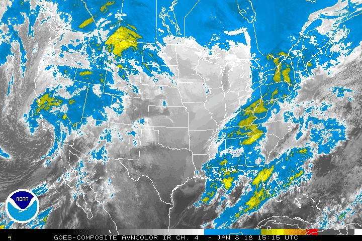
Quite the moisture plume continues across the Central US this evening as TS Sandra becomes entrained into the SW flow. The cold front is drifting into NW portions of SE TX currently and might make it to the coastal areas by Sunday evening. Upper 70s ahead of the cold front and 50s behind it. 77F at IAH and 54F in College Station with a 23F difference. Rain chances will slowly increase during the night and will remain at 30-50% through the weekend while Central and NTX take the brunt of the heaviest rains with significant icing from NW TX into OK.
- Attachments
-
- Screen Shot 2015-11-27 at 5.43.30 PM.png (173.41 KiB) Viewed 4947 times

55 around the Katy area ..... 74 here at my house in Sugar Land .... yep there's a cold front in there somewhere LOL
~~~When Thunder Roars Go Indoors~~~
~~~Turn Around Don't Drown~~~
~~~Run From The Water, Hide From The Wind~~~
~~~Turn Around Don't Drown~~~
~~~Run From The Water, Hide From The Wind~~~