December 2017: End Of The Year Weather

General Weather Discussions and Analysis
User avatar
Ptarmigan
Statistical Specialist
Posts: 4026
Joined: Wed Feb 03, 2010 7:20 pm
Contact:

mckinne63 wrote:Bring on winter! Though I think we could do without the ice. Thankfully we are not travelling this year. MIL is coming here the Friday before Christmas. I hope the ice, if we do get some, holds off until she gets here. Most of our outside pipes are already wrapped, will wrap the remainder this weekend just to be on the safe side. I think it was the winter of 1988, or was it 1987, when we had all the brown outs and major freezes? We had a pipe burst in our attic, dh tried to crimp it, than we sprung another leak. Could not find a plumber, so we were without water for Christmas Eve and Christmas Day. I call it our Little House on the Prairie Christmas. Our neighbor had water so we were bringing buckets to her house and filling them. I even heated water on the stove to take a bath!

I will be watching the forecast here as I always do now. Thank you Pro Mets for all you do to keep everyone informed!
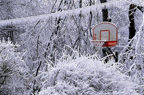
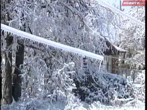
There were freezes in January 1988, February 1988, February 1989, and December 1989.

December 1989 had pipe bursts as it single digits. Houston hit single digits in February 1899 and January 1930. The February 1899 Freeze had back to back single digit lows! It probably hit single digits in January 1886.
TexasBreeze
Posts: 944
Joined: Sun Sep 26, 2010 4:46 pm
Location: NW Houston, TX
Contact:

Can't play around with the gfs model past 120 hrs or so. Fantasy land it is what it is...
User avatar
DoctorMu
Posts: 5776
Joined: Sun Jun 28, 2015 11:58 am
Location: College Station
Contact:

MontgomeryCoWx wrote:Well this partially explains the anomalous EPO in the mid and long term

https://twitter.com/RyanMaue/status/941 ... 14304?s=17

The Gateway could open this year. IIRC, CC altered upper level flow around the equator that prevent jailbreak of a huge Siberian dome of frigid air. We were left hot and bothered. This seems like an Opposite La Nina. Mischievous and willful. Get yo popcorn out! Is the Miracle Snow a preview of more surprises?
User avatar
jasons2k
Posts: 5431
Joined: Thu Feb 04, 2010 12:54 pm
Location: Imperial Oaks
Contact:

Didn’t realize but the cold spell last week already had an effect on the sea turtles:

http://m.chron.com/news/houston-texas/a ... pid=mobctp
User avatar
srainhoutx
Site Admin
Site Admin
Posts: 19620
Joined: Tue Feb 02, 2010 2:32 pm
Location: Maggie Valley, NC
Contact:

We have an active and very progressive weather pattern setting up over the next week and likely beyond as folks start the Christmas Holiday period along with many with travel plans. Radar shows a lot of activity over the Gulf this morning associated with our noisy sub tropical jet and embedded disturbances riding out of the Eastern Pacific across Mexico and over Texas. Currently any rainfall is offshore and what we see inland is virga as the first 10,000 ft is very dry, but changes begin tonight into tomorrow as a Coastal Low organizes near Brownsville and moves NE toward the Upper Texas Coast tomorrow night into Saturday. There is still some uncertainty regarding the severe threat, but there are some indications that severe storms may be possible with even a chance at some rotation and possibly a quick spin up of a tornado or two mainly near where the Coastal Low tracks close to the Coast and possibly inland depending on where the warm frontal boundary establishes.

Yet another disturbance is poised to cross our Region Monday into late Tuesday/early Wednesday bring another chance of rainfall.

Currently it looks like a strong cold front arrives Thursday night/early Friday morning possibly bringing a round of potential severe weather. Late next weeks front will likely bring the first shot of multiple Polar Cold Fronts that look to pass during the Christmas Holiday Period. I am not going to attempt to predicted what our sensible weather may bring beyond Sunday. There is way too much volatility in the forecast to offer any reasonable thoughts other than it looks chilly and raw into the extended range and possibly into the end of 2017. Stay Tuned... ;)
Carla/Alicia/Jerry(In The Eye)/Michelle/Charley/Ivan/Dennis/Katrina/Rita/Wilma/Humberto/Ike/Harvey

Member: National Weather Association
Facebook.com/Weather Infinity
Twitter @WeatherInfinity
User avatar
MontgomeryCoWx
Posts: 2357
Joined: Wed Dec 14, 2011 4:31 pm
Location: Weimar, TX
Contact:

srainhoutx wrote:We have an active and very progressive weather pattern setting up over the next week and likely beyond as folks start the Christmas Holiday period along with many with travel plans. Radar shows a lot of activity over the Gulf this morning associated with our noisy sub tropical jet and embedded disturbances riding out of the Eastern Pacific across Mexico and over Texas. Currently any rainfall is offshore and what we see inland is virga as the first 10,000 ft is very dry, but changes begin tonight into tomorrow as a Coastal Low organizes near Brownsville and moves NE toward the Upper Texas Coast tomorrow night into Saturday. There is still some uncertainty regarding the severe threat, but there are some indications that severe storms may be possible with even a chance at some rotation and possibly a quick spin up of a tornado or two mainly near where the Coastal Low tracks close to the Coast and possibly inland depending on where the warm frontal boundary establishes.

Yet another disturbance is poised to cross our Region Monday into late Tuesday/early Wednesday bring another chance of rainfall.

Currently it looks like a strong cold front arrives Thursday night/early Friday morning possibly bringing a round of potential severe weather. Late next weeks front will likely bring the first shot of multiple Polar Cold Fronts that look to pass during the Christmas Holiday Period. I am not going to attempt to predicted what our sensible weather may bring beyond Sunday. There is way too much volatility in the forecast to offer any reasonable thoughts other than it looks chilly and raw into the extended range and possibly into the end of 2017. Stay Tuned... ;)

Woooo, better than the nasty, humid 70s/80s we've experienced the last two years around this time!
Team #NeverSummer
User avatar
sambucol
Posts: 1047
Joined: Wed Feb 03, 2010 5:43 pm
Location: Mont Belvieu
Contact:

I agree!!! A cold Christmas with possibly a wintery surprise? ❄️
User avatar
snowman65
Posts: 1191
Joined: Thu Feb 04, 2010 6:39 am
Location: Orange, Tx
Contact:

Cold is a must...anything more than that is gravy...I'm not greedy...
User avatar
srainhoutx
Site Admin
Site Admin
Posts: 19620
Joined: Tue Feb 02, 2010 2:32 pm
Location: Maggie Valley, NC
Contact:

Friday morning briefing from Jeff:

Strong to severe thunderstorms and heavy rainfall likely Saturday night

A surface cold front has moved off the coast with widespread rain confined to the offshore water this morning being enhanced by an impulse in the upper level flow. A storm system currently over the SW US will eject rapidly across TX over the next 36 hours resulting in a rapid increase in moisture and rain chances. Will maintain a dry forecast for all areas except SE of US 59 today and even those locations only expecting maybe a shower or two. While the radar may look impressive much of what is showing up is not reaching the ground due to very dry low levels.

Powerful jet core will begin to arrive into the region early Saturday forcing surface low pressure formation over S TX. Winds will quickly swing around from the N today to the SE on Saturday morning starting the Gulf moisture pump. Moisture values surge to near 1.8 inches by Saturday evening which is nearly 2 SD above normal for mid December….this will support heavy rainfall on Saturday night. Surface low will move NNE from S TX toward NE TX Saturday night dragging a warm front toward the coast and possibly as far north as a Bay City to Liberty line. Forecast soundings show tremendous low level wind shear in place over the region by 600pm Saturday and as the warm front nears the coast numerous thunderstorms will develop. Instability appears lacking for widespread severe weather and surface based storms, but with a warm front nearing or possibly moving into the area and such strong low level wind shear in place a severe weather threat will be in play especially a tornado threat.

Expect strong to severe thunderstorms to develop from SW to NE across the region Saturday late afternoon through much of the night into early Sunday morning. Main threats will be tornadoes if the surface warm front pushes inland with large hail and strong winds a secondary threat with elevated activity north of the warm front. Temperatures on Saturday will range from near 50 inland rising to near 60-65 along the coast as the warm front nears.

Rainfall amounts Saturday evening will likely average 1-2 inches over the region and some of this will fall in a very short period of time likely resulting in street flooding. Should any training storms develop these totals could be locally higher. Fast forward motion of the overall system should preclude any widespread flood threat.

System will be fast moving and expect activity to gradually end early Sunday. Moisture axis is not pushed far offshore and as winds turn back S on Monday expect showers to progress back inland. Overall pattern for early to mid next week is a scattered shower with periods of fog type pattern along with warm and muggy conditions.

Extended:

Amplified upper air pattern begins to take shape across the US toward the middle of next week which looks to dislodge a cold arctic air mass out of NW Canada. Shallow arctic front should arrive into TX sometime next Friday (Dec 22). GFS and ECMWF have completely flipped solutions overnight with the GFS now showing cold and dry conditions while the ECMWF is cold and wet. Model consistency between runs and models has not become any better over the last 24 hours which leads to extremely low confidence on what sort of weather will transpire beyond next Friday. For now will go with temperatures falling into the 40’s on Friday post frontal passage under cloudy skies.
Carla/Alicia/Jerry(In The Eye)/Michelle/Charley/Ivan/Dennis/Katrina/Rita/Wilma/Humberto/Ike/Harvey

Member: National Weather Association
Facebook.com/Weather Infinity
Twitter @WeatherInfinity
User avatar
wxman57
Global Moderator
Global Moderator
Posts: 2621
Joined: Thu Feb 04, 2010 5:34 am
Location: Southwest Houston (Westbury)
Contact:

This potential winter weather event looks more terrifying than exciting. Going weeks without power and unable to travel anywhere doesn't sound like fun, to me. What's most troubling is that every GFS run indicates a significant warm nose aloft and only a very shallow surface freezing layer. That means freezing rain and sleet, not snow. It's the potential amount of freezing rain that is scary. I've lived in Texas since 1977 and I haven't seen anything like what the GFS is predicting.

I pointed out last week about the rule of thumb as to when a West Gulf Low forms. When the 500mb vorticity reaches El Paso, the low forms off the lower to mid TX coast. Once the low forms, the precipitation intensifies over Texas. Of course, there has to be a cold front out in the Gulf first, which will be the case next weekend. The GFS has the FIRST upper low/vort max reaching El Paso on Saturday, followed by at least 2 more. That means at least 3 precipitation events. With each event (in the wake of each low), more cold air will be drawn southward, pushing the sub-freezing air and freezing rain south.

What are the chances of the GFS being right? The Euro has temps above freezing through 240 hrs across Texas. Unfortunately, the Euro was way too "warm" with the snow event last week. I don't think it will handle the Arctic air well. On the bright side, there's not much snow cover to our north, so the Arctic air will modify considerably on its way south. Perhaps the surface temps will only be in the low 30s across central Texas and will remain above freezing across SE TX. I think that actually may be the most likely, but the potential for a massive ice storm is very scary.

This potential event is still 8 days away. I wouldn't panic yet. However, if the GFS is still going for it by Mon/Tue and the Euro's temps drop, then I may be treating it like a hurricane landfall. I'll fill up my 5-gal gas cans and make sure my generator is ready to go.

Image

Image

Image
harp
Posts: 248
Joined: Tue Aug 22, 2017 4:35 pm
Contact:

Wxman57, will this potentially extend into Louisiana? I lived in Oklahoma for 8 years in my youth and I remember ice storms. Believe me, people, you do NOT want an ice storm!
User avatar
MontgomeryCoWx
Posts: 2357
Joined: Wed Dec 14, 2011 4:31 pm
Location: Weimar, TX
Contact:

I was living in NE Texas during the great Christmas Ice Storm of 2000.

Here are the facts. Keep in mind that we received 1 1/4 inch of ice. Some of the latest model runs want to give us 2-3 inches next week.

For me, it was awesome and scary at the same time. I'm a glutton for severe Winter weather. I used to drive to Canada and Cleveland when I lived in Ohio to chase massive ice storms and lake effect snows.

Christmas 2000 ice storm facts:

Over 1 inch of accumulated ice in many locations from northeast Texas into southeast Oklahoma, Arkansas and northern Louisiana.

At least 600,000 customers were without power.

These were the two most widespread, damaging ice storms of record in Arkansas history at the time, dating to 1819, according to the National Weather Service.

Much of cities of Texarkana, Hot Springs and Little Rock, Ark. were without power.

Water systems in Texarkana and Hot Springs, Ark. were also down.


Image

Image
Team #NeverSummer
User avatar
wxman57
Global Moderator
Global Moderator
Posts: 2621
Joined: Thu Feb 04, 2010 5:34 am
Location: Southwest Houston (Westbury)
Contact:

harp wrote:Wxman57, will this potentially extend into Louisiana? I lived in Oklahoma for 8 years in my youth and I remember ice storms. Believe me, people, you do NOT want an ice storm!
It's possible that there could be freezing rain in south Louisiana and SE TX (I assume that's what you mean by "Louisiana"), but more likely the threat will be central TX to Arkansas, maybe northern LA.

Think of this situation being like a hurricane entering the eastern Caribbean and the 5-day track takes it to the northern Yucatan, heading generally toward the NW Gulf. You should be concerned and you should monitor the situation at this point, but the track could change.
harp
Posts: 248
Joined: Tue Aug 22, 2017 4:35 pm
Contact:

Thanks for your response. I'm asking because the 06Z GFS has it dangerously close to SE Louisiana. And I've found as a rule of thumb that, with winter weather, what Houston gets on day 1, we here in SE Louisiana get on day 2. This snow a week ago is the latest example.
kitkat77
Posts: 6
Joined: Tue Sep 28, 2010 12:21 pm
Location: Clear Lake/Pinebrook Subdivision
Contact:

So if someone were planning to drive to Nacogdoches on the evening of the 22nd, would that be safe? And would we get stuck there?
stormlover
Posts: 439
Joined: Wed Dec 04, 2013 10:21 am
Location: Lumberton TX
Contact:

way to far out to say!!!
User avatar
DoctorMu
Posts: 5776
Joined: Sun Jun 28, 2015 11:58 am
Location: College Station
Contact:

MontgomeryCoWx wrote:
srainhoutx wrote:We have an active and very progressive weather pattern setting up over the next week and likely beyond as folks start the Christmas Holiday period along with many with travel plans. Radar shows a lot of activity over the Gulf this morning associated with our noisy sub tropical jet and embedded disturbances riding out of the Eastern Pacific across Mexico and over Texas. Currently any rainfall is offshore and what we see inland is virga as the first 10,000 ft is very dry, but changes begin tonight into tomorrow as a Coastal Low organizes near Brownsville and moves NE toward the Upper Texas Coast tomorrow night into Saturday. There is still some uncertainty regarding the severe threat, but there are some indications that severe storms may be possible with even a chance at some rotation and possibly a quick spin up of a tornado or two mainly near where the Coastal Low tracks close to the Coast and possibly inland depending on where the warm frontal boundary establishes.

Yet another disturbance is poised to cross our Region Monday into late Tuesday/early Wednesday bring another chance of rainfall.

Currently it looks like a strong cold front arrives Thursday night/early Friday morning possibly bringing a round of potential severe weather. Late next weeks front will likely bring the first shot of multiple Polar Cold Fronts that look to pass during the Christmas Holiday Period. I am not going to attempt to predicted what our sensible weather may bring beyond Sunday. There is way too much volatility in the forecast to offer any reasonable thoughts other than it looks chilly and raw into the extended range and possibly into the end of 2017. Stay Tuned... ;)

Woooo, better than the nasty, humid 70s/80s we've experienced the last two years around this time!
A couple of years ago, we were greeted by a tornado at Hobby airport in the soupy air.
User avatar
jasons2k
Posts: 5431
Joined: Thu Feb 04, 2010 12:54 pm
Location: Imperial Oaks
Contact:

I’ll pass on the ice. No fun without power. I experienced 16” of snow in Birmingham in the 1993 Superstorm. It was a real fun adrenaline rush for about a day. After about the third night of sleeping in a sleeping bag in front of the fireplace I was done...but it lasted 2 more weeks. No thanks.
User avatar
MontgomeryCoWx
Posts: 2357
Joined: Wed Dec 14, 2011 4:31 pm
Location: Weimar, TX
Contact:

Euro goes extreme and buries Texas in Freezing rain, sleet and snow Christmas Eve
Team #NeverSummer
redneckweather
Posts: 1023
Joined: Mon Feb 08, 2010 7:29 pm
Location: Montgomery, Texas
Contact:

Not liking the very shallow air at the surface with surface temps at or below freezing. If the airmass is going to be that shallow, I sure the hope the temp stays above freezing!
Post Reply
  • Information
  • Who is online

    Users browsing this forum: Ahrefs [Bot] and 217 guests