cperk wrote:Getting ice accumulation on my plants, temp at 30.6 degrees.
The high surface area of leaves on the bushes are icy. Tree limbs OK because of the wind. Freezing rain, sleet, snow light mix during the night is glazing things, including the roads.
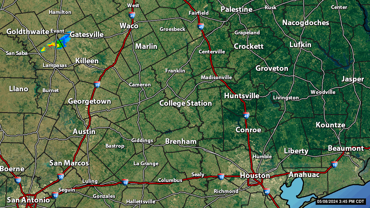
DoctorMu wrote:Besides the New Braunfels band, there's another band forming between Eagle Pass and Beeville. Also rotating east.
...and it just keeps getting colder. 25°F now in CLL. Some reporting 23°F, 24°F in town.
Cypress is reporting 27°F, 30°F in downtown Houston. Overpasses and raised roads will become ice skating rinks.
There is a shortwave that crossed Mexico overnight from the Baja yesterday morning that is nearing Eagle Pass. That feature is adding some lift so expect precipitation to continue throughout the rest of the day.
Attachments
Carla/Alicia/Jerry(In The Eye)/Michelle/Charley/Ivan/Dennis/Katrina/Rita/Wilma/Humberto/Ike/Harvey
Member: National Weather Association
Facebook.com/Weather Infinity
Twitter @WeatherInfinity
Conditions will deteriorate as the day wears on. As folks have stated, do not venture out today. It is not worth it. As I type this, the sleet is getting heavier. A big huge round of thanks to our pro and amateur Mets. Thank you so much for taking the time to guide us through this.
Light to moderate sleet here in central Liberty County. No snow mixing in yet. If this continues (or worsens) for several hours, Highway 90 bridges in the river bottoms between Dayton and Liberty will be a nightmare.
URGENT - WINTER WEATHER MESSAGE
National Weather Service Houston/Galveston TX
954 AM CST Tue Jan 16 2018
...WINTER STORM WARNING IN EFFECT UNTIL MIDNIGHT CST TONIGHT FOR
ALL OF SOUTHEAST TEXAS...
A strong arctic cold front has pushed through Southeast Texas.
Temperatures will continue to fall across the area with most of
Southeast Texas below freezing already and most areas in the 20s.
Precipitation will continue to fall throughout the day with the
possibility of pockets of heavier precipitation and bands. There
will be a transition of precipitation going from freezing rain to
sleet and possibly snow. Greatest potential for ice, sleet and
snow will be mainly along and north of Interstate 10 and then
shift south of Interstate 10 down along the coast later this
afternoon. The frozen precipitation will impact elevated surfaces
like overpasses and bridges. There will be some accumulations of
sleet and ice on structures and vegetation. Where temperatures are
below freezing longer, impacts to roads and possibly power lines
are expected with icing. Precipitation will end from north to
south beginning this afternoon, so portions of the warning may be
cancelled early. The area will see breezy north winds, gusting to
25 to 35 mph and even higher at the coast. There will also be
hazardous wind chills falling into the teens areawide by this
afternoon. Hard Freeze Warnings and Wind Chill Advisories will
likely be needed tonight through Wednesday morning.
Chambers-Wharton-Fort Bend-Jackson-Matagorda-Brazoria-Galveston-
Including the cities of Winnie, Mont Belvieu, Anahuac, El Campo,
Wharton, Pierce, Sugar Land, Missouri City, Richmond, Rosenberg,
Edna, Bay City, Palacios, Pearland, Lake Jackson, Alvin,
Angleton, Freeport, League City, Texas City, Friendswood,
and Galveston
954 AM CST Tue Jan 16 2018
...WINTER STORM WARNING IN EFFECT UNTIL MIDNIGHT CST TONIGHT...
* WHAT...Freezing rain causing ice accumulations mainly around a
few hundredths to one tenth of an inch with pockets of higher
amounts above one eighth of an inch. There may also be small
accumulations of sleet.
* WHERE...Mainly south of Interstate 10.
* WHEN...Through this afternoon and evening.
* MAIN IMPACT...Hazardous travel conditions on roads, overpasses
and bridges.
PRECAUTIONARY/PREPAREDNESS ACTIONS...
A Winter Storm Warning means significant amounts of snow...
sleet...and ice are expected or occurring. Strong winds are also
possible. This will make travel very hazardous or impossible.
Houston-Trinity-Madison-Walker-San Jacinto-Polk-Burleson-Brazos-
Washington-Grimes-Montgomery-Liberty-Colorado-Austin-Waller-
Harris-
Including the cities of Crockett, Trinity, Groveton,
Madisonville, Huntsville, Shepherd, Coldspring, Livingston,
Corrigan, Onalaska, Caldwell, Lake Somerville, College Station,
Bryan, Brenham, Navasota, The Woodlands, Conroe, Willis, Liberty,
Cleveland, Dayton, Columbus, Eagle Lake, Weimar, Sealy,
Bellville, Hempstead, Prairie View, Brookshire, Houston,
Pasadena, Katy, Tomball, and Humble
954 AM CST Tue Jan 16 2018
...WINTER STORM WARNING REMAINS IN EFFECT UNTIL MIDNIGHT CST
TONIGHT...
* WHAT...Intermittent periods of winter weather across Southeast
Texas, including: - Freezing rain accumulation potentially an
eighth of an inch or more but with a tenth or less more likely.
Minor ice accumulations possible on power lines. - Snowfall
accumulation potentially 1 inch north of Brenham to Livingston.
Trace snowfall amounts possible north of Interstate 10 where
freezing rain is most likely hazard. - Hazardous wind chills
falling into the teens areawide by this afternoon.
* WHERE...Mainly north of Interstate 10.
* WHEN...Mainly this morning, decreasing this afternoon through
early this evening from north to south.
* ADDITIONAL DETAILS...Impacts of icing to elevated surfaces
such as bridges and overpasses. Road conditions will worsen
for areas with temperatures below freezing for a longer period
of time. Snow falling on top of any icy surfaces will cause
those surfaces to become even more icy.
PRECAUTIONARY/PREPAREDNESS ACTIONS...
A Winter Storm Warning means significant amounts of snow...
sleet...and ice are expected or occurring. Strong winds are also
possible. This will make travel very hazardous or impossible.
Carla/Alicia/Jerry(In The Eye)/Michelle/Charley/Ivan/Dennis/Katrina/Rita/Wilma/Humberto/Ike/Harvey
Member: National Weather Association
Facebook.com/Weather Infinity
Twitter @WeatherInfinity
As Brooks just mentioned on air, orientation of precipitation out west is starting to have a bit more southwest to northeast movement instead of a due east to southeast orientation. This could throw a big wrench in our forecast the next few hours in terms of precipitation type and accumulation.
HGX concerned that as that shortwave approaches this afternoon, banding precipitation may develop further South than originally expected creating the need to Expand the Winter Storm Warning. The latest HRRR solutions suggest these banding features will continue across SE Texas bringing waves of freezing rain and sleet possibly changing over to snow later today into the evening hours as the precipitation ends. The threat for these banding features are expected to continue across most of our SE Texas Region, but the College Station Area may see drier air building in lessening there threat as the day progresses.
Carla/Alicia/Jerry(In The Eye)/Michelle/Charley/Ivan/Dennis/Katrina/Rita/Wilma/Humberto/Ike/Harvey
Member: National Weather Association
Facebook.com/Weather Infinity
Twitter @WeatherInfinity
Even the blues and light green returns on HGX radar represent a lot of sleetfall. Just wait till the heavier precip from Fayette and further west comes in...
Belmer wrote:As Brooks just mentioned on air, orientation of precipitation out west is starting to have a bit more southwest to northeast movement instead of a due east to southeast orientation. This could throw a big wrench in our forecast the next few hours in terms of precipitation type and accumulation.
Right. The meso that includes that band around Bastrop is not only moving in general WSW to ESE, it's also rotating over a large radius with the axis near Victoria. thus precip is working it way back to Cyress, Navasota, College Station, Hearne - probably a mix of sleet, snow, freezing rain. 25°F in CLL. Streets that have not glazed over will be soon.
Please stay off the roads if at all possible. Allow first responders open lanes and roads to traverse
Last edited by DoctorMu on Tue Jan 16, 2018 10:27 am, edited 1 time in total.
Is it looking like precip could linger into the evening hours, longer than what was expected? It was saying precip would be ending around 5pm here (Orange/Bmt).
This will be challenging for the colleges and school districts tomorrow. I believe it will range from delayed openings to closing altogether. Stay tuned.


