


Looking at the last two center fixes from Recon, I would concur with that observation. Today's Recon crew is having a heck of a time penetrating the center on the 1st pass. Saw they had to loop around and go back on both center fixes.
Outer rain bands are hitting the coast right now from Galveston to Corpus. I would expect rain chances to increase throughout the day. Were not talking 10-14 inch range. But given their tropical and slower moving nature; if you happen to be under one, 2-3 inches is not out of the question.ticka1 wrote:Okay Okay I get we aren't getting the landfalling hurricane with the eye going over us - but are we going to see any rain from Alex here in Houston? Hearing and reading so called "experts" say we won't see anything to we are going to see massive amounts of rain here in SE Texas?
Any idea?

Ed Mahmoud wrote:Seems like forum activity is dropping now
Code: Select all
000
FONT11 KNHC 291431
PWSAT1
TROPICAL STORM ALEX WIND SPEED PROBABILITIES NUMBER  16
NWS TPC/NATIONAL HURRICANE CENTER MIAMI FL   AL012010
1500 UTC TUE JUN 29 2010

AT 1500Z THE CENTER OF TROPICAL STORM ALEX WAS LOCATED NEAR LATITUDE
22.7 NORTH...LONGITUDE 93.1 WEST WITH MAXIMUM SUSTAINED WINDS NEAR
60 KTS...70 MPH...110 KM/HR.

Z INDICATES COORDINATED UNIVERSAL TIME (GREENWICH)
   ATLANTIC STANDARD TIME (AST)...SUBTRACT 4 HOURS FROM Z TIME
   EASTERN  DAYLIGHT TIME (EDT)...SUBTRACT 4 HOURS FROM Z TIME
   CENTRAL  DAYLIGHT TIME (CDT)...SUBTRACT 5 HOURS FROM Z TIME


I.  MAXIMUM WIND SPEED (INTENSITY) PROBABILITY TABLE

CHANCES THAT THE MAXIMUM SUSTAINED (1-MINUTE AVERAGE) WIND SPEED OF
THE TROPICAL CYCLONE WILL BE WITHIN ANY OF THE FOLLOWING CATEGORIES
AT EACH OFFICIAL FORECAST TIME DURING THE NEXT 5 DAYS.
PROBABILITIES ARE GIVEN IN PERCENT.  X INDICATES PROBABILITIES LESS
THAN 1 PERCENT.


      - - - MAXIMUM WIND SPEED (INTENSITY) PROBABILITIES - - -

VALID TIME   00Z WED 12Z WED 00Z THU 12Z THU 12Z FRI 12Z SAT 12Z SUN
FORECAST HOUR   12      24      36      48      72      96     120
- - - - - - - - - - - - - - - - - - - - - - - - - - - - - - - - - -
DISSIPATED       X       X       1       4      39      NA      NA
TROP DEPRESSION  X       1       4      16      35      NA      NA
TROPICAL STORM  48      20      28      57      21      NA      NA
HURRICANE       52      79      68      22       5      NA      NA
- - - - - - - - - - - - - - - - - - - - - - - - - - - - - - - - - -
HUR CAT 1       49      60      44      16       3      NA      NA
HUR CAT 2        2      16      17       4       2      NA      NA
HUR CAT 3        X       3       5       2       1      NA      NA
HUR CAT 4        X       1       1       X       X      NA      NA
HUR CAT 5        X       X       X       X       X      NA      NA
- - - - - - - - - - - - - - - - - - - - - - - - - - - - - - - - - -
FCST MAX WIND   65KT    75KT    80KT    50KT    25KT    NA      NA


II. WIND SPEED PROBABILITY TABLE FOR SPECIFIC LOCATIONS

CHANCES OF SUSTAINED (1-MINUTE AVERAGE) WIND SPEEDS OF AT LEAST
   ...34 KT (39 MPH... 63 KPH)...
   ...50 KT (58 MPH... 93 KPH)...
   ...64 KT (74 MPH...119 KPH)...
FOR LOCATIONS AND TIME PERIODS DURING THE NEXT 5 DAYS

PROBABILITIES FOR LOCATIONS ARE GIVEN AS IP(CP) WHERE
    IP  IS THE PROBABILITY OF THE EVENT BEGINNING DURING
        AN INDIVIDUAL TIME PERIOD (INDIVIDUAL PROBABILITY)
   (CP) IS THE PROBABILITY OF THE EVENT OCCURRING BETWEEN
        12Z TUE AND THE FORECAST HOUR (CUMULATIVE PROBABILITY)

PROBABILITIES ARE GIVEN IN PERCENT
X INDICATES PROBABILITIES LESS THAN 1 PERCENT
PROBABILITIES FOR 34 KT AND 50 KT ARE SHOWN AT A GIVEN LOCATION WHEN
THE 5-DAY CUMULATIVE PROBABILITY IS AT LEAST 3 PERCENT.
PROBABILITIES FOR 64 KT ARE SHOWN WHEN THE 5-DAY CUMULATIVE
PROBABILITY IS AT LEAST 1 PERCENT.


  - - - - WIND SPEED PROBABILITIES FOR SELECTED  LOCATIONS - - - -

               FROM    FROM    FROM    FROM    FROM    FROM    FROM
  TIME       12Z TUE 00Z WED 12Z WED 00Z THU 12Z THU 12Z FRI 12Z SAT
PERIODS         TO      TO      TO      TO      TO      TO      TO
             00Z WED 12Z WED 00Z THU 12Z THU 12Z FRI 12Z SAT 12Z SUN

FORECAST HOUR    (12)   (24)    (36)    (48)    (72)    (96)   (120)
- - - - - - - - - - - - - - - - - - - - - - - - - - - - - - - - - -
LOCATION       KT

GFMX 280N 910W 34  1   2( 3)   1( 4)   X( 4)   1( 5)   X( 5)   X( 5)

GFMX 280N 930W 34  4   7(11)   3(14)   1(15)   1(16)   X(16)   X(16)

PORT ARTHUR TX 34  X   1( 1)   2( 3)   1( 4)   1( 5)   X( 5)   X( 5)

GALVESTON TX   34  X   5( 5)   4( 9)   2(11)   2(13)   X(13)   X(13)

HOUSTON TX     34  X   3( 3)   4( 7)   2( 9)   1(10)   X(10)   X(10)

AUSTIN TX      34  X   X( X)   3( 3)   2( 5)   1( 6)   X( 6)   X( 6)

SAN ANTONIO TX 34  X   1( 1)   5( 6)   4(10)   2(12)   X(12)   X(12)

FREEPORT TX    34  X   7( 7)   6(13)   4(17)   1(18)   X(18)   X(18)

GFMX 280N 950W 34  3  12(15)   9(24)   3(27)   1(28)   X(28)   X(28)
GFMX 280N 950W 50  X   1( 1)   1( 2)   1( 3)   X( 3)   X( 3)   X( 3)

PORT O CONNOR  34  1   9(10)  11(21)   5(26)   2(28)   X(28)   X(28)
PORT O CONNOR  50  X   X( X)   1( 1)   1( 2)   1( 3)   X( 3)   X( 3)

CORPUS CHRISTI 34  1   9(10)  19(29)  10(39)   3(42)   X(42)   X(42)
CORPUS CHRISTI 50  X   X( X)   2( 2)   3( 5)   1( 6)   X( 6)   X( 6)
CORPUS CHRISTI 64  X   X( X)   X( X)   1( 1)   X( 1)   X( 1)   X( 1)

GFMX 270N 960W 34  4  31(35)  22(57)   4(61)   1(62)   X(62)   X(62)
GFMX 270N 960W 50  X   3( 3)  11(14)   3(17)   1(18)   X(18)   X(18)
GFMX 270N 960W 64  X   X( X)   4( 4)   1( 5)   1( 6)   X( 6)   X( 6)

BROWNSVILLE TX 34  3  31(34)  45(79)   8(87)   1(88)   X(88)   X(88)
BROWNSVILLE TX 50  X   3( 3)  34(37)  14(51)   1(52)   X(52)   X(52)
BROWNSVILLE TX 64  X   X( X)  13(13)   9(22)   1(23)   X(23)   X(23)

GFMX 250N 960W 34 13  72(85)  11(96)   1(97)   X(97)   X(97)   X(97)
GFMX 250N 960W 50  1  44(45)  30(75)   2(77)   1(78)   X(78)   X(78)
GFMX 250N 960W 64  X  18(18)  27(45)   3(48)   X(48)   X(48)   X(48)

LA PESCO MX    34  3   7(10)  19(29)   5(34)   3(37)   X(37)   X(37)
LA PESCO MX    50  X   1( 1)   4( 5)   3( 8)   1( 9)   X( 9)   X( 9)
LA PESCO MX    64  X   X( X)   1( 1)   1( 2)   1( 3)   X( 3)   X( 3)

TAMPICO MX     34  2   5( 7)   4(11)   2(13)   1(14)   X(14)   X(14)

TUXPAN MX      34  2   4( 6)   2( 8)   1( 9)   1(10)   X(10)   X(10)

VERACRUZ MX    34  1   1( 2)   1( 3)   X( 3)   X( 3)   X( 3)   X( 3)

MERIDA MX      34  3   X( 3)   X( 3)   X( 3)   X( 3)   X( 3)   X( 3)

$$
FORECASTER BEVEN
Bluefalcon wrote:This mornings shot of the Gulf: http://www.tceq.state.tx.us/assets/publ ... atest.jpeg
the NHC Discussion supports this as well...SusieinLP wrote:Alex is just so big! I looked at the satellite and this storm pretty much fills up the entire GOM......
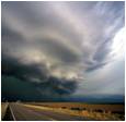
Clouds are moving in off the bay....

