Page 2 of 17
Re: General Tropical Discussion Thread
Posted: Sun Jun 20, 2010 9:31 pm
by rnmm
At what point does a storm get assigned a number? To further explain my question, the second area they are watching in the Carribbean...when will it be labeled 93L? Thank you!
Re: General Tropical Discussion Thread
Posted: Sun Jun 20, 2010 9:52 pm
by srainhoutx
rnmm wrote:At what point does a storm get assigned a number? To further explain my question, the second area they are watching in the Carribbean...when will it be labeled 93L? Thank you!
Here is the definition from NOAA rnmm...as far as when 93L will be declared, perhaps in a day or so
if it develops...
Invest:
A weather system for which a tropical cyclone forecast center (NHC, CPHC, or JTWC) is interested in collecting specialized data sets (e.g., microwave imagery) and/or running model guidance. Once a system has been designated as an invest, data collection and processing is initiated on a number of government and academic web sites, including the Naval Research Laboratory (NRL) and the University of Wisconsin Cooperative Institute for Meteorological Satellite Studies (UW-CIMSS). The designation of a system as an invest does not correspond to any particular likelihood of development of the system into a tropical cyclone; operational products such as the Tropical Weather Outlook or the JTWC/TCFA should be consulted for this purpose.
Note: Tracking guidance such as BAM, GFDL and HWRF are some of the models they speak of.
Re: General Tropical Discussion Thread
Posted: Mon Jun 21, 2010 9:28 pm
by wxdata
Re: General Tropical Discussion Thread
Posted: Fri Jul 09, 2010 10:17 am
by srainhoutx
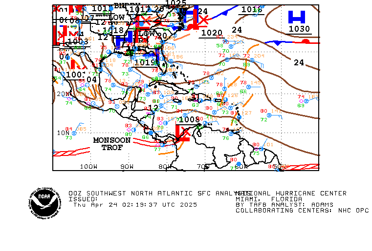
After a couple of weeks of rather active Tropical Weather things have calmed down a bit for the moment. There are a couple of waves that are worth watching. One in the SW Caribbean and another near the Windwards...

Re: General Tropical Discussion Thread
Posted: Fri Jul 09, 2010 12:07 pm
by Scott747
I posted the other day in the 97 thread to just keep a eye out over the Caribbean starting today as the Euro had been showing some very unsettled weather across the area and moving into the Gulf through Wednesday next week.
Unsettled weather - Check
With that said nothing really showing any signs of organizing.
Re: General Tropical Discussion Thread
Posted: Fri Jul 09, 2010 12:09 pm
by srainhoutx
One thing that has been showing in guidance is lower pressures across the Caribbean. I also noticed another MJO pulse may be taking shape. We shall see.
Re: General Tropical Discussion Thread
Posted: Fri Jul 09, 2010 12:26 pm
by Scott747
srainhoutx wrote:One thing that has been showing in guidance is lower pressures across the Caribbean. I also noticed another MJO pulse may be taking shape. We shall see.
Haven't checked the other boards today.
Already knew about the pressures being somewhat favorable across the Caribbean over the next few weeks but haven't seen anything about any new MJO pulse.
Can you throw me a link. Curious about the MJO.
Re: General Tropical Discussion Thread
Posted: Fri Jul 09, 2010 12:36 pm
by srainhoutx
Sort of a higher amplitude wave in region 1 & 2...
Re: General Tropical Discussion Thread
Posted: Fri Jul 09, 2010 6:46 pm
by srainhoutx
000
ABNT20 KNHC 092334
TWOAT
TROPICAL WEATHER OUTLOOK
NWS TPC/NATIONAL HURRICANE CENTER MIAMI FL
800 PM EDT FRI JUL 9 2010
FOR THE NORTH ATLANTIC...CARIBBEAN SEA AND THE GULF OF MEXICO...
THE HYDROMETEOROLOGICAL PREDICTION CENTER IS ISSUING ADVISORIES ON
TROPICAL DEPRESSION TWO...LOCATED INLAND OVER NORTHEASTERN MEXICO
ABOUT 90 MILES WEST OF LAREDO TEXAS. THESE ADVISORIES CAN BE
FOUND UNDER AWIPS HEADER TCPAT2 AND WMO HEADER WTNT32 KWNH.
A TROPICAL WAVE LOCATED OVER THE EXTREME SOUTHWESTERN CARIBBEAN SEA
IS PRODUCING A LARGE AREA OF SHOWERS AND THUNDERSTORMS AS IT MOVES
WESTWARD AT AROUND 20 MPH. WHILE TROPICAL CYCLONE FORMATION IS NOT
EXPECTED BEFORE THIS SYSTEM REACHES CENTRAL AMERICA...HEAVY
RAINFALL IS POSSIBLE TONIGHT AND SATURDAY ACROSS PORTIONS OF
HONDURAS AND NICARAGUA. THERE IS A LOW CHANCE...NEAR 0 PERCENT...OF
THIS SYSTEM BECOMING A TROPICAL CYCLONE DURING THE NEXT 48 HOURS.
FOR ADDITIONAL INFORMATION ON THIS SYSTEM...PLEASE REFER TO
PRODUCTS FROM YOUR NATIONAL METEOROLOGICAL SERVICE.
ELSEWHERE...TROPICAL CYCLONE FORMATION IS NOT EXPECTED DURING THE
NEXT 48 HOURS.
$$
FORECASTER BRENNAN
Re: General Tropical Discussion Thread
Posted: Tue Jul 13, 2010 2:26 pm
by srainhoutx
JB may be watching 40W, but I suspect the area of 'interest' that some guidance has been sniffing out for possible weak development in the SW Caribbean is currently near 50W.

Re: General Tropical Discussion Thread
Posted: Tue Jul 13, 2010 7:59 pm
by srainhoutx
Appears a favorable MJO pulse is building. WPAC responded and guidance suggests EPAC will follow...a lot of season left...
Re: General Tropical Discussion Thread
Posted: Wed Jul 14, 2010 5:26 pm
by srainhoutx
May be time to start watching the SW Caribbean. Convection has continued today and some guidance suggests an area pressure will develop over the next several days. We shall see. Also notice the waves across Africa...

Re: General Tropical Discussion Thread
Posted: Thu Jul 15, 2010 8:14 am
by srainhoutx
CPC seems to think conditions for development will improve the later this month...
Valid Saturday, July 17, 2010 - Wednesday, July 28, 2010
FOR TUESDAY JULY 20 - SATURDAY JULY 24: LITTLE OVERALL CHANGE IN THE LONGWAVE PATTERN FROM THE PREVIOUS PERIOD IS EXPECTED DURING THIS PERIOD, THOUGH SOME AMPLIFICATION OF A MEAN UPPER-LEVEL TROUGH OVER THE PACIFIC NORTHWEST AND AN EASTWARD SHIFT OF THE SOUTHERN ROCKIES UPPER-LEVEL RIDGE TOWARD THE SOUTHERN PLAINS AND SOUTHEAST IS FORECAST. WITH THE JETSTREAM CONFINED TO THE NORTHERN TIER OF THE CONUS, THE NORTHERN ROCKIES AND NORTH-CENTRAL PLAINS ARE EXPECTED TO REMAIN CONVECTIVELY ACTIVE. AREAS SOUTH OF THE JET, FROM THE CENTRAL AND SOUTHERN PLAINS, OHIO VALLEY AND THE SOUTHEAST WILL LIKELY EXPERIENCE ABOVE-AVERAGE TEMPERATURES. ENHANCED FIRE DANGER MAY EXIST ACROSS PARTS OF THE WESTERN STATES IN ADVANCE OF THE AMPLIFYING PACIFIC NORTHWEST UPPER LEVEL TROUGH. THESE POTENTIAL HAZARDS WILL CONTINUE TO BE MONITORED.
FAVORABLE CONDITIONS FOR TROPICAL CYCLONE DEVELOPMENT IN THE ATLANTIC BASIN NEAR THE END OF THIS PERIOD ARE FORECAST BY SEVERAL MODELS.
http://www.cpc.ncep.noaa.gov/products/p ... hreats.php
Re: General Tropical Discussion Thread
Posted: Thu Jul 15, 2010 1:01 pm
by kellybell4770
I'm interested!!

Re: General Tropical Discussion Thread
Posted: Thu Jul 15, 2010 1:03 pm
by srainhoutx
Looking at the 12Z Para GFS it does appear that the Upper Ridge may try to shift E a bit and leave open a door for moisture and disturbed weather to move NW from the Western Caribbean. It is always a concern just how strong and how long these Upper Ridges can persist.

Edit to add the 2 PM TWO...
KNHC 151754
TWOAT
TROPICAL WEATHER OUTLOOK
NWS TPC/NATIONAL HURRICANE CENTER MIAMI FL
200 PM EDT THU JUL 15 2010
FOR THE NORTH ATLANTIC...CARIBBEAN SEA AND THE GULF OF MEXICO...
A LARGE TROPICAL WAVE LOCATED ABOUT 400 MILES WEST OF THE CAPE VERDE
ISLANDS IS MOVING WESTWARD AT 20 TO 25 MPH. SHOWER ACTIVITY IS
CURRENTLY LIMITED WITH THIS SYSTEM...BUT ENVIRONMENTAL CONDITIONS
ARE EXPECTED TO GRADUALLY BECOME MORE CONDUCIVE FOR SOME SLOW
DEVELOPMENT TO OCCUR OVER THE NEXT COUPLE OF DAYS. THERE IS A LOW
CHANCE...10 PERCENT...OF THIS SYSTEM BECOMING A TROPICAL CYCLONE
DURING THE NEXT 48 HOURS.
ELSEWHERE...TROPICAL CYCLONE FORMATION IS NOT EXPECTED DURING THE
NEXT 48 HOURS.
$$
FORECASTER STEWART

Re: General Tropical Discussion Thread
Posted: Thu Jul 15, 2010 2:58 pm
by srainhoutx
Lake Charles make mention of the Western Caribbean disturbance...
THERE MAY BE A TROPICAL DISTURBANCE MOVING INTO THE SOUTH BAY OF CAMPECHE THIS
COMING TUESDAY IF THE GFS MODEL IS CORRECT...BUT IF THIS COMES TO PASS...
WOULD BE DIRECTED INTO MEXICO DUE TO A FAIRLY PERSISTENT STRONG HIGH
PRESSURE RIDGE ACROSS WESTERN GULF OF MEXICO.
Re: General Tropical Discussion Thread
Posted: Thu Jul 15, 2010 3:47 pm
by sleetstorm
I feel for people in Mexico for some them are not as well off as some of us are here in the United States of America, no disrespect.
Re: General Tropical Discussion Thread
Posted: Thu Jul 15, 2010 4:11 pm
by sleetstorm
The month of August is needless to say when some schools begin for the autumn semester & it is also in the heart of hurricane season just like September and October.
Re: General Tropical Discussion Thread
Posted: Thu Jul 15, 2010 6:06 pm
by srainhoutx
18Z para GFS suggests Bonnie next week in the W GOM...

Re: General Tropical Discussion Thread
Posted: Thu Jul 15, 2010 7:30 pm
by biggerbyte
Hi, guys and gals..
Whatup?
Well, it looks like we will be needing to watch the tropics even more carefully as the next few days come to pass. Two reasons for Texas. One being that the ridge that has been protecting our area and pushing storms south, is expected to migrate east, opening up the gulf and changing steering currents. Second, activity is expected to be on the increase as well. I'd bet by next weekend this forum will be hopping with activity as well. There has not been much to talk about as of late. As we've mentioned before, things are forever changing. I'm sure the folks who watch the models will be looking for trends. That can be telling.
Stay tuned...


