Page 12 of 78
Re: More Cold Air On The Way In Mid/Late February For TX/OK/LA?
Posted: Thu Feb 18, 2010 3:18 pm
by srainhoutx
Busy day for me, but the ECMWF and the UKMET continue to advertise wintry weather next week in many parts of TX. Still a ways off, but the GFS took steps in the right direction today as well if you are looking for colder and wetter (wintry) even in SE TX.

12Z ECMWF...
http://www.meteo.psu.edu/~gadomski/ECMW ... floop.html
12Z UKMET...
http://www.meteo.psu.edu/~gadomski/UKHE ... kloop.html
Re: More Cold Air On The Way In Mid/Late February For TX/OK/LA?
Posted: Thu Feb 18, 2010 3:19 pm
by don
The 12z Euro looks nice once again even though it's in 24hr intervals so its hard to see exactly finer details but setup is definitely there for another Texas winter storm if you believe the European and UKmet models.

Re: More Cold Air On The Way In Mid/Late February For TX/OK/LA?
Posted: Thu Feb 18, 2010 3:47 pm
by srainhoutx
AREA FORECAST DISCUSSION
NATIONAL WEATHER SERVICE AUSTIN/SAN ANTONIO TX
340 PM CST THU FEB 18 2010
.DISCUSSION...
SOUTHERLY LOWER LEVEL FLOW IS WELL UNDERWAY THIS AFTERNOON AHEAD
OF AN UPPER LEVEL TROUGH MOVING EAST ACROSS NORTHERN MEXICO IN A
ZONAL FLOW ALOFT. SATELLITE IMAGERY SHOWS CLOUDS MOVING NORTH FROM
SOUTHERN TEXAS AND THESE WILL COVER THE AREA BY MIDNIGHT. THE
UPPER TROUGH MOVES ACROSS SOUTHERN TEXAS ON FRIDAY WITH ONLY A
SLIGHT CHANCE OF RAIN ACROSS AREAS NEAR THE COASTAL PLAINS DUE TO
DEEPER MOISTURE (PWS NEAR 1 INCH) THERE. A WARMING TREND CONTINUES
FRIDAY INTO THIS WEEKEND, ESPECIALLY FOR LOW TEMPERATURES DUE TO
SOUTHERLY WINDS INCREASING DEWPOINTS. ANOTHER UPPER TROUGH MOVES
ACROSS THE SOUTHERN PLAINS ON SUNDAY. THIS WILL DRAG A PACIFIC
FRONT THROUGH SOUTH CENTRAL TEXAS IN THE AFTERNOON. CONVERGENCE
ALONG THE FRONT INCREASES PWS TO NEAR 1 INCH AND HAVE GONE WITH
SLIGHT CHANCE TO CHANCE POPS FOR SUNDAY. WILL MAINTAIN MENTION OF
THUNDERSTORMS AS SOME INSTABILITY IS INDICATED. SHOULD THE FRONT BE
A LITTLE SLOWER, THEN SOME STRONGER STORMS MAY BE POSSIBLE DUE TO
SOME SHEAR. A CANADIAN COLD FRONT MOVES THROUGH SOUTH CENTRAL
TEXAS SUNDAY NIGHT, HOWEVER MOISTURE WILL HAVE BEEN SCOURED OUT
AND NO POPS ARE INDICATED. COOLER, BREEZY, AND DRIER CONDITIONS
ARE EXPECTED FOR SUNDAY NIGHT INTO MONDAY. BEYOND MONDAY, THE
MODELS HAVE SIGNIFICANT DISAGREEMENTS. THE MAJORITY OF THE MODELS
SHOW A SERIES OF UPPER LEVEL SHORT-WAVES BRINGING SOUTHERLY 850 MB
LAYER FLOW BACK OVER SOUTH CENTRAL TEXAS WITH SLOWLY WARMING
TEMPERATURES TUESDAY INTO WEDNESDAY. WEAK ISENTROPIC LIFT CAUSES
SLIGHT CHANCE POPS. A COLD FRONT MOVES THROUGH WEDNESDAY NIGHT
INTO THURSDAY GENERATING SLIGHT CHANCE POPS. THE ECMWF IS MUCH
FASTER AND MORE FOCUSED BRINGING A UPPER LEVEL TROUGH AND COLDER
AIRMASS ACROSS TEXAS ON TUESDAY WITH 850 MB TEMPERATURES WELL
BELOW ZERO LEADING TO A CHANCE OF WINTER TYPE PRECIPITATION. THEN
A DRY WEST TO NORTHWEST FLOW FOR WEDNESDAY INTO THURSDAY. FOR NOW,
WILL DISREGARD THE ECMWF. LATER SHIFTS WILL CONTINUE TO MONITOR
THE CONSISTENCY AND AGREEMENT OF THE MODELS. MAV/MEX TEMPERATURE
GUIDANCE AND HPC QPF SEEMS REASONABLE.
Re: More Cold Air On The Way In Mid/Late February For TX/OK/LA?
Posted: Thu Feb 18, 2010 4:06 pm
by srainhoutx
Looks like the G-IV will continue flying RECON...
000
NOUS42 KNHC 181800
WEATHER RECONNAISSANCE FLIGHTS
CARCAH, NATIONAL HURRICANE CENTER, MIAMI, FL.
0100 PM EST THU 18 FEBRUARY 2010
SUBJECT: WINTER STORM PLAN OF THE DAY (WSPOD)
VALID 19/1100Z TO 20/1100Z FEBRUARY 2010
WSPOD NUMBER.....09-080
I. ATLANTIC REQUIREMENTS
1. NEGATIVE RECONNAISSANCE REQUIREMENTS.
2. SUCCEEDING DAY OUTLOOK.....NEGATIVE.
II. PACIFIC REQUIREMENTS
1. FLIGHT ONE - NOAA 49
A. P99/ 46.0N 160.0E/ 20/1200Z
B. NOAA9 35WSW TRACK99
C. 20/0800Z
D. DROPS EVERY 20 MINUTES EAST OF 150E
E. 39,000 TO 45,000 FT/ 20/1800Z
F. TRACK: 36.5N 140.4E, 42.9N 149.1E, 46.1N 155.0E
45.6N 160.0E, 42.6N 157.0E, 41.1N 152.8E,
38.7N 154.7E, 37.7N 159.6E, 35.9N 153.6E,
37.9N 150.4E, AND 36.6N 139.4E
2. OUTLOOK FOR SUCCEEDING DAY: POSSIBLE G-IV
TRACK 99 FOR 21/1200.
JWP
Re: More Cold Air On The Way In Mid/Late February For TX/OK/LA?
Posted: Thu Feb 18, 2010 4:17 pm
by don
Re: More Cold Air On The Way In Mid/Late February For TX/OK/LA?
Posted: Thu Feb 18, 2010 4:22 pm
by sambucol
Don, what do the maps mean for SE Texas?
Re: More Cold Air On The Way In Mid/Late February For TX/OK/LA?
Posted: Thu Feb 18, 2010 4:34 pm
by srainhoutx
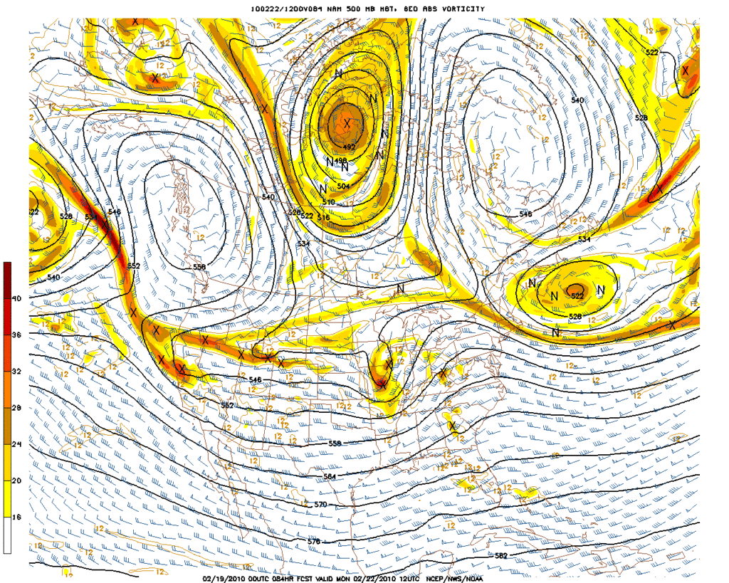
The magic 540 line is mighty close for us in SE TX. Central TX looks like snow. The Upper Air Charts are also very interesting. Now if we can string a few runs together, we may have something to talk about.
Re: More Cold Air On The Way In Mid/Late February For TX/OK/LA?
Posted: Thu Feb 18, 2010 4:46 pm
by tireman4
Caution is the word....I agree. I wont get excited until at least Sunday with a string of runs...
Re: More Cold Air On The Way In Mid/Late February For TX/OK/LA?
Posted: Thu Feb 18, 2010 5:06 pm
by C2G
snowman65 wrote:
It won't be us..maybe Dallas area again.
Couldn't agree more. One can't help but feel a little let down after this winters events, if you live in southeast Texas. We get a nice little snow miracle on Dec 4th with the promise of more miracles throughout the winter, reminiscent of the winter of 73-74. We get nothing but pipe busting cold and endless days of cloudy and unseasonably cold weather, but no snow. I guess one could argue the little sleet pellets we got when temperatures were in the low 40's a week or so ago was (a winter weather event) but I won't.
Just bring on spring and some thunderstorms already......for I feel very comfortable in predicting southeast Texas will get thunderstorms.
Re: More Cold Air On The Way In Mid/Late February For TX/OK/LA?
Posted: Thu Feb 18, 2010 5:37 pm
by Mr. T
That's snow for Houston on the 18z GFS run. No doubt about it... Just taking it verbatim
Euro ftw
Re: More Cold Air On The Way In Mid/Late February For TX/OK/LA?
Posted: Thu Feb 18, 2010 5:43 pm
by HannahMontana
Mr. T wrote:That's snow for Houston on the 18z GFS run. No doubt about it... Just taking it verbatim
Euro ftw
This is the exact time-frame the GFS started showing show for Houston for the December 5th event.
Re: More Cold Air On The Way In Mid/Late February For TX/OK/LA?
Posted: Thu Feb 18, 2010 5:52 pm
by Mr. T
HannahMontana wrote:
This is the exact time-frame the GFS started showing show for Houston for the December 5th event.
That is right!
Also, recall the GFS showing it too warm in Dallas for significant snow to fall during the Feb 12th event. The GFS predicted temperatures to be way too warm here to see anything but rain, and gave Dallas mixing issues throughout the entire event. This was a day 3 projection by the GFS! The UKMET, CMC, and Euro models continually showed a chance of flurries in Houston and it being plenty cold enough for significant snow to accumulate in Dallas. The NWS followed the GFS throughout, and that was ultimately why the heavy snow in Dallas came as a shock to many. Of course, that ended up being Dallas' biggest snow storm on record. And, flurries reached to Kingwood as well.
And, here we are yet again. GFS way too warm and not handling the southern stream or phasing correctly, while the Euro has been consistent on showing another winter storm threat for Texas, and this time probably reaching into the Houston area.
GFS has had its issues lately, and if I was a NWS met, it certainly wouldn't be my model of choice to handle this event.
Re: More Cold Air On The Way In Mid/Late February For TX/OK/LA?
Posted: Thu Feb 18, 2010 5:59 pm
by Mr. T
Ed Mahmoud wrote:Hate to be the , you know, in the punchbowl, using the magic AccuWx PPV, a total of 0.12 inches liquid falls after 850 mb reaches freezing, which sounds happy, but all of that occurs with 2 meter temps predicted between about 6ºC and 3ºC, so rain or a rain/snow mix, and no accumulation.
A model's surface temperature forecast with precipitaion falling through a freezing layer is pretty useless 6 days out, but thanks anyway.
I don't care what that shows until we are within' 2 days. This isn't the time to look at exact details like that. The point being, there is a threat of more wintry precip in Houston this month next week. We can iron out the details as we get closer.
Re: More Cold Air On The Way In Mid/Late February For TX/OK/LA?
Posted: Thu Feb 18, 2010 7:59 pm
by C2G
If I were a betting man I'd bet we get nothing more than yet another cold rain event.
Hey, but I'd really like to come out on the short end on that bet, but I probably won't.
Hope springs eternal.
Re: More Cold Air On The Way In Mid/Late February For TX/OK/LA?
Posted: Thu Feb 18, 2010 8:15 pm
by biggerbyte
Mr. T wrote:Ed Mahmoud wrote:Hate to be the , you know, in the punchbowl, using the magic AccuWx PPV, a total of 0.12 inches liquid falls after 850 mb reaches freezing, which sounds happy, but all of that occurs with 2 meter temps predicted between about 6ºC and 3ºC, so rain or a rain/snow mix, and no accumulation.
A model's surface temperature forecast with precipitaion falling through a freezing layer is pretty useless 6 days out, but thanks anyway.
I don't care what that shows until we are within' 2 days. This isn't the time to look at exact details like that. The point being, there is a threat of more wintry precip in Houston this month next week. We can iron out the details as we get closer.
Ditto on all that...

I would not discount this particular event. It is way too soon to say one way or the other.
The potential is there for some nasty weather. Let's see if this trend holds over the coming days. All I can say right now, is some folks in Texas are going to get dumped on. As far as this part of Texas, at this point I'd swing either way.
Re: More Cold Air On The Way In Mid/Late February For TX/OK/LA?
Posted: Thu Feb 18, 2010 8:30 pm
by wxman57
Too early to be sure, but not too early to say that the cards seem stacked against a frozen precip event here next week. There is no model support for anything but rain for now. It looks like the air overhead just won't get cold enough.
Re: More Cold Air On The Way In Mid/Late February For TX/OK/LA?
Posted: Thu Feb 18, 2010 8:56 pm
by srainhoutx
00Z's have started. Maybe the "night crew" will have some input...
Re: More Cold Air On The Way In Mid/Late February For TX/OK/LA?
Posted: Thu Feb 18, 2010 9:01 pm
by Gene Norman
Looks like another cold surge arrives the week of Feb 22 and today's 18Z shows sub-tropical moisture arriving at the same time. Model paints snow in Central Texas and possibly into Houston Tuesday into Wednesday morning. Yesterday, the timing was more toward Wed/Thu. There is a consistent signal and based on how "on" this model has been with the last two cold/snow episodes, I wouldn't be surprised if this verfies. Anyone else seeing this?
Re: More Cold Air On The Way In Mid/Late February For TX/OK/LA?
Posted: Thu Feb 18, 2010 9:19 pm
by Mr. T
wxman57 wrote:Too early to be sure, but not too early to say that the cards seem stacked against a frozen precip event here next week. There is no model support for anything but rain for now. It looks like the air overhead just won't get cold enough.
18z GFS supports snow at IAH... As does the 12z Euro, but I don't have any QPF maps for that model.
Re: More Cold Air On The Way In Mid/Late February For TX/OK/LA?
Posted: Thu Feb 18, 2010 9:25 pm
by Andrew
Gene Norman wrote:Looks like another cold surge arrives the week of Feb 22 and today's 18Z shows sub-tropical moisture arriving at the same time. Model paints snow in Central Texas and possibly into Houston Tuesday into Wednesday morning. Yesterday, the timing was more toward Wed/Thu. There is a consistent signal and based on how "on" this model has been with the last two cold/snow episodes, I wouldn't be surprised if this verfies. Anyone else seeing this?
Ah it is Gene. As far as an amateur's point of view, too many times has the GFS painted "Happy" snow as Ed would say only to back off of it as it gets closer. Lets hope it verifies.


