Re: July: Increasing Heavy Rain Chances & Potential Flood Th
Posted: Tue Jul 17, 2012 8:48 am
You HAD to bring that up...MontgomeryCoWx wrote:1983 was a cold Winter!
Your Infinite Source For All Things Weather
https://wxinfinity.com/
You HAD to bring that up...MontgomeryCoWx wrote:1983 was a cold Winter!
wxman57 wrote:You HAD to bring that up...MontgomeryCoWx wrote:1983 was a cold Winter!
Texas might get a couple of polar blasts like Feb/2011, but the odds of a cold winter are not good. The Northern Hemisphere's A/C unit is on track to have a record low ice extent.MontgomeryCoWx wrote:wxman57 wrote:You HAD to bring that up...MontgomeryCoWx wrote:1983 was a cold Winter!
Sorry wxman57!
All signs point to a wet and wild end of the year. I hope it phases with a few polar blasts.
The one caveat is the blocking patterns that seem to be more frequent over the last few years. This resulted in parts of Europe having a very cold late winter/early spring while most of N. America (except Alaska) had mild late winter to record warmth in early spring.In June, the Arctic lost a total of 2.86 million square kilometers (1.10 million square miles) of ice. This is the largest June ice loss in the satellite record. Similar to May, the month was characterized by a period of especially rapid ice loss (discussed in the mid-month entry, June 19th) followed by a period of slower loss. Warm conditions prevailed over most of the Arctic; temperatures at the 925 hPa level (about 3000 feet above the ocean surface) were typically 1 to 4 degrees Celsius (1.8 to 7.2 degrees Fahrenheit) above the 1981 to 2010 average, and as much as 7 to 9 degrees Celsius (12.6 to 16.2 degrees Fahrenheit) above average over northern Eurasia and near southern Baffin Bay.
One of the coldest winters, 1976-1977 did not have a lot of snow coverage.texoz wrote:
Texas might get a couple of polar blasts like Feb/2011, but the odds of a cold winter are not good. The Northern Hemisphere's A/C unit is on track to have a record low ice extent.
http://nsidc.org/arcticseaicenews/
The one caveat is the blocking patterns that seem to be more frequent over the last few years. This resulted in parts of Europe having a very cold late winter/early spring while most of N. America (except Alaska) had mild late winter to record warmth in early spring.In June, the Arctic lost a total of 2.86 million square kilometers (1.10 million square miles) of ice. This is the largest June ice loss in the satellite record. Similar to May, the month was characterized by a period of especially rapid ice loss (discussed in the mid-month entry, June 19th) followed by a period of slower loss. Warm conditions prevailed over most of the Arctic; temperatures at the 925 hPa level (about 3000 feet above the ocean surface) were typically 1 to 4 degrees Celsius (1.8 to 7.2 degrees Fahrenheit) above the 1981 to 2010 average, and as much as 7 to 9 degrees Celsius (12.6 to 16.2 degrees Fahrenheit) above average over northern Eurasia and near southern Baffin Bay.
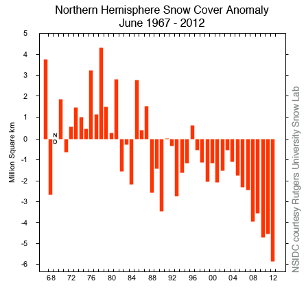
Hmm, the Snow & Ice Data Center has different info.Ptarmigan wrote:One of the coldest winters, 1976-1977 did not have a lot of snow coverage.texoz wrote:
Texas might get a couple of polar blasts like Feb/2011, but the odds of a cold winter are not good. The Northern Hemisphere's A/C unit is on track to have a record low ice extent.
http://nsidc.org/arcticseaicenews/
The one caveat is the blocking patterns that seem to be more frequent over the last few years. This resulted in parts of Europe having a very cold late winter/early spring while most of N. America (except Alaska) had mild late winter to record warmth in early spring.In June, the Arctic lost a total of 2.86 million square kilometers (1.10 million square miles) of ice. This is the largest June ice loss in the satellite record. Similar to May, the month was characterized by a period of especially rapid ice loss (discussed in the mid-month entry, June 19th) followed by a period of slower loss. Warm conditions prevailed over most of the Arctic; temperatures at the 925 hPa level (about 3000 feet above the ocean surface) were typically 1 to 4 degrees Celsius (1.8 to 7.2 degrees Fahrenheit) above the 1981 to 2010 average, and as much as 7 to 9 degrees Celsius (12.6 to 16.2 degrees Fahrenheit) above average over northern Eurasia and near southern Baffin Bay.
http://forums.khou.com/viewtopic.php?f=2&t=1126
That's some amazing video. I had known about leaders, but didn't realize they were "searching" for the return stroke like that. I get the feeling there's more we don't know about lightning than we know, i.e. the sprites into space.wxman57 wrote:With the recent lightning deaths locally, I thought you would find this high-speed super slow motion video of a lightning strike quite interesting. Note how when the first leader reaches the ground that it triggers the return stroke from the ground to the cloud:
http://vimeo.com/28457062
Yikes! the lightning in that storm was pretty fierce. Electric flicked a few times. It's moving on northward now.amandamarie01 wrote:Wow - storm really blew up out of no where over here.
edit to specify here as Pasadena (225 & Bearle)
It sure was - fierce and close! We never lost power but apparently Pasadena Refining wasn't as luckily. Can you see the black smoke from their burn-off over there in Deer Park?Poltracker wrote:amandamarie01 wrote:Wow - storm really blew up out of no where over here.
edit to specify here as Pasadena (225 & Bearle)
Yikes! the lightning in that storm was pretty fierce. Electric flicked a few times. It's moving on northward now.
amandamarie01 wrote:It sure was - fierce and close! We never lost power but apparently Pasadena Refining wasn't as luckily. Can you see the black smoke from their burn-off over there in Deer Park?Poltracker wrote:amandamarie01 wrote:Wow - storm really blew up out of no where over here.
edit to specify here as Pasadena (225 & Bearle)
Yikes! the lightning in that storm was pretty fierce. Electric flicked a few times. It's moving on northward now.
That is the data source I used. I used North America excluding Greenland.texoz wrote:Hmm, the Snow & Ice Data Center has different info.Ptarmigan wrote:
One of the coldest winters, 1976-1977 did not have a lot of snow coverage.
http://forums.khou.com/viewtopic.php?f=2&t=1126