
power outages where it went through the Willowbrook area
http://gis.centerpointenergy.com/outagetracker/
January 2017 -Warming Trend To End The Month
-
unome
- Posts: 3062
- Joined: Fri Feb 12, 2010 6:11 pm
https://twitter.com/iembot_hgx
BULLETIN - EAS ACTIVATION REQUESTED
Tornado Warning
National Weather Service Houston/Galveston TX
825 AM CST MON JAN 16 2017
The National Weather Service in League City has issued a
* Tornado Warning for...
Southeastern Waller County in southeastern Texas...
West central Harris County in southeastern Texas...
Northwestern Fort Bend County in southeastern Texas...
* Until 900 AM CST.
* At 825 AM CST, a severe thunderstorm capable of producing a tornado
was located over Simonton, or 8 miles south of Brookshire, moving
northeast at 30 mph.
HAZARD...Tornado.
SOURCE...Radar indicated rotation.
IMPACT...Expect damage to mobile homes, roofs, and vehicles.
* Locations impacted include...
Katy, Brookshire, Fulshear, Simonton, Pattison, Orchard, Weston
Lakes and Cinco Ranch.
PRECAUTIONARY/PREPAREDNESS ACTIONS...
TAKE COVER NOW! Move to an interior room on the lowest floor of a
sturdy building. Avoid windows. If you are outdoors, in a mobile
home, or in a vehicle, move to the closest substantial shelter and
protect yourself from flying debris.
Motorists should not take shelter under highway overpasses. If you
cannot safely drive away from the tornado, as a last resort, either
park your vehicle and stay put, or abandon your vehicle and lie down
in a low lying area and protect yourself from flying debris.
&&
LAT...LON 2969 9604 2968 9601 2970 9602 2971 9601
2972 9603 2977 9603 3004 9590 2990 9566
2960 9598 2962 9602 2965 9602 2966 9603
2967 9602 2968 9603 2967 9605 2968 9606
TIME...MOT...LOC 1425Z 215DEG 26KT 2967 9600
TORNADO...RADAR INDICATED
HAIL...0.00IN
-
Katdaddy

- Global Moderator

- Posts: 2521
- Joined: Thu Feb 04, 2010 8:18 am
- Location: League City, Tx
- Contact:
BULLETIN - EAS ACTIVATION REQUESTED
Tornado Warning
National Weather Service Houston/Galveston TX
825 AM CST MON JAN 16 2017
The National Weather Service in League City has issued a
* Tornado Warning for...
Southeastern Waller County in southeastern Texas...
West central Harris County in southeastern Texas...
Northwestern Fort Bend County in southeastern Texas...
* Until 900 AM CST.
* At 825 AM CST, a severe thunderstorm capable of producing a tornado
was located over Simonton, or 8 miles south of Brookshire, moving
northeast at 30 mph.
HAZARD...Tornado.
SOURCE...Radar indicated rotation.
IMPACT...Expect damage to mobile homes, roofs, and vehicles.
* Locations impacted include...
Katy, Brookshire, Fulshear, Simonton, Pattison, Orchard, Weston
Lakes and Cinco Ranch.
PRECAUTIONARY/PREPAREDNESS ACTIONS...
TAKE COVER NOW! Move to an interior room on the lowest floor of a
sturdy building. Avoid windows. If you are outdoors, in a mobile
home, or in a vehicle, move to the closest substantial shelter and
protect yourself from flying debris.
Motorists should not take shelter under highway overpasses. If you
cannot safely drive away from the tornado, as a last resort, either
park your vehicle and stay put, or abandon your vehicle and lie down
in a low lying area and protect yourself from flying debris.
-
srainhoutx

- Site Admin

- Posts: 19699
- Joined: Tue Feb 02, 2010 2:32 pm
- Location: Maggie Valley, NC
- Contact:
Monday morning briefing from Jeff:
A very active morning with a cluster of tornadic supercells moving from Wharton County to now SE Montgomery County. Appears this storm may have produced some damage near Jersey Village and SH 249 in NW Harris County…although it has been tornado warned for the last 4 hours.
Frontal boundary is stalling across the area from roughly Huntsville to Victoria and not expecting much if any movement of this boundary today and for much of the week for that matter. This will position SE TX in the firing line for rounds of thunderstorms as disturbances move along the frontal slope. Will likely see some additional development later this morning into the afternoon hours with some heating of the air mass over the region with move widespread rains Tuesday into Thursday as several disturbances move across the area.
Rainfall this morning has been heavy under the organized supercells with 1-3 inches common just NW of US 59 from Wharton County to NW Harris County. This has primed the soils for greater run-off in this corridor with any additional heavy rains.
As for the severe threat…minus the tornadic supercell this morning there has been no other severe weather and while conditions are conducive for an isolated severe storm widespread severe weather is not expected. In fact the mode of concern will be gradually shifting toward heavy rainfall and away from severe weather over the next 24-48 hours.
Carla/Alicia/Jerry(In The Eye)/Michelle/Charley/Ivan/Dennis/Katrina/Rita/Wilma/Humberto/Ike/Harvey
Member: National Weather Association
Facebook.com/Weather Infinity
Twitter @WeatherInfinity
Member: National Weather Association
Facebook.com/Weather Infinity
Twitter @WeatherInfinity
-
srainhoutx
- Site Admin
- Posts: 19699
- Joined: Tue Feb 02, 2010 2:32 pm
- Location: Maggie Valley, NC
- Contact:
From HGX: Spotter reports multiple buildings damaged Cypresswood and Champion Forest
Carla/Alicia/Jerry(In The Eye)/Michelle/Charley/Ivan/Dennis/Katrina/Rita/Wilma/Humberto/Ike/Harvey
Member: National Weather Association
Facebook.com/Weather Infinity
Twitter @WeatherInfinity
Member: National Weather Association
Facebook.com/Weather Infinity
Twitter @WeatherInfinity
-
unome
- Posts: 3062
- Joined: Fri Feb 12, 2010 6:11 pm
NWSChat Local Storm Reports: https://nwschat.weather.gov/lsr/#HGX/20 ... 701170559/
NWS Enhanced Data Display (data hog) http://go.usa.gov/x9EMD (Houston centered)
NWS Enhanced Data Display (data hog) http://go.usa.gov/x9EMD (Houston centered)
Last edited by unome on Mon Jan 16, 2017 9:42 am, edited 2 times in total.
-
Katdaddy
- Global Moderator
- Posts: 2521
- Joined: Thu Feb 04, 2010 8:18 am
- Location: League City, Tx
- Contact:
BULLETIN - EAS ACTIVATION REQUESTED
Tornado Warning
National Weather Service Houston/Galveston TX
902 AM CST MON JAN 16 2017
The National Weather Service in League City has issued a
* Tornado Warning for...
Central Montgomery County in southeastern Texas...
* Until 930 AM CST.
* At 901 AM CST, a severe thunderstorm capable of producing a tornado
was located over southwestern Conroe, moving northeast at 25 mph.
HAZARD...Tornado.
SOURCE...Radar indicated rotation.
IMPACT...Expect damage to mobile homes, roofs, and vehicles.
* Locations impacted include...
Conroe, Willis, The Woodlands, Panorama Village and Cut And Shoot.
PRECAUTIONARY/PREPAREDNESS ACTIONS...
TAKE COVER NOW! Move to a basement or an interior room on the lowest
floor of a sturdy building. Avoid windows. If you are outdoors, in a
mobile home, or in a vehicle, move to the closest substantial shelter
and protect yourself from flying debris.
-
Katdaddy
- Global Moderator
- Posts: 2521
- Joined: Thu Feb 04, 2010 8:18 am
- Location: League City, Tx
- Contact:
Severe Weather Statement
National Weather Service Houston/Galveston TX
922 AM CST MON JAN 16 2017
TXC339-161530-
/O.CON.KHGX.TO.W.0010.000000T0000Z-170116T1530Z/
Montgomery TX-
922 AM CST MON JAN 16 2017
...A TORNADO WARNING REMAINS IN EFFECT UNTIL 930 AM CST FOR CENTRAL
MONTGOMERY COUNTY...
At 921 AM CST, a severe thunderstorm capable of producing a tornado
was located near Cut And Shoot, or near Conroe, moving northeast at
25 mph.
HAZARD...TORNADO.
SOURCE...Radar indicated rotation.
IMPACT...Expect damage to mobile homes, roofs, and vehicles.
Locations impacted include...
Conroe, Willis, Panorama Village and Cut And Shoot.
PRECAUTIONARY/PREPAREDNESS ACTIONS...
TAKE COVER NOW! Move to an interior room on the lowest floor of a
sturdy building. Avoid windows. If you are outdoors, in a mobile
home, or in a vehicle, move to the closest substantial shelter and
protect yourself from flying debris.
-
srainhoutx
- Site Admin
- Posts: 19699
- Joined: Tue Feb 02, 2010 2:32 pm
- Location: Maggie Valley, NC
- Contact:
Damage Report update from Jeff:
Numerous reports of damage from this morning’s supercell. Appears the area from just north of Jersey Village to near Spring especially along the south side of FM 1960 just SW of Willowbrook Mall was hardest hit with likely a tornado. There is video footage of a weak tornado crossing SH 99 just east of I-45 and it is likely that this tornado bounced along the ground from near Jersey Village to just SE of The Woodlands.
A few of the damage reports. Note NWS will be surveying the damage to determine if it was caused by a tornado or straight line winds.
Jersey Village: Portions of roofs blown off, numerous fences down, trees down near Perry Rd/Windfern.
Jersey Village: Brick building damaged, numerous trees downed (Gessner near Sam Houston Tollway)
Champions Forest area: Buildings damaged, numerous trees snapped or uprooted. Powerlines down on top of an Urgent Care facility.
Cinco Ranch: Fences blown down and trees down
The Woodlands: confirmed tornado crossed SH 99/I-45. Damage to trees, fences, powerlines in the area.
Carla/Alicia/Jerry(In The Eye)/Michelle/Charley/Ivan/Dennis/Katrina/Rita/Wilma/Humberto/Ike/Harvey
Member: National Weather Association
Facebook.com/Weather Infinity
Twitter @WeatherInfinity
Member: National Weather Association
Facebook.com/Weather Infinity
Twitter @WeatherInfinity
-
Heat Miser

- Posts: 229
- Joined: Wed Nov 27, 2013 12:48 pm
- Location: FM 528 @ I45 border of League City, Webster, Friendswood
- Contact:
The brutal cold continues with highs in the 70's, possibly nearing 80 later this week. I put my coat and sweaters deep within my closet and replaced them with shorts and short sleeve shirts, brrrrr.
-
Ounce
- Posts: 470
- Joined: Sat Apr 17, 2010 10:18 pm
- Location: Houston
- Contact:
Plus the flying trampoline lodged in electric wires around Greenhouse and Clay Road.srainhoutx wrote:Damage Report update from Jeff:
Numerous reports of damage from this morning’s supercell. Appears the area from just north of Jersey Village to near Spring especially along the south side of FM 1960 just SW of Willowbrook Mall was hardest hit with likely a tornado. There is video footage of a weak tornado crossing SH 99 just east of I-45 and it is likely that this tornado bounced along the ground from near Jersey Village to just SE of The Woodlands.
A few of the damage reports. Note NWS will be surveying the damage to determine if it was caused by a tornado or straight line winds.
Jersey Village: Portions of roofs blown off, numerous fences down, trees down near Perry Rd/Windfern.
Jersey Village: Brick building damaged, numerous trees downed (Gessner near Sam Houston Tollway)
Champions Forest area: Buildings damaged, numerous trees snapped or uprooted. Powerlines down on top of an Urgent Care facility.
Cinco Ranch: Fences blown down and trees down
The Woodlands: confirmed tornado crossed SH 99/I-45. Damage to trees, fences, powerlines in the area.
-
MontgomeryCoWx

- Posts: 2646
- Joined: Wed Dec 14, 2011 4:31 pm
- Location: Weimar, TX
- Contact:
This weather is horrid. I'm counting down the days until the Pacific gets it act together.
Team #NeverSummer
-
ticka1
- Posts: 1265
- Joined: Wed Feb 03, 2010 3:02 pm
- Location: Baytown/Mont Belvieu
- Contact:
hot humid and no rain at all
-
srainhoutx
- Site Admin
- Posts: 19699
- Joined: Tue Feb 02, 2010 2:32 pm
- Location: Maggie Valley, NC
- Contact:
We will need to monitor for additional severe thunderstorms tomorrow with a splitting jet as a robust upper low moves into South Central Texas. Stay weather aware.
- Attachments
-
-
Carla/Alicia/Jerry(In The Eye)/Michelle/Charley/Ivan/Dennis/Katrina/Rita/Wilma/Humberto/Ike/Harvey
Member: National Weather Association
Facebook.com/Weather Infinity
Twitter @WeatherInfinity
Member: National Weather Association
Facebook.com/Weather Infinity
Twitter @WeatherInfinity
-
DoctorMu

- Posts: 7623
- Joined: Sun Jun 28, 2015 11:58 am
- Location: College Station
- Contact:
Riding the rift up here in CLL. A couple of terrific downpours and on the edge of cool...
Heard about the flying trampolines on the radio! Hope to see pics.
Heard about the flying trampolines on the radio! Hope to see pics.
-
DoctorMu
- Posts: 7623
- Joined: Sun Jun 28, 2015 11:58 am
- Location: College Station
- Contact:
We got video from KHOU:DoctorMu wrote:Riding the rift up here in CLL. A couple of terrific downpours and on the edge of cool...
Heard about the flying trampolines on the radio! Hope to see pics.
http://www.khou.com/news/local/cleanup- ... /386419795
-
srainhoutx
- Site Admin
- Posts: 19699
- Joined: Tue Feb 02, 2010 2:32 pm
- Location: Maggie Valley, NC
- Contact:
Monday evening briefing from Jeff:
Active weather pattern will continue into much of this week and the weekend
Storm system responsible for the active overnight and early morning hours has moved into the Midwest with a weak cool front having stalled for much of the day across C TX. Late this afternoon this front began to push SE and will very slowly progress into SE TX tonight. A 90kt jet stream is nosing into the coastal bend ahead of another upper level trough located over the central portion of Baja this evening. Moisture remains plentiful over SE TX, but the air mass has been capped all day which has prevented showers and thunderstorms from forming. Feel the short term rapid update models are just too aggressive with overnight rain chances as trends do not really match guidance.
Surface boundary will drift toward US 59 overnight and convergence along this feature may result in a few showers or even a thunderstorm. Don’t see much there for severe weather, but there was not much this morning either…and it still happened. Could see a few low topped supercells evolve, but the chances are fairly low.
Appears greater coverage of rain/storms will commence later Tuesday as Baja upper system nears and strong upper level divergence on nose of 130 kt sub-tropical jet streak comes to bear over the region. Front may at this point be somewhere between US 59 and the coast and storms south of this boundary could become low topped supercells…although the chances seem small. Bigger concern is the heavy rainfall potential as the air mass saturates and upper level winds are pretty close to being parallel to the surface boundary. Moisture levels around 1.5 inches of PW for mid January is fairly impressive and cell training in bands is likely in this setup. Could see some 1-2 inch per hour rates.
Rain and storms continue into Wednesday with additional disturbances passing through the longwave trough over the western US and riding across TX. Front will remain stalled near the coast and a fairly strong disturbance Wednesday evening may induce a coastal low on the front which will ride NE across the coastal waters. This may bring a brief end to the wet weather for Thursday and Friday.
Rainfall forecasted for the next 48 hours will average 1-3 inches over the area with isolated amounts of up to 4 inches possible. If this rain falls along the corridor from Wharton County to San Jacinto County where 1-2 inches of rain fell this morning more significant run-off will be likely compared to areas that saw very little or no rainfall today.
Weekend:
A powerful upper level system will sweep across TX and the southern US. Appears moisture will be just enough to work with strong jet stream dynamics to brings showers and thunderstorms Saturday into early Sunday. If moisture is better than currently being suggested a severe threat will be possible with the dynamics expected in place. System will actually intensify as it progressed across the region and backside strong winds will be possible Sunday. Still plenty of time to watch how this may unfold.
Monday AM Tornado:
NWS damage assessment teams are still working the various sections of damage which stretch from Fort Bend across much of W/NW/N Harris County into southern Montgomery County from this morning’s low topped supercell. Initial findings indicate EF0 (80mph) damage just north of Jersey Village in the Perry/Windfern Rd area. This appears to be the most significant damage along the entire damage path from this morning as damage across NE Fort Bend County in Cinco Ranch, Firethorne, and Tamarron subdivisions was mainly limited to blown down fences and airborne trampolines (3 on one street). A final assessment on this family of tornadoes should be available on Tuesday.
Carla/Alicia/Jerry(In The Eye)/Michelle/Charley/Ivan/Dennis/Katrina/Rita/Wilma/Humberto/Ike/Harvey
Member: National Weather Association
Facebook.com/Weather Infinity
Twitter @WeatherInfinity
Member: National Weather Association
Facebook.com/Weather Infinity
Twitter @WeatherInfinity
-
Cromagnum
- Posts: 3021
- Joined: Thu Feb 03, 2011 10:42 pm
- Location: Georgetown
- Contact:
Looks like we get 4 months of spring and storms, then 5 months of summer before a chance at cooling off again.
-
Katdaddy
- Global Moderator
- Posts: 2521
- Joined: Thu Feb 04, 2010 8:18 am
- Location: League City, Tx
- Contact:
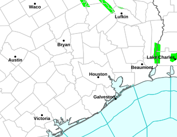
A marginal risk of severe thunderstorms remain across SE and S TX mainly along the Middle and Upper TX Coast today. This threat will transition to a widespread rain event Wednesday into Wednesday night. Current radar indicates developing showers and thunderstorms developing across inland portions of SE TX along the stalled frontal system.
- Attachments
-
- Screen Shot 2017-01-17 at 5.32.55 AM.png (187.57 KiB) Viewed 5409 times
-
- Screen Shot 2017-01-17 at 5.30.08 AM.png (11.15 KiB) Viewed 5409 times
-
srainhoutx
- Site Admin
- Posts: 19699
- Joined: Tue Feb 02, 2010 2:32 pm
- Location: Maggie Valley, NC
- Contact:
A very strong Pacific Jet is slamming into the West Coast and that should continue throughout the work week. A very stormy period is ahead for the Cascade and Sierra Nevada Ranges of Washington/Oregon and California where drought busting moisture will continue to pile up for that Region.
Closer to home, a robust Upper Low over Mexico should move into Texas and then NE bringing rounds of showers and mostly elevated thunderstorms increasing tonight into Wednesday with heavy training rainfall possible along and N of a stalled frontal boundary. We should begin to dry out some by Friday, but another storm system may begin to organize for the weekend.

Closer to home, a robust Upper Low over Mexico should move into Texas and then NE bringing rounds of showers and mostly elevated thunderstorms increasing tonight into Wednesday with heavy training rainfall possible along and N of a stalled frontal boundary. We should begin to dry out some by Friday, but another storm system may begin to organize for the weekend.
- Attachments
-
-
Carla/Alicia/Jerry(In The Eye)/Michelle/Charley/Ivan/Dennis/Katrina/Rita/Wilma/Humberto/Ike/Harvey
Member: National Weather Association
Facebook.com/Weather Infinity
Twitter @WeatherInfinity
Member: National Weather Association
Facebook.com/Weather Infinity
Twitter @WeatherInfinity