
Steve, just based off of your current atmospheric observations.. Do you see a squall line developing and moving through at a steady pace? Albeit maybe slowly, but moving... Or do you think it could move across our area and potentially slow down or maybe stall, and continue to back build as it sits here?
The HRRR is very concerning but also the outlier. If memory serves me right, I think the HRRR did pretty good (short term) on the Tax day storms. Or am I mistaking? It's been a long week.. :-/
I know it is almost impossible to say, especially since the event is unfolding and model watching is not a good reference point now, but I'm just curious as to what you think; given the winds picking up, the super humid/heavy air and the lift that appears to be available as the night progresses.
April 2016 Recap: Regional Flood/Severe Weather
-
srainhoutx

- Site Admin

- Posts: 19616
- Joined: Tue Feb 02, 2010 2:32 pm
- Location: Maggie Valley, NC
- Contact:
The Tax Day flood event was well modeled by the Global guidance a good 5 days ahead of that event David. This has been a very tricky event to attempt to forecast accurately particularly when trying to be sensitive to all those suffering from the April 17-18 Regional Flood. Still believe the best we can do is watch the radar trends overnight into tomorrow. Still have little confidence with any computer model accurately sniffing out Mesoscale features beyond an hour or two ahead of where we see actual storm development.
Carla/Alicia/Jerry(In The Eye)/Michelle/Charley/Ivan/Dennis/Katrina/Rita/Wilma/Humberto/Ike/Harvey
Member: National Weather Association
Facebook.com/Weather Infinity
Twitter @WeatherInfinity
Member: National Weather Association
Facebook.com/Weather Infinity
Twitter @WeatherInfinity

MESOSCALE DISCUSSION 0506
NWS STORM PREDICTION CENTER NORMAN OK
0807 PM CDT FRI APR 29 2016
AREAS AFFECTED...MUCH OF CENTRAL TEXAS
CONCERNING...TORNADO WATCH 124...
VALID 300107Z - 300230Z
THE SEVERE WEATHER THREAT FOR TORNADO WATCH 124 CONTINUES.
SUMMARY...SEVERE STORM DEVELOPMENT IS EXPECTED TO PERSIST ACROSS
MUCH OF CENTRAL TEXAS THROUGH MUCH OF THE EVENING...ROUGHLY CENTERED
ON THE I-35 CORRIDOR BETWEEN SAN ANTONIO AND DALLAS/FORT WORTH. A
NEW SEVERE WEATHER WATCH MAY BE NEEDED SOUTH OF TORNADO WATCH 124
WITHIN THE NEXT HOUR OR SO.
DISCUSSION...DIFLUENT UPPER FLOW BETWEEN THE BASE OF NEGATIVELY
TILTED UPPER TROUGHING NOW SHIFTING INTO THE CENTRAL AND SOUTHERN
PLAINS...AND A ZONAL SUBTROPICAL JET AXIS ACROSS THE LOWER RIO
GRANDE VALLEY...LIKELY IS ENHANCING CONVECTIVE DEVELOPMENT AHEAD OF
THE DRYLINE TO THE SOUTH SOUTHWEST OF THE DALLAS/FORT WORTH
METROPLEX. SUSTAINED DISCRETE STORMS HAVE BEEN OCCURRING TO THE
WEST/AND NORTHWEST OF THE WACO/TEMPLE AREAS...AND STORMS ARE
INITIATING AS INHIBITION WEAKENS SOUTHWARD INTO THE HILL COUNTRY AND
ADJACENT PORTIONS OF THE EDWARDS PLATEAU.
IN THE PRESENCE OF LARGE CAPE ON THE ORDER OF 1500-3000+
J/KG...FURTHER CONVECTIVE DEVELOPMENT/INTENSIFICATION AND
ORGANIZATION APPEARS POSSIBLE THROUGH THE 02-04Z TIME...ACROSS AND
NORTH OF THE SAN ANTONIO AREA INTO AREAS SOUTH OF THE METROPLEX.
SOUTHERLY LOW-LEVEL FLOW APPEARS TO HAVE STRENGTHENED ACROSS THIS
REGION...ON THE WESTERN EDGE OF A 40-50 KT 850 MB JET. AN UPSCALE
GROWING MESOSCALE CONVECTIVE SYSTEM MAY NOT BE OUT OF THE QUESTION.
IF THIS OCCURS...DAMAGING WIND POTENTIAL PROBABLY WILL INCREASE. IN
THE MEANTIME...A TORNADO OR TWO IS POSSIBLE...IN ADDITION TO THE
CONTINUING RISK FOR SEVERE HAIL.
..KERR.. 04/30/2016
...PLEASE SEE http://WWW.SPC.NOAA.GOV FOR GRAPHIC PRODUCT...
ATTN...WFO...HGX...FWD...EWX...SJT...

Yessir. Patience, folks. LLJ is just starting to crank. Just keep a close watch out west on the radar and satellite.
-
wxman57

- Global Moderator

- Posts: 2621
- Joined: Thu Feb 04, 2010 5:34 am
- Location: Southwest Houston (Westbury)
- Contact:
I've found the HRRR often way too high with rainfall totals.davidiowx wrote:Steve, just based off of your current atmospheric observations.. Do you see a squall line developing and moving through at a steady pace? Albeit maybe slowly, but moving... Or do you think it could move across our area and potentially slow down or maybe stall, and continue to back build as it sits here?
The HRRR is very concerning but also the outlier. If memory serves me right, I think the HRRR did pretty good (short term) on the Tax day storms. Or am I mistaking? It's been a long week.. :-/
I know it is almost impossible to say, especially since the event is unfolding and model watching is not a good reference point now, but I'm just curious as to what you think; given the winds picking up, the super humid/heavy air and the lift that appears to be available as the night progresses.
Thanks srain and wxman, it's always good to hear yalls input on the models as well as your personal opinions. Let's pray for the best! But prepare for the worst. It's better safe than sorry when events like this threaten our area. I love the interaction and knowledge on this forum. It's the best around.
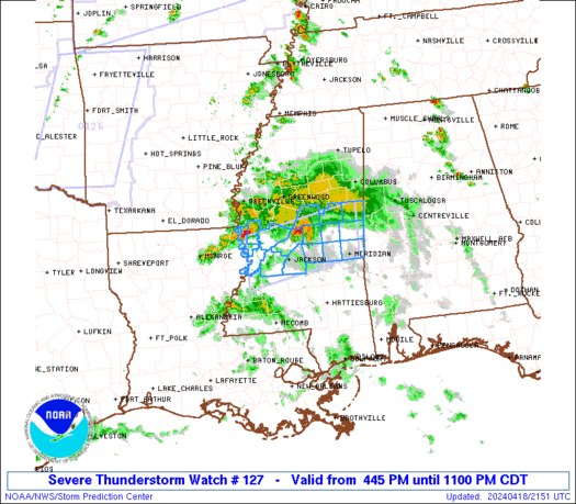
SEL7
URGENT - IMMEDIATE BROADCAST REQUESTED
SEVERE THUNDERSTORM WATCH NUMBER 127
NWS STORM PREDICTION CENTER NORMAN OK
820 PM CDT FRI APR 29 2016
THE NWS STORM PREDICTION CENTER HAS ISSUED A
* SEVERE THUNDERSTORM WATCH FOR PORTIONS OF
CENTRAL TEXAS
* EFFECTIVE THIS FRIDAY NIGHT AND SATURDAY MORNING FROM 820 PM
UNTIL 300 AM CDT.
* PRIMARY THREATS INCLUDE...
ISOLATED VERY LARGE HAIL EVENTS TO 2 INCHES IN DIAMETER POSSIBLE
ISOLATED DAMAGING WIND GUSTS TO 70 MPH POSSIBLE
SUMMARY...ISOLATED TO SCATTERED INTENSE THUNDERSTORMS WILL CONTINUE
TO DEVELOP ACROSS PARTS OF CENTRAL TX THIS EVENING AND TONIGHT. THE
STRONGER CELLS WILL POSE A RISK OF LARGE HAIL AND DAMAGING WINDS.
THE SEVERE THUNDERSTORM WATCH AREA IS APPROXIMATELY ALONG AND 60
STATUTE MILES EAST AND WEST OF A LINE FROM 70 MILES SOUTHWEST OF
HONDO TEXAS TO 50 MILES NORTH OF AUSTIN TEXAS. FOR A COMPLETE
DEPICTION OF THE WATCH SEE THE ASSOCIATED WATCH OUTLINE UPDATE
(WOUS64 KWNS WOU7).
PRECAUTIONARY/PREPAREDNESS ACTIONS...
REMEMBER...A SEVERE THUNDERSTORM WATCH MEANS CONDITIONS ARE
FAVORABLE FOR SEVERE THUNDERSTORMS IN AND CLOSE TO THE WATCH
AREA. PERSONS IN THESE AREAS SHOULD BE ON THE LOOKOUT FOR
THREATENING WEATHER CONDITIONS AND LISTEN FOR LATER STATEMENTS
AND POSSIBLE WARNINGS. SEVERE THUNDERSTORMS CAN AND OCCASIONALLY
DO PRODUCE TORNADOES.
&&
OTHER WATCH INFORMATION...CONTINUE...WW 124...WW 125...WW 126...
AVIATION...A FEW SEVERE THUNDERSTORMS WITH HAIL SURFACE AND ALOFT
TO 2 INCHES. EXTREME TURBULENCE AND SURFACE WIND GUSTS TO 60
KNOTS. A FEW CUMULONIMBI WITH MAXIMUM TOPS TO 500. MEAN STORM
MOTION VECTOR 24025.
...HART

-
srainhoutx
- Site Admin
- Posts: 19616
- Joined: Tue Feb 02, 2010 2:32 pm
- Location: Maggie Valley, NC
- Contact:
houstonia wrote:So, am I correct in thinking it looks like this system is heading toward our area at a slower progress than forecast? Since there's still a lot going on in central Texas?
That appears to be correct houstonia.
Carla/Alicia/Jerry(In The Eye)/Michelle/Charley/Ivan/Dennis/Katrina/Rita/Wilma/Humberto/Ike/Harvey
Member: National Weather Association
Facebook.com/Weather Infinity
Twitter @WeatherInfinity
Member: National Weather Association
Facebook.com/Weather Infinity
Twitter @WeatherInfinity

Thanks all for the updates as with weather its always a fluid environment! I will be here most of the night!
Thank you all for the updates. Not knowing the terminology and going back and forth to the weather 'dictionary', your input is greatly appreciated.
AREA FORECAST DISCUSSION
NATIONAL WEATHER SERVICE HOUSTON/GALVESTON TX
843 PM CDT FRI APR 29 2016
.UPDATE...
MAY HAVE DODGED THE BULLET WITH THE FIRST ROUND ACROSS MOST OF
SERN TX AS DIURNAL STORMS FAILED TO SUSTAIN THEMSELVES WITH
LIMITED CONVERGENCE/UPPER SUPPORT AND MODEST CAPPING IN PLACE.
EYES WILL TURN TO THE WEST AS WE MONITOR THE STRONG/SEVERE STORMS
OVER CENTRAL TEXAS ALONG SURFACE TROUGH AND DRY LINE AS THIS
ACTIVITY CONTINUES EAST OVERNIGHT. COULD STILL SEE A FEW SHOWERS
AHEAD OF THIS ACTIVITY...BUT MOST OF OUR RAIN POTENTIAL TONIGHT
MAY NOW BE TIED TO BROKEN LINE MOVING INTO OUR AREA AFTER 06Z.
ABUNDANT MOISTURE REMAINS ANCHORED OVER SERN TX WITH AXIS OF
1.5-2" PWS IN PLACE SO POTENTIAL FOR HEAVY RAIN REMAINS EARLY
SATURDAY MORNING...ALTHOUGH /FORTUNATELY/ OVERALL TOTALS MAY BE
LESS THAN EARLIER THOUGHT. REGARDLESS WILL KEEP FLASH FLOOD WATCH
IN PLACE GIVEN THE AMOUNT OF MOISTURE/INSTABILITY REMAINING AND
THE POSSIBILITY OF HIGH RAINFALL RATES AND SATURATED SOILS.
SCENARIO WILL BE COMPLICATED MOVING THROUGH TOMORROW DEPENDING ON
EFFECTS FROM EARLY MORNING ACTIVITY. IF THESE STORMS PUSH THROUGH
AS AN ORGANIZED MCS...WIND DAMAGE WOULD REMAIN A POSSIBILITY
OVERNIGHT. THIS COULD THEN WORK-OVER AIR MASS ENOUGH TO REDUCE
TSTM POTENTIAL IN ITS WAKE FOR MUCH OF THE DAY. HOWEVER IF THIS
ACTIVITY WEAKENS AND OR LEAVES A BOUNDARY ACROSS THE REGION...WE
COULD SEE INCREASED TSTM/HEAVY RAIN POTENTIAL TOMORROW.
HAVE UPDATED FORECAST GRIDS TO ACCOUNT FOR ABOVE MENTIONED
SCENARIO...BUMPING BACK POPS/QPF A BIT OVERNIGHT.
EVANS
It's curious to me that a decent, little cell that caused rain on some of Victoria at 8:15 has evaporated about 30 miles later. I guess the atmosphere is still capped between Victoria and Columbus?
-
TexasBreeze
- Posts: 942
- Joined: Sun Sep 26, 2010 4:46 pm
- Location: NW Houston, TX
- Contact:
It seems that nothing is organizing so far and what is out there either dissipates or goes away to the north-northeast.
It is certainly appearing that way. It's a good thing though. We don't need anymore rain right now!TexasBreeze wrote:It seems that nothing is organizing so far and what is out there either dissipates or goes away to the north-northeast.
With that said, this event is just getting started. The Tax day flood arrived way ahead of schedule.. and this event (if it even comes to fruition) may be later.
I personally think this will be a big time rain maker up to the NE of our CWA. That is just my opinion of course. Things can change quickly. We have to watch throughout the night and see what develops.
Storms to the NE seem to be backbuilding a bit...
Ever so slowly.jasons wrote:Storms to the NE seem to be backbuilding a bit...
May be some slight radar returns starting up around SW Houston...
Last edited by jasons2k on Sat Apr 30, 2016 12:40 am, edited 1 time in total.
-
- Information
-
Who is online
Users browsing this forum: 869MB, Ahrefs [Bot], Bing [Bot], Semrush [Bot] and 49 guests