
August 2016: Rain Chances Continue.
-
Katdaddy

- Global Moderator

- Posts: 2502
- Joined: Thu Feb 04, 2010 8:18 am
- Location: League City, Tx
- Contact:
A beautiful sunset on the way thanks to cirrus from the "Gulf Blob" in the N Central GOM. Not expecting tropical development but this may enhance rain chances across SE TX later this weekend and into next week as it drifts W and WNW.
- Attachments
-
-
Andrew
- Site Admin

- Posts: 3440
- Joined: Wed Feb 03, 2010 9:46 pm
- Location: North-West Houston
- Contact:
A.V. wrote:Compare NOAA observations for Bush IAH vs College Station. Bush Airport already recorded 6 days of 100F, meanwhile, College Station only has 2 days of such temps.Andrew wrote:Do you have factual evidence to support that claim? If so I would be happy to see it otherwise please stop with this type of conversation.
Then I put forth several plausible examples (UHI, soil, etc). Why else would Bush Airport be recording more frequent 100F than College Station (which is farther from the coast)? C'mon now.
Your sample period is way to small to justify an overall trend between college station and IAH. For example, look at the 2011 drought period between IAH and KCLL, and you will notice that KCLL has a lot more 100 degree days compared to IAH. 2012 and 2013 were just like that too. Using a 2 month period isn't the best evidence to back your theory.
For Your Infinite Source For All Things Weather Visit Our Facebook
-
A.V.
Well, yes, but, in all fairness, I was talking solely of this year.Andrew wrote:Your sample period is way to small to justify an overall trend between college station and IAH. For example, look at the 2011 drought period between IAH and KCLL, and you will notice that KCLL has a lot more 100 degree days compared to IAH. 2012 and 2013 were just like that too. Using a 2 month period isn't the best evidence to back your theory.

If you stop responding to him he'll stop! Were getting nowhere with this conversation and we have now filled up 4-5 pages of this back and forth debacle. Please, can we move on and discuss more of our upcoming cooler temps and wet weather?Please? Thank you
Mike
Beaumont, TX
(IH-10 & College Street)
Beaumont, TX
(IH-10 & College Street)
-
TexasBreeze
- Posts: 942
- Joined: Sun Sep 26, 2010 4:46 pm
- Location: NW Houston, TX
- Contact:
At least a good sign is more cloud cover and there were more storms around the eastern area today. The latest gfs is painting a quite wet picture in coming days...
Im looking forward to it. Just had a line go thru beaumont. Temps dropped from 90 to a hallelujah 75 in a matter of minutes. Had 40% for today. Now 50% for tomorrow and higher over the next 7 days here in Beaumont. Cmon down!!!! Gonna be a nice cool but wet weekend, but aill take that any day rather than 101 degree days! Im over those! Have a great evening my friends!
Mike
Beaumont, TX
(IH-10 & College Street)
Beaumont, TX
(IH-10 & College Street)
-
A.V.
See, now if only those lines would just sweep through Houston, and down past Corpus and Brownsville. It would allow Corpus and Brownsville to have rains they've lacked since the end of June, taking them out of fail status.djmike wrote:Im looking forward to it. Just had a line go thru beaumont. Temps dropped from 90 to a hallelujah 75 in a matter of minutes. Had 40% for today. Now 50% for tomorrow and higher over the next 7 days here in Beaumont. Cmon down!!!! Gonna be a nice cool but wet weekend, but aill take that any day rather than 101 degree days! Im over those! Have a great evening my friends!

The GOM blob approaches Thursday with uptick of rain chances Thursday. College station won't get into the action until the weekend.
Area Forecast Discussion
National Weather Service Houston/Galveston TX
854 PM CDT Wed Aug 10 2016
.DISCUSSION...
At 850 mb...a weak high was noted over E TX and a well defined 850
mb low was located over S AL. Deeper moisture had inched into SE
TX and PW values were generally above 2.00 inches. At 300 mb...a
strong and expansive upper level ridge extended from AZ to NC with
the center of the ridge over W MS. Showers continue to weaken as
they approach the eastern fringe of the HGX CWA and not expecting
more than isolated showers over the extreme east for the remainder
of the evening. An extensive cirrus shield will keep temps on the
warm side this evening and min temps will struggle to fall below
80 degrees by sunrise. Moisture levels will continue to deepen on
Thursday and rain chances should be a bit higher than the past
couple of days, especially over the eastern half of the CWA. Max
temps on Thursday look similar to todays values...maybe a degree
or two cooler with a bit more cloud cover but see no reason why
heat index values won`t exceed 108 degrees again. Peak values
today were between 109 and 112 degrees and expect something
similar on Thursday. Only significant change to the forecast will
be to issue another heat advisory for Thursday. The Heat Advisory
will run from noon to 7 PM. 43
REV DISCUSSION... /ISSUED /
DISCUSSION...
Upper level subsidence persists with the southwestward expansion
of the mid-Atlantic centered 595 dam upper ridge into the lower
Mississippi River Valley. This will again be the impetus to driving
up interior ambient temperatures into the upper 90s/100F...lower
90s along the immediate coastline. Relatively higher 2 inch PWATS
over the northwestern Gulf will be nosing westward, especially
behind today`s inland-advancing sea breeze boundary. A coastal air
mass with dew points in the upper 70s to lower 80s will produce
afternoon maximum heat indices in the 107F-113F range. Thus, the
areawide Heat Advisory will remain in effect during the afternoon
hours with the possibility of some urban sites briefly achieving
excessive heat of equal/greater to 113F. Anyone working or exercising
outside this afternoon should take the proper precautions of limiting
strenuous activity while remaining hydrated.
Recent convection blowing up off the FL to LA coastlines have pushed
mid-level outflow boundaries westward towards the upper TX waters.
Relatively lower northern gulf heights inching closer to eastern
Texas, along with greater than 2 inch PWAT air, will increase
eastern CWA precipitation probabilities. Throw in the facts that
middle 90F convective temperatures will likely be met, the existence
of a sea breeze boundary and better mid-level convergence has kept
POPs up in the (low) chance realm. Precipitation chances will be
on the rise each subsequent day going into the weekend. 5H heights
will fall by a few meters as relatively lower northern GOM heights
advance west and, with central plains shallow troughing pushing a
weak mid-level boundary towards the Red River Valley, late week
into weekend conditions will become more cloudy and unsettled.
Ensemble output pegs moderate to high chance rain probabilities to
focus over the region early next week. Thus, another day or two of
this oppressive heat before conditions become more overcast and
the day-to-day shower/storm threat, or respite from the extreme
heat, sticks as the headline from Saturday onward. 31
-
A.V.
Who knows, perhaps the moisture can push just enough to get College Station in the action.DoctorMu wrote:The GOM blob approaches Thursday with uptick of rain chances Thursday. College station won't get into the action until the weekend.
Area Forecast Discussion
National Weather Service Houston/Galveston TX
854 PM CDT Wed Aug 10 2016
.DISCUSSION...
At 850 mb...a weak high was noted over E TX and a well defined 850
mb low was located over S AL. Deeper moisture had inched into SE
TX and PW values were generally above 2.00 inches. At 300 mb...a
strong and expansive upper level ridge extended from AZ to NC with
the center of the ridge over W MS. Showers continue to weaken as
they approach the eastern fringe of the HGX CWA and not expecting
more than isolated showers over the extreme east for the remainder
of the evening. An extensive cirrus shield will keep temps on the
warm side this evening and min temps will struggle to fall below
80 degrees by sunrise. Moisture levels will continue to deepen on
Thursday and rain chances should be a bit higher than the past
couple of days, especially over the eastern half of the CWA. Max
temps on Thursday look similar to todays values...maybe a degree
or two cooler with a bit more cloud cover but see no reason why
heat index values won`t exceed 108 degrees again. Peak values
today were between 109 and 112 degrees and expect something
similar on Thursday. Only significant change to the forecast will
be to issue another heat advisory for Thursday. The Heat Advisory
will run from noon to 7 PM. 43
REV DISCUSSION... /ISSUED /
DISCUSSION...
Upper level subsidence persists with the southwestward expansion
of the mid-Atlantic centered 595 dam upper ridge into the lower
Mississippi River Valley. This will again be the impetus to driving
up interior ambient temperatures into the upper 90s/100F...lower
90s along the immediate coastline. Relatively higher 2 inch PWATS
over the northwestern Gulf will be nosing westward, especially
behind today`s inland-advancing sea breeze boundary. A coastal air
mass with dew points in the upper 70s to lower 80s will produce
afternoon maximum heat indices in the 107F-113F range. Thus, the
areawide Heat Advisory will remain in effect during the afternoon
hours with the possibility of some urban sites briefly achieving
excessive heat of equal/greater to 113F. Anyone working or exercising
outside this afternoon should take the proper precautions of limiting
strenuous activity while remaining hydrated.
Recent convection blowing up off the FL to LA coastlines have pushed
mid-level outflow boundaries westward towards the upper TX waters.
Relatively lower northern gulf heights inching closer to eastern
Texas, along with greater than 2 inch PWAT air, will increase
eastern CWA precipitation probabilities. Throw in the facts that
middle 90F convective temperatures will likely be met, the existence
of a sea breeze boundary and better mid-level convergence has kept
POPs up in the (low) chance realm. Precipitation chances will be
on the rise each subsequent day going into the weekend. 5H heights
will fall by a few meters as relatively lower northern GOM heights
advance west and, with central plains shallow troughing pushing a
weak mid-level boundary towards the Red River Valley, late week
into weekend conditions will become more cloudy and unsettled.
Ensemble output pegs moderate to high chance rain probabilities to
focus over the region early next week. Thus, another day or two of
this oppressive heat before conditions become more overcast and
the day-to-day shower/storm threat, or respite from the extreme
heat, sticks as the headline from Saturday onward. 31
To sleep, perchance to dream...

-
Katdaddy
- Global Moderator
- Posts: 2502
- Joined: Thu Feb 04, 2010 8:18 am
- Location: League City, Tx
- Contact:
Another day of hot weather with Heat Advisories in effect across SE TX but a change is on the way as the ridge is forecast to weaken allowing a weak trough to develop across the S Plains. In addition the N Central GOM disturbance will propagate slowly W and WNW into TX later this weekend and into next week bring additional moisture.
- Attachments
-
-
srainhoutx

- Site Admin
- Posts: 19616
- Joined: Tue Feb 02, 2010 2:32 pm
- Location: Maggie Valley, NC
- Contact:
Thursday morning briefing from Jeff:
Streak of high heat index and 100 degree afternoons will be ended by this weekend with onset of much higher rain chances.
Inverted westward moving mid level trough over the central Gulf coast states this morning with some very impressive PWS values of 2.5-2.7 inches will slowly work westward and into eastern TX over the next 48 hours. At the same time an upper level trough will approach from the west and help break down the ridge of high pressure over TX which has been in firm place for the last 5-8 days.
Before the break down of the upper level ridge, the area will suffer through at least one more day of high heat values and 100 or greater temperatures. Morning lows today are running about 4 degrees warmer than yesterday so think 100 will be easily reached today even with increasing cloud cover. May even make 100 again on Friday. Yesterday featured afternoon heat index values of 108-112 over the region or at or above advisory levels so the heat advisory will be in effect for today and maybe again on Friday.
Saturday-mid next week:
Onset of significant deep moisture plume just to our east over Louisiana and weakening effects of upper level ridging aloft point to a rapid increase in rain chances. PWS soar into the 2.2-2.4 inch range by Sunday with convective temperatures falling from the upper 90’s to the lower 90’s. Expect widespread coverage of showers and thunderstorms Sunday-Tuesday along the seabreeze boundary each afternoon. High moisture levels and little to no capping support rain chances really at just about anytime…but think the most active periods will be late morning into the afternoon hours with some surface heating.
Currently not looking a sustained excessive rainfall, but a few of the global models are suggesting some organization to the activity off of a weak frontal boundary Sunday moving southward out of NC TX. Storms will be prodigious rainfall producers with high hourly rainfall totals of 2-3 inches certainly possible in a very tropical air mass. Think 30-40% will work of Saturday and then go up to 60% Sunday-Tuesday. Upper level ridging attempts to build back into the area from the east by the middle of next week…but never looks to really gain a go foothold so will continue with daily rain chances through the end of the week.
Tropics:
Not much to talk about across the Atlantic basin with a lot of dry and sinking air. May see more favorable conditions begin to arrive across the basin by the third week of August.
Carla/Alicia/Jerry(In The Eye)/Michelle/Charley/Ivan/Dennis/Katrina/Rita/Wilma/Humberto/Ike/Harvey
Member: National Weather Association
Facebook.com/Weather Infinity
Twitter @WeatherInfinity
Member: National Weather Association
Facebook.com/Weather Infinity
Twitter @WeatherInfinity
-
srainhoutx
- Site Admin
- Posts: 19616
- Joined: Tue Feb 02, 2010 2:32 pm
- Location: Maggie Valley, NC
- Contact:
After a long period since June, it does appear the much anticipated pattern change is developing. It has been a long time since we 've seen the chance for Excessive Rainfall in our forecast and a fairly high Quantitative Precipitation Forecast where just about everyone may get some sorely needed rainfall. The Surface Charts over the next 3 to 7 days suggest the mechanisms needed to enhance our rain chances will be in place. Will need to monitor trends throughout the weekend as we fine tune the sensible weather forecasts going forward into mid next week.

- Attachments
-
-
Carla/Alicia/Jerry(In The Eye)/Michelle/Charley/Ivan/Dennis/Katrina/Rita/Wilma/Humberto/Ike/Harvey
Member: National Weather Association
Facebook.com/Weather Infinity
Twitter @WeatherInfinity
Member: National Weather Association
Facebook.com/Weather Infinity
Twitter @WeatherInfinity
-
CrashTestDummy
- Posts: 187
- Joined: Mon Jul 25, 2016 3:44 pm
- Location: Pearland, Texas
- Contact:
<sigh> Weeks of cloudless skies, and now days of rain and clouds during our best chance to view the best Perseid Meteor Shower in years. 
But we DO need the rain!
But we DO need the rain!
Gene Beaird,
Pearland, Texas
"You can learn a lot from a Dummy."
Pearland, Texas
"You can learn a lot from a Dummy."
-
srainhoutx
- Site Admin
- Posts: 19616
- Joined: Tue Feb 02, 2010 2:32 pm
- Location: Maggie Valley, NC
- Contact:
Consistency continues to be the theme with the afternoon Updated Climate Prediction Center Day 6 to 10 Outlook and the Day 8+ Analogs.
- Attachments
-
-
-
Carla/Alicia/Jerry(In The Eye)/Michelle/Charley/Ivan/Dennis/Katrina/Rita/Wilma/Humberto/Ike/Harvey
Member: National Weather Association
Facebook.com/Weather Infinity
Twitter @WeatherInfinity
Member: National Weather Association
Facebook.com/Weather Infinity
Twitter @WeatherInfinity

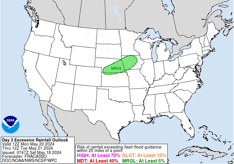
The Weather Prediction Center has moved the slight risk zone for excessive rainfall a tad to the West, to cover more of our CWA. There are a ton of model inconsistencies at the moment so I can see how this would be hard to forecast.
A transplant from Houston to Lincoln, Nebraska.

We better not get shafted with this system. Not that anyone here can control that...but still...just venting after so many misses the last decade or so.
-
Weatherdad
- Posts: 5
- Joined: Sun Aug 07, 2016 10:59 am
- Contact:
Well it looks like we will be lucky and have average August weather in Destin next week afterall. However am I going to be able to get their via I 10??? We are leaving tomorrow night about 3am ( sat morning ) going along I 10 to Destin. Does anyone have insight to what that might look like as far as heavy rains/flooding along I10- very very early Saturday morning
