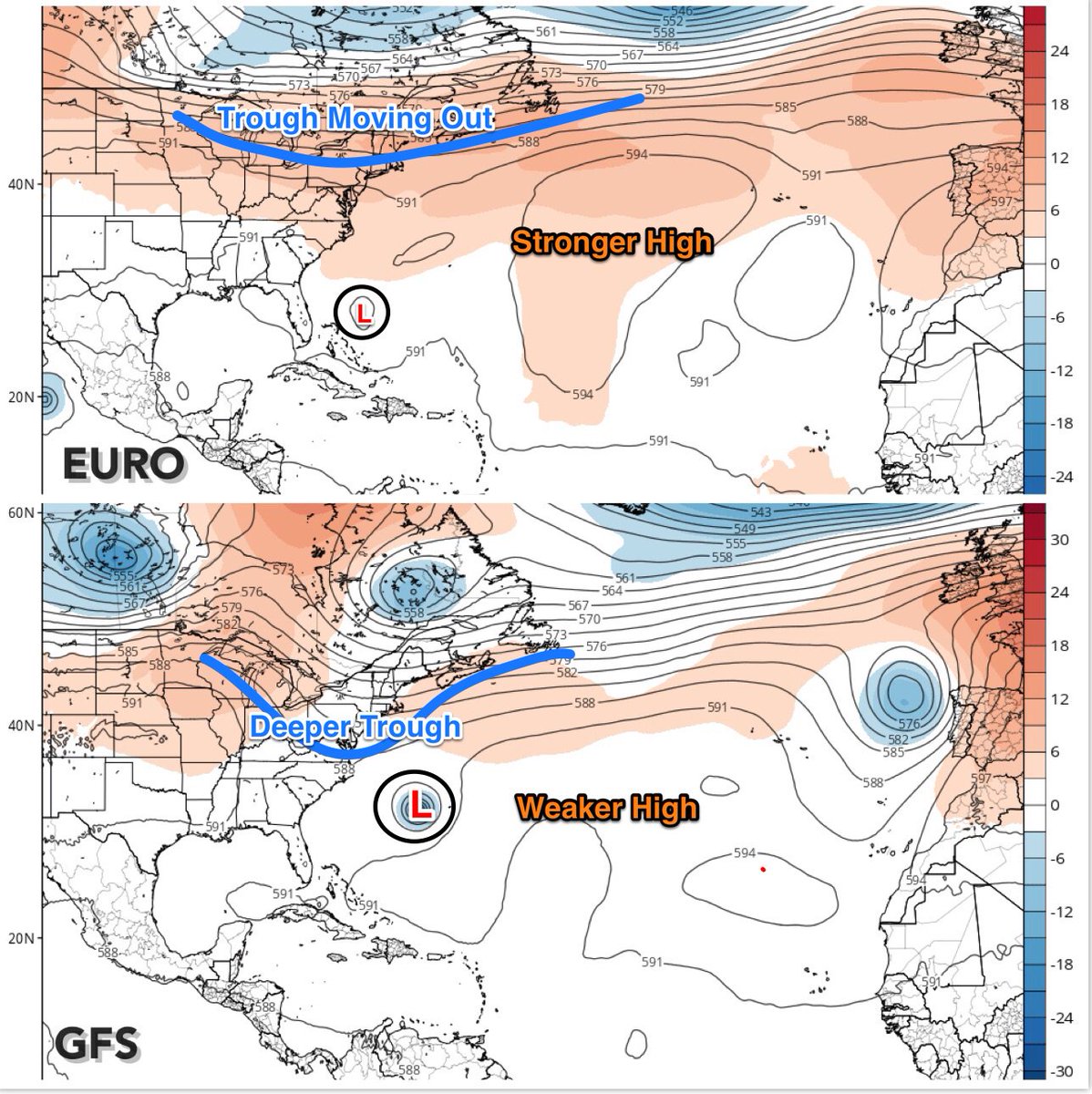
10 days out. "Don" probably won't be a direct threat to land but should sweep around the Bermuda High...and wave at the US east coast.
Initial spaghetti models:

ZCZC MIATWOAT ALL
TTAA00 KNHC DDHHMM
Tropical Weather Outlook
NWS National Hurricane Center Miami FL
800 AM EDT Mon Jul 3 2017
For the North Atlantic...Caribbean Sea and the Gulf of Mexico:
1. A nearly stationary broad area of low pressure located about 650
miles west-southwest of the Cabo Verde Islands continues to produce
disorganized showers and thunderstorms. Environmental
conditions are expected to become more conducive for development,
and a tropical depression could form later this week. The
disturbance is expected to begin moving west-northwestward in a day
or so, and it should continue moving in that direction through the
remainder of the week.
* Formation chance through 48 hours...low...20 percent.
* Formation chance through 5 days...high...70 percent.
Forecaster Cangialosi
