

SEPTEMBER 2018 - Very Wet Month Wrap Up
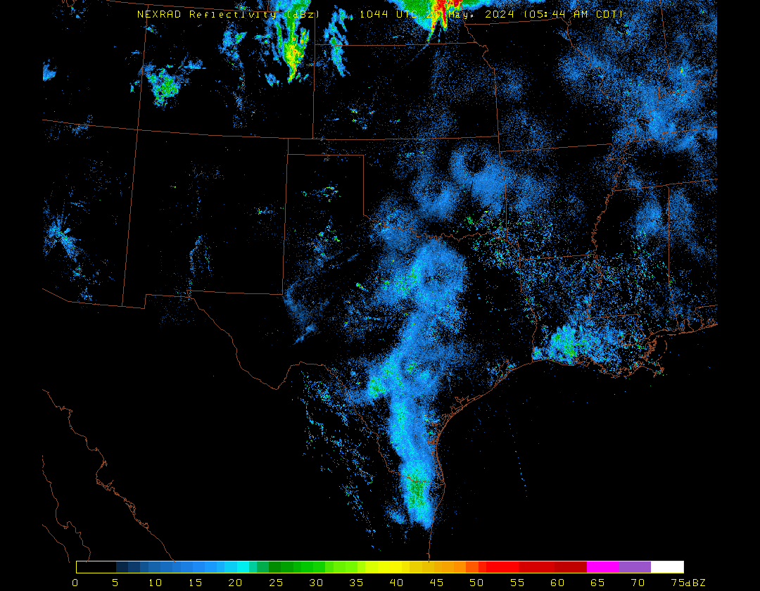
The 0z Euro is much weaker, but it’s also quite a bit further north as well with the strongest vorticity now around San Antonio Bay.
-
Katdaddy

- Global Moderator

- Posts: 2502
- Joined: Thu Feb 04, 2010 8:18 am
- Location: League City, Tx
- Contact:
Isolated heavy rains ongoing along the immediate Upper TX Coast this morning. Invest 95L remains disorganized this morning with a small burst of convection.
- Attachments
-
- Screen Shot 2018-09-12 at 5.31.12 AM.png (266.78 KiB) Viewed 3662 times
-
- Screen Shot 2018-09-12 at 5.20.00 AM.png (317.9 KiB) Viewed 3662 times
-
Katdaddy
- Global Moderator
- Posts: 2502
- Joined: Thu Feb 04, 2010 8:18 am
- Location: League City, Tx
- Contact:
The National Weather Service in League City has issued a
* Urban and Small Stream Flood Advisory for...
Northwestern Galveston County in southeastern Texas...
Southeastern Harris County in southeastern Texas...
* Until 800 AM CDT.
* At 601 AM CDT, Doppler radar indicated heavy rain due to showers
and thunderstorms. This will cause minor flooding in the advisory
area. One to two inches of rain have likely already fallen, and an
additional one to two inches is possible which could lead to minor
flooding.
* Some locations that could experience flooding include...
League City, Texas City, southern Friendswood, Dickinson, La
Marque, Santa Fe, Seabrook, Webster, Hitchcock, Kemah, southern
Clear Lake, Nassau Bay, Clear Lake Shores, San Leon, Bacliff and
Kemah Boardwalk.
PRECAUTIONARY/PREPAREDNESS ACTIONS...
Turn around, don`t drown when encountering flooded roads. Most flood
deaths occur in vehicles.
Be especially cautious at night when it is harder to recognize the
dangers of flooding.
Recon was cancelled for this afternoon.
-
Texaspirate11

- Posts: 1278
- Joined: Tue Dec 31, 2013 12:24 am
- Contact:
627 AM CDT WED SEP 12 2018
The National Weather Service in League City has issued a
* Flash Flood Warning for...
Northern Galveston County in southeastern Texas...
Southern Harris County in southeastern Texas...
* Until 830 AM CDT.
* At 624 AM CDT, Doppler radar indicated showers and thunderstorms
producing heavy rain across the warned area. One to two inches of
rain has already fallen, and an additional 1 to 2 inches of rain
is possible. Flash flooding is expected to begin shortly,
especially in and around locations that have saturated grounds
from recent heavy rainfall.
* Some locations that will experience flooding include...
League City, Texas City, eastern Friendswood, Dickinson, La Marque,
Santa Fe, southwestern Seabrook, Webster, Hitchcock, Kemah,
southeastern Clear Lake, Nassau Bay, Taylor Lake Village, El Lago,
Bayou Vista, Clear Lake Shores, Bacliff, The Johnson Space Center
and San Leon.
Just because you're disabled, you don't have to be a victim
Be Weather Aware & Prepared!
Barbara Jordan Winner in Media
Disability Integration Consultant
Be Weather Aware & Prepared!
Barbara Jordan Winner in Media
Disability Integration Consultant
-
srainhoutx

- Site Admin

- Posts: 19616
- Joined: Tue Feb 02, 2010 2:32 pm
- Location: Maggie Valley, NC
- Contact:
Avila lowered chances for development to 60%/60%
- Attachments
-
Carla/Alicia/Jerry(In The Eye)/Michelle/Charley/Ivan/Dennis/Katrina/Rita/Wilma/Humberto/Ike/Harvey
Member: National Weather Association
Facebook.com/Weather Infinity
Twitter @WeatherInfinity
Member: National Weather Association
Facebook.com/Weather Infinity
Twitter @WeatherInfinity
https://www.weather.gov/hgx/
https://twitter.com/NWSHouston
https://twitter.com/iembot_hgx

loop: http://tempest.aos.wisc.edu/radar/sp3comphtml5.html
https://twitter.com/NWSHouston
https://twitter.com/iembot_hgx
Code: Select all
BULLETIN - EAS ACTIVATION REQUESTED
Flash Flood Warning
National Weather Service Houston/Galveston TX
627 AM CDT WED SEP 12 2018

The National Weather Service in League City has issued a

* Flash Flood Warning for...
  Northern Galveston County in southeastern Texas...
  Southern Harris County in southeastern Texas...

* Until 830 AM CDT.

* At 624 AM CDT, Doppler radar indicated showers and thunderstorms
  producing heavy rain across the warned area. One to two inches of
  rain has already fallen, and an additional 1 to 2 inches of rain
  is possible. Flash flooding is expected to begin shortly,
  especially in and around locations that have saturated grounds
  from recent heavy rainfall.

* Some locations that will experience flooding include...
  League City, Texas City, eastern Friendswood, Dickinson, La Marque,
  Santa Fe, southwestern Seabrook, Webster, Hitchcock, Kemah,
  southeastern Clear Lake, Nassau Bay, Taylor Lake Village, El Lago,
  Bayou Vista, Clear Lake Shores, Bacliff, The Johnson Space Center
  and San Leon.

PRECAUTIONARY/PREPAREDNESS ACTIONS...

Turn around, don`t drown when encountering flooded roads. Most flood
deaths occur in vehicles.

Please report flooding to your local law enforcement agency when you
can do so safely.

&&

LAT...LON 2957 9505 2938 9480 2930 9500 2953 9518

$$
Code: Select all
Area Forecast Discussion
National Weather Service Houston/Galveston TX
631 AM CDT Wed Sep 12 2018

.AVIATION...
Showers and isolated thunderstorms have once again developed
along the coast this morning. For the inland terminals, a SCT/BKN
IFR deck has developed and should persist through the early
morning hours before scattering out. Expect a similar pattern
today as yesterday; scattered showers and thunderstorms through
the morning and developing inland during the afternoon. With any
storms, gusty winds, brief heavy downpours, and lower
visibilities are possible. Otherwise, VFR through the evening
with MVFR/IFR redevelopment tonight and early tomorrow morning.
Chance of showers and thunderstorms will stick around through the
remainder of the week.

22

&&

.PREV DISCUSSION... /ISSUED 339 AM CDT Wed Sep 12 2018/

DISCUSSION...
Still expecting periods of showers and thunderstorms for the
remainder of the week that could produce locally heavy rainfall.
Flooding is possible, especially if any of these heavy rains fall
on already saturated grounds. With some convergence along a weak
surface boundary in the area and a little bit of divergence aloft,
expect to see additional shower and thunderstorm development
today and tomorrow with the greatest concentration probably ending
up near and along the coast. If it looks like some of the heaviest
rains set up where grounds are already saturated, we'll likely need
a Flash Flood Watch. We continue to monitor the south central Gulf
of Mexico disturbance and the latest Tropical Weather Outlooks
from the National Hurricane Center. This system will bring more
showers and thunderstorms to parts of our area at the end of the
week with the best chances currently looking like closer to the
Matagorda Bay area. Of course, this could all change depending on
if the system develops and where it eventually tracks. Will continue
to carry a generally decreasing trend in rain chances and slightly
warmer afternoon high temperatures over the weekend and on into
next week.  42

MARINE...
A tightening surface pressure gradient today will lead to moderate
to strong east/southeast winds through Friday. Caution flags will be
in effect this afternoon through tomorrow morning. A disturbance
near the Yucatan will gradually progress closer to the Texas Coast
through Friday. Expect increasing seas beginning tonight. The
forecast strength of the disturbance has decreased in the latest
guidance, but there will still be persistent strong winds likely
requiring Advisories on Thursday and Friday. Periods of showers and
thunderstorms will continue through the remainder of the week with
locally higher winds and waves near any storms. Local forecast is
subject to substantial changes as the forecast of the disturbance
evolves over the next several days. Mariners are encouraged to keep
up with the latest forecasts.  22

&&

.PRELIMINARY POINT TEMPS/POPS...
College Station (CLL)      84  72  86  74  87 /  60  30  60  50  70
Houston (IAH)              83  73  84  75  85 /  60  40  60  50  70
Galveston (GLS)            83  80  81  79  82 /  80  60  70  60  70

&&

.HGX WATCHES/WARNINGS/ADVISORIES...
TX...NONE.
GM...SMALL CRAFT SHOULD EXERCISE CAUTION from 1 PM CDT this afternoon
     through late tonight for the following zones: Coastal
     waters from Freeport to Matagorda Ship Channel TX out 20
     NM...Coastal waters from High Island to Freeport TX out 20
     NM...Waters from Freeport to Matagorda Ship Channel TX from
     20 to 60 NM...Waters from High Island to Freeport TX from
     20 to 60 NM.

&&

$$

Discussion...42
Aviation/Marine...22
loop: http://tempest.aos.wisc.edu/radar/sp3comphtml5.html
-
srainhoutx
- Site Admin
- Posts: 19616
- Joined: Tue Feb 02, 2010 2:32 pm
- Location: Maggie Valley, NC
- Contact:
Tuesday morning briefing from Jeff:
95L has not become any better organized overnight…in fact based on the satellite images it appears to have become less organized.
The tropical wave feature has become entangled with an upper level or mid level low clearly shown on water vapor images along the N coast of the Yucatan. Deep convection has become sporadic at best.
Some forecast models have also shown a decrease in the potential for development of this feature over the next 48 hours as it moves NW toward the TX coast, while others either maintain their weak development, or in the case of the HWRF now suggest development. Most model guidance does not show any significant changes for the next 12-18 hours and then some begin to show a possible low level center forming. As has been mentioned…development of this system is most likely as it nears the TX coast on Thursday and Friday and it may not be until the system is very close to the coast that we see a low pressure center form.
Due to the uncertainty of when or if a center will form the track and intensity guidance remain of little help. Generally speaking there is a large mass of deep tropical moisture headed in the direction of the TX coast and overall where an actual center forms may not in the end be all that important. For now will continue to indicate anything between an open wave and a tropical storm making landfall along the TX coast (lower to mid coast) sometime on Friday.
Uncertainty is high and forecasts are subject to significant and rapid changes over the next few days.
Impacts:
Main impact will likely be heavy rainfall on top of already saturated grounds. Smoothing out the guidance rainfall amounts and utilizing WPC amounts indicate widespread amounts of 2-4 inches over the region with isolated higher amounts especially south of I-10. I do not have much confidence in these amounts and they may need to be raised some depending on how the system develops. Many times these types of Gulf system are “lopsided” and feature much of their rainfall on the NE side of the weak circulation so a landfall of a weak center along the mid TX coast would put much of the rainfall over our region.
Winds will start to increase later today and expect 15-25kts across the outer waters on Thursday and building to 20-30kts Thursday night into Friday. This will build seas into the 5-8 foot range by late Thursday into Friday based on WW3 guidance which feeds off the weaker GFS solution.
ides will begin to increase due to increasing wind and seas later today and remain elevated into Thursday and Friday. ET surge guidance is showing total water level along the coast of around 2.5-3.0 feet above MLLW at times of high tide on Thursday and Friday. This may cause some minor coastal flooding concerns along Bolivar, but is generally below the 4.5-5.0 feet thresholds which have historically caused bigger issues along the upper TX coast.
All of these impacts are subject to change over the coming days as it becomes clearer how/if this system will develop.
- Attachments
-
-
Carla/Alicia/Jerry(In The Eye)/Michelle/Charley/Ivan/Dennis/Katrina/Rita/Wilma/Humberto/Ike/Harvey
Member: National Weather Association
Facebook.com/Weather Infinity
Twitter @WeatherInfinity
Member: National Weather Association
Facebook.com/Weather Infinity
Twitter @WeatherInfinity
-
Texaspirate11
- Posts: 1278
- Joined: Tue Dec 31, 2013 12:24 am
- Contact:
I THINK its just gonna be a hot mess and nothing more.
Just because you're disabled, you don't have to be a victim
Be Weather Aware & Prepared!
Barbara Jordan Winner in Media
Disability Integration Consultant
Be Weather Aware & Prepared!
Barbara Jordan Winner in Media
Disability Integration Consultant
-
srainhoutx
- Site Admin
- Posts: 19616
- Joined: Tue Feb 02, 2010 2:32 pm
- Location: Maggie Valley, NC
- Contact:
MIMIC suggest a fairly healthy patch of deep tropical moisture is headed our way regardless of any development of 95L.

Carla/Alicia/Jerry(In The Eye)/Michelle/Charley/Ivan/Dennis/Katrina/Rita/Wilma/Humberto/Ike/Harvey
Member: National Weather Association
Facebook.com/Weather Infinity
Twitter @WeatherInfinity
Member: National Weather Association
Facebook.com/Weather Infinity
Twitter @WeatherInfinity
any concerns with Isaac?

The 6z HWRF starts showing development tomorrow, and forms 95l into a Tropical Storm right before landfall Friday around Matagorda Bay, with heavy rain bands moving through the area. It's starting to look like this may be one of those "sneaky" homebrew systems that don't develop until the last minute. Tropical Storm Allison, Hurricane Humberto, and Tropical Storm Bill are examples.
-
tireman4

- Global Moderator
- Posts: 4493
- Joined: Wed Feb 03, 2010 9:24 pm
- Location: Humble, Texas
- Contact:
XUS64 KHGX 121131
AFDHGX
Area Forecast Discussion
National Weather Service Houston/Galveston TX
631 AM CDT Wed Sep 12 2018
.AVIATION...
Showers and isolated thunderstorms have once again developed
along the coast this morning. For the inland terminals, a SCT/BKN
IFR deck has developed and should persist through the early
morning hours before scattering out. Expect a similar pattern
today as yesterday; scattered showers and thunderstorms through
the morning and developing inland during the afternoon. With any
storms, gusty winds, brief heavy downpours, and lower
visibilities are possible. Otherwise, VFR through the evening
with MVFR/IFR redevelopment tonight and early tomorrow morning.
Chance of showers and thunderstorms will stick around through the
remainder of the week.
22
&&
.PREV DISCUSSION... /ISSUED 339 AM CDT Wed Sep 12 2018/
DISCUSSION...
Still expecting periods of showers and thunderstorms for the
remainder of the week that could produce locally heavy rainfall.
Flooding is possible, especially if any of these heavy rains fall
on already saturated grounds. With some convergence along a weak
surface boundary in the area and a little bit of divergence aloft,
expect to see additional shower and thunderstorm development
today and tomorrow with the greatest concentration probably ending
up near and along the coast. If it looks like some of the heaviest
rains set up where grounds are already saturated, we`ll likely need
a Flash Flood Watch. We continue to monitor the south central Gulf
of Mexico disturbance and the latest Tropical Weather Outlooks
from the National Hurricane Center. This system will bring more
showers and thunderstorms to parts of our area at the end of the
week with the best chances currently looking like closer to the
Matagorda Bay area. Of course, this could all change depending on
if the system develops and where it eventually tracks. Will continue
to carry a generally decreasing trend in rain chances and slightly
warmer afternoon high temperatures over the weekend and on into
next week. 42
MARINE...
A tightening surface pressure gradient today will lead to moderate
to strong east/southeast winds through Friday. Caution flags will be
in effect this afternoon through tomorrow morning. A disturbance
near the Yucatan will gradually progress closer to the Texas Coast
through Friday. Expect increasing seas beginning tonight. The
forecast strength of the disturbance has decreased in the latest
guidance, but there will still be persistent strong winds likely
requiring Advisories on Thursday and Friday. Periods of showers and
thunderstorms will continue through the remainder of the week with
locally higher winds and waves near any storms. Local forecast is
subject to substantial changes as the forecast of the disturbance
evolves over the next several days. Mariners are encouraged to keep
up with the latest forecasts. 22
&&
.PRELIMINARY POINT TEMPS/POPS...
College Station (CLL) 84 72 86 74 87 / 60 30 60 50 70
Houston (IAH) 83 73 84 75 85 / 60 40 60 50 70
Galveston (GLS) 83 80 81 79 82 / 80 60 70 60 70
&&
.HGX WATCHES/WARNINGS/ADVISORIES...
TX...NONE.
GM...SMALL CRAFT SHOULD EXERCISE CAUTION from 1 PM CDT this afternoon
through late tonight for the following zones: Coastal
waters from Freeport to Matagorda Ship Channel TX out 20
NM...Coastal waters from High Island to Freeport TX out 20
NM...Waters from Freeport to Matagorda Ship Channel TX from
20 to 60 NM...Waters from High Island to Freeport TX from
20 to 60 NM.
&&
$$
Discussion...42
Aviation/Marine...22

Kinda crazy that we are ~48hours out with 95L and have no 'official' clue what's gonna happen yet...
I'm still thinking a weak slopfest, TS near Matagorda Bay...
I'm still thinking a weak slopfest, TS near Matagorda Bay...
-
srainhoutx
- Site Admin
- Posts: 19616
- Joined: Tue Feb 02, 2010 2:32 pm
- Location: Maggie Valley, NC
- Contact:
How many times over the years that a batch of thunderstorms over the Northern/NW/SW Gulf suddenly organize and ramp up very quickly. Seeing the support among the short fuse Hurricane Guidance lend credence to being very cautious regarding dismissing 95L until it's inland and dead.jasons wrote:Kinda crazy that we are ~48hours out with 95L and have no 'official' clue what's gonna happen yet...
I'm still thinking a weak slopfest, TS near Matagorda Bay...
Carla/Alicia/Jerry(In The Eye)/Michelle/Charley/Ivan/Dennis/Katrina/Rita/Wilma/Humberto/Ike/Harvey
Member: National Weather Association
Facebook.com/Weather Infinity
Twitter @WeatherInfinity
Member: National Weather Association
Facebook.com/Weather Infinity
Twitter @WeatherInfinity
-
stormlover
- Posts: 439
- Joined: Wed Dec 04, 2013 10:21 am
- Location: Lumberton TX
- Contact:
jason, you might be on to something with the Matagorda bay...NAM is close to that now.
The 12z RGEM develops 95L into a tropical storm right before landfall near Port Aransas, with feeder bands moving through Southeast Texas.

Looks reasonable...
-
- Information
-
Who is online
Users browsing this forum: Ahrefs [Bot], Bing [Bot], DoctorMu, Rip76 and 60 guests