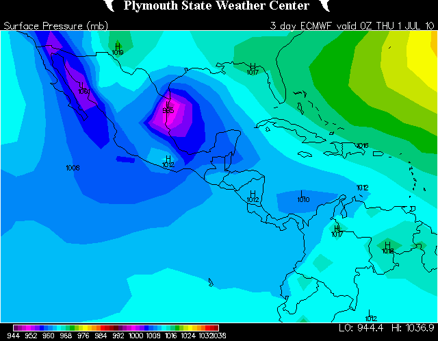
Andrew wrote:hmm parallel GFS sends it back out to sea:
Check the 850 vorticity. The main low has moved well inland by that point. That is just leftover low pressure in the Gulf
Also Tyler you know it is too early to say who is the winner and is almost foolish. I believe that a Texas strike is very well possible and what if the Euro shifts north tonight what then? I think it is a flip at this point.
I'm not saying that we should completely let our guard down, but the evidence is really against the GFS at this point... With its own parallel run flipping to the Euro's thinking, I wouldn't expect the Euro to shift much tonight. Interestingly, the 12z Euro shifted a little south of the 0z Euro landfall point.
Indeed, there is stil the remote chance of there being enough of a weakness across Texas to pull this north.
My bad on sending it back out to sea. Didn't check the 850 velocity just assumed.
My thinking personally is that this storm is going to form faster resulting in a track that is more northerly.
For Your Infinite Source For All Things Weather Visit Our Facebook
Mr. T wrote:
I'm not saying that we should completely let our guard down, but the evidence is really against the GFS at this point... With its own parallel run flipping to the Euro's thinking, I wouldn't expect the Euro to shift much tonight. Interestingly, the 12z Euro shifted a little south of the 0z Euro landfall point.
Indeed, there is stil the remote chance of there being enough of a weakness across Texas to pull this north.
From a modeling standpoint as we both agreed to the shift to the N ended earlier. Not sure when the extra data was ingested that Masters mentioned but it may have helped end some of the wild swings.
Yea at this point it looks like Corpus south is in the possibility. My original thinking was Corpus and I am going to stick with it but it will prob be too far north.
For Your Infinite Source For All Things Weather Visit Our Facebook
Yea at this point it looks like Corpus south is in the possibility. My original thinking was Corpus and I am going to stick with it but it will prob be too far north.
If you go back a few days most objective mets and solid amateurs probably put Corpus as the absolute northern extent of any track and that really hasn't changed that much until the earlier disco by Stewart.
As mentioned this morning I've got the feeling that the majority of NHC forecasters have more faith in the parallel GFS as opposed to the operational. So while the Stewart disco was great as far as explaining why the operational GFS was showing what it was - The op GFS is now the outlier and was even noted as such by Pasch in the latest disco.
Mr. T wrote:The 0z Euro shifted north quite a bit...
(old vs. new)
Who knows, maybe this is going to Texas
Haha Tyler watch next runs they are going to have a huge shift south just to mess with us.
In all seriousness though I am concerned about the models handling the strength of the storm. If RI did happen or Alex intensified faster then expected then the result could be for an even farther north track.
Paul was over in the 2k chat and I don't think he will make it much longer. He is pretty much crashing and if this storm doesn't come in fast then Paul may not make it.
For Your Infinite Source For All Things Weather Visit Our Facebook
So if the trend continues and NHC hugs the Euro some more then they should raise the cone all the way north to the border. What would that do? put us in the edge of the cone? Very interesting alright off to bed.
For Your Infinite Source For All Things Weather Visit Our Facebook
Andrew wrote:So if the trend continues and NHC hugs the Euro some more then they should raise the cone all the way north to the border. What would that do? put us in the edge of the cone? Very interesting alright off to bed.
With even their beloved consensus model moving north near the TX/MX border, they will probably shift the track a good ways north...
The GFS suddenly doesn't seem like that much of an outlier anymore, however, it is still north of the other models.
Scott747 wrote:
What's the heading and what does the upper level show?
Looks like a good NW heading out of the BOC, but it's hard to tell with only 24 hour increments.
As far as your second question, it is hard for me to tell the difference in the upper level pattern between the two runs, so perhaps you could take a look at it yourself and tell me what you think...
Andrew wrote:So if the trend continues and NHC hugs the Euro some more then they should raise the cone all the way north to the border. What would that do? put us in the edge of the cone? Very interesting alright off to bed.
With even their beloved consensus model moving north near the TX/MX border, they will probably shift the track a good ways north...
The GFS suddenly doesn't seem like that much of an outlier anymore, however, it is still north of the other models.
I think the GFS is still to far north too. I think for us here in SE Texas we should see some good amount of rain which would be really good as long as it isn't too much. The other thing that I am wondering is like Scott was saying, what is the movement it is heading because after it hits land some of the models push it NE but then some send it west into Mexico. That will be big especially for the amount of rain.
For Your Infinite Source For All Things Weather Visit Our Facebook
Looks like models are finally starting to consolidate question is will they consolidate around Brownsville/Corpus ie: GFDL CMC HWRF or around the middle Texas Coast ie:GFS BAMS models time will tell...
Scott747 wrote:
What's the heading and what does the upper level show?
Looks like a good NW heading out of the BOC, but it's hard to tell with only 24 hour increments.
As far as your second question, it is hard for me to tell the difference in the upper level pattern between the two runs, so perhaps you could take a look at it yourself and tell me what you think...
Ridge looks weaker at the beginning of the run allowing it to gain more lat in the short-term. Could be why it moves up the coast a decent amount.
Scott747 wrote:
Ridge looks weaker at the beginning of the run allowing it to gain more lat in the short-term. Could be why it moves up the coast a decent amount.
For now though Alex hasn't shown much movement.
As OSU noted on Eastern and also noticeable from satellite, some westerly shear is currently impacting Alex... May not get a ramp up in intensity for a bit


