Page 16 of 18
Re: April 2021
Posted: Thu Apr 29, 2021 9:29 am
by jasons2k
Satellite shows a period of sun coming-up for the next few hours - that should heat things up for later today. I think there may be a bit more instability than expected with the sun coming out.
Re: April 2021
Posted: Thu Apr 29, 2021 9:52 am
by JDsGN
jasons2k wrote: ↑Thu Apr 29, 2021 9:29 am
Satellite shows a period of sun coming-up for the next few hours - that should heat things up for later today. I think there may be a bit more instability than expected with the sun coming out.
Our good friend Captain Cap will keep it in check have no fear! Haha hope we get some showers blossoming this afternoon
Re: April 2021
Posted: Thu Apr 29, 2021 10:40 am
by DoctorMu
This afternoon should be interesting. However, the air outside looks a lot more stable than yesterday. No sun out. I'm calling bust...for today at least. We'll see.
Re: April 2021
Posted: Thu Apr 29, 2021 10:45 am
by DoctorMu
Moderate CAPE, lowish shear. IF we get anything it should be a light, moderate rain today.
A lot of dry, mid level air over the Hill Country today on GOES.
https://www.star.nesdis.noaa.gov/GOES/s ... &length=24
We'll see what daytime heating brings. If anything looks favorable it's actually SOUTH of HWY Unmentionable.
Re: April 2021
Posted: Thu Apr 29, 2021 11:13 am
by Cromagnum
DoctorMu wrote: ↑Thu Apr 29, 2021 10:45 am
Moderate CAPE, lowish shear. IF we get anything it should be a light, moderate rain today.
A lot of dry, mid level air over the Hill Country today on GOES.
https://www.star.nesdis.noaa.gov/GOES/s ... &length=24
We'll see what daytime heating brings. If anything looks favorable it's actually SOUTH of HWY Unmentionable.
Is that the 2 or 3 number unmentionable highway? LOL
Re: April 2021
Posted: Thu Apr 29, 2021 11:18 am
by don
Not expecting any significant rain today, widespread rain wont start till after midnight tonight and continuing tomorrow.GFS is still painting some very high rainfall totals.
Re: April 2021
Posted: Thu Apr 29, 2021 11:28 am
by DoctorMu
Cromagnum wrote: ↑Thu Apr 29, 2021 11:13 am
DoctorMu wrote: ↑Thu Apr 29, 2021 10:45 am
Moderate CAPE, lowish shear. IF we get anything it should be a light, moderate rain today.
A lot of dry, mid level air over the Hill Country today on GOES.
https://www.star.nesdis.noaa.gov/GOES/s ... &length=24
We'll see what daytime heating brings. If anything looks favorable it's actually SOUTH of HWY Unmentionable.
Is that the 2 or 3 number unmentionable highway? LOL
3

Re: April 2021
Posted: Thu Apr 29, 2021 11:29 am
by DoctorMu
don wrote: ↑Thu Apr 29, 2021 11:18 am
Not expecting any significant rain today, widespread rain wont start till after midnight tonight and continuing tomorrow.GFS is still painting some very high rainfall totals.
Guess I'm mowing later today.

Re: April 2021
Posted: Thu Apr 29, 2021 1:17 pm
by Cpv17
I think the WPC will upgrade the excessive rainfall forecast to either slight or moderate for a good part of southeast TX in their next update. Based on the latest run of models I’m seeing potential for 4+” for a large part of the area. Pw’s will be around 2” and at times could be exceeding that. We will be getting a large batch of unstable moist air from the western Caribbean/Gulf of Mexico.
Re: April 2021
Posted: Thu Apr 29, 2021 2:26 pm
by DoctorMu
Cpv17 wrote: ↑Thu Apr 29, 2021 1:17 pm
I think the WPC will upgrade the excessive rainfall forecast to either slight or moderate for a good part of southeast TX in their next update. Based on the latest run of models I’m seeing potential for 4+” for a large part of the area. Pw’s will be around 2” and at times could be exceeding that. We will be getting a large batch of unstable moist air from the western Caribbean/Gulf of Mexico.
Maybe so. It's looks pretty dry to me at the moment, with just a hair of a swirl over the western Caribbean
https://www.star.nesdis.noaa.gov/GOES/s ... &length=24
https://www.star.nesdis.noaa.gov/GOES/c ... &length=24
The low over SE New Mexico is more likely the potential wellspring of showers tonight and tomorrow.
Re: April 2021
Posted: Thu Apr 29, 2021 2:34 pm
by DoctorMu
There's a pearl thread of moisture trying to sneak into the Brazos Valley along a weak front.
https://www.star.nesdis.noaa.gov/GOES/s ... &length=24
Re: April 2021
Posted: Thu Apr 29, 2021 2:37 pm
by DoctorMu
Area Forecast Discussion
National Weather Service Houston/Galveston TX
1223 PM CDT Thu Apr 29 2021
.AVIATION...
A weak cold front is still well to the north of SE TX and it is
very slowly moving southward.
The front will reach KCLL between
23-00z and there should be a broken line of shra/tsra. Additional
showers will develop south of the front and feed into the line.
Timing things is going to be a work in progress and leaned toward
a HRRR/TT WRF blend.
Fcst soundings show some weak capping in the
850-700 mb layer both today and again on Friday yet some of the
CAMs show potential for very heavy rain.  Jet dynamics show a splitting jet structure tomorrow so have leaned toward some of the
more aggressive models. MVFR ceilings are expected this afternoon
with a mix of MVFR and IFR tonight into Friday. Could get some
patchy sea fog near KGLS as well. 43
Re: April 2021
Posted: Thu Apr 29, 2021 2:45 pm
by Cpv17
DoctorMu wrote: ↑Thu Apr 29, 2021 2:26 pm
Cpv17 wrote: ↑Thu Apr 29, 2021 1:17 pm
I think the WPC will upgrade the excessive rainfall forecast to either slight or moderate for a good part of southeast TX in their next update. Based on the latest run of models I’m seeing potential for 4+” for a large part of the area. Pw’s will be around 2” and at times could be exceeding that. We will be getting a large batch of unstable moist air from the western Caribbean/Gulf of Mexico.
Maybe so. It's looks pretty dry to me at the moment, with just a hair of a swirl over the western Caribbean
https://www.star.nesdis.noaa.gov/GOES/s ... &length=24
https://www.star.nesdis.noaa.gov/GOES/c ... &length=24
The low over SE New Mexico is more likely the potential wellspring of showers tonight and tomorrow.
Yeah that low will be tapping into a lot of moisture coming from the Gulf. The WPC mentioned that in their last excessive rainfall discussion.
Re: April 2021
Posted: Thu Apr 29, 2021 2:56 pm
by don
Cpv17 wrote: ↑Thu Apr 29, 2021 1:17 pm
I think the WPC will upgrade the excessive rainfall forecast to either slight or moderate for a good part of southeast TX in their next update. Based on the latest run of models I’m seeing potential for 4+” for a large part of the area. Pw’s will be around 2” and at times could be exceeding that. We will be getting a large batch of unstable moist air from the western Caribbean/Gulf of Mexico.
I agree, i would be surprised if they didn't upgrade to at least a slight risk with this afternoons update.I'm a little afraid some people could get caught off guard tomorrow if the higher qpf amounts verify. WPC showing widespread amounts of 3-4 inches now.
Re: April 2021
Posted: Thu Apr 29, 2021 3:30 pm
by jasons2k
I welcome the rain but after this system I will be OK with a break. Any rainy days at this point delays my pool construction!
Re: April 2021
Posted: Thu Apr 29, 2021 4:06 pm
by jasons2k
Couple of boundaries working to the NE....
Re: April 2021
Posted: Thu Apr 29, 2021 4:21 pm
by DoctorMu
jasons2k wrote: ↑Thu Apr 29, 2021 4:06 pm
Couple of boundaries working to the NE....
Mostly verga at the moment here.
Re: April 2021
Posted: Thu Apr 29, 2021 4:23 pm
by DoctorMu
Re: April 2021
Posted: Thu Apr 29, 2021 4:50 pm
by Cpv17
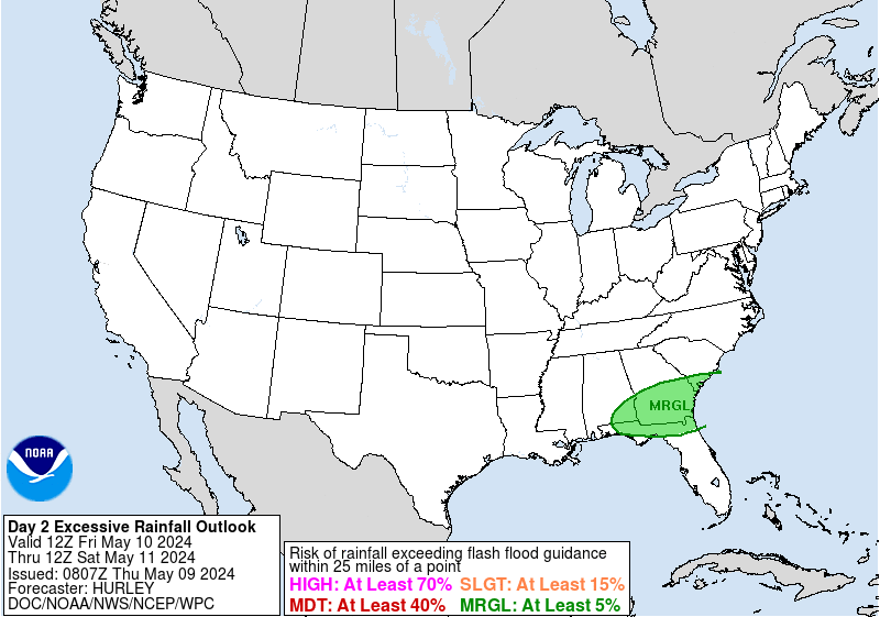
The WPC upgraded our region to the slight risk in their latest update:

Re: April 2021
Posted: Thu Apr 29, 2021 9:00 pm
by Andrew
Latest HRRR shows some concern for localized flooding Friday morning. Something to keep an eye on for sure.
