
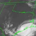
I'm not sure what you're looking at, BB, but there is no westward movement. I created a satellite loop of 2 images, one taken 6:45am yesterday and one today. The storms are clearly moving east.
http://myweb.cableone.net/nolasue/gulf.gif
Take a look at the WV loop, too. Trof axis has moved east of Houston since yesterday, driving a wedge of very dry air southward into Houston and the NW Gulf. That trof axis continues moving eastward, moving the weak low pressure area northeastward toward SE LA and Mississippi. The rotation is easier to see on satellite today because the convection that was obscuring it yesterday died out and/or moved off to the northeast with the upper-level flow. All model guidance moves the vorticity northeast into east-central MS and western AL in 24 hrs.
But that's not to say we will never see any rain here, it just won't be from that system. Once the system dies out in MS/AL late this weekend and early next week, high pressure over the eastern U.S. will ridge southwestward across the Gulf, increasing onshore flow (and moisture) across our area. This should allow for at least afternoon storms to develop this coming week.
Remnants of Hermine
perhaps the storms are moving east on the eastern side of the low? HGX did clearly state this am that the low was moving west. I also heard a local met say this on am tv

additionally, HPC's 7-day loop seems to show a low moving west http://www.hpc.ncep.noaa.gov/basicwx/day0-7loop.html , though it does not show rain moving into TX.
RGB Gulf of Mexico loop http://www.ssd.noaa.gov/goes/east/gmex/flash-rgb.html shows a circulation that appears to be moving west also - this is not centered where the large blob of storms are, they are further east
so gentlemen, can there be gray in a black & white world??? perhaps we ARE all correct
-
srainhoutx

- Site Admin

- Posts: 19616
- Joined: Tue Feb 02, 2010 2:32 pm
- Location: Maggie Valley, NC
- Contact:
Regardless, I just hope we see an increase in rain chances if even by a little.
NHC not impressed, but mentioned in TWO:
SHOWERS AND THUNDERSTORMS ASSOCIATED WITH A WEAK NON-TROPICAL LOW
PRESSURE AREA OVER THE NORTHERN GULF OF MEXICO ARE DISORGANIZED.
THE LOW IS EXPECTED TO DRIFT NORTHWARD OVER LOUISIANA LATER
TODAY...AND ADDITIONAL DEVELOPMENT IS UNLIKELY. THERE IS A LOW
CHANCE...10 PERCENT...OF THIS SYSTEM BECOMING A TROPICAL CYCLONE
DURING THE NEXT 48 HOURS.
Carla/Alicia/Jerry(In The Eye)/Michelle/Charley/Ivan/Dennis/Katrina/Rita/Wilma/Humberto/Ike/Harvey
Member: National Weather Association
Facebook.com/Weather Infinity
Twitter @WeatherInfinity
Member: National Weather Association
Facebook.com/Weather Infinity
Twitter @WeatherInfinity
-
biggerbyte
- Posts: 1142
- Joined: Thu Feb 04, 2010 12:15 am
- Location: Porter, Texas. (Montgomery County)
- Contact:
I'm not sure what you are missing, wx. The rotation is clearly evident on both radar and satellite, and there is rain associated off to its north and east. This spin was south to southeast off the LA coast yeasterday, but it is south to southwest today. It is
moving west. Not only that.... There are a number of weather organizations that spoke of this before I mentioned it. It was srain that pointed it out based on LA AFD before I even took the time to check it out.
Edit to say that, the rains yesterday were rotating around this system. I swear it looked like a dying tropical storm. The typical rains east and north wrapping around the center. Taking aside what the models are telling you, wx, or even what I am being told by other pro organizatins, the proof is in the pudding. It's doing what it's doing. Will it ever move completely over Texas? I don't know yet, but it has certainly been heading this way.
-
biggerbyte
- Posts: 1142
- Joined: Thu Feb 04, 2010 12:15 am
- Location: Porter, Texas. (Montgomery County)
- Contact:
srainhoutx wrote:Regardless, I just hope we see an increase in rain chances if even by a little.
NHC not impressed, but mentioned in TWO:
SHOWERS AND THUNDERSTORMS ASSOCIATED WITH A WEAK NON-TROPICAL LOW
PRESSURE AREA OVER THE NORTHERN GULF OF MEXICO ARE DISORGANIZED.
THE LOW IS EXPECTED TO DRIFT NORTHWARD OVER LOUISIANA LATER
TODAY...AND ADDITIONAL DEVELOPMENT IS UNLIKELY. THERE IS A LOW
CHANCE...10 PERCENT...OF THIS SYSTEM BECOMING A TROPICAL CYCLONE
DURING THE NEXT 48 HOURS.
Maybe it will lift northward from here out. This northward mention is something not spoken of by anyone yesterday, and radar supported that. Hmmm! West or north, who cares... Bring us some rain, darnit.
-
srainhoutx
- Site Admin
- Posts: 19616
- Joined: Tue Feb 02, 2010 2:32 pm
- Location: Maggie Valley, NC
- Contact:
HGX thoughts in morning update...
AREA FORECAST DISCUSSION
NATIONAL WEATHER SERVICE HOUSTON/GALVESTON TX
1033 AM CDT SAT AUG 28 2010
.DISCUSSION...
A WEAK SFC LOW PRESSURE AREA WAS EVIDENT ON SFC OBS AND VISIBLE
SATELLITE IMAGERY JUST OFF THE SW LOUISIANA COAST THIS MORNING.
THIS FEATURE IS EXPECTED TO DRIFT SLOWLY WEST OR NORTHWEST AND
DISSIPATE BY SUNDAY. WATER VAPOR IMAGERY SHOWS A LARGE SWATH OF
VERY DRY AIR AND SUBSIDENCE IN PLACE OVER SE TX. SLIGHTLY DEEPER
MOISTURE (PWS GREATER THAN 1.2 INCHES) WAS CIRCULATING AROUND THE
GULF LOW AND WILL BEGIN SPREADING INTO OUR EASTERN ZONES THIS
AFTN. THIS WILL BE SEEN IN THE FORM OF CU DEVELOPMENT AND SOMEWHAT
HIGHER SFC DEWPOINTS OVER THE ERN ZONES THIS AFTN. OTHERWISE...THE
NORTHERLY WINDS ASSOCIATED WITH THE SFC LOW WILL RESULT IN ONE
MORE DAY OF LOWER HUMIDITIES AND LOWER HEAT INDICES TODAY (THOUGH
NOT AS LOW AS YESTERDAY). WILL KEEP PRECIP OUT OF THE FORECAST AS
SUBSIDENCE SHOULD KEEP THE LID ON CONVECTIVE DEVELOPMENT. ENJOY
TODAY...BECAUSE HIGHER DEWPOINTS WILL SPREAD ACROSS THE AREA
TONIGHT/SUNDAY AS THE LOW DISSIPATES. HEAT INDICES WILL BE BACK IN
THE NEIGHBORHOOD OF 105 SUNDAY AFTERNOON.
Carla/Alicia/Jerry(In The Eye)/Michelle/Charley/Ivan/Dennis/Katrina/Rita/Wilma/Humberto/Ike/Harvey
Member: National Weather Association
Facebook.com/Weather Infinity
Twitter @WeatherInfinity
Member: National Weather Association
Facebook.com/Weather Infinity
Twitter @WeatherInfinity
-
desiredwxgd
- Posts: 125
- Joined: Wed Feb 03, 2010 6:30 pm
- Location: TX/LA/Southern New England
- Contact:
From the LCH NWS:
"AREA FORECAST DISCUSSION
NATIONAL WEATHER SERVICE LAKE CHARLES LA
1059 AM CDT SAT AUG 28 2010
.UPDATE...
AN AREA OF LOW PRESSURE CONTINUES TO SPIN OFF THE LOUISIANA
COAST...CENTERED ABOUT 60 NM SOUTH OF INTRACOASTAL CITY. EAST OF
THE CENTER...NUMEROUS SHOWERS AND THUNDERSTORMS ARE OCCURRING WITH
SOUTHERLY WINDS AROUND 20 KNOTS. MEANWHILE WEST OF THE
CENTER...CONVECTIVE COVERAGE IS MUCH LOWER...WITH NORTHEASTERLY
WINDS. SO FAR...CONVECTION IS STAYING OFFSHORE WITH ONLY SOME
LIGHT SHOWERS MAKING IT INLAND OVER EXTREME SOUTHERN LA. THIS AREA
HAS A SLIGHT RISK OF EXCEEDING FFG PER LATEST HPC OUTLOOK...HOWEVER
WILL HOLD OFF ON ISSUING FF WATCH FOR NOW BASED ON RADAR TRENDS.
"
JMS
SR. ENSC.
SR. ENSC.
-
wxman57

- Global Moderator

- Posts: 2621
- Joined: Thu Feb 04, 2010 5:34 am
- Location: Southwest Houston (Westbury)
- Contact:
The weak low center is now on the mid LA coast over Marsh Island. It's moving slowly NNE. NAM has it in western Tennessee in 36 hours. GFS moves it NNE as well, but more slowly. All heavy rain is east of the low. There are some low-level clouds rotating westward across SW LA, but no significant rain. What may happen by early next week is that the trof extending SW into the Gulf may rotate NW toward the TX coast as high pressure builds to our east. This could bring us some rain by Mon/Tue.
The grass in my yard is crunching....if I mow it - I am afraid that it will kill the grass I do have. Just have to keep my fingers crossed we get a little something passing by to give us some rain - since its too early for the coldfronts and all the tropics are on the east coast this year (i'm not complaining) either.
2 pm Discussion
THE GULF OF MEXICO...
UPPER LEVEL RIDGE OF HIGH PRESSURE COVERS A GREAT PART OF THE EASTERN HALF OF THE CONUS. BROAD STRONG SUBSIDENCE IS OVER MOST OF THIS REGION NOTED OF WATER VAPOR...WHICH ALSO SHOWS AN UPPER LEVEL LOW/SHORTWAVE STARTING TO DEVELOP ALONG THE SOUTHERN LEADING EDGE OF THIS DRY AIRMASS NEAR SOUTHEAST LOUISIANA. THIS FEATURE IS SUPPORTING A 1008 MB LOW 30 NM SOUTH OF THE CENTRAL LOUISIANA COAST NEAR 29N91W. A STATIONARY FRONT IS ANALYZED FROM FROM THE FAR EASTERN COAST OF LOUISIANA NEAR 30N89W CROSSING THE SURFACE LOW CENTER AND CONTINUING SW TO 24N95W...BECOMING A SURFACE TROUGH EXTENDING SOUTH TO COATZACOALCOS MEXICO NEAR 18N94W. MODERATE TO SCATTERED STRONG CONVECTION SURROUNDS THE LOW CENTER AND EXTENDS EAST TO THE FLORIDA PANHANDLE NORTH OF 28N BETWEEN 85W AND 92W. SCATTERED MODERATE TO STRONG CONVECTION IS WITHIN 190 NM EAST OF THE FRONT. WEAK SCATTERED TO ISOLATED MODERATE CONVECTION IS WITHIN 80 NM ON EITHER SIDE OF THE SURFACE TROUGH. COMPUTER MODELS SUGGEST THE CONVECTIVE ACTIVITY WILL SHIFT TO THE NW GULF AND THE TEXAS COAST OVER THE NEXT 24
TO 48 HOURS.
2 pm TWO
2. SHOWERS AND THUNDERSTORMS ASSOCIATED WITH A WEAK NON-TROPICAL LOW PRESSURE AREA OVER THE NORTHERN GULF OF MEXICO REMAIN DISORGANIZED. THE LOW IS DRIFTING NORTHWARD AND IS EXPECTED TO MOVE INLAND OVER LOUISIANA LATER TONIGHT. ADDITIONAL DEVELOPMENT IS UNLIKELY...AND THERE IS A LOW CHANCE...NEAR 0 PERCENT...OF THIS SYSTEM BECOMING A SUBTROPICAL OR A TROPICAL CYCLONE DURING THE NEXT 48 HOURS.
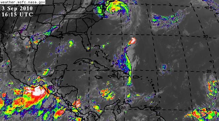
just a wee bit of convection down in the gulf? http://cimss.ssec.wisc.edu/snaap/convin ... Type=panel

-
biggerbyte
- Posts: 1142
- Joined: Thu Feb 04, 2010 12:15 am
- Location: Porter, Texas. (Montgomery County)
- Contact:
-
biggerbyte
- Posts: 1142
- Joined: Thu Feb 04, 2010 12:15 am
- Location: Porter, Texas. (Montgomery County)
- Contact:
What, I'm not worthy of a comment or two about this persistant spin out in the Gulf? Lol
It is still there today. Just a quick notice. Maybe someone else has actually checked it out?
Steve, wxman57, anyone have an opinion?
BB
It is still there today. Just a quick notice. Maybe someone else has actually checked it out?
Steve, wxman57, anyone have an opinion?
BB
Last edited by biggerbyte on Fri Sep 03, 2010 3:24 am, edited 1 time in total.
-
srainhoutx
- Site Admin
- Posts: 19616
- Joined: Tue Feb 02, 2010 2:32 pm
- Location: Maggie Valley, NC
- Contact:
Dwayne, if the 18Z GFS is correct we may have to keep an eye on the BoC in a few days.

Carla/Alicia/Jerry(In The Eye)/Michelle/Charley/Ivan/Dennis/Katrina/Rita/Wilma/Humberto/Ike/Harvey
Member: National Weather Association
Facebook.com/Weather Infinity
Twitter @WeatherInfinity
Member: National Weather Association
Facebook.com/Weather Infinity
Twitter @WeatherInfinity
-
wxman57
- Global Moderator
- Posts: 2621
- Joined: Thu Feb 04, 2010 5:34 am
- Location: Southwest Houston (Westbury)
- Contact:
It is a big upper-level low. The circulation you see is way up in the atmosphere.biggerbyte wrote:What, I'm not worthy of a comment or two about this persistant spin out in the Gulf? Lol
It is still there today. Just a quick notice. Maybe someone else has actually checked it out?
Steve, wxman57, anyone have an opinion?
BB
-
biggerbyte
- Posts: 1142
- Joined: Thu Feb 04, 2010 12:15 am
- Location: Porter, Texas. (Montgomery County)
- Contact:
Thanks, guys...
I thought that was an ULL, just at a quick glance.
Meanwhile, looks like BOC action. Then there is G. to think about. We are about to hit the time when Gulf and Caribbean systems are more active.
I thought that was an ULL, just at a quick glance.
Meanwhile, looks like BOC action. Then there is G. to think about. We are about to hit the time when Gulf and Caribbean systems are more active.
I'm not wildly enthusiastic with the GFS since it has had almost a endless supply of features over the last few months originating in the BOC/W Caribbean. This latest solution is mildly interesting with lifting the energy from the EPAC into the BOC. 12z GFS hints at development in the BOC bringing it inland around Veracruz/Tampico and up the coast towards Brownsville.
500 AM PDT FRI SEP 3 2010
FOR THE EASTERN NORTH PACIFIC...EAST OF 140 DEGREES WEST LONGITUDE..
1. A LARGE AREA OF SHOWERS AND THUNDERSTORMS ASSOCIATED WITH A BROAD
LOW PRESSURE SYSTEM OVER THE GULF OF TEHUANTEPEC IS NEARLY
STATIONARY. WHILE ENVIRONMENTAL CONDITIONS ARE SOMEWHAT
CONDUCIVE...THE PROXIMITY OF THE SYSTEM TO LAND IS EXPECTED TO
LIMIT SIGNIFICANT DEVELOPMENT OF THIS DISTURBANCE. THERE IS A LOW
CHANCE...20 PERCENT...OF THIS SYSTEM BECOMING A TROPICAL CYCLONE
DURING THE NEXT 48 HOURS. REGARDLESS OF DEVELOPMENT...THERE IS THE
POTENTIAL FOR LOCALIZED HEAVY RAIN IN ASSOCIATION WITH THIS SYSTEM
OVER PORTIONS OF SOUTHEASTERN MEXICO AND GUATEMALA DURING THE NEXT
COUPLE OF DAYS.
-
srainhoutx
- Site Admin
- Posts: 19616
- Joined: Tue Feb 02, 2010 2:32 pm
- Location: Maggie Valley, NC
- Contact:
I see TD 11 has been declared in the EPAC. Interesting that the models have been suggesting for some time lower pressures across the Western Basin and updrafts progressing eastward. Worth watching in the days ahead. Season may have just began 'locally'.
Carla/Alicia/Jerry(In The Eye)/Michelle/Charley/Ivan/Dennis/Katrina/Rita/Wilma/Humberto/Ike/Harvey
Member: National Weather Association
Facebook.com/Weather Infinity
Twitter @WeatherInfinity
Member: National Weather Association
Facebook.com/Weather Infinity
Twitter @WeatherInfinity
-
desiredwxgd
- Posts: 125
- Joined: Wed Feb 03, 2010 6:30 pm
- Location: TX/LA/Southern New England
- Contact:
Interesting......
- Attachments
-
- p120i12.gif (56.72 KiB) Viewed 4390 times
JMS
SR. ENSC.
SR. ENSC.