
August 2022
-
Stratton20
- Posts: 4248
- Joined: Tue Feb 09, 2021 11:35 pm
- Location: College Station, Texas
- Contact:
Even though the GOM blob likely will move on land something monday, I think the NHC might highlight this with a 10-20% chance, definitely looks very healthy, cant tell if its got any sort of spin though
The RGEM has some pretty nice precip totals through the end of August

For now, another miss. Several close calls today actually.
- Attachments
-

From HGX in regards to next weeks rain.
.LONG TERM...
(Monday through Saturday)
Issued at 319 PM CDT Sat Aug 27 2022
It is still looking like the area will be getting a surge of deep tropical
moisture beginning Sunday night and persisting on into at least midweek.
The blob currently located across much of the western Gulf of Mexico
will slowly work its way toward the Texas coast and will spread across
our area during the first half of the week. High precipitable water
values courtesy of this system and weaknesses aloft will be supportive
of an increasing risk of locally heavy rainfall, especially in association
with any slow moving storms or where any training manages to set up.
Any high rainfall rates occurring in a short period of time or over
the same locations could lead to our usual minor flooding in low-lying
and poor drainage areas and also in/around road construction locations.
There might be a brief break in the heavy rain threat toward the middle
to end of the week as some drier air tries to edge in from the north
and northeast, but this fall in moisture levels will be associated with
a southward sagging front which could become a focusing boundary for
more showers and thunderstorms and the potential for additional locally
heavy rain. How far this boundary gets will be a factor as to where
the heaviest rains will fall.
The "blob" looks like it's developing a mid-level spin. This was depicted on the NAM, but maybe a little early/fast. Bears watching.
-
Stratton20
- Posts: 4248
- Joined: Tue Feb 09, 2021 11:35 pm
- Location: College Station, Texas
- Contact:
Call me crazy, but I wouldnt be that shocked if we see a quick spin up with this

Yep
Still cranking through DMIN.
-
Stratton20
- Posts: 4248
- Joined: Tue Feb 09, 2021 11:35 pm
- Location: College Station, Texas
- Contact:
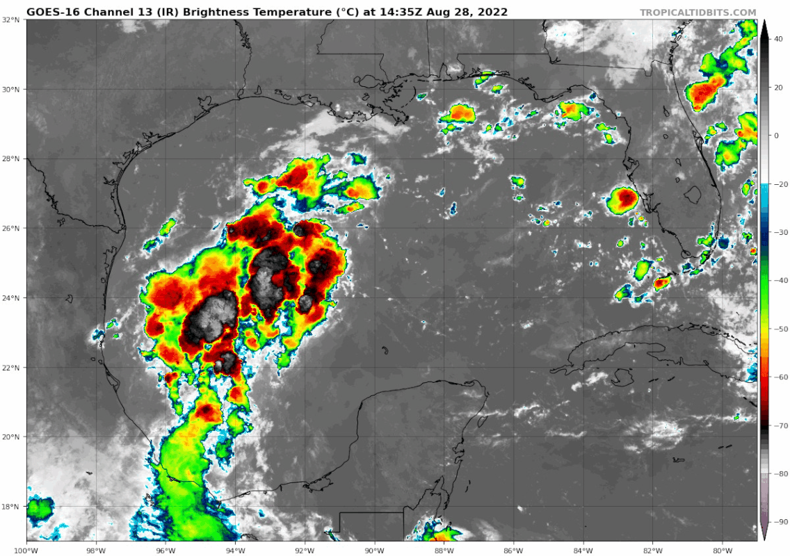
It does appear the blob is at least sustaining some of its convection in DMIN, we will see if it does anything tommorow, has roughly 36-48 hours over water before moving land Monday afternoon

Grrr, mine only loaded 1/2.
Never mind. Not cranking

Never mind. Not cranking

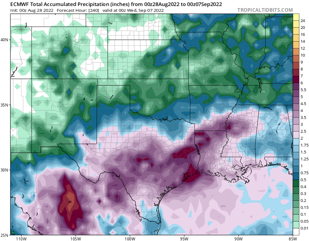
0z Euro:

-
Stratton20
- Posts: 4248
- Joined: Tue Feb 09, 2021 11:35 pm
- Location: College Station, Texas
- Contact:
Cpv17 like that euro run!
Time to sharpen up the mower blades and get at it before it gets too soggy to mow for a while. Can't remember the last time I had to say that.
Lots of thunderstorm activity out there:
-
Stratton20
- Posts: 4248
- Joined: Tue Feb 09, 2021 11:35 pm
- Location: College Station, Texas
- Contact:
That BLOB sure looks extra juicy!
Yeah it’s going through DMIN and still firing convection. Impressive.

Latest 7 day QPF is so beautiful. It’s beyond words.
Mike
Beaumont, TX
(IH-10 & College Street)
Beaumont, TX
(IH-10 & College Street)
-
vci_guy2003
- Posts: 203
- Joined: Mon Jun 28, 2010 4:04 am
- Contact:
How many inches does it show?