Re: August 2022
Posted: Sun Aug 28, 2022 6:21 pm
I still think it’s worth keeping an eye on.Stratton20 wrote: ↑Sun Aug 28, 2022 6:12 pm Lol 18z GFS with the phantom cat 4 moving in just north of Brownsville around labor day, it just refuses to give up
Stratton in 3 or 4 days we are gonna find out if the GFS is out to lunch like many think.Stratton20 wrote: ↑Sun Aug 28, 2022 7:24 pm Cpv17 Agreed, ive never seen a model be alone in support yet be this insistent that something will be their, this will be either a huge L by the GFS or an incredible Win for the moxel, granted the NAVGEM also has a similar idea as the GFS, just weaker and obvit not a great model, this consistently has been showing for a week now, boom or bust for the GFS here
That is crazy.Stratton20 wrote: ↑Sun Aug 28, 2022 7:48 pm cperk yup! Its either a massive bust or a huge W for the GFS, but I counted the model runs in a row that have shown this kind of a solution, 19 straight model runs from the GFS, absolutely crazy
Similar set up as the Euro and the Icon speaking of the storm south of Florida.Stratton20 wrote: ↑Sun Aug 28, 2022 7:52 pm I know its a sh*t model but the 12z NAVGEM although weaker, does have a similar solution. to the GFS, so I guess the GFS isn’t completely alone lol
It’s quite possible that Invest 91L gets trapped under a ridge and gets shunted off w or sw towards the northern Caribbean or SFL. I wouldn’t be the least bit surprised if it gets into the Gulf. That’s why I’ve been saying it has my attention more than the potential Caribbean system. Mainly because it has a lot more model support and a higher chance for development.cperk wrote: ↑Sun Aug 28, 2022 7:54 pmSimilar set up as the Euro and the Icon speaking of the storm south of Florida.Stratton20 wrote: ↑Sun Aug 28, 2022 7:52 pm I know its a sh*t model but the 12z NAVGEM although weaker, does have a similar solution. to the GFS, so I guess the GFS isn’t completely alone lol
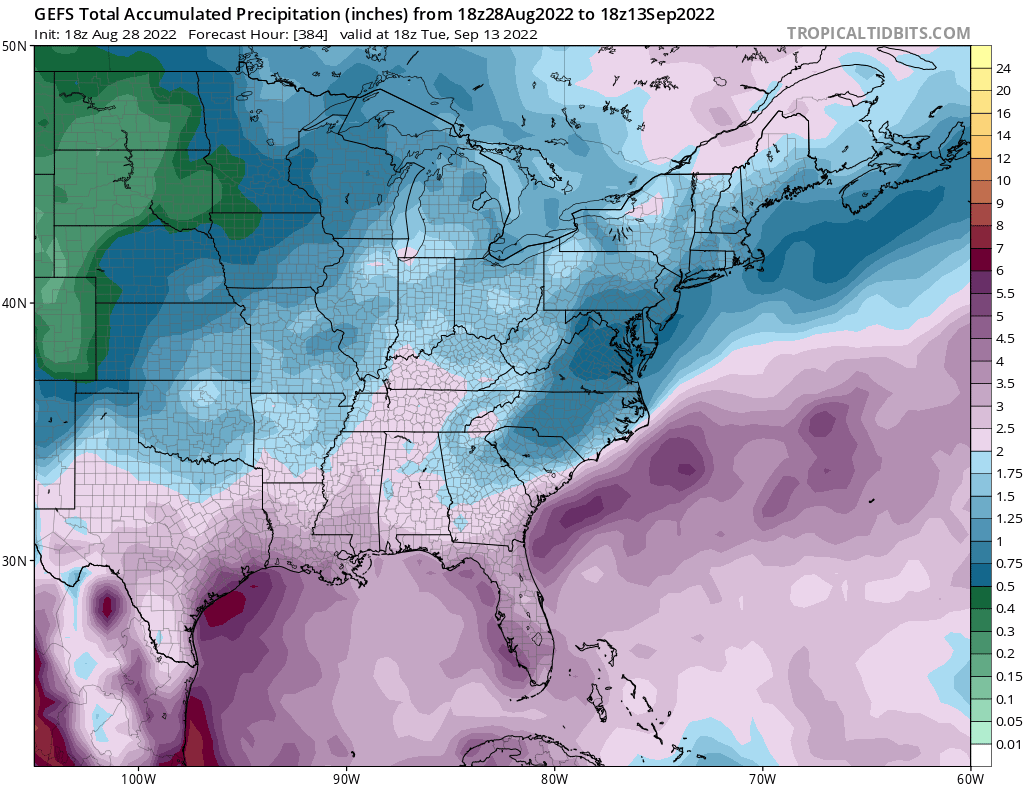
0z HRRR through 48 hours:Cromagnum wrote: ↑Sun Aug 28, 2022 9:18 pm How much of that is occurring tomorrow? My forecast is for 1-2 inches of rain on Monday alone.
Spacecity Weather guys (rather boldy I may add) state we have nothing to worry about in Houston anytime soon.
https://spacecityweather.com/eye-on-the ... t-for-now/
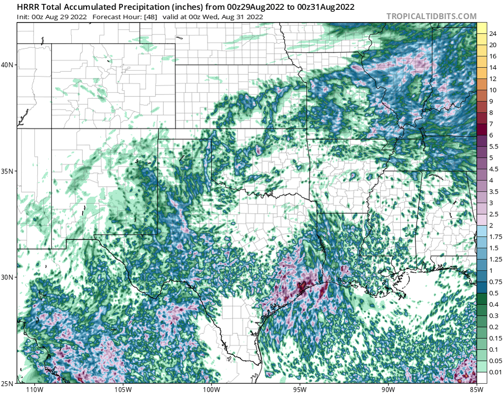
Yeah and the 18z HRRR had pockets of 10-12”.Stratton20 wrote: ↑Sun Aug 28, 2022 9:40 pm Hrrr has some pockets of 6-8 inch totals over the next 2 days, gotta watch these mesocale models, may have some localized flooding issues

