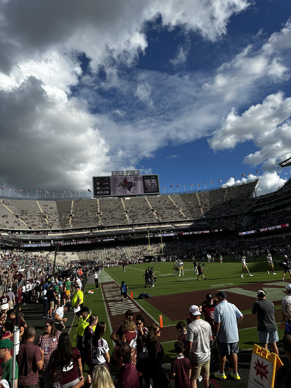
Not bad at all for the end of August!!MontgomeryCoWx wrote: ↑Sat Aug 31, 2024 7:47 am Taikgate been rocking since 530 am. High of 88. Let’s go Aggieland!
August 2024
Miami is going to be a problem in the CFB playoffs if they stay healthy. Impressive OL and DL play.
Science has a long way to go. A few days ago, we had 90% chance of rain for Friday and Saturday and I believe 60% chance for Thursday. We got a lot of rain on Thursday and very little on Friday or today. Even yesterday the chances were very high today and there was barely anything on radar all day.
Mesoscale Precipitation Discussion 0959
NWS Weather Prediction Center College Park MD
542 AM EDT Sun Sep 01 2024
Areas affected...Upper Texas Coast...
Concerning...Heavy rainfall...Flash flooding possible
Valid 010945Z - 011500Z
SUMMARY...Training band of efficient warm cloud tropical showers to produce 2-3"/hr rates with potential for focused 3-5" totals resulting in possible rapid inundation flooding through early daybreak in proximity to Galveston Bay.
DISCUSSION...Pesky stationary surface to 700mb low remains just offshore south-southwest to southwest of Galveston Bay. Core of low level moisture resides in all quadrants with exception of the southwest with Sfc to 850mb values over 1.1" continuing to near .75" through to 700mb, resulting in over 2.25-2.5" values through depth but loaded in the lowest layers, well below freezing levels to support efficient warm cloud tropical rainfall processes. Tropical profile with diurnal surface heat release off the ocean has added that surface temp to support 2000 J/kg of skinny CAPE profiles for convection. Low level flow is a tad weaker than yesterday at 5-10kts through depth but solid directional convergence will support low level moisture loading to support 2-3"/hr rates. Local observations support that with 1" totals occurring in sites along Galveston Bay in less than 20-30 minutes.
Given depth of unidirectional/confluent flow cell motions remain favorable for the northeast quadrant band to allow for training in proximity to Galveston Bay for a few more hours with favorable upstream inflow nearly equalizing in the near term to support training before converging offshore with time or through any eventual cold pool generation after a few hours. As such, spots of 3-5" are possible through 15z, which may result in rapid inundation flooding, especially if cells near urban areas like Galveston Island or west and north of the Bay itself. Still, with potential for back-building offshore, confidence does not remain high enough for extreme totals to designate a likely categorization potential and will remain possible at this time.
Gallina
...Please see www.wpc.ncep.noaa.gov for graphic product...
ATTN...WFO...HGX...LCH...
ATTN...RFC...WGRFC...NWC...
Another year of uninspired Aggie football. Sigh.
Two losses to t.u. and show Elko the door. We should have bought/hired Kiffin.
Weigman should have been pulled at the half. He wasn't mentally ready. Elko wasn't either. The WRs, FBs. Then the D broke at the end. The 2nd half was a disgrace...
oh, turn the page to September.
Welp, I witnessed it firsthand. Weigman missed on throws that a lot of high school quarterbacks would make. And all those 5 star DL couldn’t get any rush on the QB or stop the run when it mattered most. Talk about an ugly game. Oh, and the drive home south on Highway 6 last night was a nightmare. Didn’t get home till 2AM and it’s normally just a 2 hour drive for me. Still had a good time though!


