
May 2024
-
Stratton20
- Posts: 5612
- Joined: Tue Feb 09, 2021 11:35 pm
- Location: College Station, Texas
- Contact:
18z GFS, very sharp cutoff south of I-10, but does show potential for heavy rain to set up somewhere in our neck of the woods, has a bullseye of about 9 inches over the next 7 days
- Attachments
-
- IMG_3112.png
- (467.31 KiB) Downloaded 4721 times
-
Cpv17
- Posts: 6817
- Joined: Fri Aug 31, 2018 1:58 pm
- Location: El Campo/Wharton
- Contact:
Well it gives me about .90”. That’s double what I had from the last event. I’ll take it lolStratton20 wrote: ↑Fri May 10, 2024 6:08 pm 18z GFS, very sharp cutoff south of I-10, but does show potential for heavy rain to set up somewhere in our neck of the woods, has a bullseye of about 9 inches over the next 7 days
-
Cromagnum
- Posts: 3021
- Joined: Thu Feb 03, 2011 10:42 pm
- Location: Georgetown
- Contact:
Interview in NC went well today. So well that the VP gave me a verbal notice of intent to hire and said he wanted to spend his time with me to close in on an initial offer range before I traveled home. Written one will be forthcoming Monday
-
Rip76

- Posts: 2083
- Joined: Mon Feb 15, 2010 12:38 am
- Location: The Woodlands
- Contact:
Awesome. We truly need a "like" button.
-
don

- Posts: 3106
- Joined: Wed Feb 03, 2010 3:33 pm
- Location: Wichita Falls
- Contact:
-
Ptarmigan

- Statistical Specialist

- Posts: 4433
- Joined: Wed Feb 03, 2010 7:20 pm
- Contact:
Strongest solar flare observed in 20 years.
- Attachments
-
- G5 Alert - May 10, 2024 (2)_2.png (381.63 KiB) Viewed 5044 times
-
Cpv17
- Posts: 6817
- Joined: Fri Aug 31, 2018 1:58 pm
- Location: El Campo/Wharton
- Contact:
What is it that you do exactly if you don’t mind me asking?
-
Cpv17
- Posts: 6817
- Joined: Fri Aug 31, 2018 1:58 pm
- Location: El Campo/Wharton
- Contact:
I’ve seen a few people in the northern parts of the viewing area say they’ve seen the northern lights tonight.
-
Cromagnum
- Posts: 3021
- Joined: Thu Feb 03, 2011 10:42 pm
- Location: Georgetown
- Contact:
I'm an analytical chemist, which means I work on lab and process instrumentation, build and setup labs, and use different techniques to analyze materials.
It's a cool branch of chemistry that allows me to work in just about any field because just about everyone produces something that needs to be analyzed somehow. I've been at it for 20 years and did my PhD in cardiovascular research, but spent nearly all of my time since then with petrochemical companies and one role in the middle with pharmaceutical compounding.
-
Stratton20
- Posts: 5612
- Joined: Tue Feb 09, 2021 11:35 pm
- Location: College Station, Texas
- Contact:
The 12z GFS even through the end of its run continues to advertise another long duration of wet weather, im also hearing that the death ridge may set up shop more over the SW US and not directly over us for the summer, that may provide us with opportunities for most rain and a steady moisture feed coming from the gulf/ caribbean, but that also will leave texas open for tropical systems potentially
-
DoctorMu

- Posts: 7623
- Joined: Sun Jun 28, 2015 11:58 am
- Location: College Station
- Contact:
Nice - I'd move back to NC just for the weather! Good luck!
-
DoctorMu
- Posts: 7623
- Joined: Sun Jun 28, 2015 11:58 am
- Location: College Station
- Contact:
Yes, I anticipate to GoM being open for business this summer. A double-edged sword for sure.Stratton20 wrote: ↑Sat May 11, 2024 12:14 pm The 12z GFS even through the end of its run continues to advertise another long duration of wet weather, im also hearing that the death ridge may set up shop more over the SW US and not directly over us for the summer, that may provide us with opportunities for most rain and a steady moisture feed coming from the gulf/ caribbean, but that also will leave texas open for tropical systems potentially
-
DoctorMu
- Posts: 7623
- Joined: Sun Jun 28, 2015 11:58 am
- Location: College Station
- Contact:
Nice background. Ideal for Research Triangle positions.Cromagnum wrote: ↑Sat May 11, 2024 6:11 amI'm an analytical chemist, which means I work on lab and process instrumentation, build and setup labs, and use different techniques to analyze materials.
It's a cool branch of chemistry that allows me to work in just about any field because just about everyone produces something that needs to be analyzed somehow. I've been at it for 20 years and did my PhD in cardiovascular research, but spent nearly all of my time since then with petrochemical companies and one role in the middle with pharmaceutical compounding.
-
Cpv17
- Posts: 6817
- Joined: Fri Aug 31, 2018 1:58 pm
- Location: El Campo/Wharton
- Contact:
Damn! Way to go Cro!!Cromagnum wrote: ↑Sat May 11, 2024 6:11 amI'm an analytical chemist, which means I work on lab and process instrumentation, build and setup labs, and use different techniques to analyze materials.
It's a cool branch of chemistry that allows me to work in just about any field because just about everyone produces something that needs to be analyzed somehow. I've been at it for 20 years and did my PhD in cardiovascular research, but spent nearly all of my time since then with petrochemical companies and one role in the middle with pharmaceutical compounding.
On another note, damn, it’s an ugly day out there. Might as well start raining at this point. HRRR has some spotty showers and storms popping up later this afternoon.
-
don
- Posts: 3106
- Joined: Wed Feb 03, 2010 3:33 pm
- Location: Wichita Falls
- Contact:
Day 3 Convective Outlook
NWS Storm Prediction Center Norman OK
0237 AM CDT Sat May 11 2024
Valid 131200Z - 141200Z
...THERE IS A SLIGHT RISK OF SEVERE THUNDERSTORMS FROM CENTRAL AND
EAST TEXAS INTO THE LOWER MISSISSIPPI VALLEY...
...SUMMARY...
Severe thunderstorms are possible Monday from central and east Texas
into the Lower Mississippi Valley.
...Synopsis and Discussion...
A southern-stream shortwave trough will likely extend from the
central Plains south-southwestward into northeast Mexico early
Monday morning, with associated strong mid-level flow spread from
the southern Plains into the Lower MS Valley. This shortwave is
forecast to move gradually eastward, with some phasing possible with
a northern-stream shortwave contributing to more expansive troughing
from the Mid MS Valley into the eastern southern Plains by early
Tuesday morning.
Primary surface low associated with the southern-stream shortwave is
expected to progress eastward/northeastward from south-central KS
into the Mid MS Valley. As it does, an attendant cold front will
push southeastward through much of OK, TX and the Ozark Plateau,
reaching the Mid/Lower MS Valley by early Tuesday morning. A very
moist and unstable air mass will be in place ahead of this front,
with low 70s dewpoints initially extending from central into
northeast/east TX before spreading eastward with time. Moderate to
strong southwesterlies at the base of the shortwave will also
support to robust vertical shear, with the resulting combination of
buoyancy and shear contributing to an environment supportive of
severe thunderstorms.
Convective evolution of these storms is uncertain, particularly with
eastern extent, but the general expectation is for storms to develop
along the front and then push eastward throughout the day. Given the
ample low-level moisture, development along the front could occur
quite early, with one or more convective lines evolving over time.
Large to very large hail will be the primary severe threat
initially, with a trend towards more damaging gust potential as
storms grow upscale. Relatively weak low-level flow show keep the
tornado threat low. The only exception is near the warm front, which
will likely extend from northeast TX eastward into the southern
AR/northern LA vicinity from Monday morning until at least the mid
afternoon.
..Mosier.. 05/11/2024
-
DoctorMu
- Posts: 7623
- Joined: Sun Jun 28, 2015 11:58 am
- Location: College Station
- Contact:
We'll get a dousing at least.don wrote: ↑Sat May 11, 2024 3:24 pm sgpcd3cat.us_sc.png
Day 3 Convective Outlook
NWS Storm Prediction Center Norman OK
0237 AM CDT Sat May 11 2024
Valid 131200Z - 141200Z
...THERE IS A SLIGHT RISK OF SEVERE THUNDERSTORMS FROM CENTRAL AND
EAST TEXAS INTO THE LOWER MISSISSIPPI VALLEY...
...SUMMARY...
Severe thunderstorms are possible Monday from central and east Texas
into the Lower Mississippi Valley.
...Synopsis and Discussion...
A southern-stream shortwave trough will likely extend from the
central Plains south-southwestward into northeast Mexico early
Monday morning, with associated strong mid-level flow spread from
the southern Plains into the Lower MS Valley. This shortwave is
forecast to move gradually eastward, with some phasing possible with
a northern-stream shortwave contributing to more expansive troughing
from the Mid MS Valley into the eastern southern Plains by early
Tuesday morning.
Primary surface low associated with the southern-stream shortwave is
expected to progress eastward/northeastward from south-central KS
into the Mid MS Valley. As it does, an attendant cold front will
push southeastward through much of OK, TX and the Ozark Plateau,
reaching the Mid/Lower MS Valley by early Tuesday morning. A very
moist and unstable air mass will be in place ahead of this front,
with low 70s dewpoints initially extending from central into
northeast/east TX before spreading eastward with time. Moderate to
strong southwesterlies at the base of the shortwave will also
support to robust vertical shear, with the resulting combination of
buoyancy and shear contributing to an environment supportive of
severe thunderstorms.
Convective evolution of these storms is uncertain, particularly with
eastern extent, but the general expectation is for storms to develop
along the front and then push eastward throughout the day. Given the
ample low-level moisture, development along the front could occur
quite early, with one or more convective lines evolving over time.
Large to very large hail will be the primary severe threat
initially, with a trend towards more damaging gust potential as
storms grow upscale. Relatively weak low-level flow show keep the
tornado threat low. The only exception is near the warm front, which
will likely extend from northeast TX eastward into the southern
AR/northern LA vicinity from Monday morning until at least the mid
afternoon.
..Mosier.. 05/11/2024
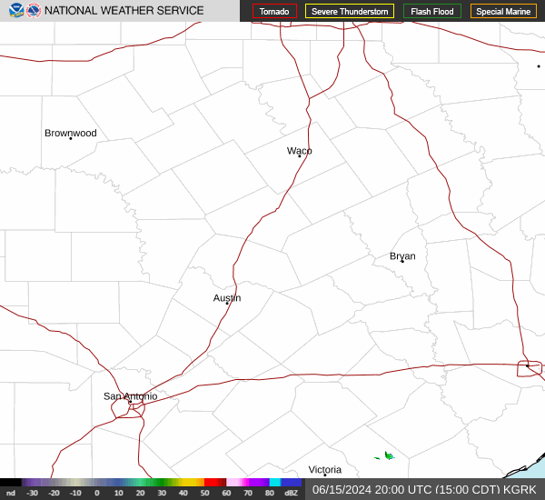
HAIL yes that cell near Brownwood looks nasty. I'm not sure it will make it to CLL and the HGX area. We'll see.
-
Pas_Bon
- Posts: 921
- Joined: Tue Sep 11, 2018 7:58 am
- Location: League City, TX
- Contact:
DoctorMu wrote: ↑Sat May 11, 2024 1:40 pmYes, I anticipate to GoM being open for business this summer. A double-edged sword for sure.Stratton20 wrote: ↑Sat May 11, 2024 12:14 pm The 12z GFS even through the end of its run continues to advertise another long duration of wet weather, im also hearing that the death ridge may set up shop more over the SW US and not directly over us for the summer, that may provide us with opportunities for most rain and a steady moisture feed coming from the gulf/ caribbean, but that also will leave texas open for tropical systems potentially
Unfortunately, I will put great money on the notion that the Upper TX coast will get walloped this season. I live here (Galveston County), so I’m not thrilled about thinking it or saying it, but I have a really sinking, foreboding feeling about this.
-
Katdaddy

- Global Moderator

- Posts: 2521
- Joined: Thu Feb 04, 2010 8:18 am
- Location: League City, Tx
- Contact:
I agree Pas_Bon. I have that vibe also which has been ongoing. I hope we are both wrong but it’s time to be prepared.