
December Weather Discussion. Will We See Rain?
-
TexasMetBlake
- Pro Met

- Posts: 839
- Joined: Wed Feb 03, 2010 7:03 pm
- Location: Spring/Woodlands
- Contact:
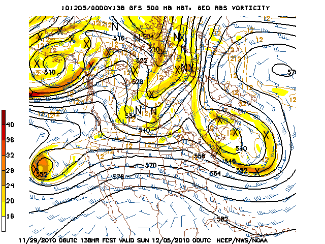
Woke up to use the bathroom and realized it was time for the 00z euro. Just glanced at it with literally one eye open and it continues the trend of a very deep trough at 192-240 range with a coastal low developing. This run looks to be a bit further east with the cold but again, that is just a 1 sec. glance at the model. You can't really trust me as I am typing this with literally one eye open. Back to bed.
-
srainhoutx

- Site Admin

- Posts: 19699
- Joined: Tue Feb 02, 2010 2:32 pm
- Location: Maggie Valley, NC
- Contact:
Here is the HPC morning Prelim discussion concerning the overnight models and the differences between them...still more questions than answers...
PRELIMINARY EXTENDED FORECAST DISCUSSION
NWS HYDROMETEOROLOGICAL PREDICTION CENTER CAMP SPRINGS MD
319 AM EST MON NOV 29 2010
VALID 12Z FRI DEC 03 2010 - 12Z MON DEC 06 2010
DEEPENING CYCLONES IN THE NORTHEAST PACIFIC AND OFFSHORE NEW
ENGLAND/ATLANTIC CANADA NORMALLY IMPLIES RIDGING IN BETWEEN. NOT
SO THIS PERIOD AS A SYSTEM FROM THE EASTERN PACIFIC DIVES
SOUTHEAST INTO CALIFORNIA AND PROGRESSES ACROSS THE ROCKIES AHEAD
OF A NARROW AMPLIFYING RIDGE...SQUEEZING THE RIDGE ACROSS THE
SOUTH SLOWLY OUT OF EXISTENCE BY MID NEXT WEEK. THE GUIDANCE IS
IN VERY GOOD AGREEMENT ON MOST OF THE FORECAST THIS PERIOD. SINCE
THE 00Z GFS IS IN BEST AGREEMENT WITH THE ENSEMBLE MEANS ON THE
LARGE SCALE...USED A 00Z GFS/00Z GEFS MEAN COMPROMISE/BLEND AS A
STARTING POINT FOR THE PRESSURES.
THE 64000 DOLLAR QUESTION CONTINUES TO CIRCLE AROUND WHAT WILL
HAPPEN WITH AN INTERMEDIATE SHORTWAVE PROGRESSING INTO THE PACIFIC
NORTHWEST EARLY ON WHICH MOVES OVER A PRE-EXISTING BROAD RIDGE
LOCATED OVER THE SOUTHERN STATES. OF ALL THE GUIDANCE...THE 00Z
CANADIAN HAS MAINTAINED THE BEST MULTI-DAY CONTINUITY WITH THIS
SYSTEM...THOUGH ITS SOLUTION IS SLOWER THAN THE ENSEMBLE MEANS
SUGGEST...SO FROM THAT STANDPOINT IT COULD NOT BE USED EARLY THIS
MORNING. THE 00Z GFS DAMPENS THE PACIFIC SHORTWAVE OUT OF
EXISTENCE WHILE THE 00Z ECMWF/00Z CANADIAN MOVE THIS SHORTWAVE
THROUGH THE RIDGE...DAMPENING THE RIDGE OUT OF EXISTENCE. IF
THERE WERE A POLAR VORTEX OVER HUDSON BAY...THE ECMWF/CANADIAN
SOLUTION WOULD HAVE MORE MERIT. HOWEVER...THE GUIDANCE HAS THE
VORTEX CENTERED OVER NUNAVUT...SO ITS INFLUENCE ON THE FLOW OVER
THE LOWER 48 SHOULD BE MINIMAL IF THE CURRENT GUIDANCE IS CORRECT
IN ITS POSITION AS WELL AS THE POSITION/STRENGTH OF THE DEEP
CYCLONE NEAR NEW ENGLAND. BELIEVE THE 00Z CANADIAN/00Z ECMWF ARE
TOO STRONG AND THE 00Z GFS IS TOO WEAK WITH THIS SHORTWAVE...SO
USED THE 12Z GLOBAL ENSEMBLE CLUSTERING TO MOVE THIS SYSTEM ON AN
INTERMEDIATE TRACK WHICH RESPECTS THE RIDGING MORE THAN THE
CANADIAN/ECMWF ADVERTISE...TAKING A FRONTAL WAVE TOWARDS MICHIGAN
BEFORE IT SHEARS OUT ON THE WESTERN SIDE OF THE NORTHWEST ATLANTIC
CYCLONE. THIS ENDS UP WITH A SET OF PRESSURES THAT MAINTAIN
REASONABLE CONTINUITY...BUT CONFIDENCE IS NO BETTER THAN AVERAGE
IN THIS PREFERENCE.
GGEM (Canadian)...

Euro...

GFS...

HGX...
THE RIDGE BEGINS TO BREAK DOWN
NEXT MONDAY AS AN UPPER TROUGH TAKES SHAPE OVER THE SOUTHERN
ROCKIES. THE TROUGH IS EXPECTED TO MOVE ACROSS THE SOUTHERN PLAINS
BRINGING ANOTHER CHANCE OF RAIN NEXT MON/TUES WITH SEVERAL LONG
RANGE MODELS HINTING AT A MUCH COLDER AIR MASS FOR EARLY NEXT
WEEK.
Dallas/Ft Worth...
LOOKING AT THE BIGGER PICTURE...UPPER LEVEL PATTERN WILL FEATURE
A BLOCK FROM GREENLAND SOUTHWARD WITH LONGWAVE TROUGHS LOCATED
ALONG THE EAST COAST AND ACROSS THE NE PACIFIC OCEAN. STATIONARY
LOW PRESSURES AT EACH EDGE OF THE CONTINENT WILL FOSTER THE GROWTH
OF A LARGE SPRAWLING HIGH PRESSURE CELL ACROSS CANADA INTO THE
CENTRAL US BY EARLY NEXT WEEK. THIS HIGH SHOULD EXPAND INTO THE
REGION ALLOWING FOR PROLONGED NORTHERLY FLOW TO TAP INTO SOME
CANADIAN AIR AND GRADUALLY BRING IT INTO NORTH TEXAS. THUS IT IS
WITH REASONABLY HIGH CONFIDENCE THAT NEXT WEEK WILL FEATURE A
PERIOD OF COOLER THAN NORMAL TEMPS. MODELS ARE STILL DIFFERING ON
THE DETAILS...WITH THE ECMWF SUGGESTING THIS FRONT WILL ARRIVE
SATURDAY WITH GRADUAL COOLING INTO THE NEXT WEEK...AND THE GFS IS
DELAYING THE COOL DOWN UNTIL AFTER THE WEEKEND. THE CANADIAN/UKMET
AND MOST OF THE GFS ENSEMBLE MEMBERS ARE IN AGREEMENT WITH THE
OPERATIONAL GFS AND THUS HAVE KEPT HIGHS WARM SATURDAY...BUT DID
START TO TREND THINGS COOLER SUNDAY AND ESPECIALLY SO ON MONDAY.
OTHERWISE THE ECMWF ALSO REMAINS THE OUTLIER WITH THE STRENGTH OF
A MON-TUE UPPER LEVEL WAVE...BUT IT DID TREND TOWARD THE WEAKER
AND LESS AMPLIFIED FORECASTS OF THE GFS/UKMET/CANADIAN AND
MAJORITY OF THE ENSEMBLE MEMBERS. THERE IS SOME POTENTIAL FOR
PRECIPITATION WITH THIS SYSTEM AND WITH THE COLUMN COOLING IT IS
POSSIBLE IT MAY BE OF FROZEN VARIETY ALONG THE RED RIVER. THE
UPPER PATTERN DOES FIT INTO A CLIMATOLOGICAL SIGNAL FOR SNOW...BUT
ONE THAT ONLY PRODUCED SIGNIFICANT SNOWS NORTH OF I-20 WITH
TEMPERATURE PROFILES USUALLY TOO WARM ACROSS NORTH TEXAS. STILL A
LONG WAY OUT AND EXPECT MODELS TO CONTINUE TO WAFFLE...SO
CONFIDENCE IN WINTER PRECIPITATION REMAINS VERY LOW.
Norman, OK...
NEXT WEEKEND IS TOUGH TO CALL. IT ALL DEPENDS ON HOW THE VARIOUS
SYSTEMS INTERACT OFF THE W COAST LATE IN THE WEEK... AND ONE OF
THOSE IS CURRENTLY N OF JAPAN. ECMWF CONTINUES TO SHOW A MORE
AMPLIFIED TROUGH COMING OUT INTO THE PACIFIC NW AND MOVING
THROUGH THE NORTHERN STATES LATE IN THE WEEK... AND DRIVES A
CANADIAN AIRMASS S THROUGH THE PLAINS IN ITS WAKE. GFS SHOWS NO
SUCH TROUGH... AND THUS DELAYS ANY SERIOUS COLD INTRUSION IN THE S
PLAINS UNTIL LATE IN THE WEEKEND OR EARLY NEXT WEEK. THE MOST
REASONABLE SCENARIO MAY BE IN BETWEEN... WITH A WEAKER UPPER
TROUGH AND A SLOWER... MORE TEMPERED INTRUSION OF COLD AIR INTO
OK NEXT WEEKEND THAN SHOWN BY THE ECMWF. THIS IS THE WAY HPC IS
LEANING... SEE THEIR PRELIM MED-RANGE DISCUSSION AND EARLY DAY5-7
SFC PROGS... AND IS SUPPORTED TO SOME DEGREE BY THE GEFS. A LOT OF
BUST POTENTIAL ON TEMPERATURES SAT-SUN DEPENDING ON HOW MUCH AND
HOW FAST THE COLDER AIR TAKES CHARGE.
WHATEVER THE CASE MAY BE... POTENTIAL STILL EXISTS FOR MUCH COLDER
AIR AND POSSIBLE SNOW/ICE EARLY NEXT WEEK... ESPECIALLY MON-TUE
DEC 6-7. DETAILS MUCH TOO UNCERTAIN TO OFFER ANY SPECIFICS THIS
FAR OUT.
Dodge City, KS...
DAYS 3-7...
THERE IS CONSIDERABLE UNCERTAINTY TOWARDS THE SECOND WEEK OF
DECEMBER (TOWARDS THE END OF THE FORECAST PERIOD). MODELS HAVE BEEN
FLIP FLOPPING ALL OVER THE PLACE. FOR EXAMPLE, THE 12Z OPERATIONAL
RUN OF THE ECMWF DEVELOPS A HUGE CUTOFF LOW ACROSS THE DESERT
SOUTHWEST ON THE 6TH WHICH WOULD RAISE EYEBROWS FOR THE POTENTIAL
FOR WINTER TYPE PRECIPITATION ACROSS SOUTHWESTERN KANSAS. THE 00Z
ECMWF IS COMPLETELY DIFFERENT AND MUCH MORE PROGRESSIVE WITH UPPER
LEVEL DYNAMICS. COMPARING THIS WITH THE 00Z GFS DOES INDICATE THE
POTENTIAL FOR MORE UNSETTLED WEATHER TOWARDS THE END OF THE FORECAST
PERIOD AS THE GFS ALSO HINTS AT A SHORTWAVE DIVING DOWN FROM THE
NORTHWEST. THE ATMOSPHERIC COLUMN DURING THIS PERIOD COULD BE COLD
ENOUGH FOR SNOW. THE PNA INDEX IS ALSO FORECAST TO GO NEGATIVE
TOWARDS THE MIDDLE OF DECEMBER WHICH WOULD FAVOR LOWER 500 HPA
HEIGHTS OUT WEST. THE NCEP ENSEMBLE MEAN ALSO FAVORS THE DEVELOPMENT
OF A TROUGH OUT WEST ALTHOUGH THE 12Z ECMWF ENSEMBLE MEAN HAS THE
STORM TRACK FURTHER EAST. AS A RESULT OF THE GENERAL HINT AND TREND
TOWARDS A MORE ACTIVE STORM TRACK, I HAVE INSERTED SILENT POPS IN
THE GRIDS FROM SUNDAY ON. OF COURSE, CONFIDENCE IS VERY LOW AND TO
JUMP ON ANY PARTICULAR MODEL SOLUTION AT THIS POINT WOULD BE SILLY,
HOWEVER A TREND TO COOLER AND POSSIBLY WETTER WEATHER SEEMS
APPROPRIATE AT THIS POINT IN TIME. THESE GHOST POPS ALSO MATCH
BETTER WITH OUR WFO NEIGHBORS, PARTICULARLY TO THE EAST. LASTLY,
BECAUSE OF FRONTAL TIMING DIFFERENCES, I USED CONSALL FOR GRID
MODIFICATIONS. THIS SEEMED TO BE IN THE MIDDLE GROUND FROM THE
EXTREMELY COLD GFS TO THE MORE MODERATE ECMWF AS A SIGNIFICANT COLD
FRONT AND ASSOCIATED ARCTIC MASS DIVES SOUTH TOWARDS DAY 8, HOWEVER
BOTH MODELS DO POOR WITH ARCTIC AIRMASSES SO THE POTENTIAL FOR
TEMPERATURE BUSTS IS FAIRLY HIGH ATTM.
PRELIMINARY EXTENDED FORECAST DISCUSSION
NWS HYDROMETEOROLOGICAL PREDICTION CENTER CAMP SPRINGS MD
319 AM EST MON NOV 29 2010
VALID 12Z FRI DEC 03 2010 - 12Z MON DEC 06 2010
DEEPENING CYCLONES IN THE NORTHEAST PACIFIC AND OFFSHORE NEW
ENGLAND/ATLANTIC CANADA NORMALLY IMPLIES RIDGING IN BETWEEN. NOT
SO THIS PERIOD AS A SYSTEM FROM THE EASTERN PACIFIC DIVES
SOUTHEAST INTO CALIFORNIA AND PROGRESSES ACROSS THE ROCKIES AHEAD
OF A NARROW AMPLIFYING RIDGE...SQUEEZING THE RIDGE ACROSS THE
SOUTH SLOWLY OUT OF EXISTENCE BY MID NEXT WEEK. THE GUIDANCE IS
IN VERY GOOD AGREEMENT ON MOST OF THE FORECAST THIS PERIOD. SINCE
THE 00Z GFS IS IN BEST AGREEMENT WITH THE ENSEMBLE MEANS ON THE
LARGE SCALE...USED A 00Z GFS/00Z GEFS MEAN COMPROMISE/BLEND AS A
STARTING POINT FOR THE PRESSURES.
THE 64000 DOLLAR QUESTION CONTINUES TO CIRCLE AROUND WHAT WILL
HAPPEN WITH AN INTERMEDIATE SHORTWAVE PROGRESSING INTO THE PACIFIC
NORTHWEST EARLY ON WHICH MOVES OVER A PRE-EXISTING BROAD RIDGE
LOCATED OVER THE SOUTHERN STATES. OF ALL THE GUIDANCE...THE 00Z
CANADIAN HAS MAINTAINED THE BEST MULTI-DAY CONTINUITY WITH THIS
SYSTEM...THOUGH ITS SOLUTION IS SLOWER THAN THE ENSEMBLE MEANS
SUGGEST...SO FROM THAT STANDPOINT IT COULD NOT BE USED EARLY THIS
MORNING. THE 00Z GFS DAMPENS THE PACIFIC SHORTWAVE OUT OF
EXISTENCE WHILE THE 00Z ECMWF/00Z CANADIAN MOVE THIS SHORTWAVE
THROUGH THE RIDGE...DAMPENING THE RIDGE OUT OF EXISTENCE. IF
THERE WERE A POLAR VORTEX OVER HUDSON BAY...THE ECMWF/CANADIAN
SOLUTION WOULD HAVE MORE MERIT. HOWEVER...THE GUIDANCE HAS THE
VORTEX CENTERED OVER NUNAVUT...SO ITS INFLUENCE ON THE FLOW OVER
THE LOWER 48 SHOULD BE MINIMAL IF THE CURRENT GUIDANCE IS CORRECT
IN ITS POSITION AS WELL AS THE POSITION/STRENGTH OF THE DEEP
CYCLONE NEAR NEW ENGLAND. BELIEVE THE 00Z CANADIAN/00Z ECMWF ARE
TOO STRONG AND THE 00Z GFS IS TOO WEAK WITH THIS SHORTWAVE...SO
USED THE 12Z GLOBAL ENSEMBLE CLUSTERING TO MOVE THIS SYSTEM ON AN
INTERMEDIATE TRACK WHICH RESPECTS THE RIDGING MORE THAN THE
CANADIAN/ECMWF ADVERTISE...TAKING A FRONTAL WAVE TOWARDS MICHIGAN
BEFORE IT SHEARS OUT ON THE WESTERN SIDE OF THE NORTHWEST ATLANTIC
CYCLONE. THIS ENDS UP WITH A SET OF PRESSURES THAT MAINTAIN
REASONABLE CONTINUITY...BUT CONFIDENCE IS NO BETTER THAN AVERAGE
IN THIS PREFERENCE.
GGEM (Canadian)...
Euro...
GFS...
HGX...
THE RIDGE BEGINS TO BREAK DOWN
NEXT MONDAY AS AN UPPER TROUGH TAKES SHAPE OVER THE SOUTHERN
ROCKIES. THE TROUGH IS EXPECTED TO MOVE ACROSS THE SOUTHERN PLAINS
BRINGING ANOTHER CHANCE OF RAIN NEXT MON/TUES WITH SEVERAL LONG
RANGE MODELS HINTING AT A MUCH COLDER AIR MASS FOR EARLY NEXT
WEEK.
Dallas/Ft Worth...
LOOKING AT THE BIGGER PICTURE...UPPER LEVEL PATTERN WILL FEATURE
A BLOCK FROM GREENLAND SOUTHWARD WITH LONGWAVE TROUGHS LOCATED
ALONG THE EAST COAST AND ACROSS THE NE PACIFIC OCEAN. STATIONARY
LOW PRESSURES AT EACH EDGE OF THE CONTINENT WILL FOSTER THE GROWTH
OF A LARGE SPRAWLING HIGH PRESSURE CELL ACROSS CANADA INTO THE
CENTRAL US BY EARLY NEXT WEEK. THIS HIGH SHOULD EXPAND INTO THE
REGION ALLOWING FOR PROLONGED NORTHERLY FLOW TO TAP INTO SOME
CANADIAN AIR AND GRADUALLY BRING IT INTO NORTH TEXAS. THUS IT IS
WITH REASONABLY HIGH CONFIDENCE THAT NEXT WEEK WILL FEATURE A
PERIOD OF COOLER THAN NORMAL TEMPS. MODELS ARE STILL DIFFERING ON
THE DETAILS...WITH THE ECMWF SUGGESTING THIS FRONT WILL ARRIVE
SATURDAY WITH GRADUAL COOLING INTO THE NEXT WEEK...AND THE GFS IS
DELAYING THE COOL DOWN UNTIL AFTER THE WEEKEND. THE CANADIAN/UKMET
AND MOST OF THE GFS ENSEMBLE MEMBERS ARE IN AGREEMENT WITH THE
OPERATIONAL GFS AND THUS HAVE KEPT HIGHS WARM SATURDAY...BUT DID
START TO TREND THINGS COOLER SUNDAY AND ESPECIALLY SO ON MONDAY.
OTHERWISE THE ECMWF ALSO REMAINS THE OUTLIER WITH THE STRENGTH OF
A MON-TUE UPPER LEVEL WAVE...BUT IT DID TREND TOWARD THE WEAKER
AND LESS AMPLIFIED FORECASTS OF THE GFS/UKMET/CANADIAN AND
MAJORITY OF THE ENSEMBLE MEMBERS. THERE IS SOME POTENTIAL FOR
PRECIPITATION WITH THIS SYSTEM AND WITH THE COLUMN COOLING IT IS
POSSIBLE IT MAY BE OF FROZEN VARIETY ALONG THE RED RIVER. THE
UPPER PATTERN DOES FIT INTO A CLIMATOLOGICAL SIGNAL FOR SNOW...BUT
ONE THAT ONLY PRODUCED SIGNIFICANT SNOWS NORTH OF I-20 WITH
TEMPERATURE PROFILES USUALLY TOO WARM ACROSS NORTH TEXAS. STILL A
LONG WAY OUT AND EXPECT MODELS TO CONTINUE TO WAFFLE...SO
CONFIDENCE IN WINTER PRECIPITATION REMAINS VERY LOW.
Norman, OK...
NEXT WEEKEND IS TOUGH TO CALL. IT ALL DEPENDS ON HOW THE VARIOUS
SYSTEMS INTERACT OFF THE W COAST LATE IN THE WEEK... AND ONE OF
THOSE IS CURRENTLY N OF JAPAN. ECMWF CONTINUES TO SHOW A MORE
AMPLIFIED TROUGH COMING OUT INTO THE PACIFIC NW AND MOVING
THROUGH THE NORTHERN STATES LATE IN THE WEEK... AND DRIVES A
CANADIAN AIRMASS S THROUGH THE PLAINS IN ITS WAKE. GFS SHOWS NO
SUCH TROUGH... AND THUS DELAYS ANY SERIOUS COLD INTRUSION IN THE S
PLAINS UNTIL LATE IN THE WEEKEND OR EARLY NEXT WEEK. THE MOST
REASONABLE SCENARIO MAY BE IN BETWEEN... WITH A WEAKER UPPER
TROUGH AND A SLOWER... MORE TEMPERED INTRUSION OF COLD AIR INTO
OK NEXT WEEKEND THAN SHOWN BY THE ECMWF. THIS IS THE WAY HPC IS
LEANING... SEE THEIR PRELIM MED-RANGE DISCUSSION AND EARLY DAY5-7
SFC PROGS... AND IS SUPPORTED TO SOME DEGREE BY THE GEFS. A LOT OF
BUST POTENTIAL ON TEMPERATURES SAT-SUN DEPENDING ON HOW MUCH AND
HOW FAST THE COLDER AIR TAKES CHARGE.
WHATEVER THE CASE MAY BE... POTENTIAL STILL EXISTS FOR MUCH COLDER
AIR AND POSSIBLE SNOW/ICE EARLY NEXT WEEK... ESPECIALLY MON-TUE
DEC 6-7. DETAILS MUCH TOO UNCERTAIN TO OFFER ANY SPECIFICS THIS
FAR OUT.
Dodge City, KS...
DAYS 3-7...
THERE IS CONSIDERABLE UNCERTAINTY TOWARDS THE SECOND WEEK OF
DECEMBER (TOWARDS THE END OF THE FORECAST PERIOD). MODELS HAVE BEEN
FLIP FLOPPING ALL OVER THE PLACE. FOR EXAMPLE, THE 12Z OPERATIONAL
RUN OF THE ECMWF DEVELOPS A HUGE CUTOFF LOW ACROSS THE DESERT
SOUTHWEST ON THE 6TH WHICH WOULD RAISE EYEBROWS FOR THE POTENTIAL
FOR WINTER TYPE PRECIPITATION ACROSS SOUTHWESTERN KANSAS. THE 00Z
ECMWF IS COMPLETELY DIFFERENT AND MUCH MORE PROGRESSIVE WITH UPPER
LEVEL DYNAMICS. COMPARING THIS WITH THE 00Z GFS DOES INDICATE THE
POTENTIAL FOR MORE UNSETTLED WEATHER TOWARDS THE END OF THE FORECAST
PERIOD AS THE GFS ALSO HINTS AT A SHORTWAVE DIVING DOWN FROM THE
NORTHWEST. THE ATMOSPHERIC COLUMN DURING THIS PERIOD COULD BE COLD
ENOUGH FOR SNOW. THE PNA INDEX IS ALSO FORECAST TO GO NEGATIVE
TOWARDS THE MIDDLE OF DECEMBER WHICH WOULD FAVOR LOWER 500 HPA
HEIGHTS OUT WEST. THE NCEP ENSEMBLE MEAN ALSO FAVORS THE DEVELOPMENT
OF A TROUGH OUT WEST ALTHOUGH THE 12Z ECMWF ENSEMBLE MEAN HAS THE
STORM TRACK FURTHER EAST. AS A RESULT OF THE GENERAL HINT AND TREND
TOWARDS A MORE ACTIVE STORM TRACK, I HAVE INSERTED SILENT POPS IN
THE GRIDS FROM SUNDAY ON. OF COURSE, CONFIDENCE IS VERY LOW AND TO
JUMP ON ANY PARTICULAR MODEL SOLUTION AT THIS POINT WOULD BE SILLY,
HOWEVER A TREND TO COOLER AND POSSIBLY WETTER WEATHER SEEMS
APPROPRIATE AT THIS POINT IN TIME. THESE GHOST POPS ALSO MATCH
BETTER WITH OUR WFO NEIGHBORS, PARTICULARLY TO THE EAST. LASTLY,
BECAUSE OF FRONTAL TIMING DIFFERENCES, I USED CONSALL FOR GRID
MODIFICATIONS. THIS SEEMED TO BE IN THE MIDDLE GROUND FROM THE
EXTREMELY COLD GFS TO THE MORE MODERATE ECMWF AS A SIGNIFICANT COLD
FRONT AND ASSOCIATED ARCTIC MASS DIVES SOUTH TOWARDS DAY 8, HOWEVER
BOTH MODELS DO POOR WITH ARCTIC AIRMASSES SO THE POTENTIAL FOR
TEMPERATURE BUSTS IS FAIRLY HIGH ATTM.
Carla/Alicia/Jerry(In The Eye)/Michelle/Charley/Ivan/Dennis/Katrina/Rita/Wilma/Humberto/Ike/Harvey
Member: National Weather Association
Facebook.com/Weather Infinity
Twitter @WeatherInfinity
Member: National Weather Association
Facebook.com/Weather Infinity
Twitter @WeatherInfinity
-
Mr. T

- Posts: 992
- Joined: Wed Feb 03, 2010 4:22 pm
- Location: Kingwood
- Contact:
Look at the 6z GFS for the same time as the 0z run you posted above, Steve. Very different! Note the big East Coast snow system is gone. (perhaps some flurries for northern sections of SE TX on that run?) Since we're dealing with a Pacific system in an area with not a lot of data assimilation, we're probably going to see quite a few different view of things until we get a few days in advance with this system coming ashore on the West Coast
-
srainhoutx
- Site Admin
- Posts: 19699
- Joined: Tue Feb 02, 2010 2:32 pm
- Location: Maggie Valley, NC
- Contact:
I was going to mention the differences via the 06Z a bit later, Tyler. That run is also a bit colder in our area as well. Time to start watching the Far Western Pacific as our system is near Japan this morning and no doubt we will have several days to see how everything evolves.
Carla/Alicia/Jerry(In The Eye)/Michelle/Charley/Ivan/Dennis/Katrina/Rita/Wilma/Humberto/Ike/Harvey
Member: National Weather Association
Facebook.com/Weather Infinity
Twitter @WeatherInfinity
Member: National Weather Association
Facebook.com/Weather Infinity
Twitter @WeatherInfinity
-
Mr. T
- Posts: 992
- Joined: Wed Feb 03, 2010 4:22 pm
- Location: Kingwood
- Contact:
You can notice the glaring differences in the Pacific at day 6 between the 0z GFS and 6z GFS
Atlantic features are being depicted fairly similar, but the Pacific is an absolute mess. This obviously has major implications down the road, and is why any confidence with a forecast beyond day 6 is near null...
Atlantic features are being depicted fairly similar, but the Pacific is an absolute mess. This obviously has major implications down the road, and is why any confidence with a forecast beyond day 6 is near null...
Last edited by Mr. T on Mon Nov 29, 2010 6:59 am, edited 1 time in total.
-
srainhoutx
- Site Admin
- Posts: 19699
- Joined: Tue Feb 02, 2010 2:32 pm
- Location: Maggie Valley, NC
- Contact:
Taking a look at the 180 hour GFS 850 ensembles, there are even some differences in the individual members. I wish we would see some Winter Storm Pacific RECON, but no indication of that either, if at all. Also, I just looked at the Canadian ensembles as well. Some glaring differences as well. Interesting week ahead...
00Z GFS Ensembles 850mb...
00Z Canadian Ensembles 500mb...
00Z GFS Ensembles 850mb...
00Z Canadian Ensembles 500mb...
Carla/Alicia/Jerry(In The Eye)/Michelle/Charley/Ivan/Dennis/Katrina/Rita/Wilma/Humberto/Ike/Harvey
Member: National Weather Association
Facebook.com/Weather Infinity
Twitter @WeatherInfinity
Member: National Weather Association
Facebook.com/Weather Infinity
Twitter @WeatherInfinity
-
srainhoutx
- Site Admin
- Posts: 19699
- Joined: Tue Feb 02, 2010 2:32 pm
- Location: Maggie Valley, NC
- Contact:
The 00Z Euro ensemble means for hour 216...
Carla/Alicia/Jerry(In The Eye)/Michelle/Charley/Ivan/Dennis/Katrina/Rita/Wilma/Humberto/Ike/Harvey
Member: National Weather Association
Facebook.com/Weather Infinity
Twitter @WeatherInfinity
Member: National Weather Association
Facebook.com/Weather Infinity
Twitter @WeatherInfinity
-
srainhoutx
- Site Admin
- Posts: 19699
- Joined: Tue Feb 02, 2010 2:32 pm
- Location: Maggie Valley, NC
- Contact:
Updated HPC Prelim Discussion:
CENTRAL/EASTERN US...
THE PRIMARY UNCERTAINTY CONTINUES TO REVOLVE AROUND WHAT WILL
HAPPEN WITH A MID LEVEL SHORTWAVE PROGRESSING FROM THE NORTHERN
ROCKIES ACROSS THE CENTRAL PLAINS/MS VALLEY AND POINTS FURTHER
EAST.
THE LARGE SCALE PATTERN FEATURES A PERSISTENT TROUGH OVER NEW
ENGLAND AND COASTAL TO OFFSHORE WATERS...AS A HIGH AMPLITUDE RIDGE
ALONG THE LATITUDE OF GREENLAND ACTS AS A BLOCK. THIS LEADS TO
PERSISTENT COLD CONDITIONS IN THE NORTHEAST US.
ANOTHER CLOSED LOW EXISTS OVER NORTH CENTRAL CANADA WITH CONFLUENT
FLOW BETWEEN THE CYCLONIC CIRCULATION IN CENTRAL CANADA AND A MEAN
500 MB RIDGE DRIFTING EAST ACROSS MEXICO. THE 00Z ECMWF AND
CANADIAN GLOBAL MODELS SHOW A MORE AMPLIFIED 850-500 MB WAVE
MOVING EAST-SOUTHEAST IN THE CONFLUENT FLOW AND THE 00Z GFS AND
UKMET MORE SUPPRESSED. THE NCEP AND ECMWF ENSEMBLE MEMBERS
GENERALLY SHOW A LOWER AMPLITUDE WAVE THAN THE OPERATIONAL ECMWF
AND A MEAN SOLUTION WAS USED TO MITIGATE THE DIFFERENCES BETWEEN
THE TWO DIFFERENT APPROACHES TO THIS SYSTEM. THE 06Z GFS BECOMES
AN OUTLIER 06-12Z SAT IN THE NORTHERN PLAINS WITH A SEPARATE LOW
THAT MIGRATES TOWARDS THE GREAT LAKES...WITH THE PRIMARY NORTHERN
STREAM CLOSED 500 MB LOW DEVELOPING IN THE LAKES BY SUNDAY 05 DEC.
CONFIDENCE IS LOW WITH THIS LARGE OF A RUN TO RUN CHANGE AND
DIFFERENCE FROM 00-06Z ENSEMBLE MEMBER/MEAN SOLUTIONS.
THE MODELS/ENSEMBLES SHOW THE 500 MB TROUGH CROSSING THE SOUTHERN
ROCKIES ON
SUN AND THEN SOUTHERN PLAINS ON MON 06 DEC. LOW PRESSURE SHOULD
DEVELOP IN THE SOUTHERN PLAINS TO GULF COAST AS THIS WAVE MOVES
EAST. CONTINUING TIMING/PHASING DIFFERENCES AMONG THE
MODELS/MEANS PERSIST...BUT THE 500 MB WAVE HOLDS CONTINUITY IN THE
ECMWF/GFS/CANADIAN MODELS AND NCEP/ECMWF ENSEMBLE MEANS.
AGAIN...THE MEAN SOLUTION WAS USED TO DECIDE ON THE
DIFFERENCES....WITH GOOD AGREEMENT AMONG THE 00-06Z GEFS MEAN/00Z
ECMWF ENSEMBLE MEAN IN SPITE OF A LARGE SPREAD IN THE ECMWF
ENSEMBLE SOLUTIONS REGARDING WHETHER/WHERE A CLOSED LOW DEVELOPS
WITHIN THIS LG SCALE TROUGH.
Carla/Alicia/Jerry(In The Eye)/Michelle/Charley/Ivan/Dennis/Katrina/Rita/Wilma/Humberto/Ike/Harvey
Member: National Weather Association
Facebook.com/Weather Infinity
Twitter @WeatherInfinity
Member: National Weather Association
Facebook.com/Weather Infinity
Twitter @WeatherInfinity
-
redneckweather
- Posts: 1058
- Joined: Mon Feb 08, 2010 7:29 pm
- Location: Montgomery, Texas
- Contact:
Good morning everyone! Well hopefully models will start coming together on a wintry surprise for us some time next week! 
On a side note: I see that the majority of the members on this board come here to find out what what is going on in the weather world and are not models readers or don't know the weather lingo. I'm halfway decent on reading model maps (still a lot to learn of course) but I can tell most here don't have a clue what these maps are showing. If you are just posting models, most here think they are looking at japanese writing so a quick explanation on the the map you are posting would be nice. Just a little food for thought. Feel free to agree or disagree.
On a side note: I see that the majority of the members on this board come here to find out what what is going on in the weather world and are not models readers or don't know the weather lingo. I'm halfway decent on reading model maps (still a lot to learn of course) but I can tell most here don't have a clue what these maps are showing. If you are just posting models, most here think they are looking at japanese writing so a quick explanation on the the map you are posting would be nice. Just a little food for thought. Feel free to agree or disagree.
-
ticka1
- Posts: 1265
- Joined: Wed Feb 03, 2010 3:02 pm
- Location: Baytown/Mont Belvieu
- Contact:
Well said Redneckweather - I know more with the hurricanes and models then I do winter weather. A brief summary of what the models that the educated ones post would be very helpful.redneckweather wrote:Good morning everyone! Well hopefully models will start coming together on a wintry surprise for us some time next week!
On a side note: I see that the majority of the members on this board come here to find out what what is going on in the weather world and are not models readers or don't know the weather lingo. I'm halfway decent on reading model maps (still a lot to learn of course) but I can tell most here don't have a clue what these maps are showing. If you are just posting models, most here think they are looking at japanese writing so a quick explanation on the the map you are posting would be nice. Just a little food for thought. Feel free to agree or disagree.
-
srainhoutx
- Site Admin
- Posts: 19699
- Joined: Tue Feb 02, 2010 2:32 pm
- Location: Maggie Valley, NC
- Contact:
Not much time, but the 12Z GFS suggests we do have a Pacific Upper Air feature and the cold front is moving S through the Plains on the 6th. Beyond that time frame the cold front arrives, but the Upper Air low is sheared/dampened out over the Intermountain West and brings nothing wintry wise to TX.
Carla/Alicia/Jerry(In The Eye)/Michelle/Charley/Ivan/Dennis/Katrina/Rita/Wilma/Humberto/Ike/Harvey
Member: National Weather Association
Facebook.com/Weather Infinity
Twitter @WeatherInfinity
Member: National Weather Association
Facebook.com/Weather Infinity
Twitter @WeatherInfinity
-
srainhoutx
- Site Admin
- Posts: 19699
- Joined: Tue Feb 02, 2010 2:32 pm
- Location: Maggie Valley, NC
- Contact:
The Canadian through hour 144 suggests a frontal passage on Sunday (5th) and does hint at an Upper Air feature lingering to our W, but it is way West in the Pacific.
Carla/Alicia/Jerry(In The Eye)/Michelle/Charley/Ivan/Dennis/Katrina/Rita/Wilma/Humberto/Ike/Harvey
Member: National Weather Association
Facebook.com/Weather Infinity
Twitter @WeatherInfinity
Member: National Weather Association
Facebook.com/Weather Infinity
Twitter @WeatherInfinity
-
wxman57

- Global Moderator

- Posts: 2621
- Joined: Thu Feb 04, 2010 5:34 am
- Location: Southwest Houston (Westbury)
- Contact:
None of the models is predicting anything more than another 2 cold fronts over the next 10 days. One tonight and one early next week. Nothing colder than what we saw with the front on Thanksgiving, and no post-frontal precip. Pretty much normal weather for this time of year.
Euro does indicate possible snow up in KS/OK with next week's front, but nothing way down here.
Euro does indicate possible snow up in KS/OK with next week's front, but nothing way down here.
-
srainhoutx
- Site Admin
- Posts: 19699
- Joined: Tue Feb 02, 2010 2:32 pm
- Location: Maggie Valley, NC
- Contact:
The 12Z Euro is running and is out through hour 144. That model suggests the cold front will pass through TX on Sunday and it does have an Upper Air feature lagging in the W inland over CA/AZ.
Carla/Alicia/Jerry(In The Eye)/Michelle/Charley/Ivan/Dennis/Katrina/Rita/Wilma/Humberto/Ike/Harvey
Member: National Weather Association
Facebook.com/Weather Infinity
Twitter @WeatherInfinity
Member: National Weather Association
Facebook.com/Weather Infinity
Twitter @WeatherInfinity
-
srainhoutx
- Site Admin
- Posts: 19699
- Joined: Tue Feb 02, 2010 2:32 pm
- Location: Maggie Valley, NC
- Contact:
By hour 168, the Euro suggests a wrapped up storm taking shape to our W. Moisture is beginning to increase in W TX and the East Coast is hammered by a big snow storm.
Carla/Alicia/Jerry(In The Eye)/Michelle/Charley/Ivan/Dennis/Katrina/Rita/Wilma/Humberto/Ike/Harvey
Member: National Weather Association
Facebook.com/Weather Infinity
Twitter @WeatherInfinity
Member: National Weather Association
Facebook.com/Weather Infinity
Twitter @WeatherInfinity
-
srainhoutx
- Site Admin
- Posts: 19699
- Joined: Tue Feb 02, 2010 2:32 pm
- Location: Maggie Valley, NC
- Contact:
By hour 192, the Euro suggests temps plunge across TX as the Upper Air feature is crossing N Central TX.
Carla/Alicia/Jerry(In The Eye)/Michelle/Charley/Ivan/Dennis/Katrina/Rita/Wilma/Humberto/Ike/Harvey
Member: National Weather Association
Facebook.com/Weather Infinity
Twitter @WeatherInfinity
Member: National Weather Association
Facebook.com/Weather Infinity
Twitter @WeatherInfinity
-
wxman57
- Global Moderator
- Posts: 2621
- Joined: Thu Feb 04, 2010 5:34 am
- Location: Southwest Houston (Westbury)
- Contact:
By 192 hrs (Tuesday morning), the Euro predicts cold rain here, maybe around 38-40 degrees. Possibly mixed with sleet (5000 ft freezing line almost to Houston). Still seeing a good bit of variation from one run to the next to have much confidence in next week's weather.
http://www.meteo.psu.edu/~gadomski/ECMW ... z/f192.gif
12Z GFS is not nearly as cold and with no significant precip in the area next Tuesday. No Canadian in yet, but last night's run was closer to the GFS.
http://www.meteo.psu.edu/~gadomski/ECMW ... z/f192.gif
12Z GFS is not nearly as cold and with no significant precip in the area next Tuesday. No Canadian in yet, but last night's run was closer to the GFS.
-
srainhoutx
- Site Admin
- Posts: 19699
- Joined: Tue Feb 02, 2010 2:32 pm
- Location: Maggie Valley, NC
- Contact:
You see that Deep S TX low wxman57 at hour 192? On Allan's site at 216 it is near Mobile.
Carla/Alicia/Jerry(In The Eye)/Michelle/Charley/Ivan/Dennis/Katrina/Rita/Wilma/Humberto/Ike/Harvey
Member: National Weather Association
Facebook.com/Weather Infinity
Twitter @WeatherInfinity
Member: National Weather Association
Facebook.com/Weather Infinity
Twitter @WeatherInfinity
-
wxman57
- Global Moderator
- Posts: 2621
- Joined: Thu Feb 04, 2010 5:34 am
- Location: Southwest Houston (Westbury)
- Contact:
Yeah, I see what the new Euro is forecasting. Classic pattern for frozen precip down to Houston/south Louisiana next Tuesday. At 8 days out, it's a curiosity but not something I'd forecast with no support from GFS or Canadian.
-
srainhoutx
- Site Admin
- Posts: 19699
- Joined: Tue Feb 02, 2010 2:32 pm
- Location: Maggie Valley, NC
- Contact:
By hour 240, the Euro suggests a hard freeze for our area.
Carla/Alicia/Jerry(In The Eye)/Michelle/Charley/Ivan/Dennis/Katrina/Rita/Wilma/Humberto/Ike/Harvey
Member: National Weather Association
Facebook.com/Weather Infinity
Twitter @WeatherInfinity
Member: National Weather Association
Facebook.com/Weather Infinity
Twitter @WeatherInfinity