
OCTOBER: Halloween Storm: Severe Storms/Flash Flood Threat?
-
Andrew
- Site Admin

- Posts: 3506
- Joined: Wed Feb 03, 2010 9:46 pm
- Location: North-West Houston
- Contact:
It is concerning to see the clearing in central Texas. Looks like a boundary is setting up west of college station. Temps are already in the low to mid 80's which will increase cape layers quite a bit. Could have a bigger severe threat than originally planned.
For Your Infinite Source For All Things Weather Visit Our Facebook
-
Karen
- Posts: 85
- Joined: Thu Feb 04, 2010 6:58 am
- Location: League City, Texas
- Contact:
we did not get much today down south. Do you think we will see some rain tomorrow
-
srainhoutx

- Site Admin
- Posts: 19699
- Joined: Tue Feb 02, 2010 2:32 pm
- Location: Maggie Valley, NC
- Contact:
Karen wrote:we did not get much today down south. Do you think we will see some rain tomorrow
I suspect everyone will see some rainfall as the front moves across the area tomorrow.

Carla/Alicia/Jerry(In The Eye)/Michelle/Charley/Ivan/Dennis/Katrina/Rita/Wilma/Humberto/Ike/Harvey
Member: National Weather Association
Facebook.com/Weather Infinity
Twitter @WeatherInfinity
Member: National Weather Association
Facebook.com/Weather Infinity
Twitter @WeatherInfinity
-
Paul Robison
See, folks, I was right about this being the worst think to hit Houston since Hurricane Ike! EVERYBODY will have their power knocked out tomorrow!srainhoutx wrote:Karen wrote:we did not get much today down south. Do you think we will see some rain tomorrow
I suspect everyone will see some rainfall as the front moves across the area tomorrow.
-
mckinne63
- Posts: 553
- Joined: Fri Jul 08, 2011 4:50 pm
- Location: Stafford, TX
- Contact:
Don't feed the trolls, don't feed the trolls.... And don't appreciate the references to Ike when so many, including myself, suffered much damage. This is NOT going to be a hurricane. I repeat, this is NOT going to be a hurricane.Paul Robison wrote:
See, folks, I was right about this being the worst think to hit Houston since Hurricane Ike! EVERYBODY will have their power knocked out tomorrow!
-
Paul Robison
Well, I suppose I am going a little overboard with my Ike references. This is NOT going to be a hurricane (Thank God!) But it will cause some people some problems, and usually I'm unlucky enough to be one of those people. (powerwise, anyway).mckinne63 wrote:Don't feed the trolls, don't feed the trolls.... And don't appreciate the references to Ike when so many, including myself, suffered much damage. This is NOT going to be a hurricane. I repeat, this is NOT going to be a hurricane.Paul Robison wrote:
See, folks, I was right about this being the worst think to hit Houston since Hurricane Ike! EVERYBODY will have their power knocked out tomorrow!
Any trolling with this comment is, I assure you, unintentional.
-
Andrew
- Site Admin
- Posts: 3506
- Joined: Wed Feb 03, 2010 9:46 pm
- Location: North-West Houston
- Contact:
Hey Paul if we could just chill out a little that would be great. Just don't want to over hype a situation. Thanks!Paul Robison wrote:Well, I suppose I am going a little overboard with my Ike references. This is NOT going to be a hurricane (Thank God!) But it will cause some people some problems, and usually I'm unlucky enough to be one of those people. (powerwise, anyway).mckinne63 wrote:Don't feed the trolls, don't feed the trolls.... And don't appreciate the references to Ike when so many, including myself, suffered much damage. This is NOT going to be a hurricane. I repeat, this is NOT going to be a hurricane.Paul Robison wrote:
See, folks, I was right about this being the worst think to hit Houston since Hurricane Ike! EVERYBODY will have their power knocked out tomorrow!
Any trolling with this comment is, I assure you, unintentional.
For Your Infinite Source For All Things Weather Visit Our Facebook
-
SusieinLP

- Posts: 184
- Joined: Fri Feb 05, 2010 6:07 am
- Location: Galveston Bay
- Contact:
Going by the Harris County rain totals it does not look like my part of town got much but looking at my yard and area ditches it appears some places in LaPorte got way more than what gauges show.
Oh and we must of had a pretty good gust of wind seeing how my patio chairs and umbrella were strewn in the courtyard.
Oh and we must of had a pretty good gust of wind seeing how my patio chairs and umbrella were strewn in the courtyard.
-
Portastorm

- Posts: 800
- Joined: Wed Feb 03, 2010 3:04 pm
- Location: Southwest Austin/Oak Hill, TX
- Contact:
Out to your west, we're seeing training cells along the I-35 corridor. Currently raining quite hard here in southwest Austin and the radar looks primed for a lot more ... and this isn't even the main show! 
-
unome
- Posts: 3062
- Joined: Fri Feb 12, 2010 6:11 pm
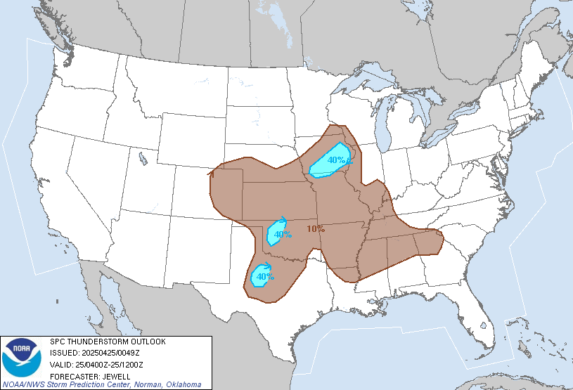
SPC updates http://www.spc.noaa.gov/
...ERN/SERN TEXAS...
A WEAK WARM FRONTAL ZONE EXTENDING FROM UPPER TEXAS COASTAL AREAS
INTO PARTS OF NORTH CENTRAL TEXAS MAY BECOME AN INCREASING FOCUS FOR
STRONG/SEVERE STORM DEVELOPMENT OVERNIGHT...AS THE LOW-LEVEL JET
STRENGTHENS. LAPSE RATES WILL REMAIN WEAK...BUT HODOGRAPHS WILL
BECOME FAVORABLE FOR ORGANIZED STORM DEVELOPMENT... INCLUDING
ISOLATED SUPERCELLS...WITH AT LEAST SOME RISK FOR TORNADOES...IN
ADDITION TO DAMAGING WIND GUSTS.
-
unome
- Posts: 3062
- Joined: Fri Feb 12, 2010 6:11 pm
new meso discussion for your areaPortastorm wrote:Out to your west, we're seeing training cells along the I-35 corridor. Currently raining quite hard here in southwest Austin and the radar looks primed for a lot more ... and this isn't even the main show! :shock:
http://www.spc.noaa.gov/products/md/md1986.html

MESOSCALE DISCUSSION 1986
NWS STORM PREDICTION CENTER NORMAN OK
0912 PM CDT WED OCT 30 2013
AREAS AFFECTED...MUCH OF CNTRL TX
CONCERNING...SEVERE POTENTIAL...WATCH POSSIBLE
VALID 310212Z - 310415Z
PROBABILITY OF WATCH ISSUANCE...40 PERCENT
SUMMARY...STORMS ARE EXPECTED TO GAIN SOME STRENGTH THIS
EVENING...BUT IT IS UNCLEAR WHEN A WATCH WOULD BE NEEDED. LOCALIZED
STRONG WINDS OR BRIEF TORNADOES WILL BE POSSIBLE.
DISCUSSION...A RELATIVELY NARROW LINE OF STORMS CONTINUES TO BECOME
BETTER ESTABLISHED GENERALLY ALONG I-35 IN CNTRL TX...WHICH IS ON
THE WRN FRINGE OF THE TROPICAL AIR MASS WITH LOWER 70S F DEWPOINTS.
THIS AREA IS ALSO SITUATED ALONG THE WRN FRINGES OF A DEVELOPING LOW
LEVEL JET CORE...WITH SPEEDS OF 40-50 KT EXPECTED LATER TONIGHT.
MEANWHILE....FLOW ALOFT CONTINUES TO INCREASE AND HODOGRAPHS VIA VAD
WIND PROFILES ARE QUITE FAVORABLE FOR SUPERCELLS. LOW LEVEL VEERING
WINDS AND LOW LCLS SUGGEST A BRIEF TORNADO CANNOT BE RULED OUT. THE
OUTFLOW BOUNDARY COULD SUPPORT BRIEF INCREASES IN ROTATION AS
WELL...BUT RESIDENCE TIME ON THE BOUNDARY SHOULD BE SHORT GIVEN
PRESENT ORIENTATION.
ALTHOUGH LAPSE RATES ALOFT ARE NOT STEEP...THE SUBSTANTIAL MOISTURE
CONTENT MAY OFFSET AND ALLOW FOR A FEW SEVERE STORMS TO EVENTUALLY
DEVELOP AS SHEAR ACTS ON THIS LINE OF STORMS OVER TIME. IF ROTATION
BECOMES APPARENT...A WATCH MAY BE REQUIRED.
..JEWELL/HART.. 10/31/2013
ATTN...WFO...HGX...FWD...CRP...EWX...
LAT...LON 28649873 28379898 28329928 28609951 29549919 30379864
31089798 31599716 31929616 31749552 31329512 30889525
30629590 30379696 29639787 28959853 28649873
-
Paul Robison
unome wrote:SPC updates http://www.spc.noaa.gov/
...ERN/SERN TEXAS...
A WEAK WARM FRONTAL ZONE EXTENDING FROM UPPER TEXAS COASTAL AREAS
INTO PARTS OF NORTH CENTRAL TEXAS MAY BECOME AN INCREASING FOCUS FOR
STRONG/SEVERE STORM DEVELOPMENT OVERNIGHT...AS THE LOW-LEVEL JET
STRENGTHENS. LAPSE RATES WILL REMAIN WEAK...BUT HODOGRAPHS WILL
BECOME FAVORABLE FOR ORGANIZED STORM DEVELOPMENT... INCLUDING
ISOLATED SUPERCELLS...WITH AT LEAST SOME RISK FOR TORNADOES...IN
ADDITION TO DAMAGING WIND GUSTS.
Main threat are STILL seems to be north of the Houston metro. Is that correct?
-
srainhoutx
- Site Admin
- Posts: 19699
- Joined: Tue Feb 02, 2010 2:32 pm
- Location: Maggie Valley, NC
- Contact:
Good night for that weather radio across Central and SE Texas with late night/early morning severe threat that does appear to be increasing. I believe Andrew is working on an update for everyone. That Junior year Met Student knowledge he is gaining from Texas A&M will come in handy in the days and months ahead... 
Carla/Alicia/Jerry(In The Eye)/Michelle/Charley/Ivan/Dennis/Katrina/Rita/Wilma/Humberto/Ike/Harvey
Member: National Weather Association
Facebook.com/Weather Infinity
Twitter @WeatherInfinity
Member: National Weather Association
Facebook.com/Weather Infinity
Twitter @WeatherInfinity
-
Andrew
- Site Admin
- Posts: 3506
- Joined: Wed Feb 03, 2010 9:46 pm
- Location: North-West Houston
- Contact:
Looks like we have a nice line setting up west along the I-35 Corridor. The models haven't been the most accurate in predicting the movement of the H5 trough throughout the central United States. Movement of the front has been pretty minimal throughout the day which will postpone rain chances some (and delayed severe weather this evening in central Texas). Looking at the water vapor imagery from the pacific shows a lot of mid level moisture filtering from the SW. This paired with the 850mb moisture transport from the south has allowed PW Values to get to the 2+ range for much of central and SE Texas. Not only is moisture levels at an August type level (as mentioned before), severe threat could increase throughout the night as we see a jet streak rotating around the trough producing 40-50kt directional shear. Helicity looks good throughout central Texas and paired with a low LCL (500m high), this should allow for some nice low level clouds. Won't take much rotation (if you get it) to reach the ground. The one major component that is missing right now is CAPE, and whatever CAPE that is present looks thin which would limit vertical velocities, and as a result decrease hail chances. Looking at the GFS and NAM soundings show an almost completely saturated atmosphere which would limit evaporation and decrease chances of strong winds. I still think we will see some isolated to scattered stronger storms with the amount of shear that is present but my main concern is still flooding. Storm movement seems to be parallel currently with the boundaries that are currently set up allowing for a lot of training to occur. There are already multiple flash flood warnings present and I suspect that this will only increase throughout the night. As lift increases overnight expect for the line west to expand and intensify. The High Res NAM picked up on this and doesn't really move the rain of the coast until late tomorrow evening (about 6 hour later than previously expected). I wouldn't even be surprised to see a brief MCS spin up especially if the front continues with this slow movement. Is looks like a busy night ahead for many as we continue to escape this drought that has affected the state for the last couple years.
For Your Infinite Source For All Things Weather Visit Our Facebook
-
skidog40
- Posts: 193
- Joined: Sat Jan 01, 2011 11:03 pm
- Contact:
what's going on with circulation. oh my. let me move my car
-
Andrew
- Site Admin
- Posts: 3506
- Joined: Wed Feb 03, 2010 9:46 pm
- Location: North-West Houston
- Contact:
Central Texas:
000
NOUS64 KFWD 310332
FTMGRK
Message Date: Oct 31 2013 03:32:54
KGRK WSR-88D HAS FAILED. A RESTORATION TIME HAS NOT BEEN DETERMINED.
000
NOUS64 KFWD 310332
FTMGRK
Message Date: Oct 31 2013 03:32:54
KGRK WSR-88D HAS FAILED. A RESTORATION TIME HAS NOT BEEN DETERMINED.
For Your Infinite Source For All Things Weather Visit Our Facebook
-
Paul Robison
Andrew wrote:Looks like we have a nice line setting up west along the I-35 Corridor. The models haven't been the most accurate in predicting the movement of the H5 trough throughout the central United States. Movement of the front has been pretty minimal throughout the day which will postpone rain chances some (and delayed severe weather this evening in central Texas). Looking at the water vapor imagery from the pacific shows a lot of mid level moisture filtering from the SW. This paired with the 850mb moisture transport from the south has allowed PW Values to get to the 2+ range for much of central and SE Texas. Not only is moisture levels at an August type level (as mentioned before), severe threat could increase throughout the night as we see a jet streak rotating around the trough producing 40-50kt directional shear. Helicity looks good throughout central Texas and paired with a low LCL (500m high), this should allow for some nice low level clouds. Won't take much rotation (if you get it) to reach the ground. The one major component that is missing right now is CAPE, and whatever CAPE that is present looks thin which would limit vertical velocities, and as a result decrease hail chances. Looking at the GFS and NAM soundings show an almost completely saturated atmosphere which would limit evaporation and decrease chances of strong winds. I still think we will see some isolated to scattered stronger storms with the amount of shear that is present but my main concern is still flooding. Storm movement seems to be parallel currently with the boundaries that are currently set up allowing for a lot of training to occur. There are already multiple flash flood warnings present and I suspect that this will only increase throughout the night. As lift increases overnight expect for the line west to expand and intensify. The High Res NAM picked up on this and doesn't really move the rain of the coast until late tomorrow evening (about 6 hour later than previously expected). I wouldn't even be surprised to see a brief MCS spin up especially if the front continues with this slow movement. Is looks like a busy night ahead for many as we continue to escape this drought that has affected the state for the last couple years.
Hazardous Weather Outlook
HAZARDOUS WEATHER OUTLOOK
NATIONAL WEATHER SERVICE SHREVEPORT LA
1158 AM CDT WED OCT 30 2013
ARZ072-073-LAZ003>006-010>014-017>022-TXZ152-153-165>167-311700-
COLUMBIA-UNION AR-WEBSTER-CLAIBORNE-LINCOLN-UNION LA-DE SOTO-
RED RIVER-BIENVILLE-JACKSON-OUACHITA-SABINE LA-NATCHITOCHES-WINN-
GRANT-CALDWELL-LA SALLE-NACOGDOCHES-SHELBY-ANGELINA-SAN AUGUSTINE-
SABINE TX-
1158 AM CDT WED OCT 30 2013
THIS HAZARDOUS WEATHER OUTLOOK IS FOR PORTIONS OF SOUTH CENTRAL
ARKANSAS...SOUTHWEST ARKANSAS...NORTH CENTRAL LOUISIANA...
NORTHWEST LOUISIANA AND EAST TEXAS.
.DAY ONE...THIS AFTERNOON AND TONIGHT...
SCATTERED SHOWERS OF MOSTLY LIGHT TO MODERATE RAIN...WILL INCREASE
ACROSS THE AREA THIS AFTERNOON. BY LATE TONIGHT...WIDESPREAD
SHOWERS AND THUNDERSTORMS...LIKELY WITH LOCALLY HEAVY
RAINFALL...AND POSSIBLY STRONG GUSTY WINDS...WILL SLOWLY MOVE INTO
THE REGION FROM THE WEST...AS A STRONG UPPER LEVEL DISTURBANCE
APPROACHES THE REGION.
.DAYS TWO THROUGH SEVEN...THURSDAY THROUGH TUESDAY...
THUNDERSTORMS WILL BECOME MORE WIDESPREAD BY THURSDAY MORNING...
AS THE APPROACHING COLD FRONT AND UPPER LEVEL DISTURBANCE FINALLY
BEGIN TO MOVE THROUGH. THE STRONG FORCING ASSOCIATED WITH THE COLD
FRONT...COUPLED WITH STRONG WIND SHEAR AND UPPER LEVEL SUPPORT
WILL BRING THE RISK FOR SEVERE THUNDERSTORMS...MAINLY ALONG AND
SOUTH OF A MINEOLA TEXAS...TO TEXARKANA...TO HOPE ARKANSAS LINE.DAMAGING WINDS AND ISOLATED TORNADOES WILL BE THE PRIMARY
CONCERNS...ALONG WITH THE THREAT OF LOCALIZED FLOODING OF POOR
DRAINAGE AREAS. THUNDERSTORMS WILL BEGIN MOVING OUT OF THE REGION
BY THURSDAY AFTERNOON...WITH MORE CHANCES FOR THUNDERSTORMS
RETURNING BY NEXT WORK WEEK.
.SPOTTER INFORMATION STATEMENT...
ACTIVATION OF EMERGENCY MANAGEMENT PERSONNEL...AMATEUR RADIO
OPERATORS AND STORM SPOTTERS SHOULD NOT BE NEEDED THROUGH
TONIGHT.
$$
Location! Location! Location!
-
Andrew
- Site Admin
- Posts: 3506
- Joined: Wed Feb 03, 2010 9:46 pm
- Location: North-West Houston
- Contact:
Radar estimates are showing 6-7 inches of rain up and down the I-35 Corridor. Some estimates had up to 4 inches in an hour. More inches are to be expected around the area as the line slowly drifts east.
For Your Infinite Source For All Things Weather Visit Our Facebook
-
Andrew
- Site Admin
- Posts: 3506
- Joined: Wed Feb 03, 2010 9:46 pm
- Location: North-West Houston
- Contact:
MESOSCALE DISCUSSION 1988
NWS STORM PREDICTION CENTER NORMAN OK
0151 AM CDT THU OCT 31 2013
AREAS AFFECTED...SERN/S-CNTRL TX
CONCERNING...SEVERE POTENTIAL...WATCH POSSIBLE
VALID 310651Z - 310845Z
PROBABILITY OF WATCH ISSUANCE...60 PERCENT
SUMMARY...LOCALIZED STRONG TO SEVERE WIND GUSTS AND LOW TORNADO RISK
ARE ANTICIPATED NEAR-TERM. MONITORING FOR GRADUAL
INTENSIFICATION/EXPANSION OF THREATS FOR A WW ISSUANCE.
DISCUSSION...PORTION OF A SW/NE-ORIENTED BAND OF PERSISTENT STORMS
PRODUCING VERY HEAVY RAINFALL FROM NERN TO CNTRL TX HAS SHOWN RECENT
SIGNS OF INCREASED ORGANIZATION...WITH COOLING CLOUD TOPS AND BOWING
STRUCTURE JUST E OF AUS. THIS APPEARS TO BE THE START OF THE GRADUAL
INTENSIFICATION FORECAST EARLIER IN MCD 1986 AND LARGELY SUPPORTED
BY 00Z WRF-BASED CONVECTION-ALLOWING GUIDANCE. AIR MASS TO THE S/SE
OF THIS PORTION OF THE LINE HAS BEEN UNIMPEDED BY ANTECEDENT
CONVECTION AND REMAINS RICHLY BUOYANT WITH MIDDLE 70S SURFACE DEW
POINTS AND TEMPERATURES HOLDING NEAR 80.
A LOCALIZED STRONG TO SEVERE WIND AND CONDITIONAL TORNADO THREAT IS
ANTICIPATED NEAR-TERM. BUT PRIMARY UNCERTAINTY IS OVER EXACTLY WHEN
THE SEVERE RISK WOULD SUFFICIENTLY INCREASE FOR A WW ISSUANCE.
700-500 MB WINDS SHOULD GRADUALLY STRENGTHEN THROUGH THE MORNING ON
THE GLANCING INFLUENCE OF THE SHORTWAVE TROUGH EJECTING EWD FROM THE
CNTRL/SRN HIGH PLAINS.
..GRAMS/EDWARDS.. 10/31/2013
For Your Infinite Source For All Things Weather Visit Our Facebook
-
Andrew
- Site Admin
- Posts: 3506
- Joined: Wed Feb 03, 2010 9:46 pm
- Location: North-West Houston
- Contact:
Very Concerning to see the training in NW Harris County and points NE and SW. This is ahead of the main line of storms and has plenty to work with. Could fill in through the morning hours.
For Your Infinite Source For All Things Weather Visit Our Facebook