El Niño is expected to continue at least through the Northern Hemisphere spring 2010.
A moderate-to-strong El Niño continued during February 2010, with sea surface temperature (SST) anomalies exceeding 1.5oC in parts of the equatorial Pacific Ocean at the end of the month (Fig. 1). Weekly values of the Niño-3.4 index remained steady at +1.2oC during February (Fig. 2). An oceanic Kelvin wave was initiated in early February, which acted to increase the subsurface heat content anomalies (average temperatures in the upper 300m of the ocean, Fig. 3), and to strengthen subsurface temperature departures (exceeding +2oC down to 100-175m) across much of the equatorial Pacific (Fig. 4). SSTs were sufficiently warm to support deep tropical convection, which strongly increased across the central and eastern tropical Pacific, while remaining suppressed over Indonesia (Fig. 5). Equatorial low-level westerly wind anomalies also strengthened during February, while upper-level easterly wind anomalies weakened slightly. Collectively, these oceanic and atmospheric anomalies reflect a moderate-to-strong El Niño episode.
Nearly all models predict decreasing SST anomalies in the Niño-3.4 region through 2010, with the model spread increasing at longer lead times (Fig. 6). The majority of models predict the 3-month Niño-3.4 SST anomaly will drop below +0.5oC by May-June-July 2010, indicating a transition to ENSO-neutral conditions near the onset of Northern Hemisphere summer. However, several models suggest the potential of continued weak El Niño conditions through 2010, while others predict the development of La Niña conditions later in the year. Predicting when El Niño will dissipate and what may follow remains highly uncertain.
srainhoutx wrote:I'll bump this up as wxman57 should have some interesting thought from the National Hurricane Conference...
I'll be heading out of Hobby at 11:35 this morning for Orlando. Will look up Phil Klotzbach when I get there to get an idea what he's thinking. I'd wager he and Dr. Gray will be bumping up their numbers from the early December outlook.
Sun cycles? come on....predicting landfall is like throwing darts this early in the season. I do have a bad feeling about NO this year...
I did a correlation between Sun cycles and hurricane season and it was all over the place. No correlation right there! Now, there is a correlation between El Nino and Southern Oscillation though.
srainhoutx wrote:I'll bump this up as wxman57 should have some interesting thought from the National Hurricane Conference...
I'll be heading out of Hobby at 11:35 this morning for Orlando. Will look up Phil Klotzbach when I get there to get an idea what he's thinking. I'd wager he and Dr. Gray will be bumping up their numbers from the early December outlook.
Look forward to your encounters young Dr. Klotzbach. It will be in interesting what he and Dr. Gray are thinking. We appreciate your input wxman57.
Carla/Alicia/Jerry(In The Eye)/Michelle/Charley/Ivan/Dennis/Katrina/Rita/Wilma/Humberto/Ike/Harvey
Member: National Weather Association
Facebook.com/Weather Infinity
Twitter @WeatherInfinity
The Caribbean and Tropical Atlantic don't cool all that much, except closer to the coast of Africa.
Not many hurricanes (the odd one, but very infrequent) in the Caribbean in January.
Takes more than just warm water to crank a storm...
that is true Ed, hostile conditions all over the ALT. I was referring to anomalies and rapidly rising heat content through out the basin. The waters off of Africa and the MDR are above normal. I also like watching the GOM warmup via the LC...
\]
Dr. Gray and Dr. Klotzbach spoke for about an hour at the close of today's meeting. Phil Klotzbach is waiting until April 7th to reveal the new outlook, though he said that looking at the 11-16 named storms predicted in December, he'd be leaning toward the higher number.
Here's a shot of Dr. Gray introducing Phil. Max Mayfield is sitting in the middle:
I think it would be wise to prepare for an active season this year. Go ahead and get hurricane supplies in order and have a plan. People around my area are feeling this year is going to be much different from last year. There's an anxiousness in the air regarding the 2010 season.
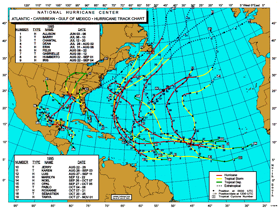
Many analog years will be mentioned as we approach the Tropical Season. 1995 may be a fairly good 'match' to what we can expect. As always, we shall see.
Carla/Alicia/Jerry(In The Eye)/Michelle/Charley/Ivan/Dennis/Katrina/Rita/Wilma/Humberto/Ike/Harvey
Member: National Weather Association
Facebook.com/Weather Infinity
Twitter @WeatherInfinity
wxman57 wrote:Dr. Gray and Dr. Klotzbach spoke for about an hour at the close of today's meeting. Phil Klotzbach is waiting until April 7th to reveal the new outlook, though he said that looking at the 11-16 named storms predicted in December, he'd be leaning toward the higher number.
Here's a shot of Dr. Gray introducing Phil. Max Mayfield is sitting in the middle:
Information obtained through March 2010 indicates that the 2010 Atlantic hurricane season will have significantly more activity than the average 1950-2000 season. We estimate that 2010 will have about 8 hurricanes (average is 5.9), 15 named storms (average is 9.6), 75 named storm days (average is 49.1), 35 hurricane days (average is 24.5), 4 major (Category 3-4-5) hurricanes (average is 2.3) and 10 major hurricane days (average is 5.0). The probability of U.S. major hurricane landfall is estimated to be about 130 percent of the long-period average. We expect Atlantic basin Net Tropical Cyclone (NTC) activity in 2010 to be approximately 160 percent of the long-term average. We have increased our seasonal forecast from the mid-point of our early December forecast.
This forecast is based on an extended-range early April statistical prediction scheme that utilizes 58 years of past data. Analog predictors are also utilized. The influence of El Niño conditions is implicit in these predictor fields, and therefore we do not utilize a specific ENSO forecast as a predictor.
We expect current moderate El Niño conditions to transition to neutral conditions by this year’s hurricane season. The predicted weakening of El Niño conditions combined with a very strong anomalous warming of the tropical Atlantic are the primary reasons why we are increasing our forecast. We believe that these two features will lead to favorable dynamic and thermodynamic conditions for hurricane formation and intensification.
Have to agree with everything he is saying. Is it me or is Phil 17 yrs old?